webshop.nl
Categorieën
  Sluiten

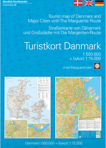
Wegenkaart - landkaart Turistkort Danmark med Margueritruten + bykort - Margrietroute | Scanmaps

Nordisk Korthandel has published a new Tourist Map of Denmark and Major Cities with The Marguerite Route.   As a newly added feature the Tourist map of Denmark includes the scenic Marguerite Route.   The Marguerite route is a 3600 km long route through the danish landscape, and was opened in 1991 by Queen Margrethe of Denmark. The route runs throug...
16,95

Webshops met dit product

Webshop
Bezorging
Prijs

Anderen bekeken ook

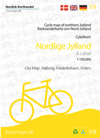
Fietskaart 5 Nordlige Jylland - Noordelijk Jutland | Scanmaps
Eindelijk een fietskaartenserie van Denemarken. Gedrukt op scheur- en watervastpapier, met een schaal van 1:100.000, zijn het zeer overzichtelijke fietskaarten. De basis is de 1:100.000 topografische kaart waarop de nationale, regionale en lokale fietsroutes op zijn ingetekend. Op de achterzijde staat informatie over fietstransport met het openbaar vervoer. Gewone fietspaden en toeristische informatie zoals campings en fietsenmakers staan er echter niet op vermeld.    Deze kaarten hebben dan ook vooral zin voor de bestaande fietsroutes. Echter aangezien er verder niet veel is aan detailkaarten met dit soort informatie, zijn deze kaarten wel degelijk bijzonder nuttig voor de fietser in Denemarken.   Cycle map of Nothern Jutland   Find your way to Skagen where the two seas meet, follow the Hærvejen (The old army road) and many other experiences with the bicycle map of Northern Jutland.   For a better overview and planning of your bicycle trip through Denmark, a full map of Denmark …
22,50
Fietskaart Cykelkort Danmark and Copenhagen - Cycle Map of Denmark | Scanmaps
De kaart van Denemarken bevat vitale informatie voor fietsen in Denemarken. Het bevat nationale en regionale fietsroutes, fietspaden, hostels, campings, toeristische informatie, enz., En er is een Eurovelo-kaart met internationale fietsroutes in Denemarken. Informatie over deense verkeersregels voor fietsen is inbegrepen. Er zijn meer dan 160 regionale en 11 nationale fietsroutes op de kaart, en er zijn nieuwe routes zoals Kulturringen (Oost-Jutland) en Vestegnsruten (Kopenhagen) inbegrepen.   3. edition of Nordisk Korthandel's cyclemap of Denmark is now including a cycle map of Copenhagen in scale 1:35.000, which can help finding your way in the capitol.   The map of Denmark contains vitale information for cycling touring in Denmark. It contains national and regional cycle routes, cycle paths, hostels, campsites, tourist information etc., and there is a Eurovelo map showing international bicycle routes in Denmark. Information about danish traffic rules for bicycling is included. There…
22,50
Fietskaart 3 Fyn - Funen (Denemarken) | Scanmaps
Eindelijk een fietskaartenserie van Denemarken. Gedrukt op scheur- en watervastpapier, met een schaal van 1:100.000, zijn het zeer overzichtelijke fietskaarten. De basis is de 1:100.000 topografische kaart waarop de nationale, regionale en lokale fietsroutes op zijn ingetekend. Op de achterzijde staat informatie over fietstransport met het openbaar vervoer. Gewone fietspaden en toeristische informatie zoals campings en fietsenmakers staan er echter niet op vermeld.    Deze kaarten hebben dan ook vooral zin voor de bestaande fietsroutes. Echter aangezien er verder niet veel is aan detailkaarten met dit soort informatie, zijn deze kaarten wel degelijk bijzonder nuttig voor de fietser in Denemarken.   Cycle map of Funen   Go on a cycling trip on Funen and the famous South Funen archipelago, and get inspired for exciting trips with the cycling map.   For a better overview and planning of your bicycle trip through Denmark, a full map of Denmark in the scale 1:500.000 is avaible here: C…
22,50
Fietskaart 6 Vestlige Jylland - West Jutland (Denemarken) | Scanmaps
Eindelijk een fietskaartenserie van Denemarken. Gedrukt op scheur- en watervastpapier, met een schaal van 1:100.000, zijn het zeer overzichtelijke fietskaarten. De basis is de 1:100.000 topografische kaart waarop de nationale, regionale en lokale fietsroutes op zijn ingetekend. Op de achterzijde staat informatie over fietstransport met het openbaar vervoer. Gewone fietspaden en toeristische informatie zoals campings en fietsenmakers staan er echter niet op vermeld.    Deze kaarten hebben dan ook vooral zin voor de bestaande fietsroutes. Echter aangezien er verder niet veel is aan detailkaarten met dit soort informatie, zijn deze kaarten wel degelijk bijzonder nuttig voor de fietser in Denemarken. Cycle map of Western Jutland   Although the west coast of Denmark is known for its particullar fresh winds along the coast, there are plenty of cycling routes to try - also further inland. So this map is for both the sea lovers and those who want to ride along the fields.   For a better o…
22,50
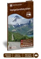
Wegenkaart - landkaart 13 Nasjonale Turistveger Helgelandskysten | Nordeca
Speciale map met daarin een wegenkaart van een Nationale Toerist Route in Noorwegen. Naast een gedetailleerde landkaart van schaal 1: 250.000 met hoogtelijnen en toeristische aanduidingen staat op de achterzijde toeristische informatie, alsmede adressen voor eten, drinken en overnachting.   De kaart beschrijft spectaculaire uitzichtpunten, natuurfenomenen, attracties, accommodaties, horeca en bezienswaardigheden langs de Nationale Toeristenweg. De teksten op de kaart zijn drietalig: Noors, Engels en Duits.   En elke map is ook nog eens voorzien van 5 XL-ansichtkaarten van het gebied. Als aandenken of om te versturen.   National Tourist Route Helgelandskysten, which is connected by six ferries, offers a wealth of contrasts as it passes through a verdant cultural landscape interspersed with craggy peaks, glaciers, sweeping coastlines and swirling ocean currents. Many remarkable natural phenomena are found along this route. In the south you will pass the peaks of the Seven Sisters and th…
29,95
Wegenkaart - landkaart Mexico Central & Mexico City | ITMB
Goede wegenkaart met duidelijk kleurgebruik. Het betreft een deel van Mexico met op de achterkant een stadsplattegrond van het centrale deel van Mexico City. MC is the largest city in the Western Hemisphere, with a population of 28,000,000 (or twice as big as New York City!). It would be impractical to portray the entire urban area on one map and have it make sense, so we show the portion of greatest interest to visitors, from the Chapultepec Zoological Park in the west to the incredibly busy Tapo Bus Terminal in the east, and from the railway station in the north to the southern east-west motorway just south of the main hospital complex. Much of MC’s touristic interest is concentrated in the Zona Rosa, Reforma, and Zocalo segments of the city centre, and these are shown in detail, noting hotels, major restaurants, shopping areas, and points of interest.   The map also includes inset maps of the San Angel area just north of the university, an inset map of the greater Mexico City Federa…
13,95
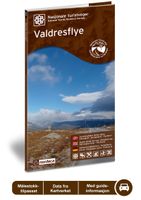
Wegenkaart - landkaart 06 Nasjonale Turistveger Valdresflye | Nordeca
Speciale map met daarin een wegenkaart van een Nationale Toerist Route in Noorwegen. Naast een gedetailleerde landkaart van schaal 1: 50.000 met hoogtelijnen en toeristische aanduidingen staat op de achterzijde toeristische informatie, alsmede adressen voor eten, drinken en overnachting.   De kaart beschrijft spectaculaire uitzichtpunten, natuurfenomenen, attracties, accommodaties, horeca en bezienswaardigheden langs de Nationale Toeristenweg. De teksten op de kaart zijn drietalig: Noors, Engels en Duits.   The road across the Valdresflye plateau offers sweeping views of mountains and open expanses, from which it seems to swoop into the Jotunheimen massif like the beginning of an endless journey. To the north, you can catch a view of the Jotunheimen National Park, where the mountains are steeper and wilder than to the south, where the landscape widens into serene, rolling hills. Here, cultural landscapes dominate, with mountain pastures and a number of tourist lodges that have long tra…
29,95
Wegenkaart - landkaart Portugal | Marco Polo
Duidelijke wegenkaart van Marco Polo: alle wegen, zowel de verharde als belangrijke onverharde wegen zijn weergegeven.  Mooie toeristisch interessante wegen die de moeite waard zijn, zijn groen gearceerd. Veel toeristische informatie is toegevoegd zoals de nationale parken, campings, kastelen en vliegvelden. Afstanden tussen belangrijke steden en benzinestations staan ook op de kaart. Een plaatsnamenregister ontbreekt niet.   ---   This Marco Polo map features really easy to read cartography. Topography is highlighted with relief shading and loads of spot heights and the road network is clearly shown with roads ranging from motorways all the way through to minor secondary roads. The map also clearly indicates airports, places of interest, scenic/tourist routes, view points etc.   The map includes a booklet attached to the cover that contains some useful information and a very extensive index that covers locations, places of interest and geographical features. Also included are a distan…
13,95
Wegenkaart - landkaart Montenegro | Marco Polo
Duidelijke wegenkaart van Marco Polo: alle wegen, zowel de verharde als belangrijke onverharde wegen zijn weergegeven.  Mooie toeristisch interessante wegen die de moeite waard zijn, zijn groen gearceerd. Veel toeristische informatie is toegevoegd zoals de nationale parken, campings, kastelen en vliegvelden. Afstanden tussen belangrijke steden en benzinestations staan ook op de kaart. Een plaatsnamenregister ontbreekt niet.   ---   This Marco Polo map features really easy to read cartography. Topography is highlighted with relief shading and loads of spot heights and the road network is clearly shown with roads ranging from motorways all the way through to minor secondary roads. The map also clearly indicates airports, places of interest, scenic/tourist routes, view points etc.   The map includes a booklet attached to the cover that contains some useful information and a very extensive index that covers locations, places of interest and geographical features. Also included are a distan…
13,95
Wegenkaart - landkaart India | Marco Polo
Duidelijke wegenkaart van Marco Polo: alle wegen, zowel de verharde als belangrijke onverharde wegen zijn weergegeven.  Mooie toeristisch interessante wegen die de moeite waard zijn, zijn groen gearceerd. Veel toeristische informatie is toegevoegd zoals de nationale parken, campings, kastelen en vliegvelden. Afstanden tussen belangrijke steden en benzinestations staan ook op de kaart. Een plaatsnamenregister ontbreekt niet.   ---   This Marco Polo map features really easy to read cartography. Topography is highlighted with relief shading and loads of spot heights and the road network is clearly shown with roads ranging from motorways all the way through to minor secondary roads. The map also clearly indicates airports, places of interest, scenic/tourist routes, view points etc.   The map includes a booklet attached to the cover that contains some useful information and a very extensive index that covers locations, places of interest and geographical features. Also included are a distan…
13,95

Klanten-reviews van Wegenkaart - landkaart Turistkort Danmark med Margueritruten + bykort - Margrietroute | Scanmaps

Er zijn nog geen beoordelingen voor dit productBen jij de eerste die een review plaatst?

Meer over Wegenkaart - landkaart Turistkort Danmark med Margueritruten + bykort - Margrietroute | Scanmaps

Productomschrijving

Nordisk Korthandel has published a new Tourist Map of Denmark and Major Cities with The Marguerite Route.   As a newly added feature the Tourist map of Denmark includes the scenic Marguerite Route.   The Marguerite route is a 3600 km long route through the danish landscape, and was opened in 1991 by Queen Margrethe of Denmark. The route runs through beautiful regions of Denmark, and in most places it is possible to cycle or walk along the route. Most of the route is situated on small roads, and therefore it is not the quickest or shortest way from point A to B, but instead it is an invitation to visit the many attractions, that you will find in Denmark. It runs through the danish mainland and is therefore not covering islands like Bornholm and Samsø. If you want to leave the mainland, you can find information, on ferry routes that depart from danish harbours, on the map.   The route uses the daisy flower as a symbol, and you will find it on the road signs, that are placed alongside the route, so follow these signs, if you want to make sure to stay on route. The signs are equipped with an arrow, that shows when to turn.   The Tourist map of Denmark contains: Main roads and motorways with road numbers, beaches, campsites, attractions and ferry routes with travel information. Detailed city maps in scale 1:15.000 of Copenhagen, Odense, Aarhus and Aalborg with road names.   The Tourist Map of Denmark is a perfect choice, when the summervacation takes you around Denmark.   You do not need to take the quickest or the shortest route - take your time - make a detour and get new natur experiences and explore the many sights of Denmark.   Practical information in Danish, English and German.   The map fits nicely into your pocket and comes with a protective plastic cover.
Webshop.nl maakt gebruik van cookies. Ga je verder op onze website, ga dan akkoord met het plaatsen van cookies en de verwerking van deze data door ons en vermelde partners.