webshop.nl
Categorieën
  Sluiten

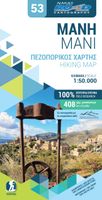
Wandelkaart 8.10 Exo Mani | Anavasi

Uitstekende wandelkaart op scheur- en watervast papier van het wandelgebied rond Kardamyli maar ook nog met Agios Nikolaos. De wandelpaden staan er op ingetekend, zo ook alle bezienswaardigheden als klooster, kastelen en meerdere opgravingen.  Mani is the middle and southernmost peninsula of the Peloponnese and is split between Laconia and Messinia...
11,95

Webshops met dit product

Webshop
Bezorging
Prijs

Anderen bekeken ook

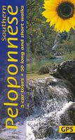
Wandelgids southern Peloponnese - Peloponnessos | Sunflower books
Wandelgids: vele dagtochten worden degelijk beschreven met openbaar vervoer informatie, goede routebeschrijvingen en kaartmateriaal. Tevens enkele autotochten. Deze gids staat goed bekend! Engelstalig 5 car tours (each with picnic suggestions), 50 long and short walks 152 pages + 2 touring maps (eastern and western Peloponnese), 1:50,000 topo maps   There are hidden landscapes throughout mainland Greece, but the region which packs the most variety into the smallest space is the Peloponnese. From the beaches of Arcadia to the fir forests of Mt Parnon, from the olive groves of Kalamata to the pyramidal peak of Prophet Elijah, from classical Sparta to medieval Mani, this compact semi-island has it all. Though the ancients called it ‘the island of Pelops’, after their mythical king, this three-fingered landmass is joined to the mainland by a narrow isthmus at Corinth. Only in the 19th century was a canal finally cut through the isthmus, but it retains the cultural diversity and spectacular…
20,95
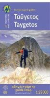
Wandelkaart 8.1 Mt. Taygetos - Peloponnesos | Anavasi
Uitstekende topografische kaarten van een deel van Griekenland: zonder meer hele goede kaarten voor wandeltochten in een onbekend stuk Griekenland! Ze zijn gedrukt op scheurvast en watervast papier op een schaal van 1:25.000 met een UTM grid voor GPS gebruikers. Op de meeste kaarten is geven de hoogtelijnen een interval van 20m. aan. Met schaduwkleuren, punten met hoogtemeters, bronnen, riviertjes en landgebruik geven ze de topografie van het land goed weer. Lokale voetpaden, herbergen en berghutten zijn duidelijk weergegeven. De wegen zijn in gradaties getekend: verhard en onverhard, groot en klein, met afstanden en benzinepompen. Toeristische bezienswaardigheden als kloosters, grotten, kerken etc staan ingetekend. Achterop de kaart worden suggesties gegeven voor wandelroutes met wandeltijd in uren. This is not just a hiking map, this is a hiking guide AND 1: 25 000 map.   Taygetos extends as 70 km of magnificent massif anchoring the southern tip of Greece. From a dense network of cha…
25,95
Reisverhaal Mani - Travels in the Southern Peloponnessos | Patrick Leigh Fermor
Mani is het meest afgelegen, meest geïsoleerde en wildste gebied van Griekenland. Van de rest van het land afgesneden door de torenhoge bergketen van de Taygetos en ingeklemd tussen de Egeïsche en Ionische Zee, is deze rotsgie centrale uitloper van de Peloponnesus het zuidelijkste punt van mediterraan Europa. Tussen Kaap Matapan, het antieke Tenaron, en de kust van Afrika liggen alleen nog een paar verspreide eilanden. Dicht bij de laatste kaap ligt de grot die naar Hades leidt. Deze bergen waren volgens de bewoners het toevluchtsoord van hun voorouders, de Spartanen, toen er aan hun hegemonie achter de Taygetos een einde werd gemaakt. Het is een gebied vol peilloze afgronden, desolaat en ondoordringbaar, en de paar reizigers die zich er hebben gewaagd, wijzen steeds op een overeenkomst tussen de grillige rotsen en de mensen die er wonen. Mani is het verslag van het verblijf van Patrick Leigh Fermor in deze ruige streek, waarin hij op onnavolgbare wijze het heden en het verleden bij el…
15,50
Wandelkaart Kythera, Antikythera | Anavasi
Compatible card printed on lightweight, waterproof and tear-resistant plastic paper.   Kythera is a unique island in many ways. First of all, she has an interesting body shape. It is a vast plateau bordered by hills cut by deep gorges, some dry and majestic, others filled with water, ending in beaches of exceptional beauty.   Explore this unique terrain and traditional villages of Kythira along the ancient trails depicted on the map. Through this landscape, the history of the island takes shape: from mythology to the present day, it has dotted the island with numerous monuments.   Antikythera, due to its geographical position, has always been a springboard between the Peloponnese and Crete, both for sailors and for migratory birds. In modern times, the name has become famous due to the shipwreck and the unique finds. Otherwise, it is a destination of absolute tranquility and abstraction.
9,95
Wandelkaart 6.2 Prespa - Vitsi - Voras | Anavasi
Uitstekende topografische kaarten van een deel van Griekenland: zonder meer hele goede kaarten voor wandeltochten in een onbekend stuk Griekenland! Ze zijn gedrukt op scheurvast en watervast papier op een schaal van 1:50.000 met een UTM grid voor GPS gebruikers.   Op de meeste kaarten is geven de hoogtelijnen een interval van 20m. aan. Met schaduwkleuren, punten met hoogtemeters, bronnen, riviertjes en landgebruik geven ze de topografie van het land goed weer.   Lokale voetpaden, herbergen en berghutten zijn duidelijk weergegeven. De wegen zijn in gradaties getekend: verhard en onverhard, groot en klein, met afstanden en benzinepompen.   Toeristische bezienswaardigheden als kloosters, grotten, kerken etc staan ingetekend. Achterop de kaart worden suggesties gegeven voor wandelroutes met wandeltijd in uren.   The two maps, Prespa - Mt Varnous - Mt Vitsi, on one side and Mt Voras, on the other, include border areas of Western Mac¬edonia that were until recently off the beaten track. Nowa…
11,95
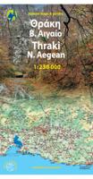
Wandelkaart Thraki-Aegan Noord anavasi - Thraki Aegan North | Anavasi
The Thraki-North Aegean map guides us to areas of Greece with a rich history and important ecosystems. On the one side, Eastern Macedonia & Thrace where Ancient, Byzantine and Ottoman monuments coexist with the virgin forests of the Rhodope mountains, precious wetlands and the birds of prey sanctuary of Dadia. On the other side, the islands of the North Aegean, Thassos, Samothraki, Limnos, Lesvos, Chios and the smaller Ai Stratis and Psara complete the wonderful mosaic of nature and culture, as this NE edge of Greece has been through time a bridge between East and the West.  
11,95
Wandelkaart 10.33 Chalki | Anavasi
 wandelkaart schaal 1:20.000 met hoogtelijnen, wandelpaden, toeristische informatie en UTM grid, de kaart is geschikt voor gebruik met GPS. A tiny island though very rich in monuments and ancient remains. More than 50 byzantine chappels, dozens of rock carved cisterns and old agricultural settlements and a well-preserved medieval caslte with a ruined medieval settlement at its foot. The new detailed map by ANAVASI will be your precious guide to discover all these little known remains, most of them accessible only by footpaths.
9,95

Klanten-reviews van Wandelkaart 8.10 Exo Mani | Anavasi

Er zijn nog geen beoordelingen voor dit productBen jij de eerste die een review plaatst?

Meer over Wandelkaart 8.10 Exo Mani | Anavasi

Productomschrijving

Uitstekende wandelkaart op scheur- en watervast papier van het wandelgebied rond Kardamyli maar ook nog met Agios Nikolaos. De wandelpaden staan er op ingetekend, zo ook alle bezienswaardigheden als klooster, kastelen en meerdere opgravingen.  Mani is the middle and southernmost peninsula of the Peloponnese and is split between Laconia and Messinia. Exo Mani is the name of the northwestern part, which belongs to the prefecture of Messinia. Exo Mani preserves a treasure trove of Byzantine and post-Byzantine churches and castles in breathtaking landscapes.The new map covers the entire Exo Mani, the are formerly covered by the three older maps "Verga-Kampos", "Kardamyli-Stoupa" and "Agios Nikolaos-Trachila. " The area has wonderful cobbled paths ideal for walking all year round.
Webshop.nl maakt gebruik van cookies. Ga je verder op onze website, ga dan akkoord met het plaatsen van cookies en de verwerking van deze data door ons en vermelde partners.