webshop.nl
Categorieën
  Sluiten

Wandelkaart Thraki-Aegan Noord anavasi - Thraki Aegan North | Anavasi

The Thraki-North Aegean map guides us to areas of Greece with a rich history and important ecosystems. On the one side, Eastern Macedonia & Thrace where Ancient, Byzantine and Ottoman monuments coexist with the virgin forests of the Rhodope mountains, precious wetlands and the birds of prey sanctuary of Dadia. On the other side, the islands of the ...
11,95

Webshops met dit product

Webshop
Bezorging
Prijs

Anderen bekeken ook

Reisgids Northern Greece - Noord Griekenland | Bradt Travel Guides
Voor vele landen net zo goed, zo niet beter dan de Planet. Beduidend soberder uitgevoerd, maar ook met veel informatie voor backpackers en met veel kaartmateriaal. Een aanrader! This new guide to Northern Greece, written by Greece expert and long-time travel writer Dana Facaros, is the only guide available to the region and includes the areas of Epirus, Thessaly, Macedonia and Thrace, complete with their five dramatically beautiful national parks, the country's highest peaks and mountain lakes, rushing rivers and the world's deepest gorge, and (this is Greece, after all) long sandy beaches. Sections on background and practical information are followed by an easy-to-follow breakdown of the area offering detailed coverage in 12 chapters, from Greece's second city, Thessaloníki, to Chalkidikí, Central Macedonia, Eastern Macedonia, Thrace, Western Macedonia, Epirus (including Ioánnina), Thessaly and Magnesía, the Pelion Peninsula and the Islands, plus a short chapter on Athens, the gateway…
22,50
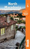
Reisgids North Macedonia - Noord-Macedonië | Bradt Travel Guides
Voor vele landen net zo goed, zo niet beter dan de Planet. Beduidend soberder uitgevoerd, maar ook met veel informatie voor backpackers en met veel kaartmateriaal. Een aanrader! Engelstalig Bradt's North Macedonia remains the only standalone English-language guidebook to this increasingly popular destination available outside the country. Originally written by Thammy Evans, a political analyst who lived there for five years, this new edition has been thoroughly updated and restructured to make it even easier to use by Philip Briggs, arguably the world's most experienced guidebook writer.   Coverage of national parks has been increased and hiking information has been fully integrated to make it more accessible to casual users. Introductions to many points of interest have been expanded to give more of an overview of what the attractions are and there are several new and redrawn maps.   Of all the new countries formed following the break-up of Yugoslavia in 1991, North Macedonia was the …
24,95
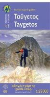
Wandelkaart 8.1 Mt. Taygetos - Peloponnesos | Anavasi
Uitstekende topografische kaarten van een deel van Griekenland: zonder meer hele goede kaarten voor wandeltochten in een onbekend stuk Griekenland! Ze zijn gedrukt op scheurvast en watervast papier op een schaal van 1:25.000 met een UTM grid voor GPS gebruikers. Op de meeste kaarten is geven de hoogtelijnen een interval van 20m. aan. Met schaduwkleuren, punten met hoogtemeters, bronnen, riviertjes en landgebruik geven ze de topografie van het land goed weer. Lokale voetpaden, herbergen en berghutten zijn duidelijk weergegeven. De wegen zijn in gradaties getekend: verhard en onverhard, groot en klein, met afstanden en benzinepompen. Toeristische bezienswaardigheden als kloosters, grotten, kerken etc staan ingetekend. Achterop de kaart worden suggesties gegeven voor wandelroutes met wandeltijd in uren. This is not just a hiking map, this is a hiking guide AND 1: 25 000 map.   Taygetos extends as 70 km of magnificent massif anchoring the southern tip of Greece. From a dense network of cha…
25,95
Wandelkaart 10.50 Karpathos | Anavasi
Zeer goede kaart van Karpathos. Topografische details zijn goed uitgewerkt, zeer leesbare kaart met ook nog eens alle toeristisch interessante punten. Karpathos, a mountainous island with rugged terrain and magnificent landscapes, is one of the most authentic places in Greece. It has endless sandy beaches in the south and secluded coves with emerald-blue waters in the north. The more developped south of the island is popular to surfers while the north still keeps folkways alive especially in the magical village of Olymbos, perched on a saddle between two mountains and two seas. Off the northern tip of Kárpathos, separated from it by a narrow channel is the uninhabited island of Sariá with old agricultural settlements and remains of medieval houses at Palatia. This new detailed map of Anavasi proposes 12 hiking trails in the north and 6 in the south and presents the major highlights of the island.
9,95
Wegenkaart - landkaart 3018 Adventure Map Turkey Turkije | National Geographic
Wegenkaart van Turkije met vermelding van veel bezienswaardigheden, nationale parken en attrakties. Watervast en scheurvast. National Geographic's Turkey Adventure Map is designed to meet the unique needs of adventure travelers with its durability and accurate information. This folded map provides global travelers with the perfect combination of detail and perspective, highlighting hundreds of points of interest and the diverse and unique destinations within the country.   The front side of the Turkey map details the eastern region of the country, from its borders with Syria and Iraq to the south, and with Iran and Armenia to the East, extending to the Black Sea and Georgia to the north. The regions featured on this side are Southeast Anatolia and East Anatolia. The reverse side of the map details Turkey’s western portion of the country, from its border with Greece to the west, to the Mediterranean Sea to the south, extending to the Black Sea to the north. This side covers the Black Se…
17,50
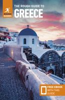
Reisgids Griekenland - Greece | Rough Guides
Zeer goede reisgids voor zowel de georganiseerde maar vooral voor de zelfstandige reiziger. Boordevol informatie over reizen, slapen, eten, maar ook musea en cultuur. Voor Europese landen meestal completer en beter dan de Lonely Planet ! Discover ancient history and blissful beaches with the most clued-up and entertaining guidebook on the market. Whether you plan to join in the Easter celebrations, kick-back on the idyllic island of Santoríni or explore the awe-inspiring ruins at Delphi, The Rough Guide to Greece will show you the ideal places to sleep, eat, drink, shop and visit along the way.- Independent, trusted reviews written with Rough Guides' trademark blend of humour, honesty and insight, to help you get the most out of your visit, with options to suit every budget.- Full-colour maps throughout - navigate Athens' bazaar area or plan your island-hopping route without needing to get online.- Stunning images - a rich collection of inspiring colour photography- Things not to miss …
26,50
Wandelkaart 901 Banff North National Park | National Geographic
Prachtige geplastificeerde kaart van het bekende nationaal park. Met alle recreatieve voorzieningen als campsites, maar ook met topografische details en wandelroutes ed. Door uitgekiend kleurgebruik zeer prettig in gebruik. Scheur en watervast! The front side of the Banff North map details the south side of the national park, from Siffleur Wilderness Area to the north, to Kootenay National Park to the south. This side also covers survival tips, area trails, entry fees and details both Kootenay and Yoho Nationals Parks. The reverse side of the map details the north side of the park, extending from Siffleur Wilderness area to the south, to White Goat Wilderness to the North. Insets show safe travel in Bear Country, and all the recreation the park has to offer with backpacking, camping, biking, hiking and horseback riding.  National Geographic's Trails Illustrated map of Banff North is a two-sided, waterproof map designed to meet the needs of outdoor enthusiasts with unmatched durability …
17,95
Wegenkaart - landkaart 3316 Adventure Map Greece - Griekenland | National Geographic
Wegenkaart van Griekenland met vermelding van veel bezienswaardigheden, nationale parken en attrakties. Watervast en scheurvast. Juist door deze vermeldingen onderscheidt de kaart zich van andere wegenkaarten. National Geographic's Greece Adventure Map is designed to meet the unique needs of adventure travelers with its durability and accurate information. This folded map provides global travelers with the perfect combination of detail and perspective, highlighting hundreds of points of interest and the diverse and unique destinations within the country.   The front side of the Greece map shows the northern region of the country with Macedonia and Bulgaria to the north, Albania to the west, and Turkey to the east. There are insets detailing the islands of Kerkyra and Zakynthos. The reverse side of the map details the southern portion of Greece showing the islands down to Crete. The map includes the locations of cities and towns with a user-friendly index, plus a clearly marked road net…
17,50
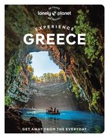
Reisgids Experience Greece | Lonely Planet
Lonely Planet's Experience Greece is your guide to unforgettable experiences and local surprises. Marvel at Athens' ancient Acropolis, island-hop through the Aegean Sea, and relax on pristine beaches - all guided by local experts with fresh perspectives. Uncover Greece's best experiences and get away from the everyday! Inside Lonely Planet's Experience Greece: Unique experiences to string together an unforgettable trip Inspiring full-colour travel photography and maps throughout Highlights and trip builders to help tailor a trip to your personal needs and interests Fresh perspectives to surprise you with things you hadn't thought of, as well as fresh takes on the well-known sights Insider tips help you discover hidden gems and get around like a local Expert insights take you to the heart of the place - food, culture, history, politics Practical info and tips on money, getting around, unique and local ways to stay, and responsible travel Covers Athens, Thessaloniki and northern Greece, …
23,95
Wandelkaart - Wegenkaart - landkaart 903 Jasper North National Park | National Geographic
Goede kaart van een deel van Jasper National Park. Geschikt voor overzicht maar ook voor de langere trails: campsites, rivieren, paden, alles kun je er op terug vinden. National Geographic's Trails Illustrated map of Jasper North is a two-sided, waterproof map designed to meet the needs of outdoor enthusiasts with unmatched durability and detail. This map was created in conjunction with local land management agencies and is loaded with valuable recreation information.   The front side of Jasper North map details the east side of the national park, from Rock Lake Solomon Creek Wildland Park to the north, to Whistler's Summit to the south. The reverse side of the map details the west side of the park, extending from Mt. Terry Fox Provincial Park to the south, to Willmore Wilderness Park to the North. Insets show survival tips, safe travel in Bear Country, and what to do while visiting.   Trails Illustrated maps are expertly researched and frequently updated. The maps are printed in the U…
17,50

Klanten-reviews van Wandelkaart Thraki-Aegan Noord anavasi - Thraki Aegan North | Anavasi

Er zijn nog geen beoordelingen voor dit productBen jij de eerste die een review plaatst?

Meer over Wandelkaart Thraki-Aegan Noord anavasi - Thraki Aegan North | Anavasi

Productomschrijving

The Thraki-North Aegean map guides us to areas of Greece with a rich history and important ecosystems. On the one side, Eastern Macedonia & Thrace where Ancient, Byzantine and Ottoman monuments coexist with the virgin forests of the Rhodope mountains, precious wetlands and the birds of prey sanctuary of Dadia. On the other side, the islands of the North Aegean, Thassos, Samothraki, Limnos, Lesvos, Chios and the smaller Ai Stratis and Psara complete the wonderful mosaic of nature and culture, as this NE edge of Greece has been through time a bridge between East and the West.  
Webshop.nl maakt gebruik van cookies. Ga je verder op onze website, ga dan akkoord met het plaatsen van cookies en de verwerking van deze data door ons en vermelde partners.