webshop.nl
Categorieën
  Sluiten

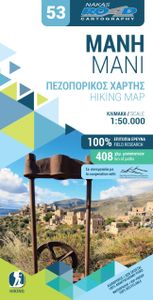
Wandelkaart 53 Mani hiking map | Road Editions

Gedetailleerde wandelkaart die 2 mooie gebieden combineert: op de ene kant Mani en op de andere zijde het berggebied rond Mt. Taygetos. Met hoogtelijnen, ook de kleinere wegen en grotere wandelpaden.  Hiking map in Mani and around Mount Taygetos 1/50 (1cm = 500m) published by Cartography Road. With panoramic routes, trails and a map of the Poseidon...
9,95

Webshops met dit product

Webshop
Bezorging
Prijs

Anderen bekeken ook

Wandelkaart Trekking map Drakensbergen - Zuid Afrika | TerraQuest
Geplastificeerde trekking-kaart. Relatief zeer gedetailleerd. Het Ukhahlamba Park ligt op de grens van Zuid-Afrika en Lesotho met de hoogste berg en het meest interessante gebied van de Draak. Met wandelroutes, toeristische info, GPS coordinaten in WGS-84. Hiking map of the Drakensberg in the Ukhahlamba Park, on the South Africa and Lesotho border. Waterproof and tear resistant map published by Terraquest. The map is double-sided and covers the park in two overlapping sections. Coverage extends north-west to include the Royal Natal National Park. The map covers the entire Ukhahlamba Park - the highest in the Drakensberg area.   The map is distinguished by its topographical accuracy (contour) and the detailed content focused on tourism (symbols show locations of hotels, mountain refuges and campsites, bivouac and picnic places, restaurants, car parks and petrol stations, medical facilities, viewpoints, etc...) The map shows rural roads and footpaths, and highlights trekking trails indic…
18,50
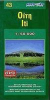
Wandelkaart 43 Iti | Road Editions
Mt Oiti/Iti at 1:50,000 in a series of contoured maps from Road Editions covering popular hiking areas of Greece. All the maps have altitude coloring and spot heights - contour interval varies, as indicated in the descriptions of individual titles. Local footpaths are marked and, for road users the maps show picturesque routes, intermediate driving distances on minor roads, and locations of petrol stations and tyre repairs workshops. Boundaries of national parks and administrative regions are marked, and symbols show campsites, hotels and mountain refuges, and various landmarks and places of interest, e.g. archaeological sites, churches, etc. All place names are in both Greek and Latin alphabet. All the titles have latitude and longitude margin ticks, many also show GPS waypoints. Some maps come with a booklet or notes on the reverse side giving further information about the area and/or descriptions of hiking routes. Map legends include English. In this title: Mount Oiti (Iti) and th…
7,95
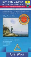
Wandelkaart - Wegenkaart - landkaart St Helena & Dependencies | Gizi Map
Met name door het kleurgebruik een mooie kaart: heel duidelijk wordt het landschap weergegeven. Daarnaast veel topografische details.  St. Helena at 1:35,000 from Gizi Map, with the other islands of the British Overseas Territories in the Atlantic: Tristan da Cunha, plus Ascension, Inaccessible and Gough Islands at 1:75,000, with superb cartography and places of interest.    The map excellently presents the topography of all the islands, with bright colouring and vivid relief shading, accompanied by spot heights and names of many peaks, valleys and other geographic features. Small settlements and many individual buildings are shown, roads and local tracks are marked. On St. Helena hiking trails are also highlighted and local administrative boundaries are marked.    The map indicates locations with tourist accommodation and prominently shows various places of interest. Special highlighting marks sites associated with Napoleon’s exile on St Helena and the map also shows the boundary of t…
15,95
Wandelkaart Trekking map Aconcagua | TerraQuest
Gedetailleerde wandelkaart - trekking map van de Aconcagua en omgeving. Handig uitgevoerd: geplastificeerd maar toch makkelijk om te slaan en op te vouwen met de gewenste kant voor. De wandelroutes staan ingetekend, zo ook de berghutten en kampen. Dé kaart om de hoogste berg van Zuid Amerika te beklimmen. Laminated topographic map of Mount Aconcagua (Argentina) published by Terra Quest in 2013. Waterproof and tear-resistant, contoured and GPS compatible map, providing coverage of the Aconcagua Provincial Park with access from the road linking Punta de Vascas, Los Penitentes, Puente del Inca and the Cristo Redentor Tunnel crossing to Chile.   The map divides the area north/south with a good overlap between the sides, extending north to Cerro La Mano on the northern boundary of the park, and south of the road to include Cerro Panitentes. A hiking map characterized by topographic data (contours). An overprint highlights the approach routes to Aconcagua, indicating main trails and difficul…
18,50
Wandelkaart Banff - Egypt Lake | Gem Trek Maps
Mooie, gedetailleerde kaart uit de serie van Gem Trek Hiking map-guides. Helder kleurgebruik en met de beste / mooiste wandelroutes, hikes en interessante plaatsen erop aangegeven. Gem Trek’s 1:50,000-scale BANFF–EGYPT LAKE MAP covers the most popular hiking trails in the immediate area of the town of Banff in more detail than our Banff & Mount Assiniboine Map.   The Banff–Egypt Lake Map features detailed cartography, accurate hiking trails with distances, and details such as side trips and backcountry campgrounds. For road travellers, it includes viewpoints, picnic areas, and campgrounds.   On the back of the map are trail descriptions of 17 recommended day hikes and four classic multi-day trips, all referenced to the map on the front. Also on the back is a list of trails recommended for early season, birdwatching, wildflowers, waterfalls, expansive views, awe-inspiring scenery, alpine meadows and rainy days. Included are contact numbers for visitor centres and backcountry bookin…
17,95
Wandelkaart 04 Lake Louise & Yoho | Gem Trek Maps
Gedetailleerde kaart van dit prachtige gebied; deze kaart is geplastificeerd, scheur- en watervast. Gem Trek’s LAKE LOUISE & YOHO MAP is designed for visitors looking to explore one of North America’s premier day hiking destinations. Whether you are new to hiking or experienced in backcountry travel, you’ll find the waterproof and tear-resistant Lake Louise & Yoho Map to be an invaluable tool.   This map features detailed cartography, accurate hiking trails with distances, and details such as campgrounds, lodges, huts, teahouses, and picnic areas. On the reverse side of  the map are photos and trail descriptions of 11 recommended day hikes covered on the main map, ranging from easy lakeshore walks to more demanding hikes into alpine country. Four overnight or multi-day trips are also featured, along with contact information for two backcountry lodges, Skoki Lodge and Twin Falls Chalet.   Lake Louise & Yoho Map Coverage The Lake Louise & Yoho Map centres on Lake Louise, but also …
17,95
Wandelkaart 8.10 Exo Mani | Anavasi
Uitstekende wandelkaart op scheur- en watervast papier van het wandelgebied rond Kardamyli maar ook nog met Agios Nikolaos. De wandelpaden staan er op ingetekend, zo ook alle bezienswaardigheden als klooster, kastelen en meerdere opgravingen.  Mani is the middle and southernmost peninsula of the Peloponnese and is split between Laconia and Messinia. Exo Mani is the name of the northwestern part, which belongs to the prefecture of Messinia. Exo Mani preserves a treasure trove of Byzantine and post-Byzantine churches and castles in breathtaking landscapes.The new map covers the entire Exo Mani, the are formerly covered by the three older maps "Verga-Kampos", "Kardamyli-Stoupa" and "Agios Nikolaos-Trachila. " The area has wonderful cobbled paths ideal for walking all year round.
11,95
Wandelkaart 37 Mount Agrafa | Road Editions
Mt Agrafa at 1:50,000 in a series of contoured maps from Road Editions covering popular hiking areas of Greece. All the maps have altitude coloring and spot heights - contour interval varies, as indicated in the descriptions of individual titles. Local footpaths are marked and, for road users the maps show picturesque routes, intermediate driving distances on minor roads, and locations of petrol stations and tyre repairs workshops. Boundaries of national parks and administrative regions are marked, and symbols show campsites, hotels and mountain refuges, and various landmarks and places of interest, e.g. archaeological sites, churches, etc. All place names are in both Greek and Latin alphabet. All the titles have latitude and longitude margin ticks, many also show GPS waypoints. Some maps come with a booklet or notes on the reverse side giving further information about the area and/or descriptions of hiking routes. Map legends include English. In this title: the Agrafa region, on the…
5,25
Wandelkaart 09 Highwood & Cataract Creek | Gem Trek Maps
Gedetailleerde kaart van dit prachtige gebied; deze kaart is geplastificeerd, scheur- en watervast. Gem Trek’s Highwood & Cataract Creek map meets the needs of visitors looking to explore the southern portion of Kananaskis Country. Whether you are touring along the roads or heading into the backcountry, you’ll find the waterproof and tear-resistant Highwood & Cataract Creek map to be an invaluable tool.   This map features detailed cartography, accurate hiking trails with distances, and details such as logging roads, campgrounds, equestrian routes, picnic areas, and fire lookouts. On the back are descriptions of the most popular hiking trails, as well details of services such as campgrounds and visitor centres.   The Highwood & Cataract Creek map covers the southern portion of Alberta’s Kananaskis Country, from Sheep River Falls in the north to Plateau Mountain in the south. It extends coverage south where the Bragg Creek & Sheep Valley map leaves off, and east of the Kananaskis Lakes…
16,95
Wandelkaart 02 Columbia Icefield | Gem Trek Maps
Waterproof and tear-resistant hiking and recreation map for the Columbia Icefield region of the Canadian Rockies.   Updated with the latest satellite imagery of the icefield extent, Gem Trek's Columbia Icefield Map is designed for visitors looking to explore North America s largest icefield south of Alaska. Located beside the Icefields Parkway in Jasper National Park, the icefield is both spectacular and accessible. Whether you are touring along the parkway and taking an Ice Explorer out onto the Athabasca Glacier or heading off to explore the surrounding wilderness on foot, you'll find the waterproof and tear-resistant Columbia Icefield an invaluable tool for making the most of your visit.   The Columbia Icefield Map features detailed cartography, accurate hiking trails with distances, and details such as glacier flow direction and drainage routes. Campgrounds and highway viewpoints are also marked.   In addition to the map, this product is a user-friendly guide to the Columbia Icefie…
14,95

Klanten-reviews van Wandelkaart 53 Mani hiking map | Road Editions

Er zijn nog geen beoordelingen voor dit productBen jij de eerste die een review plaatst?

Meer over Wandelkaart 53 Mani hiking map | Road Editions

Productomschrijving

Gedetailleerde wandelkaart die 2 mooie gebieden combineert: op de ene kant Mani en op de andere zijde het berggebied rond Mt. Taygetos. Met hoogtelijnen, ook de kleinere wegen en grotere wandelpaden.  Hiking map in Mani and around Mount Taygetos 1/50 (1cm = 500m) published by Cartography Road. With panoramic routes, trails and a map of the Poseidon sanctuary Tenaron. 
Webshop.nl maakt gebruik van cookies. Ga je verder op onze website, ga dan akkoord met het plaatsen van cookies en de verwerking van deze data door ons en vermelde partners.