Wandelkaart 1&2 South Africa: Drakensberg North | Slingsby Maps

0
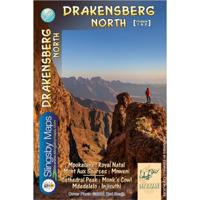
DRAKENSBERG NORTH: This double-sided A1-sized map is the first of three maps in the latest edition of our famous “Slingsby” Drakensberg map series. Side One covers the area from Mpokelana through Royal Natal to the dramatic Mnweni area, while Side Two details the ever-popular section of the Maloti-Drakensberg Park that includes Cathedral Peak, Did...

Verkopers met dit product

Verkoper
Bezorging
Prijs
DeZwerver.nl logo
DeZwerver.nl
2,95
29,95

Anderen bekeken ook

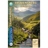
Wandelkaart 3&4 South Africa: Drakensberg Central | Slingsby Maps
DRAKENSBERG CENTRAL: This double-sided A1-sized map is the second of three maps in the latest edition of our famous “Slingsby” Drakensberg map series. Side One covers the area from Injesuthi southwards through the Giants Castle Game Reserve to Highmoor and Mkhomazi Wilderness. Side Two details Highmoor itself and the Mkhomazi Wilderness, including Lotheni and Kamberg. The map is printed on Duraflex waterproof material and is packaged in a plastic pocket.   The map is printed on Duraflex waterproof material, tear resistant and is packaged in a plastic pocket.   We can proudly claim that this is the best and most definitive hiking map of the Central Drakensberg ever produced.
29,95
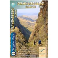
Wandelkaart 5&6 South Africa: Drakensberg South | Slingsby Maps
This double-sided map is the third of three maps in the latest edition of our famous “Slingsby” Drakensberg map series. Side One covers the area from Lotheni southwards through Vergelegen and the Mkhomazi Wilderness to the Sani Pass and Cobham. Side Two continues southwards through the Mzimkhulu Wilderness to Garden Castle, and from there to Bushman’s Nek and the Sehlabathebe National Park.   The map is printed on Duraflex waterproof material, tear resistant and is packaged in a plastic pocket.   We can proudly claim that this is the best and most definitive hiking map of the Southern Drakensberg ever produced.
29,95
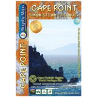
Wandelkaart South Africa: Cape Point and Simon's Town & Fish Hoek | Slingsby Maps
This is map three in our three-map series of Table Mountain National Park. Waterproof and tear resistant in plastic sleeve.   This brand new, fully redrawn and highly detailed map shows all approved paths and includes full GPS information for this historically-fascinating hiking area. The double-sided map with Cape Point on one side and Simon’s Town (including Kommetjie, Glencairn, Fish Hoek and Kalk Bay) on the reverse also highlights the Hoerikwaggo Trail.   The Cape Point side includes the whole Cape Point Nature Reserve: the area south of Miller’s Point and Klaasjagers all the way to Cape Point and the Cape of Good Hope.   The Simon’s Town side covers the area from Kommetjie to Fish Hoek/Kalk Bay and south to Glencairn, Simon’s Town and Miller’s Point, and west to Red Hill, Scarborough and Witsand.
29,95
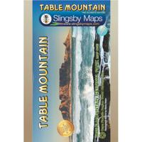
Wandelkaart South Africa: Table Mountain | Slingsby Maps
This highly detailed map shows all approved paths on the mountain and includes full GPS information. The map shows the Hoerikwaggo and the Peoples Trail, and covers the area from Signal Hill to Devils Peak and Llandudno to Constantia Nek and the Vlakkenberg Plateau. This is the only map of the mountain endorsed by the Table Mountain National Park, and approved by the Mountain Club of South Africa.   Distances and estimated times shown for all paths above the Contour Path or Pipe Track Long/Lat grid at 10" intervals as well as the 200 metre square UTM grid; Completely revised vegetation distribution Some vanished paths removed; some new ones added Three Firs, Oudekraal Ravine and Constantia Corner routes upgraded; Clearer depiction of many features, including dangerous routes All approved paths, with DD MM SS GPS coordinates for major junctions 10 metre contours & delicate colour height shading bring the topography to life Forty quality photos of the most prominent mountain flow…
29,95
Wandelkaart Namibia: Fish River Canyon | Slingsby Maps
This double-sided A1-sized map covers the entire iconic Fish River Canyon hike; and on the reverse the complete and fascinating geological map of the oldest canyon on Planet Earth matches the hiking map exactly. The map is printed on Duraflex waterproof material and is packaged in a plastic pocket.Data collected over four years has informed the content of this first-ever detailed topo map of the world-famous canyon. The map shows the suggested sides of the river to hike on, all the short-cuts, the usually-perennial pools, suggested overnight spots, etc etc. The maps includes distances both down the river and along the recommended route, as well as GPS coordinates, altitudes, etc A1+ full colour, double-sided map Scale 1:40 000 (2.5cm = 1km) 10m contours; relief shading 10" Long/Lat grid Coords in DDMMSS format at all recognised path junctions Contact numbers and detailed safety information WATERPROOF and TEAR RESISTANT in plastic wallet
29,95
Wegenkaart - landkaart South Africa: Baviaanskloof | Slingsby Maps
Whether you’re a hiker, mountain biker or 4×4 enthusiast this is the map you need for your visit to the spec- tacular Baviaanskloof. This is the most comprehensive, fully researched and detailed map of the Baviaansk- loof ever published. The map is fully GPS-compatible and will enable you to explore this fabulous, rugged wilderness, its geological marvels, extraordinary flora and fauna, and the poignant reminders of its Khoisan past…   Includes the new Leopard Trail and several interactive features.
29,95
Wegenkaart - landkaart South Africa: Wild Coast | Slingsby Maps
Wild Coast   Brand new 6th Edition of this great map : for 15 years the best and only detailed touring map of the Wild Coast!   The Wild Coast is a wilderness paradise, strewn with natural wonders. Over one hundred lagoons thread this romantic coast, pristine beaches await fishermen, surfers and holiday makers; mighty waterfalls plunge directly into the sea, rivers gouge deep secret valleys into this heartland of South Africa’s history. Birthplace and resting place of Nelson Rolihlahla Mandela, this extraordinary landscape is where visions were dreamed, battles fought, ships came to dramatic ends.   The sixth edition of our Wild Coast map is bigger and better than ever. The fully-revised map now includes larger insets of some important areas, as well as distance charts for coastal hikers, with the estuary-to-estuary distances down the length of the coast, from Port Edward to East London, amongst many other updates.
29,95
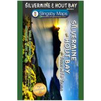
Wandelkaart South Africa: Silvermine & Hout Bay | Slingsby Maps
The map also includes:   The Constantia Winelands All sections of the Hoerikwaggo Trail are shown All approved paths, with detailed DDMMSS GPS coordinates for major junctions, are clearly marked with distances and approximate times for each path section 10 metre contours and delicate colour height shading bring the topography to life Additional info:   Silvermine and Hout Bay areas of the Cape Peninsula at 1:20,000 on a double-sided map printed on water-proof and tear-resistant synthetic paper.   The title is part of a series of high quality, detailed walking maps from Slingsby Maps, with excellent cartog- raphy and plenty of tourist information.   Contour lines are drawn at 10m intervals with additional altitude colouring. Roads indicate restricted access. Footpaths are highlighted and show waymarked routes and sections not recommended or dangerous. Sym- bols indicate information for visitors to the area: car parks, view points, signposts, public toilets, picnic areas, places of inte…
29,95
Wegenkaart - landkaart SC3-SC4 Swellendam to Mossel Bay | Tracks4Africa
The Cape to Addo map series covers the southern parts of the Western Cape of South Africa in a series of eight highly detailed maps, printed on four sheets of A1 durable paper.   We start in Cape Town in the west and move along the southern coast through the Overberg, Winelands, Garden Route, Klein Karoo R62, Baviaanskloof to eventually arrive in the Addo National Park up to Gqeberha (Port Elizabeth) in the east.   The maps are highly detailed and well researched. Our map scale is 1:200 000 which allows us to show a lot of detail including minor gravel roads, hiking trails, farm boundaries and points of interest which are relevant to self-drive tourists.   The size of the paper is kept small enough to allow this to be the perfect road tripping map. We use Duraflex paper and print two maps per sheet of A1 paper, making this a four-sheet series. Each map sheet is individually packed in a plastic protective sleeve.   The maps are perfect for day drives, overlanding or just doing road tri…
29,95
Wegenkaart - landkaart SC5-SC6 George to Kareedouw | Tracks4Africa
The Cape to Addo map series covers the southern parts of the Western Cape of South Africa in a series of eight highly detailed maps, printed on four sheets of A1 durable paper.   We start in Cape Town in the west and move along the southern coast through the Overberg, Winelands, Garden Route, Klein Karoo R62, Baviaanskloof to eventually arrive in the Addo National Park up to Gqeberha (Port Elizabeth) in the east.   The maps are highly detailed and well researched. Our map scale is 1:200 000 which allows us to show a lot of detail including minor gravel roads, hiking trails, farm boundaries and points of interest which are relevant to self-drive tourists.   The size of the paper is kept small enough to allow this to be the perfect road tripping map. We use Duraflex paper and print two maps per sheet of A1 paper, making this a four-sheet series. Each map sheet is individually packed in a plastic protective sleeve.   The maps are perfect for day drives, overlanding or just doing road tri…
29,95

Klanten-reviews van Wandelkaart 1&2 South Africa: Drakensberg North | Slingsby Maps

Er zijn nog geen beoordelingen voor dit productBen jij de eerste die een review plaatst?

Meer over Wandelkaart 1&2 South Africa: Drakensberg North | Slingsby Maps

Productomschrijving

DRAKENSBERG NORTH: This double-sided A1-sized map is the first of three maps in the latest edition of our famous “Slingsby” Drakensberg map series. Side One covers the area from Mpokelana through Royal Natal to the dramatic Mnweni area, while Side Two details the ever-popular section of the Maloti-Drakensberg Park that includes Cathedral Peak, Didima, Monk’s Cowl and Injesuthi.   The map is printed on Duraflex waterproof material, tear resistant and is packaged in a plastic pocket.   We can proudly claim that this is the best and most definitive hiking map of the Northern Drakensberg ever produced.

Verken gerelateerde categorieën

Webshop.nl maakt gebruik van cookies. Ga je verder op onze website, ga dan akkoord met het plaatsen van cookies en de verwerking van deze data door ons en vermelde partners.