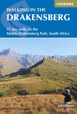

Wandelgids Drakensbergen - Walking in the Drakensberg | South Africa | Cicerone

0
Uitstekende wandelgids van dit geweldige gebied. goed beschreven met veel praktische informatie om de route te kunnen lopen, inclusief redelijke kaarten. This guidebook presents 75 day walks of 1km to 26km in South Africa's Maloti-Drakensberg Park, a UNESCO World Heritage Site. Located in KwaZulu Natal and easily accessible from Johannesburg, Harr...

Alle aanbiedingen van dit product

Verkoper
Bezorging
Prijs
DeZwerver.nl logo
DeZwerver.nl
niet bekend
2,95
25,95

Anderen bekeken ook

Wandelgids Drakensbergen - Walking in the Drakensberg | South Africa | Cicerone
Uitstekende wandelgids van dit geweldige gebied. goed beschreven met veel praktische informatie om de route te kunnen lopen, inclusief redelijke kaarten. This guidebook presents 75 day walks of 1km to 26km in South Africa's Maloti-Drakensberg Park, a UNESCO World Heritage Site. Located in KwaZulu Natal and easily accessible from Johannesburg, Harrismith, Pietermaritzburg and Durban, the region boasts dramatic cliffs, gorges and waterfalls, abundant wildlife and 2,000 year old rock paintings. The key centres for the walks are the entrances to the individual areas of the Park and usually have nearby accommodation of all types. They include the Royal Natal National Park, Cathedral Peak, Monk's Cowl, Injisuthi, Giant's Castle, Highmoor, Kamberg, Lotheni, the Himeville and Underberg districts, plus Bushman's Nek.
25,95
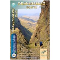
Wandelkaart 5&6 South Africa: Drakensberg South | Slingsby Maps
This double-sided map is the third of three maps in the latest edition of our famous “Slingsby” Drakensberg map series. Side One covers the area from Lotheni southwards through Vergelegen and the Mkhomazi Wilderness to the Sani Pass and Cobham. Side Two continues southwards through the Mzimkhulu Wilderness to Garden Castle, and from there to Bushman’s Nek and the Sehlabathebe National Park.   The map is printed on Duraflex waterproof material, tear resistant and is packaged in a plastic pocket.   We can proudly claim that this is the best and most definitive hiking map of the Southern Drakensberg ever produced.
29,95
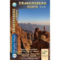
Wandelkaart 1&2 South Africa: Drakensberg North | Slingsby Maps
DRAKENSBERG NORTH: This doublesided A1-sized map is the first of three maps in the latest edition of our famous “Slingsby” Drakensberg map series. Side One covers the area from Mpokelana through Royal Natal to the dramatic Mnweni area, while Side Two details the ever-popular section of the Maloti-Drakensberg Park that includes Cathedral Peak, Didima, Monk’s Cowl and Injesuthi.   The map is printed on Duraflex waterproof material, tear resistant and is packaged in a plastic pocket.   We can proudly claim that this is the best and most definitive hiking map of the Northern Drakensberg ever produced.
29,95
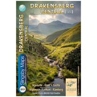
Wandelkaart 3&4 South Africa: Drakensberg Central | Slingsby Maps
DRAKENSBERG CENTRAL: This doublesided A1-sized map is the second of three maps in the latest edition of our famous “Slingsby” Drakensberg map series. Side One covers the area from Injesuthi southwards through the Giants Castle Game Reserve to Highmoor and Mkhomazi Wilderness. Side Two details Highmoor itself and the Mkhomazi Wilderness, including Lotheni and Kamberg. The map is printed on Duraflex waterproof material and is packaged in a plastic pocket.   The map is printed on Duraflex waterproof material, tear resistant and is packaged in a plastic pocket.   We can proudly claim that this is the best and most definitive hiking map of the Central Drakensberg ever produced.
29,95
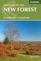
Wandelgids Walking in the New Forest | Cicerone
Goede wandelgids met veel dagtochten, geschikt voor iedereen.   A guidebook to 30 walks of between 3 and 10 miles set throughout the New Forest National Park in Hampshire and Wiltshire. Routes explore ancient woodland, heather-clad heath and dramatic coastline, all within easy reach of Southampton, Bournemouth and Salisbury. Walks for all abilities, easily combined to create longer challenges.   This guidebook presents 30 walks in the New Forest in Hampshire and Wiltshire, Britain's smallest National Park. Easily accessible from Southampton, Bournemouth, Salisbury and Winchester, the New Forest encompasses varied landscapes, from ancient woodlands to open heaths, rivers and coastline. Routes of between 5 and 16km (3 and 10 miles) explore the Forest, mainly on fairly flat terrain, often on well-defined tracks and paths. Most walks are suitable for all the family and many can be combined to make longer outings. Each walk is described in detail, highlighting the many points of interest…
18,95
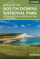
Wandelgids Walking in the South Downs National Park | Cicerone
Goede wandelgids uit de bekende Cicerone serie, dus met mooie foto's en duidelijke routebeschrijvingen en kaartjes. A guidebook to 40 circular day walks in the South Downs National Park. Exploring the beautiful chalk hills between Eastbourne and Winchester, there’s something for beginner and experienced walkers alike.   The walks range in length from 8 to 18km (5–11 miles), each is circular and where possible begins and ends at a place accessible by public transport.   1:50,000 OS maps are included for each walk Detailed information on public transport, accommodation and car parking Highlights include Beachy Head and Seven Sisters Easy access from Brighton and Worthing  
21,95
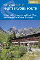
Wandelgids Walking in the Haute Savoie: South | Cicerone
Uitstekende wandelgids van dit geweldige gebied. goed beschreven met veel praktische informatie om de route te kunnen lopen, inclusief redelijke kaarten.   A guidebook of walks in the lovely Haute Savoie mountains of France. This guide describes 30 circular routes of between 7 and 20km, based around Annecy, La Clusaz, Grand Bornand, Plateau d'Assy, Samoëns, Sixt, Sallanches, Thônes, la Roche-sur-Foron. Graded from easy to difficult, there are walks to suit most abilities, but a few have some exposed sections and need a head for heights.   The guidebook is divided into 6 areas covering the Arve Valley, the Haut Giffre valley, the Chaîne des Aravis (north and south), Plateau de la Borne and Lake Annecy. Alongside a detailed route description and map, each walk has a summary of all you need to know before you set out (distance, time to walk, ascent, maximum altitude, grade and instructions for accessing the start). There is advice on travel, accommodation and equipment, as well as inform…
24,95
Wandelgids Walking in the Thames Valley | Cicerone
Walking in the Thames Valley offers 25 challenging circular walks around the River Thames and River Kennet in the south of England, taking in the Southern Chilterns, the Berkshire and North Hampshire Downs, Southern Oxfordshire and the eastern edge of Wiltshire. All routes are within easy reach of Reading, Newbury, Abingdon and London. While some walks visit Iron Age hill forts, others pass more modern features such as Wilton Windmill and the Kennet and Avon Canal. Some follow sections of the Ridgeway, while others meander along the banks of the Thames. What they all have in common is that they take the keen rambler to some of the best parts of the Thames Valley – a patchwork of open chalk grassland, broadleaved woodland and farmland and home to two Areas of Outstanding Natural Beauty. • walks from 10 to 18 miles, including one 2-day route • shorter, less strenuous alternatives for many of the walks • detailed route descriptions with information on local points of interest, OS mapping…
15,95
Wandelgids Walking in the Languedoc | Cicerone
Uitstekende wandelgids van dit geweldige gebied. goed beschreven met veel praktische informatie om de route te kunnen lopen, inclusief redelijke kaarten. 31 walks in the stunningly beautiful Parc Naturel du Haut-Languedoc. The climate is warm, the vineyards stretch out below you, and above is the towering Espinouse Massif. The Languedoc has for too long been in the shadow of Provence. Sharing the same Mediterranean climate and vegetation, it has not had done to it what Peter Mayle did for the Luberon - yet! Apart from its beaches, it is a quiet, beautiful place which retains more than a hint of the old France. This book is the fruit of 10 years' exploration of the central part of the Languedoc, north of Béziers. Much of this area forms the Parc Naturel du Haut-Languedoc, at the heart of which is the stunning Espinouse massif, rising abruptly some 850m from the valley floor. Close by is the valley of Lac du Salagou, an enormous man-made lake surrounded by impressive hills. A little fur…
23,95
Wandelgids Walking in the North Pennines | Cicerone
Uitstekende wandelgids van dit geweldige gebied. goed beschreven met veel praktische informatie om de route te kunnen lopen, inclusief redelijke kaarten. This guidebook describes 50 day walks across the North Pennines, England's remotest Area of Outstanding Natural Beauty taking in parts of Cumbria, County Durham and Northumberland. Most of the routes are circular and they range from 5 to 14 miles, with something to suit all abilities. Route descriptions are accompanied by 1:50K OS mapping. A guidebook to day walks in the North Pennines Area of Outstanding Natural Beauty (AONB), across Cumbria, County Durham and Northumberland. The book includes 50 walks exploring England’s ‘last wilderness’, ranging from 5 miles (8km) to 14 miles (23km). Most are circular, though there are some linear routes, and there is something to suit all abilities over a variety of terrain. Route descriptions are illustrated with OS mapping and colour photographs, and the book includes details of local transpor…
19,95

Klanten-reviews van Wandelgids Drakensbergen - Walking in the Drakensberg | South Africa | Cicerone

Er zijn nog geen beoordelingen voor dit productBen jij de eerste die een review plaatst?

Meer over Wandelgids Drakensbergen - Walking in the Drakensberg | South Africa | Cicerone

Productomschrijving

Uitstekende wandelgids van dit geweldige gebied. goed beschreven met veel praktische informatie om de route te kunnen lopen, inclusief redelijke kaarten.

This guidebook presents 75 day walks of 1km to 26km in South Africa's Maloti-Drakensberg Park, a UNESCO World Heritage Site. Located in KwaZulu Natal and easily accessible from Johannesburg, Harrismith, Pietermaritzburg and Durban, the region boasts dramatic cliffs, gorges and waterfalls, abundant wildlife and 2,000 year old rock paintings.

The key centres for the walks are the entrances to the individual areas of the Park and usually have nearby accommodation of all types. They include the Royal Natal National Park, Cathedral Peak, Monk's Cowl, Injisuthi, Giant's Castle, Highmoor, Kamberg, Lotheni, the Himeville and Underberg districts, plus Bushman's Nek.

Productinformatie

    Verken gerelateerde categorieën

    Webshop.nl maakt gebruik van cookies. Ga je verder op onze website, ga dan akkoord met het plaatsen van cookies en de verwerking van deze data door ons en vermelde partners.