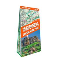

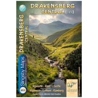
Wandelkaart 3&4 South Africa: Drakensberg Central | Slingsby Maps

0
DRAKENSBERG CENTRAL: This doublesided A1-sized map is the second of three maps in the latest edition of our famous “Slingsby” Drakensberg map series. Side One covers the area from Injesuthi southwards through the Giants Castle Game Reserve to Highmoor and Mkhomazi Wilderness. Side Two details Highmoor itself and the Mkhomazi Wilderness, including ...

Alle aanbiedingen van dit product

Verkoper
Bezorging
Prijs
DeZwerver.nl logo
DeZwerver.nl
niet bekend
2,95
29,95

Anderen bekeken ook

Wandelkaart 3&4 South Africa: Drakensberg Central | Slingsby Maps
DRAKENSBERG CENTRAL: This doublesided A1-sized map is the second of three maps in the latest edition of our famous “Slingsby” Drakensberg map series. Side One covers the area from Injesuthi southwards through the Giants Castle Game Reserve to Highmoor and Mkhomazi Wilderness. Side Two details Highmoor itself and the Mkhomazi Wilderness, including Lotheni and Kamberg. The map is printed on Duraflex waterproof material and is packaged in a plastic pocket.   The map is printed on Duraflex waterproof material, tear resistant and is packaged in a plastic pocket.   We can proudly claim that this is the best and most definitive hiking map of the Central Drakensberg ever produced.
29,95
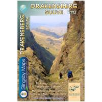
Wandelkaart 1&2 South Africa: Drakensberg North | Slingsby Maps
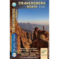
DRAKENSBERG NORTH: This doublesided A1-sized map is the first of three maps in the latest edition of our famous “Slingsby” Drakensberg map series. Side One covers the area from Mpokelana through Royal Natal to the dramatic Mnweni area, while Side Two details the ever-popular section of the Maloti-Drakensberg Park that includes Cathedral Peak, Didima, Monk’s Cowl and Injesuthi.   The map is printed on Duraflex waterproof material, tear resistant and is packaged in a plastic pocket.   We can proudly claim that this is the best and most definitive hiking map of the Northern Drakensberg ever produced.
29,95
Wandelkaart 3 South West Coast Path 3 | Harvey Maps
Een bijzonder handige kaart voor een deel van dit lange-afstands-wandelpad (Minehead tot St Ives) van het in totaal maar liefst 1014 km lange South West Coast Path. Op waterafstotend papier met veel details, uitstekend en voldoende voor dit deel van de route. De totale route bestaat uit 3 kaarten.    The South West Coast path is a 1014km (630mile) long distance path and the longest National Trail in England. The path stretches from Minehead in Somerset to Poole in Dorset. - This updated Trail Map covers the third and final section of the South West Coast Path from Plymouth to Poole Harbour which is 339km (211 miles).   - Includes the Jurassic Coast World Heritage Site and Durdle Door, the famous sea arch in Dorset. - The entire route on 3 sheets. This is map 3 of 3, a good two weeks? walking on one map.   - The XT40 is based on original HARVEY mapping with all the detail a walker would expect on a map at 1:40,000 scale. - Clear and easy to read mapping which is uncluttered by inf…
26,95

Klanten-reviews van Wandelkaart 3&4 South Africa: Drakensberg Central | Slingsby Maps

Er zijn nog geen beoordelingen voor dit productBen jij de eerste die een review plaatst?

Meer over Wandelkaart 3&4 South Africa: Drakensberg Central | Slingsby Maps

Productomschrijving

DRAKENSBERG CENTRAL: This doublesided A1-sized map is the second of three maps in the latest edition of our famous “Slingsby” Drakensberg map series. Side One covers the area from Injesuthi southwards through the Giants Castle Game Reserve to Highmoor and Mkhomazi Wilderness. Side Two details Highmoor itself and the Mkhomazi Wilderness, including Lotheni and Kamberg. The map is printed on Duraflex waterproof material and is packaged in a plastic pocket.   The map is printed on Duraflex waterproof material, tear resistant and is packaged in a plastic pocket.   We can proudly claim that this is the best and most definitive hiking map of the Central Drakensberg ever produced.

Productinformatie

    Verken gerelateerde categorieën

    Webshop.nl maakt gebruik van cookies. Ga je verder op onze website, ga dan akkoord met het plaatsen van cookies en de verwerking van deze data door ons en vermelde partners.