webshop.nl
Categorieën
  Sluiten

Wandelgids Walking the GR7 in Andalucia | Cicerone

Uitstekende wandelgids van een gerenommeerde Engelse uitgever. De tochten zijn met zorg beschreven en voorzien van allerhande nuttige informatie. With its white sandy beaches, pine forests, snow-capped peaks, traditional villages, lush river valleys and olive groves, the GR7 in Andalucía takes you on a journey through the most geographically divers...
26,50

Webshops met dit product

Webshop
Bezorging
Prijs

Anderen bekeken ook

Wandelgids Walking in Andalucia - Andalusië | Cicerone
Mooi en duidelijke wandelgids over bepaalde streken in Andalusië: goed beschreven wandelingen met een redelijke kaart. De tekst is behoorlijk kompleet. Daarnaast ook praktische informatie per route. This guidebook explores six of Andalucía's most beautiful Natural Parks, the Sierra Nevada regions of Aracena, Grazalema, Los Alcornocales and the Gaucín, La Axarquía, the Alpujarras and Cazorla, along the great belt of the Cordillera Bética mountains. The thirty-six half-day and full-day mostly circular walks are evenly split within these six regions, and range in length from 4 to 21km. Walks are graded and some involve steep ascents and descents, all within the capabilities of a reasonably fit walker. The vast mountain range of the Cordillera Bética offers some of the finest year-round walking in Europe. Towering above the Mediterranean, the highest peaks of the Sierra Nevada rise to almost 3500m, mainland Spain's highest mountains. And wrapped within this mighty belt of mountains are so…
22,95
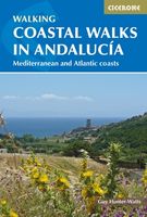
Wandelgids Coastal walks in Andalucia | Cicerone
Wandelgids met 40 wandelingen in Andalusië. Goede omschrijvingen, veel praktische informatie. Redelijk kaartmateriaal.    A guidebook to 40 half and full day coastal walks in Andalucía. The graded routes, which are suitable for any reasonably fit walker, range from 6km to 19.5km and can be walked all year round. The walks are located in seven of the region’s most beautiful National Parks and protected areas (including La Breña y las Marismas, Los Alcornocales y del Estrecho, La Sierra de las Nieves and Níjar-Cabo de Gata) and are mostly circular in nature, negating the need for any logistical legwork.   Step-by-step route descriptions for each walk are accompanied by 1:50,000 mapping, together with information about points of interest en route. Also included is a useful glossary and route summary table, plus all the practical information needed to explore Andalucía’s coast on foot – equipment, safety, when to go, refreshments, accommodation and more.   The picturesque coastline of Anda…
20,95
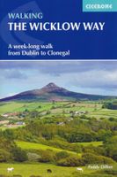
Wandelgids Walking the Wicklow Way | Cicerone
The Wicklow Way was the first long-distance walking trail to be established in Ireland. Coming in at 130km (81 miles), the route traverses the county of Wicklow, from Marlay Park on the outskirts of Dublin to Clonegal, just over the county border in neighbouring Carlow, and can be comfortably completed in a week. The guide also details several adjacent trails that can be interchanged with the main route, and short detours off-route (also described) lead to welcoming villages offering accommodation and a range of other facilities. The route is presented in seven stages, each with an overview followed by clear route description and mapping. There are elevation profiles and notes on local points of interest. In addition to background information about the county's history, geology, plants and wildlife, you will find all the information you need to walk the route, with helpful advice on transport, accommodation and kit. Accommodation listings, useful contacts and a glossary of Irish place-…
18,95
Wandelgids Walking in the Thames Valley | Cicerone
Walking in the Thames Valley offers 25 challenging circular walks around the River Thames and River Kennet in the south of England, taking in the Southern Chilterns, the Berkshire and North Hampshire Downs, Southern Oxfordshire and the eastern edge of Wiltshire. All routes are within easy reach of Reading, Newbury, Abingdon and London. While some walks visit Iron Age hill forts, others pass more modern features such as Wilton Windmill and the Kennet and Avon Canal. Some follow sections of the Ridgeway, while others meander along the banks of the Thames. What they all have in common is that they take the keen rambler to some of the best parts of the Thames Valley – a patchwork of open chalk grassland, broadleaved woodland and farmland and home to two Areas of Outstanding Natural Beauty. • walks from 10 to 18 miles, including one 2-day route • shorter, less strenuous alternatives for many of the walks • detailed route descriptions with information on local points of interest, OS mapping …
18,50
Wandelgids The Andalucian Coast to Coast Walk - Andalusie | Cicerone
Wandelgids met goed beschreven etappes met veel praktische informatie om de route te kunnen lopen, inclusief redelijke kaarten. Kaartmateriaal is vrij beperkt, maar het is moeilijk om deze route geheel met kaarten te dekken, dan heb je er wel erg veel nodig. De beschrijvinen zijn echter best goed, met wat gepuzzel ter plekke is het prima te doen.  Guidebook to the Andalucian Coast to Coast Walk, a 440km, 21-day route from Maro on the Mediterranean coast to Bolonia, on the Atlantic. The route, which passes through 7 Natural Parks, links some of Andalucía's most beautiful villages and passes historical sites of both Roman and Moorish origins, including Ronda and Tarifa.   Seasons Seasons Andalucía's mild winter climate means that this is a region that is suited to year-round walking, apart from July and August when temperatures are generally too hot for comfortable hiking.   Centres Centres Frigiliana, Cómpeta, Alcaucín, Riogordo, Villanueva de la Concepción, El Chorro, Carratraca, El Bu…
20,95
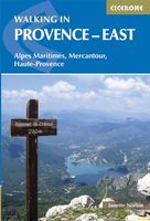
Wandelgids Walking in Provence - East | Cicerone
This guide offers 30 circular day walks in the eastern half of Provence, the large sun-kissed coastal region of south-east France. Spanning from the red rocks in the Ésterel on the Mediterranean to high mountains inland, the walks are set in the areas of the Alpes Maritimes, the Alpes de Haute-Provence and the Mercantour. Provence’s sunshine and Mediterranean charm attract many visitors to its coast, yet the area also has much more to offer the walker. The countryside inland boasts a range of scenery from remote mountaintops to spectacular gorges. History is everywhere, in medieval villages, arcaded streets, abbeys, churches and castles.    This guide covers the eastern regions, with its companion volume, Walking in Provence: West, covering the rest of this fascinating and historic landscape. The walking is incredibly diverse, and explores the country that hugs the Côte d'Azur and Italian border. The Alpes Maritimes rise craggy and wild above towns as unique as Grasse, Cannes and Monac…
21,95
Wandelgids The Ridgeway | Cicerone
Uitstekende wandelgids van de Ridgeway, waarbij naast alle noodzakelijke informatie ook gebruik gemaakt wordt van de echte topografische kaart. Inclusief gidsje met routekaarten van 1:25000   This guidebook - which includes both a guide to the route and a separate OS map booklet - describes the Ridgeway National Trail, an 87 mile (139km) route through southern England from Avebury in Wiltshire to Ivinghoe Beacon in Buckinghamshire. Typically walked in 6 or 8 days, this is a low-level waymarked route suitable for all abilities and for year round walking.   The guidebook details the trail in both directions, west to east and east to west. Step-by-step route descriptions are accompanied by 1:100,000 OS mapping and a separate OS 1:25,000 map booklet showing the entire route is included. Packed with details on points of interest and a trek planner giving at-a-glance information about facilities, public transport and accommodation available along the way, this book is an indispensable guide …
23,95
Wandelgids Walking in Cornwall | Cicerone
40 half to full day rambles on the coasts and inland hills of Cornwall are explored in this guidebook.  Routes range from short, 2 mile strolls to long, wild walks of over 8 miles. With plenty of opportunities to combine routes together, this guide provides a wealth of variety for walkers of all abilities.   The guidebook is divided into 6 sections, including walks on Bodmin Moor (for which good navigational skills are required), the North Coast, Penwith and West Cornwall, the Inland Mining Districts, Land's End and the Lizard and Roseland Peninsulas.    Cornwall has a lot to offer walkers; stunning coastal scenery and long stretches of wild moorland, with quiet estuaries cutting through high and rocky headlands. Birdlife and wildlife, from choughs to falcons to seals are found throughout the county, as are historical sites from the neolithic, to Iron Age hill forts and a long history of mining. The towns and villages of Cornwall, from the popular spots such as St Ives, Newquay and Pad…
19,95
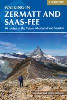
Wandelgids Walking in Zermatt and Saas-Fee | Cicerone
Wandelgids met dagtochten: goed beschreven met veel praktische informatie om de route te kunnen lopen, inclusief redelijke kaarten. Enorm veel keus in een groot gebied! Guidebook describing 50 varied walks in the Valais region in the heart of the Swiss Alps. The graded day walks based around the popular resort towns of Zermatt and Saas-Fee explore the Mattertal and Saastal valleys and the surrounding mountains. Ranging from 4 to 18km, the easily accessible routes make use of the area's extensive network of well-made mountain paths and its lift system. There are walks here to suit all tastes, from low-level lake walks or easy strolls up to mountain restaurants, through to serious mountain outings on steep and rocky trails. Distance, walking time and difficulty are shown for each route, and the detailed route description is accompanied by clear mapping.   Dominated by 4000m the giants, the Matterhorn and Monte Rosa, this is a land of contrasts, with snow-capped mountains and glaciers abo…
23,95
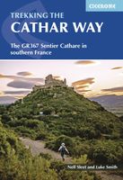
Wandelgids The Cathar Way | Cicerone
Guidebook to the GR367 Cathar Way (Sentier Cathare) in the Languedoc region of southern France. The 260km waymarked trail from Port la Nouvelle on the Mediterranean to Foix traces the history of the Cathars through the Eastern foothills of the Pyrenees. Split into 13 stages and offering a northern variant, the route takes about 2 weeks to complete. Two of the southernmost départements of France, the Pyrénées-Orientales and Ariège are inextricably linked with the history of the Cathars, a heretical Christian sect who were subjected to a crusade in the thirteenth century. Striking castles built on jagged rocky precipices are a highlight of the region and a reminder of those turbulent times. This guidebook describes the 260km Cathar Way (Sentier Cathare or GR367), a long-distance trail from Port-la-Nouvelle on the Mediterranean coast to Ariége's departmental capital Foix linking several of the impressive Cathar castles. The route follows ancient footpaths, jeep tracks and country lanes an…
22,95

Klanten-reviews van Wandelgids Walking the GR7 in Andalucia | Cicerone

Er zijn nog geen beoordelingen voor dit productBen jij de eerste die een review plaatst?

Meer over Wandelgids Walking the GR7 in Andalucia | Cicerone

Productomschrijving

Uitstekende wandelgids van een gerenommeerde Engelse uitgever. De tochten zijn met zorg beschreven en voorzien van allerhande nuttige informatie. With its white sandy beaches, pine forests, snow-capped peaks, traditional villages, lush river valleys and olive groves, the GR7 in Andalucía takes you on a journey through the most geographically diverse region on the Iberian peninsula. This wonderfully varied route starts at the southernmost tip of Spain at Tarifa, and meanders through the provinces of Cádiz and Málaga before dividing. The northern route heads through Córdoba and Jaén provinces (711km in total), whilst the southern route passes through Almería and Granada (720km). The route crosses seven stunning natural parks and the Sierra Nevada national park. • The first guide to cover the whole of the GR7 in Andalucía. • Detailed route description for around 60 days of walking, with options for creating shorter sections and days. • Information on all the villages en route offering accommodation so that you can plan your own route. The GR7 is one of Europe's longest GR long-distance routes, stretching from Tarifa, the southernmost town of continental Europe, through Spain, Andorra and France to Alsace. This guide presents the Andalucian section of the route, which offers well over 700km of fantastic walking through the diverse landscapes of one of Spain's most evocative regions. The route splits at the small village of Villanueva de Cauche, and the guide describes both the northern and southern variants. Although walking is on good footpaths, country tracks and, occasionally, minor roads, some of the stages are long and can involve considerable ascent, meaning that a good level of fitness is required. The full Andalucian GR7 takes well over a month to walk; however, the guide also includes suggestions for highlight sections that can be walked in a week or fortnight.   In addition to clear route description, mapping and elevation profiles, the guide provides background information on local history, plants and wildlife, and advice for planning your trip, such as when to go, what to take and where to stay.   The route showcases Andalucia's rich history and culture and varied landscapes, which include pine forests, semi-arid desert, snow-capped peaks, fertile plains, lush valleys, olive groves, cultivated terraces and hills of cork woodland. Historic towns and traditional whitewashed villages offer overnight accommodation and a chance to sample local cuisine.
Webshop.nl maakt gebruik van cookies. Ga je verder op onze website, ga dan akkoord met het plaatsen van cookies en de verwerking van deze data door ons en vermelde partners.