webshop.nl
Categorieën
  Sluiten

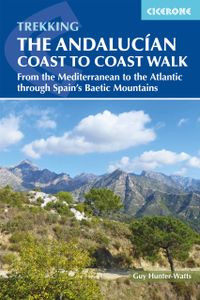
Wandelgids The Andalucian Coast to Coast Walk - Andalusie | Cicerone

Wandelgids met goed beschreven etappes met veel praktische informatie om de route te kunnen lopen, inclusief redelijke kaarten. Kaartmateriaal is vrij beperkt, maar het is moeilijk om deze route geheel met kaarten te dekken, dan heb je er wel erg veel nodig. De beschrijvinen zijn echter best goed, met wat gepuzzel ter plekke is het prima te doen.  ...
20,95

Webshops met dit product

Webshop
Bezorging
Prijs

Anderen bekeken ook

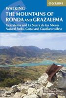
Wandelgids Walking the mountains of Ronda and Grazalema | Cicerone
Eén van de mooiste wandelgebieden van Europa: de zuidelijke Sierras van Spanje. Geweldige natuur met veel planten en vogels en bijzondere witte dorpen met een lekkere culinair hoogstaande keuken. De ideale combinatie voor een mooie week in voor- en najaar.  Deze wandelgids is dan ook een schot in de roos: veel dagtochten in genoemde parken, goed beschreven met veel praktische informatie. Kaartmateriaal is beperkt. Aanbevolen wandelkaarten bij deze gids: Wandelkaart Sierra de Grazalema | Editorial Penibetica Wandelkaart Sierra de las Nieves | Editorial Penibetica The dramatically situated town of Ronda can make a great base for a walking holiday in the mountains of Andalucia, as can any one of the picturesque 'pueblos blancos' (white villages) that nestle among the surrounding hills. This guidebook presents 32 mainly circular walks in the Ronda region, covering the town and its environs, the Natural Parks of La Sierra de Grazalema and La Sierra de las Nieves (both UNESCO biosphere reser…
23,95
Wandelgids Coastal walks in Andalucia | Cicerone
Wandelgids met 40 wandelingen in Andalusië. Goede omschrijvingen, veel praktische informatie. Redelijk kaartmateriaal.    A guidebook to 40 half and full day coastal walks in Andalucía. The graded routes, which are suitable for any reasonably fit walker, range from 6km to 19.5km and can be walked all year round. The walks are located in seven of the region’s most beautiful National Parks and protected areas (including La Breña y las Marismas, Los Alcornocales y del Estrecho, La Sierra de las Nieves and Níjar-Cabo de Gata) and are mostly circular in nature, negating the need for any logistical legwork.   Step-by-step route descriptions for each walk are accompanied by 1:50,000 mapping, together with information about points of interest en route. Also included is a useful glossary and route summary table, plus all the practical information needed to explore Andalucía’s coast on foot – equipment, safety, when to go, refreshments, accommodation and more.   The picturesque coastline of Anda…
20,95
Wandelgids The Peddars Way and Norfolk Coast Path | Cicerone
Uitstekende wandelgids van de Peddars Way en de Norfolk Coast Path, waarbij naast alle noodzakelijke informatie ook gebruik gemaakt wordt van de echte topografische kaart. The Peddars Way and Norfolk Coast Path National Trail is an easy-to-follow 130-mile trail that combines the best of inland and coastal walking in Norfolk, and one that, being well waymarked, largely flat and within easy reach of public transport for most of its length, is ideal for people new to long-distance walks.   Described here in 11 stages, the route can be walked in just over a week but also easily split into day walks or over a series of weekends, with full information about access to start and finish points for each stage by public transport. This handy guidebook is illustrated throughout with extracts of OS 1:50,000 mapping and stunning photographs depicting the Trail in all seasons and describes points of interest along the way, including the Nofolk Songlines sculptures, and also facilities available in th…
18,50
Wandelgids Coast to Coast Walk, From St Bees to Robin Hood's Bay | Cicerone
De beschrijving van de klassieke kust naar kust wandeling in het noorden van Engeland. Een van de mooiste en meest afwisselende wandeltochten van heel Engeland. Inclusief gidsje met routekaarten van 1:25000 First devised by Alfred Wainwright, the Coast to Coast Walk has emerged as a favourite among long-distance walkers. The route stretches some 185 miles (296km) from St Bees, an historic seaside village on Cumbria's west coast to Robin Hood's Bay in North Yorkshire. It is suitable for most fit walkers and can be comfortably walked in around a fortnight.   This guidebook presents the full route from west to east in 13 stages of 10½-20¾ miles (16.8-33.2km), with summaries covering the opposite direction. Alongside step-by-step route description, 1:100,000 mapping and fascinating notes about points of interest along the way, a comprehensive trek planner offers a helpful overview of facilities on route, and full accommodation listings and useful contacts can be found in the appendices. Th…
23,95
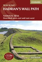
Wandelgids Hadrian's Wall Path | Cicerone
Meest duidelijke wandelgids van de route: veel details in kaarten en informatie, beide kanten op beschreven! The essential guidebook to walking the 84-mile Hadrian’s Wall Path. One of the UK's most visited National Trails, it runs the length of the Roman Wall from Bowness-on-Solway in Cumbria to Wallsend, Newcastle.   Begun in AD122 and stretching from the River Tyne to the Solway Firth, Hadrian’s Wall was a massive feat of engineering and is the best preserved frontier from the classical Roman Empire. Today it is a World Heritage Site, with iconic scenery and fascinating archaeological remains like Birdoswald, Housesteads and Vindolanda, giving a glimpse into Roman life and power. The trail is presented here in 10 stages, with suggestions for five and eight-day itineraries. It is suitable for beginners, although a reasonable level of fitness is required if doing it as a multi-day trek. The route is described both west to east and east to west, and the guidebook also features extension…
24,95
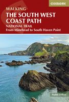
Wandelgids The South West Coast Path | Cicerone
Goede wandelgids van het langste gemarkeerde wandelpad van Groot Brittanië; 1015 km! Uit de bekende Cicerone serie, dus met mooie foto's en duidelijke routebeschrijvingen en kaartjes. The South West Coast Path is Britain's longest way-marked trail, measuring a staggering 1015km (630 miles). Written by the well-known outdoor writer, Paddy Dillon, the guide provides a wealth of detailed knowledge to help tackle this immense route with confidence. It describes the way-marked trail from Minehead to Poole along the north Devon, Cornish and south Devon coastline to finish at Poole Harbour. A full introduction provides the route's historical background, advice on accommodation along the route and details on travelling to and around the South West.There is detailed information on how to use this guide to make the most of your walk, whether you choose to walk the whole route in one go or decide to achieve sections at intervals.Day-by-day route summaries accompany the 45-day stages and the final…
24,95
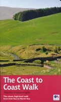
Wandelgids Coast to Coast Walk - van Ierse Zee tot Noordzee | Aurum Press
Goede gids over dit inmiddels beroemde pad. Kaartmateriaal is perfect, alsmede achtergrondinformatie. Praktische info wat minder, maar die is op de ramblerssite op internet te vinden! The Coast to Coast Walk is unique among Britain's long-distance footpaths in that it was the invention of one man, the legendary Alfred Wainwright, and enjoys no official status like, for example, the National trails in England and Wales. Nevertheless, it has become one of Britain's most popular long-distance walks, which is hardly surprising as it traverses some of the finest walking territory in the country. Starting at St Bees on the Cumbrian coast, the route runs for 192 miles (307 km) to Robin Hood's Bay on the North Sea and lies, for the most part, within the boundaries of three of Britain's loveliest National Parks - the Lake District, the Yorkshire Dales and the North York Moors. As well as the main route there are also alternatives available at several points. Martin Wainwright's description of t…
20,95
Wandelgids Coast to Coast the Wainwright Route | Rucksack Readers
Lange afstandswandelgids van de Coast to Coast wandeling. Wandelgids met kaarten en beschrijving. op waterbestendig papier, in spiraalbinding. This challenging walk of 184 miles (296 km) crosses the north of England from St Bees on the Cumbria coast to Robin Hood’s Bay on the North Sea. It passes through three National Parks – the Lake District, Yorkshire Dales and North York Moors – with splendidly varied scenery. Many walkers complete it within 12 to 16 days, although some divide it into two separate week-long walks.   Devised by the legendary Alfred Wainwright, the Coast to Coast is justly famous as England's most popular walk. It is waymarked, has plenty of accommodation and features welcoming pubs. Both its ends and two midpoints (Kirkby Stephen and Richmond) are accessible by public transport.   The new edition features many photographs by the award-winning landscape photographer Karen Frenkel. It also has freshly commissioned mapping, which appears on 25 of its 126 pages. It cov…
22,50
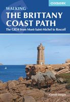
Wandelgids The Brittany Coast Path | Cicerone
Uitstekende wandelgids van deze mooie route. goed beschreven met veel praktische informatie om de route te kunnen lopen, inclusief redelijke kaarten This guide describes a 624km section of French long-distance route the GR34, following the north coast of Brittany from ever-popular Mont-Saint-Michel to the port of Roscoff. (The full GR34--also known as 'Sentier des Douaniers, ' the Customs Officers Path--totals some 2000km and follows in the footsteps of customs officers of old who patrolled the coast in attempt to curb smuggling.) The trail is waymarked and well maintained, offering mainly easy hiking, though there are a few more strenuous sections and some short steep ascents and descents. It takes around a month to complete but the guide also includes suggestions for four five-day 'highlight' sections. The route is described from east to west and presented in 28 stages. For each stage, you will find clear route description and mapping, summary statistics and notes on facilities, acco…
23,95
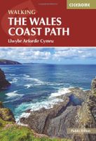
Wandelgids Walking the Wales Coast Path | Cicerone
The Wales Coast Path offers an unparalleled opportunity to walk a nation's coastline in its entirety. Stretching 1400km (870 miles) from Chester to Chepstow, including Anglesey, the waymarked trail takes 2-3 months to complete but can easily be broken into shorter sections. The walking is generally not difficult, although there are occasional rugged sections, steep ascents and descents and more remote stretches with fewer facilities.   The route is presented in 57 stages, ranging from 16 to 32km, each featuring clear route description illustrated with 1:100,000 mapping, overview statistics and notes on the availability of accommodation, facilities and public transport links. You'll find plenty of helpful advice for planning your walk, plus background information on Welsh history, geology, plants, wildlife and local points of interest.   Passing through the Snowdonia and Pembrokeshire Coast National Parks, as well as numerous AONBs and sections of Heritage Coast, the Wales Coast Path ta…
22,50

Klanten-reviews van Wandelgids The Andalucian Coast to Coast Walk - Andalusie | Cicerone

Er zijn nog geen beoordelingen voor dit productBen jij de eerste die een review plaatst?

Meer over Wandelgids The Andalucian Coast to Coast Walk - Andalusie | Cicerone

Productomschrijving

Wandelgids met goed beschreven etappes met veel praktische informatie om de route te kunnen lopen, inclusief redelijke kaarten. Kaartmateriaal is vrij beperkt, maar het is moeilijk om deze route geheel met kaarten te dekken, dan heb je er wel erg veel nodig. De beschrijvinen zijn echter best goed, met wat gepuzzel ter plekke is het prima te doen.  Guidebook to the Andalucian Coast to Coast Walk, a 440km, 21-day route from Maro on the Mediterranean coast to Bolonia, on the Atlantic. The route, which passes through 7 Natural Parks, links some of Andalucía's most beautiful villages and passes historical sites of both Roman and Moorish origins, including Ronda and Tarifa.   Seasons Seasons Andalucía's mild winter climate means that this is a region that is suited to year-round walking, apart from July and August when temperatures are generally too hot for comfortable hiking.   Centres Centres Frigiliana, Cómpeta, Alcaucín, Riogordo, Villanueva de la Concepción, El Chorro, Carratraca, El Burgo, Ronda, Montejaque, Cortes de la Frontera, Jimena de la Frontera, Castillo de Castellar, Los Barrios, Tarifa   Difficulty Difficulty The route is within the capabilities of anyone who is reasonably fit and walks on a regular basis. Stages vary in length from 14km to 27km, so all can be comfortably covered in a day: most are graded Medium-Medium Difficult, with just a couple graded Difficult due to length.   Must See Must See Some of Andalucía's most beautiful mountain villages, including Ronda, Frigiliana, Tarifa and El Burgo; Arab and Roman paths; high mountains; ocean views; great food and accommodation; six Natural parks; fascinating historical sites of Roman and Moorish origin  
Webshop.nl maakt gebruik van cookies. Ga je verder op onze website, ga dan akkoord met het plaatsen van cookies en de verwerking van deze data door ons en vermelde partners.