webshop.nl
Categorieën
  Sluiten

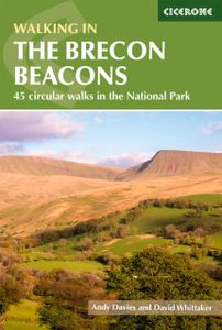
Wandelgids Walking on the Brecon Beacons | Cicerone

Uitstekende wandelgids van dit geweldige gebied. goed beschreven met veel praktische informatie om de route te kunnen lopen, inclusief redelijke kaarten. Guidebook to 45 graded circular walks in the Brecon Beacons National Park, perfect for those wishing to discover the diversity of the region, away from the crowds. The routes range from 4 to 24km ...
20,95

Webshops met dit product

Webshop
Bezorging
Prijs

Anderen bekeken ook

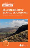
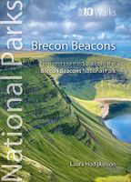
Wandelgids Brecon Beacons | Northern Eye Books
This good looking, modern walking book will take you on ten short circular themed walks across South Wales’ ever-popular Brecon Beacons National Park.   The Brecon Beacons was Britain’s 10th National Park, established in 1957 to preserve and highlight the unique landscape of the area. The Brecon Beacons are said to be named after the historical practice of lighting beacons of fire upon hilltops to forewarn neighbouring valleys of invasion.    The Brecon Beacons cover 1,344 square kilometres / 519 square miles with it’s spectacular waterfalls, valleys and expanse of hilly terrain; the Black Mountain to the west, the Fforest Fawr Geopark, Waterfall Country and the Pen y Fan range at the centre, and The Black Mountains to the east.   The variety of flora and fauna is as vast as the landscape. Rare sub-arctic, alpine plants thrive within this unique climate. Mammals you’re likely to spot include include wild mountain ponies, horseshoe bats, otters and water voles. Often seen birds of prey …
10,95
Wandelgids Brecon Beacons | Ordnance Survey
Get outside and enjoy ten short leisurely strolls across the Brecon Beacons National Park, indulging in wonderful mountain views across Southern Britain’s hilliest terrain. With routes for all abilities, enjoy a diverse range of experiences, including waterfalls, woodlands, riversides and even 12th century castle ruins.   Brecon Beacons Short Walks Made Easy routes include:       • Discover great mountain views from relatively level ground with routes at Mynydd Illtud and Craig y Cilau   • Or for a more strenuous walk, the ascent of Sugar Loaf will reward your uphill efforts with stupendous views across the national park   • Enjoy the thunderous sounds of the spectacular cascading waterfalls of Sgŵd Clun-gwyn and Sgŵd yr Eira, some of Wales most impressive!   • Delve into the Usk Valley for soothing riverside rambles from Brecon and Abergavenny, blessed with stunning views southwards towards the park’s highest peaks   • Spot an abundance of wildlife from the towpath along the Monmouths…
13,50
Wandelgids 18 Pathfinder Guides Brecon Beacons | Ordnance Survey
Wandelgids van een deel van Engeland. Deze gids bevat 28 dagwandelingen, variërend van korte tochten tot pittige dagtochten. De bijbehorende kaarten zijn uitstekend: men heeft de topografische kaarten van Ordnance Survey gebruikt waarop de route is ingetekend. Daarnaast praktische informatie over de wandeling en wat beschrijvingen van het gebied.   28 fabulous country walks in the Becon Beacons National Park, graded by length and ranging from 3 to 10 miles.   All routes come with a clear, large-scale OS map, GPS waypoints and highlight where to park, good pubs and places of interest en route.   Within the boundaries of the Brecon Beacons National Park there are four separate mountain ranges, including the Black Mountains as well as the Beacons themselves. Most of the area is underlain by old red sandstone, which distinguishes it from the more rugged mountains of North Wales, and several walks explore this terrain of smooth, sweeping grassy uplands and wide, open vistas, including the B…
18,50
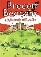
Wandelgids Brecon Beacons | Pocket Mountains
The Brecon Beacons National Park is home to some of the most spectacular mountain and moorland scenary in Britain. Bridging South and Mid Wales, the park can be divided into three distinct upland areas, with the central flat-topped peaks of the Brecon Beacons massif sandwiched by the rolling ridges of the Black Mountains in the East and the similarly named, but quite different, Black Mountain region in the West. As well as being packed full of standing stones, castles, wildlife and waterfalls, the park is also home to the Fforest Fawr UNESCO Global Geopark and is recognised as an International Dark Sky Reserve.   The 40 circular routes in the volume cover all the most popular peaks, as well as highlighting some lesser-known gems in one of Britain's best-loved national parks.  
10,95
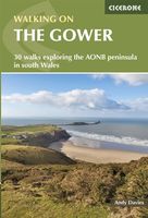
Wandelgids Walking on the Gower | Cicerone
Wandelgids met 30 wandelroutes in het zuiden van Wales This guidebook presents 30 circular day walks across the Gower Area of Outstanding Natural Beauty, taking in the rich variety of landscapes across this beautiful area of South Wales. Ranging from 2½ to 14 miles long, there are walks to suit all abilities. The peninsula is famous for its spectacularly steep, rugged coastline and golden sandy beaches but this guide also takes walkers to the inland valleys, hills and ridges little explored by most holidaymakers.   Routes are illustrated with OS mapping extracts and inspiring photography and accompanied by a route summary table to help you choose walks to suit your location and ability. Along the way, the author provides a wealth of information on plants, animals, geology, history and archaeology of a region. There is something for everyone, all within a compact area easily accessible from Swansea and Mumbles.   Coastal areas such as those around Langland, Oxwich and Port Eynon are wel…
19,50
Wandelkaart Brecon Beacons West | Harvey Maps
Includes Pen y Fan, Foel Fraith, Fan Fawr and Fan Gyhirych.   Detailed map for hillwalkers of the western part of the Brecon Beacons National Park at the popular scale of 1:25,000.   New, Superwalker XT25 of the Brecon Beacons National Park on 2 sheets. Brecon Beacons WEST - This map covers Pen y Fan, Fforest Fawr and, the Black Mountain in the far west. Brecon Beacons National Park boasts a magnificent array of Old Red Sandstone peaks, open moorland and green valleys covering 500 square miles (1344 Square km) of beautiful mid-Wales countryside. Revised and re-designed they have got everything. Genuine original HARVEY mapping at 1:25,000. Ideal for walking. Clear, easy to read. Easy to re-fold, Opens directly to either side of the sheet. Slim and flexible. Light to carry. Tearproof, durable, AND - 100% waterproof as standard.
24,95
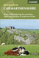
Wandelgids Walking in Carmarthenshire | Cicerone
This guidebook presents 30 contrasting day walks exploring the mountains, valleys and coastline of Carmarthernshire in south-west Wales. Ranging from 2 to 10 miles in length and suitable for walkers of all abilities, the routes introduce the varied walking on offer in this county, including parts of the Brecon Beacons and the Cambrian Mountains.   Alongside detailed route descriptions and clear OS mapping, the book is packed with interesting information about the places and heritage encountered. Notes on landscape, geology and wildlife of the area are included, and for each walk there is useful practical information on transport and refreshments.   A county of contrasts with around 1850 miles of footpaths, Carmarthernshire is a walker's paradise. Highlights include the Black Mountains (Mynydd Du), the Teifi Valley, Camarthen Bay, the southwestern Coast, and 'Dylan Thomas Country' around Laugharne.   Activities Walking   Seasons The walks can be done at any time of year, but the drier m…
19,50
Wandelgids 100 outstanding British Walks | Ordnance Survey
Beschrijving van de 100 mooiste Pathfinder wandelingen in Engeland, Wales en Schotland. Uitstekende beschrijving van de route met een zeer duidelijke topografische kaart waarop de route is ingetekend.  This magnificent compendium of outstanding British walks brings together the finest selection of Pathfinder Walks in Britain s officially designated places of scenic beauty and historic interest: National Parks, Areas of Outstanding Natural Beauty, National Scenic Areas, Heritage Coast, National Trails and UNESCO World Heritage Sites. There are 100 walking gems in this collection, recommended by a group of experienced authors and guides. The walks span a range of distances and degrees of challenge and are organised by region with coverage across England, Wales and Scotland. 100 Outstanding British Walks is lavishly illustrated with stunning landscape photography and informative introductions to each of the walks. It is designed to be enjoyed at home, while the OS Maps app provides the pr…
27,95
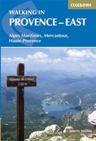
Wandelgids Walking in Provence - East | Cicerone
This guide offers 30 circular day walks in the eastern half of Provence, the large sun-kissed coastal region of south-east France. Spanning from the red rocks in the Ésterel on the Mediterranean to high mountains inland, the walks are set in the areas of the Alpes Maritimes, the Alpes de Haute-Provence and the Mercantour. Provence’s sunshine and Mediterranean charm attract many visitors to its coast, yet the area also has much more to offer the walker. The countryside inland boasts a range of scenery from remote mountaintops to spectacular gorges. History is everywhere, in medieval villages, arcaded streets, abbeys, churches and castles.    This guide covers the eastern regions, with its companion volume, Walking in Provence: West, covering the rest of this fascinating and historic landscape. The walking is incredibly diverse, and explores the country that hugs the Côte d'Azur and Italian border. The Alpes Maritimes rise craggy and wild above towns as unique as Grasse, Cannes and Monac…
21,95
Reisgids South Wales - Zuid Wales | Bradt Travel Guides
Voor vele landen net zo goed, zo niet beter dan de Planet. Beduidend soberder uitgevoerd, maar ook met veel informatie voor backpackers en met veel kaartmateriaal. Een aanrader! This new Bradt guidebook is the first solely dedicated to a specific part of Wales, encompassing the country's southern third. Covering Monmouthshire, Glamorgan, Carmarthenshire, Pembrokeshire and Brecon Beacons National Park, this guide provides in-depth coverage of a broad range of attractions. Catering for walkers, heritage aficionados, wildlife lovers, families, mountain bikers, foodies and city-lovers, it furnishes all the practical information you need to plan and enjoy time in South Wales.The region boasts 400 miles of coastline, along which some of Britain's finest beaches nestle between comely resorts and traditional fishing villages, including in the dramatic Pembrokeshire Coast National Park. Inland, The Valleys encompass a former powerhouse of the British coal-mining industry where abandoned collier…
22,50

Klanten-reviews van Wandelgids Walking on the Brecon Beacons | Cicerone

Er zijn nog geen beoordelingen voor dit productBen jij de eerste die een review plaatst?

Meer over Wandelgids Walking on the Brecon Beacons | Cicerone

Productomschrijving

Uitstekende wandelgids van dit geweldige gebied. goed beschreven met veel praktische informatie om de route te kunnen lopen, inclusief redelijke kaarten. Guidebook to 45 graded circular walks in the Brecon Beacons National Park, perfect for those wishing to discover the diversity of the region, away from the crowds. The routes range from 4 to 24km and cover the north-eastern, eastern and south-western valleys and ridges, Fforest Fawr, Waterfall Country, the Black Mountain (Mynydd Du) and the Black Mountains (y Mynyddoedd Duon). Designed to include all the interesting facts an expert park ranger would provide, the guide contains a wealth of information about local geology, botany, archaeology, history, mythology, industrial heritage and environmental issues.   Clear route description is illustrated with 1:50,000 OS Landranger mapping, summary statistics are provided for each walk and handy tables make it easy to compare routes or choose according to points of interest.   A remarkably varied landscape, the Brecon Beacons National Park showcases some of the best scenery in Wales. The walks take in mountain peaks and ridges, waterfalls, wooded river gorges and remote upland valleys, with highlights including Pen y Fan, the highest peak in south Wales, and the spectacular Sgwd Gwladus (White Lady Falls), Sgwd yr Eira and Sgwd Clun-gwyn waterfalls. Picturesque market towns on the edges of the park, such as Llandovery, Brecon, Crickhowell and Abergavenny, are also great places to explore and ideal bases for a walking holiday.
Webshop.nl maakt gebruik van cookies. Ga je verder op onze website, ga dan akkoord met het plaatsen van cookies en de verwerking van deze data door ons en vermelde partners.