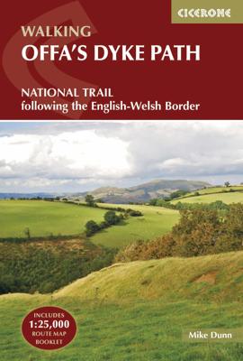

Wandelgids The Offa's Dyke Path - Wales | Cicerone

0
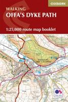
Engelstalige beschrijving van de mooiste wandeltocht in Wales. De gids voldoet aan alle verwachtingen die je kunt hebben, het enige dat je mist is een overzichtskaart. Inclusief gidsje met routekaarten van 1:25000 (deze is hier ook los te bestellen) This guidebook - which includes both a guide to the route and a separate OS map booklet - describes...

Alle aanbiedingen van dit product

Verkoper
Bezorging
Prijs
DeZwerver.nl logo
DeZwerver.nl
2,95
25,95

Anderen bekeken ook

Wandelgids The Offa's Dyke Path - Wales | Cicerone
Engelstalige beschrijving van de mooiste wandeltocht in Wales. De gids voldoet aan alle verwachtingen die je kunt hebben, het enige dat je mist is een overzichtskaart. Inclusief gidsje met routekaarten van 1:25000 (deze is hier ook los te bestellen) This guidebook - which includes both a guide to the route and a separate OS map booklet - describes Offa's Dyke Path National Trail from south to north, following the longest linear earthwork in Britain, running 177 miles along the English-Welsh border between Sedbury (near Chepstow) and Prestatyn on the north Wales Coast. It links the Severn Estuary and the Irish Sea, following the longest linear earthwork in Britain, contouring above the Wye and Dee, visiting hillforts and Norman castles and exploring the hidden heritage of the Marches. The route is exceptional in all seasons, although the Black Mountains and Clwydian range deserve respect in winter conditions.   The guidebook splits one of Britain's classic trails into 12 stages, with s…
25,95
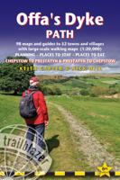
Wandelgids Offa's Dyke Path | Trailblazer Guides
Goede wandelgids van de Offa's Dyke Path. Met veel details zijn alle etappes beschreven. Tevens informatie over overnachtingen en openbaar vervoer.   All the information you need to walk Offa's Dyke Path in this two-way edition, with routes re-walked in both directions - from Chepstow to Prestatyn and from Prestatyn to Chepstow and reformatted for use by walkers hiking south to north and north to south. The Offa's Dyke Path is a magnificent National Trail that runs from the North Wales coast to the Severn Estuary following the line of Offa's Dyke, an impressive 8th century earthwork along the English/Welsh border. The ever-changing landscape - the Wye Valley, the Black Mountains, the Shropshire Hills and the Clwydian Hills - is steeped in history and legend providing 177 miles of fascinating walking.   This sixth edition has been re-walked and fully updated and includes:98 walking maps - 1:20,000 (3 and 1/8 inches to 1 mile) - the largest-scale maps availableUnique mapping feature…
21,95
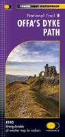
Wandelkaart Offa's Dyke Path | Harvey Maps
Wandelkaart van het Offa's Dyke Path met uitsnedes van de route. Entire route on one map   Offa's Dyke Path is a National Trail 285km long (178 miles) along the border between Wales and England. The route runs from Chepstow in the south to Prestatyn on the north Wales coast.   Offa was a famous king of Mercia from 757 to 796, ruling an area stretching across a large part of England.   Offa's Dyke Path runs from sea to sea - the Severn Estuary to Liverpool Bay. For about 112km (70 miles) the Path follows the course of what was originally an 8m ditch and rampart. Castles, forts and historic sites dot the route.   Tough, light, durable and 100% waterproof Includes Rights of Way Genuine original HARVEY mapping Route clearly marked
29,95
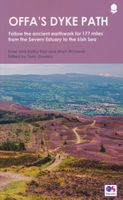
Wandelgids Offa's Dyke Path (Prestatyn - Chepstow) | Aurum Press
Goede beschrijving van de aantrekkelijke route. Kaartmateriaal van Ordnance Survey - de Engelse topografische dienst op een schaal van 1:25.000. Praktische info voor overnachten ed. niet altijd uitgebreid, maar die is op de site van de Ramblers (de engelse wandelorganisatie) te vinden. Offa's Dyke Path is the 177-mile (283-km) National Trail following the course of the man-made dyke that gives it its name. This volume, now fully updated, features the complete section of the Path, following Natural England's acorn waymarks from Chepstow to Prestatyn.  This is the complete, official guide for the long distance walker or the weekend stroller. All you need is this one book. National Trail Guides are the official guidebooks to the fifteen National Trails in England and Wales and are published in association with Natural England, the official body charged with developing and maintaining the Trails. 
20,95
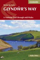
Wandelgids Glyndwr's Way - Wales | Cicerone
Een beschrijving van de Glyndwr's way, goede beschrijving met gedetailleerd kaartmateriaal..Ook praktische informatie en hoogteprofielen per etappe. Guidebook to walking Glyndwr's Way, a long-distance National Trail through mid-Wales. The 135 mile route from Knighton via Machynlleth to Welshpool takes 9 days to walk, and 2 days (29 miles) to complete the loop down the Offa's Dyke Path to create a circular trail. A lovely trail through quiet hills, forests and rolling countryside.   A complete guide to walking Glyndr's Way National Trail. This guidebook divides the 135 mile trail into nine day stages, starting at Knighton and ending at Welshpool. Days 10 and 11 follow the Offa's Dyke Path National Trail for those who prefer a circular route. The step-by-step route descriptions are accompanied by OS map extracts, photographs and lots of information on facilities available and historical points of interest along the way. Glyndr's Way is clearly waymarked throughout and there is accommoda…
23,95
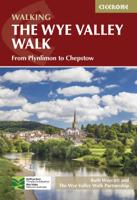
Wandelgids guide to the Wye Valley Walk - Welsh borders, Wales | Cicerone
Uitstekende wandelgids van dit geweldige gebied. goed beschreven met veel praktische informatie om de route te kunnen lopen, inclusief goede kaarten. The official guide to backpacking or walking the Wye Valley Walk, 136 miles through the Welsh borders, crossing between south Wales and Herefordshire, from Chepstow to Plynlimon. Easy walking through wooded gorges, riverside meadows and open moorland, passing sites such as Tintern Abbey, Goodrich Castle, Hereford Cathedral and Hay-on-Wye. The Wye Valley Way offers a perfect mix of river and hill walking as it follows the River Wye for 136 miles from river’s mouth at Chepstow to the slopes of Plynlimon in Powys criss -crossing the border between England and Wales. The walk leads through a dramatic limestone gorge, dense woodland beneath limestone crags and past peaceful river meadows in some of the most superb scenery in the heart of the Wye Valley Area of Outstanding Natural Beauty, the birthplace of tourism and the Picturesque movement.…
21,95
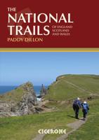
Wandelgids the National Trails - Great British Walks - Engeland, Wales en Schotland | Cicerone
Guidebook to Britain's National Trails - 19 long-distance walking routes through England, Wales and Scotland, describing what makes each of them so special and providing the practical information to help you plan your route. A definitive reference to the best of British walking. England South West Coast Path South Downs Way North Downs Way The Ridgeway Thames Path Cotswold Way Peddars Way & Norfolk Coast Path Cleveland Way Pennine Bridleway Hadrian's Wall Path Wales Pembrokeshire Coast Path Offa's Dyke Path Glyndwyrs Way Scotland Southern Upland Way Speyside Way West Highland Way Great Glen Way In 1965 as the first National Trail in the country was opened – ‘a Pennine Way from the Peak to the Cheviots’. Together, the National Trails cover well over 5000 kilometres (3100 miles), exploring the rich, scenic, historic countryside of Britain. Some trails are short and easy, while others are long and challenging. Some have a strong theme, following rugged coastlines or meandering rivers. Ot…
27,95
Wandelgids Hadrian's Wall Path | Cicerone
Meest duidelijke wandelgids van de route: veel details in kaarten en informatie, beide kanten op beschreven! The essential guidebook to walking the 84-mile Hadrian’s Wall Path. One of the UK's most visited National Trails, it runs the length of the Roman Wall from Bowness-on-Solway in Cumbria to Wallsend, Newcastle.   Begun in AD122 and stretching from the River Tyne to the Solway Firth, Hadrian’s Wall was a massive feat of engineering and is the best preserved frontier from the classical Roman Empire. Today it is a World Heritage Site, with iconic scenery and fascinating archaeological remains like Birdoswald, Housesteads and Vindolanda, giving a glimpse into Roman life and power. The trail is presented here in 10 stages, with suggestions for five and eight-day itineraries. It is suitable for beginners, although a reasonable level of fitness is required if doing it as a multi-day trek. The route is described both west to east and east to west, and the guidebook also features extensio…
24,95
Wandelgids The Cotswold Way | England | Cicerone
Uitstekende wandelgids van de Cotswolds Way, waarbij naast alle noodzakelijke informatie ook gebruik gemaakt wordt van de echte topografische kaart. inclusief gidsje met routekaarten van 1:25000 (deze is hier ook los te bestellen) Guidebook to walking the 102 mile (163km) Cotswold Way National Trail between Chipping Campden and Bath, across the Cotswolds AONB. The guidebook - which includes both a guide to the route and a separate OS 1:25,000 map booklet - describes the route in both directions.   The route is described over 13 stages, each following the Cotswold escarpment, with dramatic and far-reaching views across the Severn Vale towards the Welsh hills, plunging down to visit honey-coloured villages, old market towns and the elegant and historic city of Bath. The longest of the 13 stages is 10 miles, the shortest 6 miles: these are dictated by the existence of overnight accommodation. For the determined, the trail can be walked in as little as five days.   The Cotswold Way offers…
24,95
Wandelgids The Westweg | Cicerone
Uitstekende wandelgids van een meerdaagse tocht in het Zwarte Woud in Duitsland. Goede beschrijvingen, veel praktische informatie en redelijke kaarten al zullen deze niet helemaal voldoende zijn. Guidebook to the Westweg (Westway), a 285km walk across Germany's Black Forest from Pforzheim to Basel. This classic route, which includes Feldberg, Black Forest's highest peak, takes 13 to 14 days, each day stage ranging from 15 to 28km. Two variants are described, both well way-marked and suitable for those new to long distance walking. This guidebook is all you need to discover The Westweg, a 285km walk along the length Germany's Black Forest from Pforzheim to Basel. This classic long-distance trail takes around two weeks to walk, in stages of 15-28km. The route is well way-marked and suitable for experienced hikers and those new to long distance walking, though some sections are steep. The Westweg incorporates many of the region's highlights, such the Schwarzwald National Park, the source…
23,95

Klanten-reviews van Wandelgids The Offa's Dyke Path - Wales | Cicerone

Er zijn nog geen beoordelingen voor dit productBen jij de eerste die een review plaatst?

Meer over Wandelgids The Offa's Dyke Path - Wales | Cicerone

Productomschrijving

Engelstalige beschrijving van de mooiste wandeltocht in Wales. De gids voldoet aan alle verwachtingen die je kunt hebben, het enige dat je mist is een overzichtskaart. Inclusief gidsje met routekaarten van 1:25000 (deze is hier ook los te bestellen)

This guidebook - which includes both a guide to the route and a separate OS map booklet - describes Offa's Dyke Path National Trail from south to north, following the longest linear earthwork in Britain, running 177 miles along the English-Welsh border between Sedbury (near Chepstow) and Prestatyn on the north Wales Coast. It links the Severn Estuary and the Irish Sea, following the longest linear earthwork in Britain, contouring above the Wye and Dee, visiting hillforts and Norman castles and exploring the hidden heritage of the Marches. The route is exceptional in all seasons, although the Black Mountains and Clwydian range deserve respect in winter conditions.   The guidebook splits one of Britain's classic trails into 12 stages, with suggestions for alternative 8 and 16 day schedules. This is a long but not too difficult walk for walkers of all abilities. Step-by-step route descriptions are accompanied by 1:100,000 OS mapping. A trek planner gives at a glance information about facilities, public transport and accommodation available along the route. Also included is a convenient booklet of 1:25,000 OS maps, which provides all the mapping needed to complete the trail.    The walk is astonishingly varied, taking in the lower Wye gorge, the Severn and the Dee rift valley, the pastures and woodlands of the border country, the remote moorland of the Black Mountains and the Clwydian range, and the dramatic limestone escarpments of Eglwyseg mountain. What makes it even more special is over 60 miles walking alongside the Saxon earthwork of Offa's Dyke, the path sometimes on the Dyke and sometimes alongside.    Steden en Dorpen Chepstow, Hay-on-Wye, Kington, Bishops Castle, Montgomery, Welshpool, Oswestry, Llangollen, Denbigh, Prestatyn  


Productinformatie

    Verken gerelateerde categorieën

    Webshop.nl maakt gebruik van cookies. Ga je verder op onze website, ga dan akkoord met het plaatsen van cookies en de verwerking van deze data door ons en vermelde partners.