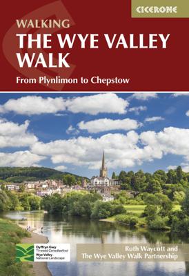

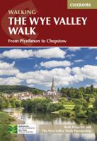
Wandelgids guide to the Wye Valley Walk - Welsh borders, Wales | Cicerone

0
Uitstekende wandelgids van dit geweldige gebied. goed beschreven met veel praktische informatie om de route te kunnen lopen, inclusief goede kaarten. The official guide to backpacking or walking the Wye Valley Walk, 136 miles through the Welsh borders, crossing between south Wales and Herefordshire, from Chepstow to Plynlimon. Easy walking through...

Alle aanbiedingen van dit product

Verkoper
Bezorging
Prijs
DeZwerver.nl logo
DeZwerver.nl
niet bekend
2,95
21,95

Anderen bekeken ook

Wandelgids guide to the Wye Valley Walk - Welsh borders, Wales | Cicerone
Uitstekende wandelgids van dit geweldige gebied. goed beschreven met veel praktische informatie om de route te kunnen lopen, inclusief goede kaarten. The official guide to backpacking or walking the Wye Valley Walk, 136 miles through the Welsh borders, crossing between south Wales and Herefordshire, from Chepstow to Plynlimon. Easy walking through wooded gorges, riverside meadows and open moorland, passing sites such as Tintern Abbey, Goodrich Castle, Hereford Cathedral and Hay-on-Wye. The Wye Valley Way offers a perfect mix of river and hill walking as it follows the River Wye for 136 miles from river’s mouth at Chepstow to the slopes of Plynlimon in Powys criss -crossing the border between England and Wales. The walk leads through a dramatic limestone gorge, dense woodland beneath limestone crags and past peaceful river meadows in some of the most superb scenery in the heart of the Wye Valley Area of Outstanding Natural Beauty, the birthplace of tourism and the Picturesque movement.…
21,95
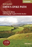
Wandelgids The Offa's Dyke Path - Wales | Cicerone
Engelstalige beschrijving van de mooiste wandeltocht in Wales. De gids voldoet aan alle verwachtingen die je kunt hebben, het enige dat je mist is een overzichtskaart. Inclusief gidsje met routekaarten van 1:25000 (deze is hier ook los te bestellen) This guidebook - which includes both a guide to the route and a separate OS map booklet - describes Offa's Dyke Path National Trail from south to north, following the longest linear earthwork in Britain, running 177 miles along the English-Welsh border between Sedbury (near Chepstow) and Prestatyn on the north Wales Coast. It links the Severn Estuary and the Irish Sea, following the longest linear earthwork in Britain, contouring above the Wye and Dee, visiting hillforts and Norman castles and exploring the hidden heritage of the Marches. The route is exceptional in all seasons, although the Black Mountains and Clwydian range deserve respect in winter conditions.   The guidebook splits one of Britain's classic trails into 12 stages, with s…
25,95
Wandelgids Glyndwr's Way - Wales | Cicerone
Een beschrijving van de Glyndwr's way, goede beschrijving met gedetailleerd kaartmateriaal..Ook praktische informatie en hoogteprofielen per etappe. Guidebook to walking Glyndwr's Way, a long-distance National Trail through mid-Wales. The 135 mile route from Knighton via Machynlleth to Welshpool takes 9 days to walk, and 2 days (29 miles) to complete the loop down the Offa's Dyke Path to create a circular trail. A lovely trail through quiet hills, forests and rolling countryside.   A complete guide to walking Glyndr's Way National Trail. This guidebook divides the 135 mile trail into nine day stages, starting at Knighton and ending at Welshpool. Days 10 and 11 follow the Offa's Dyke Path National Trail for those who prefer a circular route. The step-by-step route descriptions are accompanied by OS map extracts, photographs and lots of information on facilities available and historical points of interest along the way. Glyndr's Way is clearly waymarked throughout and there is accommoda…
23,95
Wandelgids 029 Pathfinder Guides Wye Valley and Forest of Dean | Ordnance Survey
Wandelgids Wye Valley en Forest of Dean. Deze gids bevat 28 dagwandelingen, variërend van korte tochten tot pittige dagtochten. De bijbehorende kaarten zijn uitstekend: men heeft de topografische kaarten van Ordnance Survey gebruikt waarop de route is ingetekend. Daarnaast praktische informatie over de wandeling en wat beschrijvingen van het gebied. The Wye Valley and Forest of Dean Pathfinder guidebook contains 28 circular walks for all abilities. Walks are from 4km to 17km long, and each route includes a difficulty rating, route directions, an extract of the Ordnance Survey map and notes and photos of key features to look for. All of them have been created and tested by experienced walkers to help you make the most of the area.   This guide focuses on the middle and lower sections of the Wye Valley, roughly where the river leaves its upper reaches in mid-Wales to enter Herefordshire. Hay-on-Wye, Hereford and the walled town of Chepstow are also covered, as is the classic view over t…
18,95
Wandelgids the National Trails - Great British Walks - Engeland, Wales en Schotland | Cicerone
Guidebook to Britain's National Trails - 19 long-distance walking routes through England, Wales and Scotland, describing what makes each of them so special and providing the practical information to help you plan your route. A definitive reference to the best of British walking. England South West Coast Path South Downs Way North Downs Way The Ridgeway Thames Path Cotswold Way Peddars Way & Norfolk Coast Path Cleveland Way Pennine Bridleway Hadrian's Wall Path Wales Pembrokeshire Coast Path Offa's Dyke Path Glyndwyrs Way Scotland Southern Upland Way Speyside Way West Highland Way Great Glen Way In 1965 as the first National Trail in the country was opened – ‘a Pennine Way from the Peak to the Cheviots’. Together, the National Trails cover well over 5000 kilometres (3100 miles), exploring the rich, scenic, historic countryside of Britain. Some trails are short and easy, while others are long and challenging. Some have a strong theme, following rugged coastlines or meandering rivers. Ot…
27,95
Wandelgids Walking in the Thames Valley | Cicerone
Walking in the Thames Valley offers 25 challenging circular walks around the River Thames and River Kennet in the south of England, taking in the Southern Chilterns, the Berkshire and North Hampshire Downs, Southern Oxfordshire and the eastern edge of Wiltshire. All routes are within easy reach of Reading, Newbury, Abingdon and London. While some walks visit Iron Age hill forts, others pass more modern features such as Wilton Windmill and the Kennet and Avon Canal. Some follow sections of the Ridgeway, while others meander along the banks of the Thames. What they all have in common is that they take the keen rambler to some of the best parts of the Thames Valley – a patchwork of open chalk grassland, broadleaved woodland and farmland and home to two Areas of Outstanding Natural Beauty. • walks from 10 to 18 miles, including one 2-day route • shorter, less strenuous alternatives for many of the walks • detailed route descriptions with information on local points of interest, OS mapping…
15,95
Wandelgids Walking the GR7 in Andalucia | Cicerone
Uitstekende wandelgids van een gerenommeerde Engelse uitgever. De tochten zijn met zorg beschreven en voorzien van allerhande nuttige informatie. With its white sandy beaches, pine forests, snow-capped peaks, traditional villages, lush river valleys and olive groves, the GR7 in Andalucía takes you on a journey through the most geographically diverse region on the Iberian peninsula. This wonderfully varied route starts at the southernmost tip of Spain at Tarifa, and meanders through the provinces of Cádiz and Málaga before dividing. The northern route heads through Córdoba and Jaén provinces (711km in total), whilst the southern route passes through Almería and Granada (720km). The route crosses seven stunning natural parks and the Sierra Nevada national park. • The first guide to cover the whole of the GR7 in Andalucía. • Detailed route description for around 60 days of walking, with options for creating shorter sections and days. • Information on all the villages en route offering ac…
27,95
Wandelgids The North Downs Way | Cicerone
Uitstekende wandelgids van de North Downs Way, waarbij naast alle noodzakelijke informatie ook gebruik gemaakt wordt van de echte topografische kaart. inclusief gidsje met routekaarten van 1:25000 A guidebook to walking the North Downs Way National Trail, a 130 mile (208km) walk between the high downland of Farnham and the historic city of Dover on the Kent coast, with an optional visit to Canterbury. The route is described in 11 stages, and is fully illustrated with colour photographs and OS map extracts. The North Downs Way is one of the easier national trails with a modest number of steep (but short) ascents and descents and long sections with no noticeable height gain or loss. Several historic sites including Neolithic burial chambers, Roman roads and Norman churches are passed and much of the route follows The Pilgrims' Way. The area also boasts many literary connections with some of the most celebrated voices in English literature. A separate pocket-sized map booklet is included…
25,95
Wandelgids Walking in Cumbria's Eden Valley - Lake district | Cicerone
Uitstekende Engelstalige wandelgids van dit prachtige gebied op de grens van Engeland en Schotland. Guidebook to 30 of the best walks in Cumbria's enchanting Eden Valley. The graded routes, which range from 3 to 15 miles, explore the region's diverse landscapes and offer dramatic views, either of the Pennines, the Lake District or the Scottish hills.  The walks, which work well from bases such as Kirkby Steven, Dufton and Appleby, are predominantly circular. Some of the linear routes link with the Settle-Carlisle railway. Map extracts from the 1:50K OS Landranger series accompany route description, and the handy route summary table makes it easy for walkers to compare routes. Invaluable information on transport, accommodation, clothing, equipment and safety is included, as are notes on the region's geology, wildlife and history.   Situated next to the iconic Lake District, the Eden Valley is often overlooked as a walking destination. This works in its favour - it is as quiet as it is …
18,95
Wandelgids Chamonix to Zermatt | Cicerone
Uitstekende wandelgids die in etappes de route nauwkeurig beschrijft; ook de zijtakken en alternatieve routes koman aan bod. Kaarten zijn schetsmatig en in onze ogen onvoldoende, zeker bij slechte weersomstandigheden. Wij raden dan ook om er losse kaarten bij te kopen. A guidebook to the classic Chamonix to Zermatt trek from Mont Blanc to the Matterhorn. The 225km Walker's Haute Route through the French and Swiss Alps crosses 11 passes, gains more than 14,000m in height and is a strong contender for the title of Most Beautiful Walk in Europe. The high-level route is described in 14 day stages, with optional variants, and is suitable for walkers with a good level of fitness and some previous alpine trekking experience. The final approach to Zermatt adopts the dramatic Europaweg, a high-level traverse of the east wall of the Mattertal, crossing the 500-metre suspension bridge at Randa. An alternative valley route to Zermatt can be taken if this does not appeal. Alongside clear route des…
25,95

Klanten-reviews van Wandelgids guide to the Wye Valley Walk - Welsh borders, Wales | Cicerone

Er zijn nog geen beoordelingen voor dit productBen jij de eerste die een review plaatst?

Meer over Wandelgids guide to the Wye Valley Walk - Welsh borders, Wales | Cicerone

Productomschrijving

Uitstekende wandelgids van dit geweldige gebied. goed beschreven met veel praktische informatie om de route te kunnen lopen, inclusief goede kaarten.

The official guide to backpacking or walking the Wye Valley Walk, 136 miles through the Welsh borders, crossing between south Wales and Herefordshire, from Chepstow to Plynlimon. Easy walking through wooded gorges, riverside meadows and open moorland, passing sites such as Tintern Abbey, Goodrich Castle, Hereford Cathedral and Hay-on-Wye.

The Wye Valley Way offers a perfect mix of river and hill walking as it follows the River Wye for 136 miles from river’s mouth at Chepstow to the slopes of Plynlimon in Powys criss -crossing the border between England and Wales. The walk leads through a dramatic limestone gorge, dense woodland beneath limestone crags and past peaceful river meadows in some of the most superb scenery in the heart of the Wye Valley Area of Outstanding Natural Beauty, the birthplace of tourism and the Picturesque movement. The route passes through historic Tintern, Monmouth and Ross-on-Wye and into the gentler rolling landscape of Herefordshire with black and white villages, famed cider orchards, landscaped parks and fertile agricultural plains into the rugged uplands of Powys.

The new official guide describes the whole route in detail, from Chepstow to its source in Hafren Forest, all illustrated with colour photographs and OS map extracts, and also includes a Wye Valley Walk passport, for walkers to collect stamps along the route for a permanent record of their journey.

Steden en Dorpen

Chepstow, Monmouth, Ross-on-Wye, Hereford, Hay-on-Wye, Builith Wells, Rhayader

Productinformatie

    Verken gerelateerde categorieën

    Webshop.nl maakt gebruik van cookies. Ga je verder op onze website, ga dan akkoord met het plaatsen van cookies en de verwerking van deze data door ons en vermelde partners.