
Wandelkaart Offa's Dyke Path | Harvey Maps

0
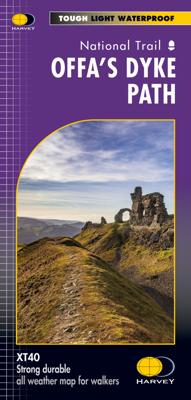
Wandelkaart van het Offa's Dyke Path met uitsnedes van de route. Entire route on one map   Offa's Dyke Path is a National Trail 285km long (178 miles) along the border between Wales and England. The route runs from Chepstow in the south to Prestatyn on the north Wales coast.   Offa was a famous king of Mercia from 757 to 796, ruling an area stretc...

Alle aanbiedingen van dit product

Verkoper
Bezorging
Prijs
DeZwerver.nl logo
DeZwerver.nl
2,95
29,95

Anderen bekeken ook

Wandelkaart Offa's Dyke Path | Harvey Maps
Wandelkaart van het Offa's Dyke Path met uitsnedes van de route. Entire route on one map   Offa's Dyke Path is a National Trail 285km long (178 miles) along the border between Wales and England. The route runs from Chepstow in the south to Prestatyn on the north Wales coast.   Offa was a famous king of Mercia from 757 to 796, ruling an area stretching across a large part of England.   Offa's Dyke Path runs from sea to sea - the Severn Estuary to Liverpool Bay. For about 112km (70 miles) the Path follows the course of what was originally an 8m ditch and rampart. Castles, forts and historic sites dot the route.   Tough, light, durable and 100% waterproof Includes Rights of Way Genuine original HARVEY mapping Route clearly marked
29,95
Wandelgids Offa's Dyke Path | Trailblazer Guides
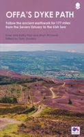
Goede wandelgids van de Offa's Dyke Path. Met veel details zijn alle etappes beschreven. Tevens informatie over overnachtingen en openbaar vervoer.   All the information you need to walk Offa's Dyke Path in this two-way edition, with routes re-walked in both directions - from Chepstow to Prestatyn and from Prestatyn to Chepstow and reformatted for use by walkers hiking south to north and north to south. The Offa's Dyke Path is a magnificent National Trail that runs from the North Wales coast to the Severn Estuary following the line of Offa's Dyke, an impressive 8th century earthwork along the English/Welsh border. The ever-changing landscape - the Wye Valley, the Black Mountains, the Shropshire Hills and the Clwydian Hills - is steeped in history and legend providing 177 miles of fascinating walking.   This sixth edition has been re-walked and fully updated and includes:98 walking maps - 1:20,000 (3 and 1/8 inches to 1 mile) - the largest-scale maps availableUnique mapping feature…
21,95
Wandelgids The Offa's Dyke Path - Wales | Cicerone
Engelstalige beschrijving van de mooiste wandeltocht in Wales. De gids voldoet aan alle verwachtingen die je kunt hebben, het enige dat je mist is een overzichtskaart. Inclusief gidsje met routekaarten van 1:25000 (deze is hier ook los te bestellen) This guidebook - which includes both a guide to the route and a separate OS map booklet - describes Offa's Dyke Path National Trail from south to north, following the longest linear earthwork in Britain, running 177 miles along the English-Welsh border between Sedbury (near Chepstow) and Prestatyn on the north Wales Coast. It links the Severn Estuary and the Irish Sea, following the longest linear earthwork in Britain, contouring above the Wye and Dee, visiting hillforts and Norman castles and exploring the hidden heritage of the Marches. The route is exceptional in all seasons, although the Black Mountains and Clwydian range deserve respect in winter conditions.   The guidebook splits one of Britain's classic trails into 12 stages, with s…
25,95
Wandelgids Offa's Dyke Path (Prestatyn - Chepstow) | Aurum Press
Goede beschrijving van de aantrekkelijke route. Kaartmateriaal van Ordnance Survey - de Engelse topografische dienst op een schaal van 1:25.000. Praktische info voor overnachten ed. niet altijd uitgebreid, maar die is op de site van de Ramblers (de engelse wandelorganisatie) te vinden. Offa's Dyke Path is the 177-mile (283-km) National Trail following the course of the man-made dyke that gives it its name. This volume, now fully updated, features the complete section of the Path, following Natural England's acorn waymarks from Chepstow to Prestatyn.  This is the complete, official guide for the long distance walker or the weekend stroller. All you need is this one book. National Trail Guides are the official guidebooks to the fifteen National Trails in England and Wales and are published in association with Natural England, the official body charged with developing and maintaining the Trails. 
20,95
Wandelkaart 3 South West Coast Path 3 | Harvey Maps
Een bijzonder handige kaart voor een deel van dit lange-afstands-wandelpad (Minehead tot St Ives) van het in totaal maar liefst 1014 km lange South West Coast Path. Op waterafstotend papier met veel details, uitstekend en voldoende voor dit deel van de route. De totale route bestaat uit 3 kaarten.    The South West Coast path is a 1014km (630mile) long distance path and the longest National Trail in England. The path stretches from Minehead in Somerset to Poole in Dorset. - This updated Trail Map covers the third and final section of the South West Coast Path from Plymouth to Poole Harbour which is 339km (211 miles).   - Includes the Jurassic Coast World Heritage Site and Durdle Door, the famous sea arch in Dorset. - The entire route on 3 sheets. This is map 3 of 3, a good two weeks? walking on one map.   - The XT40 is based on original HARVEY mapping with all the detail a walker would expect on a map at 1:40,000 scale. - Clear and easy to read mapping which is uncluttered by inf…
26,95
Wandelkaart 1 South West Coast Path 1 | Harvey Maps
Een bijzonder handige kaart voor een deel van dit lange-afstands-wandelpad (Minehead tot St Ives) van het in totaal maar liefst 1014 km lange South West Coast Path. Op waterafstotend papier met veel details, uitstekend en voldoende voor dit deel van de route. De totale route bestaat uit 3 kaarten.  Ideal map for walkers on Britiain's longest and one of its most popular National Trails. It runs along the coast of Somerset, Cornwall, Devon, and Dorset from Minehead round via Land's End to Poole. It includes all 95 miles of the World Heritage site known as the Jurassic Coast. 3 HARVEY maps will cover the whole 630-mile route. Each map covers a section of the Path suitable for 16 days of walking. Map 1 covers the Path from the start at Minehead to St Ives   This map is bio-degradable   Information on finding accommodation, camping, food. Directions to the start. Also Ranger Service contact numbers and enlargements of towns/villages showing facilities available and tips on weather and clot…
26,95
Wandelkaart Pennine Way North | Harvey Maps
Mooie, duidelijke kaart van het Noordelijke gedeelte van de Pennine Way (Middleton-in-Teesdale naar Kirk Yetholm). The whole of the Pennine Way on just 2 maps!   Pennine Way North map covers the route from Middleton-in-Teesdale to Kirk Yetholm.   The Pennine Way is a National Trail. It follows the backbone of England from the Peak District to the Scottish borders. It is one of the toughest UK long distance footpaths, and forms part of the European Footpath Network.   The Pennine Way was Britain's first National Trail, opened in 1965.   Just 2 HARVEY maps cover the whole 431km (268 miles) route. Each starts and finishes near public transport, so no hassle with getting lifts.   Each map also contains lots of information and useful telephone numbers to assist the walker with planning.   Tough, light, durable and 100% waterproof Includes Rights of Way Genuine original HARVEY mapping Route clearly marked  
29,95
Wandelkaart Pennine Way South | Harvey Maps
Mooie, duidelijke kaart van het zuidelijke gedeelte van de Pennine Way (Edale to Middleton-in-Teesdale). The whole of the Pennine Way on just 2 maps!   Pennine Way South map covers the route from Edale to Middleton-in-Teesdale.   The Pennine Way is a National Trail. It follows the backbone of England from the Peak District to the Scottish borders. It is one of the toughest UK long distance footpaths, and forms part of the European Footpath Network.   The Pennine Way was Britain's first National Trail, opened in 1965.   Just 2 HARVEY maps cover the whole 431km (268 miles) route. Each starts and finishes near public transport, so no hassle with getting lifts.   Each map also contains lots of information and useful telephone numbers to assist the walker with planning.   Tough, light, durable and 100% waterproof Includes Rights of Way Genuine original HARVEY mapping Route clearly marked  
29,95
Wandelkaart Skye Trail | Harvey Maps
Een bijzonder handige kaart van dit lange-afstands-wandelpad. Op waterafstotend papier met veel details. Het enige dat je eigenlijk een beetje mist is een overzicht. Verder uitstekend en voldoende voor de route.   The Skye Trail is a challenging unmarked route of 127km (79 miles) through the island of Skye. It is specifically aimed at experienced hillwalkers. The Skye Trail is a challenging unofficial route through the island. The route follows much of the amazing Trotternish Ridge and passes beneath the peaks and pinnacles of the Cuillin, which are considered to be the finest mountains in Britain. There are also remarkable coastal cliffs, steep trails, high drops and haunting ruins of deserted villages destroyed in the highland clearances. You have various choices of different routes through tough terrain or easier walking with spectacular mountain views and coastal scenery. It is not waymarked making this map an essential piece of your equipment.
26,95
Wandelkaart North Downs Way | Harvey Maps
Mooie, duidelijke kaart van de North Downs Way in Engeland. Geplastificeerd met veel extra informatie en uitsnedes van de route.    XT40 - Leap forward in technical excellence. Tough, light and 100% waterproof   Compact and light - the map itself weighs just 60gms - a third of the weight of a laminated map, and much less bulky. And you can fold or refold it time and again, or stuff it in your back pocket and it won't fall to pieces.   Revised edition and format Shows the entire route on one XT40 map sheet.   The Way is 246km (156 miles). This map covers the whole route from Farnham in the west to Dover on the south east coast.   Information on finding accommodation, camping, food. Directions to the start and end points. Shows facilities available and includes tips on weather and clothing.     Detailed mapping, full legend. National Grid - can be used with GPS. 1:40,000 scale. Waterproof. Supplied in clear plastic pocket.
26,95

Klanten-reviews van Wandelkaart Offa's Dyke Path | Harvey Maps

Er zijn nog geen beoordelingen voor dit productBen jij de eerste die een review plaatst?

Meer over Wandelkaart Offa's Dyke Path | Harvey Maps

Productomschrijving

Wandelkaart van het Offa's Dyke Path met uitsnedes van de route.

Entire route on one map   Offa's Dyke Path is a National Trail 285km long (178 miles) along the border between Wales and England. The route runs from Chepstow in the south to Prestatyn on the north Wales coast.   Offa was a famous king of Mercia from 757 to 796, ruling an area stretching across a large part of England.   Offa's Dyke Path runs from sea to sea - the Severn Estuary to Liverpool Bay. For about 112km (70 miles) the Path follows the course of what was originally an 8m ditch and rampart. Castles, forts and historic sites dot the route.  
  • Tough, light, durable and 100% waterproof
  • Includes Rights of Way
  • Genuine original HARVEY mapping
  • Route clearly marked

Productinformatie

    Verken gerelateerde categorieën

    Webshop.nl maakt gebruik van cookies. Ga je verder op onze website, ga dan akkoord met het plaatsen van cookies en de verwerking van deze data door ons en vermelde partners.