webshop.nl
Categorieën
  Sluiten

Meer Trailblazer Guides

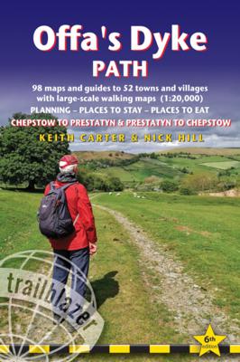
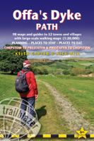
Wandelgids Offa's Dyke Path | Trailblazer Guides

0
Goede wandelgids van de Offa's Dyke Path. Met veel details zijn alle etappes beschreven. Tevens informatie over overnachtingen en openbaar vervoer.   All the information you need to walk Offa's Dyke Path in this two-way edition, with routes re-walked in both directions - from Chepstow to Prestatyn and from Prestatyn to Chepstow and reformatted fo...

Webshops met dit product

Webshop
Bezorging
Prijs

Anderen bekeken ook

Wandelgids Offa's Dyke Path | Trailblazer Guides
Goede wandelgids van de Offa's Dyke Path. Met veel details zijn alle etappes beschreven. Tevens informatie over overnachtingen en openbaar vervoer.   All the information you need to walk Offa's Dyke Path in this two-way edition, with routes re-walked in both directions - from Chepstow to Prestatyn and from Prestatyn to Chepstow and reformatted for use by walkers hiking south to north and north to south. The Offa's Dyke Path is a magnificent National Trail that runs from the North Wales coast to the Severn Estuary following the line of Offa's Dyke, an impressive 8th century earthwork along the English/Welsh border. The ever-changing landscape - the Wye Valley, the Black Mountains, the Shropshire Hills and the Clwydian Hills - is steeped in history and legend providing 177 miles of fascinating walking.   This sixth edition has been re-walked and fully updated and includes:98 walking maps - 1:20,000 (3 and 1/8 inches to 1 mile) - the largest-scale maps availableUnique mapping features…
21,95
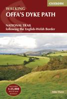
Wandelgids The Offa's Dyke Path - Wales | Cicerone
Engelstalige beschrijving van de mooiste wandeltocht in Wales. De gids voldoet aan alle verwachtingen die je kunt hebben, het enige dat je mist is een overzichtskaart. Inclusief gidsje met routekaarten van 1:25000 (deze is hier ook los te bestellen) This guidebook - which includes both a guide to the route and a separate OS map booklet - describes Offa's Dyke Path National Trail from south to north, following the longest linear earthwork in Britain, running 177 miles along the English-Welsh border between Sedbury (near Chepstow) and Prestatyn on the north Wales Coast. It links the Severn Estuary and the Irish Sea, following the longest linear earthwork in Britain, contouring above the Wye and Dee, visiting hillforts and Norman castles and exploring the hidden heritage of the Marches. The route is exceptional in all seasons, although the Black Mountains and Clwydian range deserve respect in winter conditions.   The guidebook splits one of Britain's classic trails into 12 stages, with su…
25,95
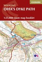
Wandelkaart Offa's Dyke Path - Wales | Cicerone
Handzaam gidsje met alleen de topografische routekaarten van 1:25000. De uitgebreide wandelgids (inclusief dit gidsje) is hier te bestellen. All the mapping you need to complete the Offa's Dyke Path National Trail, the longest linear earthwork in Britain, running 177 miles along the English–Welsh border between Sedbury (near Chepstow) and Prestatyn on the north Wales Coast   NOTE: An accompanying Cicerone guidebook - Offa's Dyke Path - describes the full route with lots of other practical and historical information. The accompanying guidebook includes a copy of this map booklet.   This booklet of Ordnance Survey 1:25,000 Explorer maps has been designed for convenient use on the trail. It shows the full and up-to-date line of the Offa's Dyke Path, along with the relevant extract from the OS Explorer map legend. It is conveniently sized for slipping into a jacket pocket or top of a rucksack and comes in a clear PVC sleeve.   The walk is astonishingly varied, taking in the lower Wye gorge…
14,95
Wandelgids Thames Path | Trailblazer Guides
This book follows the Thames Path National Trail from the river's source in Gloucestershire to the Thames Barrier in London. Officially 184 miles (294km) in length (although the actual distance you walk will depend on a number of decisions you make en route), the path meanders, accompanied by its watery muse, through pristine and tranquil countryside, past historic sites and buildings, via pub, lock, weir, and the occasional scattering of waterfowl, to a city, once the fulcrum of an empire, and now the heart of modern day England. The river, responsible for the metropolis' very being, tells tales, inspires artists, accommodates swans, geese, and water voles, reflects the silhouettes of red kites and kingfishers, provides employment, entices adventure, and allows time for carefree pilgrims to procrastinate and think. Following its banks is a grand way to go for a ramble. The path begins, as the river does, in a meadow in the Cotswolds; its upper reaches lonely and wild, the meadows and …
19,95
Wandelkaart Offa's Dyke Path | Harvey Maps
Wandelkaart van het Offa's Dyke Path met uitsnedes van de route. Entire route on one map   Offa's Dyke Path is a National Trail 285km long (178 miles) along the border between Wales and England. The route runs from Chepstow in the south to Prestatyn on the north Wales coast.   Offa was a famous king of Mercia from 757 to 796, ruling an area stretching across a large part of England.   Offa's Dyke Path runs from sea to sea - the Severn Estuary to Liverpool Bay. For about 112km (70 miles) the Path follows the course of what was originally an 8m ditch and rampart. Castles, forts and historic sites dot the route.   Tough, light, durable and 100% waterproof Includes Rights of Way Genuine original HARVEY mapping Route clearly marked
28,50
Wandelgids Gllyndwr's Way | Trailblazer Guides
This title in our British Walking Guides series covers the 135-mile National Trail in Wales following in the footsteps of Owain Glyndŵr, the Welsh prince who led a rebellion against the English in 1400. Traversing a range of open farmland and forest, it links with another National Trail, Offa's Dyke Path, at its start in Knighton and end in Welshpool. 10 town plans and 58 large-scale walking maps - at just under 1:20,000 - showing route times, places to stay, points of interest and much more Plus 10 overview maps Itineraries for all walkers - whether walking the route in its entirety over seven to eight days or sampling the highlights on day walks and short breaks Practical information for all budgets - camping, bunkhouses, hostels, B&Bs, pubs and hotels - where to stay, where to eat, what to see, plus detailed street plans Comprehensive public transport information - for all access points on the path. Flora and fauna - four page full color flower guide, plus an illustrated secti…
20,95

Klanten-reviews van Wandelgids Offa's Dyke Path | Trailblazer Guides

Er zijn nog geen beoordelingen voor dit productBen jij de eerste die een review plaatst?

Meer over Wandelgids Offa's Dyke Path | Trailblazer Guides

Productomschrijving

Goede wandelgids van de Offa's Dyke Path. Met veel details zijn alle etappes beschreven. Tevens informatie over overnachtingen en openbaar vervoer.   All the information you need to walk Offa's Dyke Path in this two-way edition, with routes re-walked in both directions - from Chepstow to Prestatyn and from Prestatyn to Chepstow and reformatted for use by walkers hiking south to north and north to south. The Offa's Dyke Path is a magnificent National Trail that runs from the North Wales coast to the Severn Estuary following the line of Offa's Dyke, an impressive 8th century earthwork along the English/Welsh border. The ever-changing landscape - the Wye Valley, the Black Mountains, the Shropshire Hills and the Clwydian Hills - is steeped in history and legend providing 177 miles of fascinating walking.   This sixth edition has been re-walked and fully updated and includes:98 walking maps - 1:20,000 (3 and 1/8 inches to 1 mile) - the largest-scale maps availableUnique mapping features - walking times, directions, tricky junctions, places to stay, places to eat, points of interestItineraries for all walkers - whether walking the route in its entirety or sampling the highlights on day walks and short breaksPractical information for all budgets - what to see, where to stay, where to eat: pubs, B&Bs, hotels, campsites, hostels, with reviewsGuides to 52 towns and villages - along the wayPublic transport information - for all access points on the pathGPS waypoints - also downloadable from the Trailblazer website Includes extra colour sections: 16pp colour introduction and 16pp of colour mapping for stage sections (one stage per page) with trail profiles

Productspecificaties

Artikelnummer(s)
Brand
Trailblazer Guides
Webshop.nl maakt gebruik van cookies. Ga je verder op onze website, ga dan akkoord met het plaatsen van cookies en de verwerking van deze data door ons en vermelde partners.