webshop.nl
Categorieën
  Sluiten

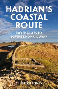
Wandelgids Hadrian's coastal route | The History Press

Dit is meer een reisgids dan een wandelgids: de kaarten zijn slechts schetsmatig, een wandelkaart er bij is wel zo handig! Hadrian's Wall, running from Wallsend to Bowness, is a much visited attraction and an iconic landmark with over 200 years of serious research behind it. The Western Frontier has had barely 70 but through the efforts of a small ...
18,50

Webshops met dit product

Webshop
Bezorging
Prijs

Anderen bekeken ook

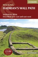
Wandelgids Hadrian's Wall Path | Cicerone
Meest duidelijke wandelgids van de route: veel details in kaarten en informatie, beide kanten op beschreven! The essential guidebook to walking the 84-mile Hadrian’s Wall Path. One of the UK's most visited National Trails, it runs the length of the Roman Wall from Bowness-on-Solway in Cumbria to Wallsend, Newcastle.   Begun in AD122 and stretching from the River Tyne to the Solway Firth, Hadrian’s Wall was a massive feat of engineering and is the best preserved frontier from the classical Roman Empire. Today it is a World Heritage Site, with iconic scenery and fascinating archaeological remains like Birdoswald, Housesteads and Vindolanda, giving a glimpse into Roman life and power. The trail is presented here in 10 stages, with suggestions for five and eight-day itineraries. It is suitable for beginners, although a reasonable level of fitness is required if doing it as a multi-day trek. The route is described both west to east and east to west, and the guidebook also features extension…
24,95
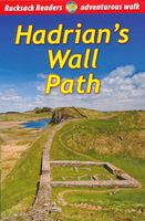
Wandelgids Hadrian's Wall path | Rucksack Readers
Uitgevoerd in de vorm van een klapper, met ringband geeft deze gids een goede beschrijving van de lange afstands route. De kaarten zijn schetsmatig maar wel duidelijk.   Hadrian's Wall Path runs for 86 miles (138 km) between Bowness-on-Solway and Wallsend (Newcastle) along the line of the Roman Wall completed in AD122 under the Emperor Hadrian. This National Trail crosses northern England from Irish Sea to North Sea and offers many chances to look at the forts, milecastles and interpretation centres within this UNESCO World Heritage Site.    The route is clearly waymarked and well supported by public transport, giving flexibility to walk it in linear sections or as loop walks. Although the book's detailed description runs from west to east (Bowness to Wallsend), it includes notes for east-to-west walkers. For conservation reasons, you are encouraged to walk the Path between May and October. This guidebook contains all you need to plan and enjoy a classic week's walking
17,95
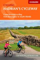
Fietsgids Hadrian's Cycleway | Cicerone
Hadrian's Cycleway is a 174 mile route from Ravenglass in Cumbria to South Shields. Also known as Route 72, this coast-to-coast route heads north up the Cumbrian coast to reach the Solway AONB before crossing northern England along Hadrian's Wall and into Northumberland. Suitable for cyclists of all abilities, the ride is usually completed over three days from west to east.   The route allows cyclists to explore Hadrian's Wall World Heritage Site, visiting Roman forts including Vindolanda and Housesteads as well as milecastles, abbeys and historic towns. Other highlights include the Cumbrian coast, Tyne Valley and the famous Sycamore Gap.   While the main route is described from west to east over three days, the guide provides plenty of information about other options. Advice is given at the end of each stage about how to complete the route from east to west, as the route can be used in connection with other coast to coast routes to create week-long round trips. Other itineraries inclu…
16,50
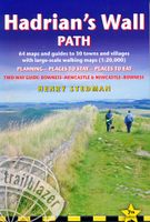
Wandelgids Hadrian's Wall Path | Trailblazer Guides
Goede wandelgids van de hele route van kust naar kust. Met veel details zijn alle etappes beschreven. Tevens informatie over overnachtingen en openbaar vervoer. Hadrian’s Wall Path, 84 miles from end to end, follows the course of northern Europe’s largest surviving Roman monument, a 2nd-century fortification built – in the border country between England and Scotland – on the orders of the Emperor Hadrian in AD122. Hadrian’s Wall Path is the first National Trail to follow the course of a UNESCO World Heritage Site. This week-long walk is regarded as one of the least challenging of the National Trails. 7 town plans and 45 large scale walking maps – at just under 1:20,000 – showing route times, places to stay, points of interest and much more Itineraries for all walkers – whether walking the route in its entirety over seven to eight days or sampling the highlights on day walks and short breaks Practical information for all budgets, all updated for the new edition – camping, bunkhouses, ho…
19,95
Wandelgids The Cumbria Coastal Way | Cicerone
This guidebook follows the continuous 298km (182 mile) walking route from Silverdale, on Morecambe Bay, towards Gretna on the Scottish border. The route links a number of gems of landscape, wildlife, archaeology and history along this often little-known coastline. A walk of 10-14 days suitable for all levels of ability.   THE CUMBRIA COASTAL WAY is a continuous 298km (182 mile) walking route from north Lancashire towards the Scottish border, and links a number of gems of landscape, wildlife, archaeology and history that are found on this often little-known coastline.   Starting at Silverdale, on Morecambe Bay, and edging the coast up towards Gretna, the coastal way can be walked in its entirety (10–14 days), or in sections, by people of all ages and abilities. Much of the route-finding is easy, and the route, which rarely climbs higher than 100m above sea level, has been designed to link with public transport.    This is a totally new edition of the guidebook written by two walkers who…
18,50
Wandelkaart Adventure Atlas Hadrian's Wall Path | A-Z Map Company
AZ heeft de meest gedetailleerde wandelkaarten van het Hadrian's Wall Path gebundeld in een atlasje. Daardoor is het heel handig qua formaat. De kaarten zelf zijn perfect voor het wandelen. Schaal 1:25.000 The A-Z Adventure Series of maps combines the best of OS and A-Z, creating the perfect companion for walkers, off-road cyclists, horse riders and anyone wishing to explore the great outdoors. Hadrian's Wall Path is a National Trail which follows the line of Hadrian's Wall from coast-to-coast. The 84 mile (135km) path weaves through beautiful countryside, encountering historic remains of Roman forts and milecastles, splendid bridges, views from the Whin Sill escarpment and Solway salt marshes. Starting in Wallsend in Newcastle and ending in Bowness-on-Solway, the route on the map is clearly highlighted in yellow with mileage markers added to guage distances when planning sections of the walk to enjoy. This official National Trail Map of Hadrian's Wall Path features 38 pages of continu…
12,95
Wandelgids Hadrian's Wall Path | Aurum Press
Beschrijving van Hadrian's Wall Path. Historische en culturele aspecten komen vrij uitgebreid aan bod, praktische informatie is wel summier. Kaartmateriaal van Ordnance Survey is zonder meer uitstekend! Since it opened in 2003 Hadrian's Wall Path has become one of Britain's most popular long-distance paths. Its 84 miles are a convenient week's walking, shadowing for the most part the historic line of Hadrian's Wall in its spectacular progress across the superbly wild landscape of the north of England. Starting in what used to be Tyneside's shipbuilding heart, and joining Newcastle in the east with Carlisle in the west, it takes you via the extraordinary Roman forts of Vindolanda and Housesteads, close to handsome towns like Hexham and Corbridge, to finish on the lonely shores of the Solway Firth with views of Scotland. Comprehensive and engrossing, this official guide, published in conjunction with Natural England, is the only companion you need. Ordnance Survey mapping for the entire …
20,95
Wandelgids Lleyn Peninsula Coastal Path | Cicerone
Guidebook that describes a walkers’ route along the 95-mile coastal path that runs around the Lleyn Peninsula of north Wales from Caernarfon to Porthmadoc. Options for mountain and road bikes along the coastal path. Also includes circular walks and rides suitable for day excursions.  The western coastline of England and Wales has three peninsulas pushing out into the sea. The Cornish and Pembroke peninsulas have famous coast paths but the Lleyn peninsula of North Wales is less well known. Although the Lleyn cannot match the sheer scale of its bigger brothers it has no trouble competing when the grandeur of scenery is compared. The route connects the pilgrim sites leading to the remote island of Bardsey, dating back to the 6th century. In doing so its 95 miles cross a variety of landscapes from rocky cliffs to secluded bays. The nature of the landscape means that diversions inland have to be made, but although the route crosses hills and rises to over 1000ft in places the coast is alway…
18,50
Wandelkaart Hadrian's Wall Path | Vertebrate Publishing
The 138-kilometre Hadrian's Wall Path traces a grey line along Great Whin Sill, the dolerite ridge chosen by the Romans for their historic wall. The route, one of Britain's most popular National Trails, is dotted with milecastles and forts, and attracts trail runners and walkers all year round due to its sweeping views. Beginning in Newcastle, the trail passes through rolling grassy paths and grey-green crags to reach Bowness-on-Solway on the Cumbrian Coast.   Hadrian's Wall Path appeals to people who have different levels of experience and travel at all speeds, and this Vertebrate Publishing Guidemap is unique in that it caters for four categories of user, providing custom itineraries for walkers, trekkers, fastpackers and trail runners. This lightweight, waterproof, durable and easy-to-use folding map features all the essential information for a successful Hadrian's Wall Path, including 1:40,000-scale mapping for the linear route starting in Wallsend and finishing in Bowness-on-Solwa…
24,50
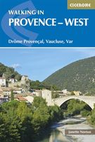
Wandelgids Walking in Provence - West | Cicerone
This guide offers 30 circular day walks in the western half of Provence, the large sun-kissed coastal region of south-east France. Spanning from the Baronnies in the north to the Ste-Baume ridge in the south, the walks are set in the areas of the Drôme Provençale, Vaucluse and the Var. Provence’s sunshine and Mediterranean charm attract many visitors to its coast, yet the area also has much more to offer the walker. The countryside inland boasts a range of scenery from remote mountaintops to spectacular gorges. History is everywhere, in medieval villages, arcaded streets, abbeys, churches and castles.    This guide covers the western regions, with its companion volume, Walking in Provence: East, covering the rest of this fascinating and historic landscape. The walking is incredibly diverse; from the green waves of the Barronies hills in Drôme Provençale, to the unforgettable silhouette of Mont Ventoux giving way to limestone plateaux cut with ravines in the Vauclause. Further south lie…
21,95

Klanten-reviews van Wandelgids Hadrian's coastal route | The History Press

Er zijn nog geen beoordelingen voor dit productBen jij de eerste die een review plaatst?

Meer over Wandelgids Hadrian's coastal route | The History Press

Productomschrijving

Dit is meer een reisgids dan een wandelgids: de kaarten zijn slechts schetsmatig, een wandelkaart er bij is wel zo handig! Hadrian's Wall, running from Wallsend to Bowness, is a much visited attraction and an iconic landmark with over 200 years of serious research behind it. The Western Frontier has had barely 70 but through the efforts of a small band of archaeologists and the Hadrian's Wall Heritage Trust Ltd this is gradually changing. The frontier route followed in this guide, running from Ravenglass to Bowness on Solway, is punctuated by Roman forts, the visible remains of a frontier of watchtowers, mileforts and manned bases. ‘Be part of history, walk a frontier lost for over fifteen hundred years.’The Western Hadrianic Frontier of the Roman Empire is little known by the general public. Until recently the frontier was viewed as merely a series of forts with a fluid means of defence and administration between them, and the public was understandably drawn to the physical remains of Hadrian’s Wall crossing from Bowness-on-Solway to Wallsend. Archaeologists have always known different, and it is only now that they are beginning to shout from the rooftops that the Western Frontier is as important as the stones that cross the Pennines.   Fortunately, through the efforts of a small band of archaeologists and Historic England, the public perception is changing. There is a wealth of magnificent and diverse scenery and amazing archaeology which rivals the better-known sites along the Hadrian’s Wall. Walking the frontier offers opportunities for personal adventure and discovery.   There is plenty of variety in the west; catch a train or bus, buy local produce, enjoy a beer and a good bed, but most of all enjoy the quest. This fully updated and illustrated guide offers the walker an insight into this relatively unknown world – one that still has much to reveal.

Verken gerelateerde categorieën

Webshop.nl maakt gebruik van cookies. Ga je verder op onze website, ga dan akkoord met het plaatsen van cookies en de verwerking van deze data door ons en vermelde partners.