webshop.nl
Categorieën
  Sluiten

Wandelgids The Cumbria Coastal Way | Cicerone

This guidebook follows the continuous 298km (182 mile) walking route from Silverdale, on Morecambe Bay, towards Gretna on the Scottish border. The route links a number of gems of landscape, wildlife, archaeology and history along this often little-known coastline. A walk of 10-14 days suitable for all levels of ability.   THE CUMBRIA COASTAL WAY is...
18,50

Webshops met dit product

Webshop
Bezorging
Prijs

Anderen bekeken ook

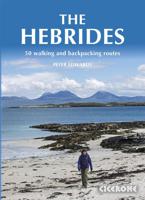
Wandelgids The Hebrides - De Hebriden Schotland | Cicerone
This inspirational guide offers 50 varied hiking and backpacking routes on the Scottish Hebrides islands, set out in a large guidebook to be savoured. The hikes highlight all the very best landscapes and scenery to be found on the spectacular islands of the Hebrides, a wonderland for adventurous walkers to return to time and time again. Inspirational guidebook to walking in Scotland's Hebrides islands. 50 adventurous walks on well-known and remote islands; from Syke, Mull, Rum, the Uists and Barra, Ulva, Iona, Eigg and Muck and more besides. Most of the walks provide a full day for experienced walkers, with a few multi-day adventures as well as some shorter routes. The terrain is often rough, rugged and pathless, while waymarking and public transport can, in many places, be hard to find. The challenge of wild walking, and the self-reliance needed to discover the best of the Hebrides, make the islands all the more appealing for adventurous walkers.   The walks also include Hebrides clas…
28,50
Wandelgids The Cumbria Way | Cicerone
A guidebook to the Cumbria Way, a 73-mile long distance path through the heart of the English Lake District from Ulverston to Carlisle. The route is largely low-level, and accessible to new trekkers, but this guide offers alternative mountain days to climb some of the famous fells en route.   The guide divides the route into 5 stages of between 12 and 16 miles, but there is plenty of opportunity to plan your itinerary for a more easy-going 7 to 8 days. The Lake District is a walkers paradise, and there is no better way to experience the fells, lakes and woodlands of the Lake District than by trekking through their midst.    This guidebook also provides useful information for every stage, from accommodation to available facilities en route, as well as an annotated OS map and details on points of interest. The result is a guidebook that enhances a walk on the Cumbria Way, as well as providing the walker with the tools to complete the trek.   Steden en Dorpen Ulverston, Torver, Coniston, …
20,95
Wandelgids Fife Coastal Path | Rucksack Readers
The Fife Coastal Path runs around the coastline of eastern Scotland for 117 miles (187 km) from Kincardine on the Forth to Newburgh on the Tay. Starting west of the famous Forth bridges, the route heads through former mining towns towards the villages of Fife's East Neuk (corner), with their rich tradition of smuggling and fishing. After rounding Fife Ness, the route follows the coastline through St Andrews, golf capital of the world and former religious centre of Scotland.Fife has long played an important part in Scottish history and the route passes many castles, towers and churches. There are splendid views along the coast and over the Firths of Forth and Tay, with great chances to sight seabirds, seals and dolphins. The villages have welcoming pubs, famous fish-and-chip shops and good B&Bs. Transport by train and bus makes for easy access throughout. The guidebook contains everything you need to plan and enjoy the Fife Coastal Path – on foot, or on a bike where cycling is appropria…
23,95
Wandelgids The Pennine Way | Cicerone
Uitstekende wandelgids van de Pennine Way, waarbij naast alle noodzakelijke informatie ook gebruik gemaakt wordt van de echte topografische kaart. inclusief gidsje met routekaarten van 1:25000  Guidebook to the Pennine Way National Trail with OS map booklet. The 270 mile route from Edale to Kirk Yetholm takes three weeks to walk and is suitable for fit and experienced long distance walkers. The route crosses the Peak District, Yorkshire Dales and North Pennines National Parks. Includes separate OS 1:25,000 map booklet of the route. The Pennine Way is Britain's oldest, toughest long-distance footpath – and arguably its most iconic. Now a National Trail, the 427km (265½ mile) route from Edale in Derbyshire to Kirk Yetholm in the Scottish Borders offers wayfarers the opportunity to immerse themselves in wild beauty of the North. The Pennines boast rolling hills, sweeping moorland and wide glacial valleys, and the Pennine Way has come to embody personal challenge and adventure.    This gui…
23,95
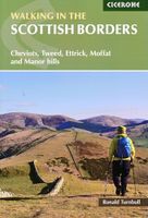
Wandelgids Walking in the Scottish Borders | Cicerone
This guidebook provides 45 day walks in the Scottish Borders. Separated into six sections, these walks are divided between the north and south Cheviots, Tweed, Ettrick, Moffat and Manor hills and feature main centres including Wooler, Kelso, Melrose, Peebles and Moffat. The guide's seventh section outlines long distance routes, including a walk along the Border from Gretna to Berwick-on-Tweed. The Scottish Borders are rich in both history and geology. These walks explore many historical sites, from Iron Age forts on hillsides to bastles and towers dating from the Border Reivers era. The stunning and varied scenery is a result of complex geological processes; a visit to Dobb's Linn showcases preserved fossils, while the coastline at St Abbs Head features iconic folded rock formations which are home to a myriad of birds including guillemots. Each walk features 1:50,000 OS mapping, comprehensive route description and plenty of information about points of interest along the route. The walk…
18,50
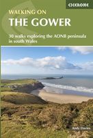
Wandelgids Walking on the Gower | Cicerone
Wandelgids met 30 wandelroutes in het zuiden van Wales This guidebook presents 30 circular day walks across the Gower Area of Outstanding Natural Beauty, taking in the rich variety of landscapes across this beautiful area of South Wales. Ranging from 2½ to 14 miles long, there are walks to suit all abilities. The peninsula is famous for its spectacularly steep, rugged coastline and golden sandy beaches but this guide also takes walkers to the inland valleys, hills and ridges little explored by most holidaymakers.   Routes are illustrated with OS mapping extracts and inspiring photography and accompanied by a route summary table to help you choose walks to suit your location and ability. Along the way, the author provides a wealth of information on plants, animals, geology, history and archaeology of a region. There is something for everyone, all within a compact area easily accessible from Swansea and Mumbles.   Coastal areas such as those around Langland, Oxwich and Port Eynon are wel…
19,50
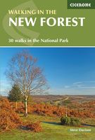
Wandelgids Walking in the New Forest | Cicerone
Goede wandelgids met veel dagtochten, geschikt voor iedereen.   A guidebook to 30 walks of between 3 and 10 miles set throughout the New Forest National Park in Hampshire and Wiltshire. Routes explore ancient woodland, heather-clad heath and dramatic coastline, all within easy reach of Southampton, Bournemouth and Salisbury. Walks for all abilities, easily combined to create longer challenges.   This guidebook presents 30 walks in the New Forest in Hampshire and Wiltshire, Britain's smallest National Park. Easily accessible from Southampton, Bournemouth, Salisbury and Winchester, the New Forest encompasses varied landscapes, from ancient woodlands to open heaths, rivers and coastline. Routes of between 5 and 16km (3 and 10 miles) explore the Forest, mainly on fairly flat terrain, often on well-defined tracks and paths. Most walks are suitable for all the family and many can be combined to make longer outings. Each walk is described in detail, highlighting the many points of interest …
18,50
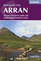
Wandelgids Walking on Arran | Cicerone
Uitstekende wandelgids voor dit uitdagende wandelgebied in Schotland. Dagtochten. The 45 walking routes in this Isle of Arran guidebook range from easy 3km (2 miles) nature trails to long arduous mountain routes with scrambles (up to 32km) providing thorough coverage of Arran, including the ascent of Goatfell and nearby Holy Isle. Most routes are 10km to 15km long but many give opportunities to create longer cross island walks. This guidebook presents a selection of 45 day walks on the popular and accessible Isle of Arran. The routes are between 2 miles (3km) and 20 miles (32km) in length, from easy waymarked forest trails to more arduous mountain walks, exposed ridge routes and scrambles. There are linear and circular walks to choose from, and opportunities to link routes together and create longer walks across the length and breadth of the island. With highlights including Goatfell, Beinn Tarsuinn, the Sannox Horseshoe, Glen Rosa and the Cock of Arran, there's something here to suit …
23,95
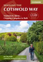
Wandelgids The Cotswold Way | Cicerone
Uitstekende wandelgids van de Cotswolds Way, waarbij naast alle noodzakelijke informatie ook gebruik gemaakt wordt van de echte topografische kaart. inclusief gidsje met routekaarten van 1:25000 (deze is hier ook los te bestellen) Guidebook to walking the 102 mile (163km) Cotswold Way National Trail between Chipping Campden and Bath, across the Cotswolds AONB. The guidebook - which includes both a guide to the route and a separate OS 1:25,000 map booklet - describes the route in both directions.   The route is described over 13 stages, each following the Cotswold escarpment, with dramatic and far-reaching views across the Severn Vale towards the Welsh hills, plunging down to visit honey-coloured villages, old market towns and the elegant and historic city of Bath. The longest of the 13 stages is 10 miles, the shortest 6 miles: these are dictated by the existence of overnight accommodation. For the determined, the trail can be walked in as little as five days.   The Cotswold Way offers …
23,50
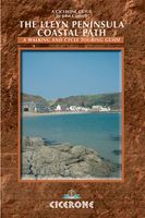
Wandelgids Lleyn Peninsula Coastal Path | Cicerone
Guidebook that describes a walkers’ route along the 95-mile coastal path that runs around the Lleyn Peninsula of north Wales from Caernarfon to Porthmadoc. Options for mountain and road bikes along the coastal path. Also includes circular walks and rides suitable for day excursions.  The western coastline of England and Wales has three peninsulas pushing out into the sea. The Cornish and Pembroke peninsulas have famous coast paths but the Lleyn peninsula of North Wales is less well known. Although the Lleyn cannot match the sheer scale of its bigger brothers it has no trouble competing when the grandeur of scenery is compared. The route connects the pilgrim sites leading to the remote island of Bardsey, dating back to the 6th century. In doing so its 95 miles cross a variety of landscapes from rocky cliffs to secluded bays. The nature of the landscape means that diversions inland have to be made, but although the route crosses hills and rises to over 1000ft in places the coast is alway…
18,50

Klanten-reviews van Wandelgids The Cumbria Coastal Way | Cicerone

Er zijn nog geen beoordelingen voor dit productBen jij de eerste die een review plaatst?

Meer over Wandelgids The Cumbria Coastal Way | Cicerone

Productomschrijving

This guidebook follows the continuous 298km (182 mile) walking route from Silverdale, on Morecambe Bay, towards Gretna on the Scottish border. The route links a number of gems of landscape, wildlife, archaeology and history along this often little-known coastline. A walk of 10-14 days suitable for all levels of ability.   THE CUMBRIA COASTAL WAY is a continuous 298km (182 mile) walking route from north Lancashire towards the Scottish border, and links a number of gems of landscape, wildlife, archaeology and history that are found on this often little-known coastline.   Starting at Silverdale, on Morecambe Bay, and edging the coast up towards Gretna, the coastal way can be walked in its entirety (10–14 days), or in sections, by people of all ages and abilities. Much of the route-finding is easy, and the route, which rarely climbs higher than 100m above sea level, has been designed to link with public transport.    This is a totally new edition of the guidebook written by two walkers who regularly explore Cumbria’s diverse coast.
Webshop.nl maakt gebruik van cookies. Ga je verder op onze website, ga dan akkoord met het plaatsen van cookies en de verwerking van deze data door ons en vermelde partners.