webshop.nl
Categorieën
  Sluiten

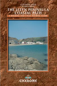
Wandelgids Lleyn Peninsula Coastal Path | Cicerone

Guidebook that describes a walkers’ route along the 95-mile coastal path that runs around the Lleyn Peninsula of north Wales from Caernarfon to Porthmadoc. Options for mountain and road bikes along the coastal path. Also includes circular walks and rides suitable for day excursions.  The western coastline of England and Wales has three peninsulas p...
18,50

Webshops met dit product

Webshop
Bezorging
Prijs

Anderen bekeken ook

Wandelgids 44 Pathfinder Guides Essex | Ordnance Survey
Pathfinder Guide to Essex offers excellent lowland walking in the south-east of England. The routes are all circular exploring the finer countryside of the county, in a series of parkland, farmland, woodland and coastal and estuarine walks, visiting its places of historic interest, attractive towns and charming villages. Given the pleasant and undramatic nature of the terrain, routes only really vary in length in terms of difficulty and there is a general progression through the book from shortest to longest. Beginning with a short walk linking Laindon Common with Great and Little Burstead, encountering the infant River Crouch, the book progresses to a near 10-mile excursion across Bradwell Marsh, with its wide open horizons, and a visit to the isolated and tiny Saxon chapel of St Peter-on-the-Wall. Sea air can also be taken on walks from Walton-on-the-Naze, a circuit of the eastern end of Mersea Island, along St Osyth Creek, at Maldon, from Burnham-on-Crouch, and overlooking Benfleet …
18,50
Wandelgids Walking in the Thames Valley | Cicerone
Walking in the Thames Valley offers 25 challenging circular walks around the River Thames and River Kennet in the south of England, taking in the Southern Chilterns, the Berkshire and North Hampshire Downs, Southern Oxfordshire and the eastern edge of Wiltshire. All routes are within easy reach of Reading, Newbury, Abingdon and London. While some walks visit Iron Age hill forts, others pass more modern features such as Wilton Windmill and the Kennet and Avon Canal. Some follow sections of the Ridgeway, while others meander along the banks of the Thames. What they all have in common is that they take the keen rambler to some of the best parts of the Thames Valley – a patchwork of open chalk grassland, broadleaved woodland and farmland and home to two Areas of Outstanding Natural Beauty. • walks from 10 to 18 miles, including one 2-day route • shorter, less strenuous alternatives for many of the walks • detailed route descriptions with information on local points of interest, OS mapping …
18,50
Wandelgids 82 Pathfinder Guides Orkney and Shetland | Ordnance Survey
Wandelgids van een deel van Engeland. Deze gids bevat 28 dagwandelingen, variërend van korte tochten tot pittige dagtochten. De bijbehorende kaarten zijn uitstekend: men heeft de topografische kaarten van Ordnance Survey gebruikt waarop de route is ingetekend. Daarnaast praktische informatie over de wandeling en wat beschrijvingen van het gebied. 28 outstanding walks – 23 circular and five there-and-back routes visiting eleven islands across both archipelagos. The size and nature of the islands lend themselves best to short and half-day walks where unhurried and free-range walking is encouraged and the endless distractions of scenery, seabirds, wildflowers and sea watching are best appreciated and enjoyed at a relaxed pace.   In Orkney, the first walk is a short stroll around Hoxa Head with its extensive views across Scapa Flow and subsequent routes go on to explore more widely over Mainland Orkney and take in the islands of Hoy, Rousay and South Ronaldsay, concluding with a ramble alo…
18,50
Wandelgids Coastal walks in Andalucia | Cicerone
Wandelgids met 40 wandelingen in Andalusië. Goede omschrijvingen, veel praktische informatie. Redelijk kaartmateriaal.    A guidebook to 40 half and full day coastal walks in Andalucía. The graded routes, which are suitable for any reasonably fit walker, range from 6km to 19.5km and can be walked all year round. The walks are located in seven of the region’s most beautiful National Parks and protected areas (including La Breña y las Marismas, Los Alcornocales y del Estrecho, La Sierra de las Nieves and Níjar-Cabo de Gata) and are mostly circular in nature, negating the need for any logistical legwork.   Step-by-step route descriptions for each walk are accompanied by 1:50,000 mapping, together with information about points of interest en route. Also included is a useful glossary and route summary table, plus all the practical information needed to explore Andalucía’s coast on foot – equipment, safety, when to go, refreshments, accommodation and more.   The picturesque coastline of Anda…
20,95
Wandelgids 54 Pathfinder Guides Hertfordshire and Bedfordshire | Ordnance Survey
Wandelgids van een deel van Engeland, Schotland of Wales. Deze gids bevat 28 dagwandelingen, variërend van korte tochten tot pittige dagtochten. De bijbehorende kaarten zijn uitstekend: men heeft de topografische kaarten van Ordnance Survey gebruikt waarop de route is ingetekend. Daarnaast praktische informatie over de wandeling en wat beschrijvingen van het gebied. Both counties tend to be underrated by walkers, often overlooked in favour of the delights of the Thames Valley or the hillier Chilterns country of Buckinghamshire. But they do possess much fine walking country, with a diversity of terrain, gentle hilly regions, lots of pleasant woodland, attractive riverside landscapes and an impressive collection of pretty villages.   There are a large number of country parks, especially in Bedfordshire, which make excellent starting points for walks in the surrounding countryside, linked by the public footpath network. Both Hertfordshire and Bedfordshire have an extensive network of well…
18,50
Wandelgids Walking in Provence - East | Cicerone
This guide offers 30 circular day walks in the eastern half of Provence, the large sun-kissed coastal region of south-east France. Spanning from the red rocks in the Ésterel on the Mediterranean to high mountains inland, the walks are set in the areas of the Alpes Maritimes, the Alpes de Haute-Provence and the Mercantour. Provence’s sunshine and Mediterranean charm attract many visitors to its coast, yet the area also has much more to offer the walker. The countryside inland boasts a range of scenery from remote mountaintops to spectacular gorges. History is everywhere, in medieval villages, arcaded streets, abbeys, churches and castles.    This guide covers the eastern regions, with its companion volume, Walking in Provence: West, covering the rest of this fascinating and historic landscape. The walking is incredibly diverse, and explores the country that hugs the Côte d'Azur and Italian border. The Alpes Maritimes rise craggy and wild above towns as unique as Grasse, Cannes and Monac…
21,95
Wandelgids Pathfinder Guides 85 Outer Hebrides | Ordnance Survey
This new title to the Outer Hebrides represents a very welcome addition to our Pathfinder® Guide series: 28 outstanding walks – 23 circular and five there-and-back routes visiting ten islands. The size and nature of the islands lend themselves best to short and half-day walks where unhurried and free-range walking is encouraged and the endless distractions of scenery, wildlife, history and Gaelic cultural heritage are best appreciated and enjoyed at a relaxed pace.   Featured Outer Hebrides walks include:   This wonderful collection of island walks is divided into three chapters: Lewis and Harris Berneray, North Uist, Benbecula, South Uist and Eriskay Barra and Vatersay There is an illustrated introduction to each of these island groups and planning information on ferries from the mainland and inter-island connections. Walks are presented sequentially geographically, starting in Stornoway, heading up to the Butt of Lewis and then working southwards along the main touring route down the…
18,50
Wandelgids Walking in the Auvergne | Cicerone
Uitgebreide wandelgids van de Auvergne: goede beschrijvingen, veel keuze, kaarten wat minder goed. This handy guidebook offers the finest day walks in five different areas of the Auvergne, an often-forgotten region in central France perfect for accessible day walking in a unique and spectacular landscape. Towns such as Vichy, Clermont-Ferrand and Puy-en-Velay also offer delightful places to base yourself for that perfect walking holiday. The ridges, rocky peaks and verdant valleys of the Cantal supervolcano dominate south-western Auvergne. The centre of the region hosts the unique chain of 'puys' with their pudding bowl forms and the pristine crater lakes of the Sancy massif. In the north, the Montagne Bourbonnaise preserves a pastoral way of life which is quintessentially French while the Haute Loire's rivers and medieval abbeys reward those venturing further off the beaten track. Notes on the geology and history of points of interest passed en route help you to get the most out of yo…
19,95
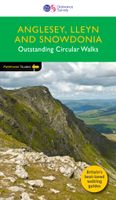
Wandelgids 78 Pathfinder Guides Anglesey, Lleyn and Snowdonia | Ordnance Survey
Fraaie, goed verzorgde wandelgidsjes met 28 wandelingen van max. een dag, (beginnend bij korte, eindigend bij langere wandelingen). Weergegeven op duidelijke topografische kaartjes (1:25.000). Bevat verder wetenswaardigheden en praktische informatie voor onderweg. Experience breathtaking north Wales with 28 unforgettable walks through Anglesey, the Lleyn Peninsula and the Snowdonia National Park. Find stunning views of the Welsh coast, the ‘holy isle’ of Ynys Mon and sublime Snowdonia with a range of walks graded by length and difficulty, from relaxed rambles to challenging climbs.   Featured Anglesey, Lleyn and Snowdonia walks include:   - Enjoy views of Snowdon from the shores of Llyn Padarn, dotted with remnants of the Llanberis slate quarries and a medieval castle - Climb to Holyhead Mountain, Anglesey’s highest point, through the South Stacks Cliff Nature Reserve - See the glorious Lleyn Heritage Coast from the headland of Trywn-y-Tâl, circling back to the pleasant village of Tref…
18,50
Wandelgids Walking The Munros Vol 1 Southern, Central and Western Highlands - Schotland | Cicerone
Uitstekende wandelgids van het zuiden, midden en westen van de Schotse Hooglanden. Goed beschreven met veel praktische informatie om de route te kunnen lopen, inclusief redelijke kaarten. Guidebook to walking the Munros in southern, central and western Highlands. Describes 69 challenging routes across 139 of the iconic 3000ft+ mountains covering areas such as Glencoe, Bridge of Orchy and Mull. Includes routes up Ben More, Ben Alder, Ben Lomond and Ben Nevis, the highest mountain in the British Isles. Volume 1 of two guidebooks.   Seasons The guide is intended for summer hillwalkers (usually April/May to October in Scotland). In winter conditions the routes become more serious mountaineering expeditions requiring appropriate skills, equipment and experience.   Centres Arrochar, Crianlarich, Killin, Pitlochry, Tyndrum, Glencoe, Fort William, Spean Bridge, Dalwhinnie, Braemar, Glenshee   Difficulty Most of the Munros are straightforward walks but some involve ridge walking, scr…
20,95

Klanten-reviews van Wandelgids Lleyn Peninsula Coastal Path | Cicerone

Er zijn nog geen beoordelingen voor dit productBen jij de eerste die een review plaatst?

Meer over Wandelgids Lleyn Peninsula Coastal Path | Cicerone

Productomschrijving

Guidebook that describes a walkers’ route along the 95-mile coastal path that runs around the Lleyn Peninsula of north Wales from Caernarfon to Porthmadoc. Options for mountain and road bikes along the coastal path. Also includes circular walks and rides suitable for day excursions.  The western coastline of England and Wales has three peninsulas pushing out into the sea. The Cornish and Pembroke peninsulas have famous coast paths but the Lleyn peninsula of North Wales is less well known. Although the Lleyn cannot match the sheer scale of its bigger brothers it has no trouble competing when the grandeur of scenery is compared. The route connects the pilgrim sites leading to the remote island of Bardsey, dating back to the 6th century. In doing so its 95 miles cross a variety of landscapes from rocky cliffs to secluded bays. The nature of the landscape means that diversions inland have to be made, but although the route crosses hills and rises to over 1000ft in places the coast is always nearby. The Lleyn has many tiny lanes and byways which allow cyclists to complete the route. Whilst many of the cliff paths are only for walkers cyclists can still sample the delights of this exquisite area and details of cycle routes are included.   1 Introduction Grading of circular walks Maps Equipment Accommodation History 2 Caernarfon to Penygroes Walking route Cycling route Other walks and rides: Dinas Dinlle Circular; South Caernarfon Circular; Lon Eifion Cycle Ride 3 Penygroes to Nefyn Walking route Cycling route Other walks: The hillforts of Yr Eifl; Clynnog-fawr Circular; Nant Gwrtheyrn Circular 4 Nefyn to Aberdaron Walking route Cycling route Other walks: Morfa Nefyn and Porth Dinllaen; The Cliffs of Aberdaron; Carn Fadryn; Land’s End Circular 5 Aberdaron to Abersoch Walking route Cycling route Other walks and rides: Mynydd y Graig; Western Lleyn Circular Cycle Ride; Porth Ceiriad 6 Abersoch to Pwllheli Walking route Cycling route Other walks and rides: Llanbedrog Headland; Abersoch Cicrcular Cycle Ride 7 Pwllheli to Portmadoc Walking route Cycling route Other walks: In the Steps of Lloyd George; Black Rock and Borth-y-Gest; Tyn Llan Circular Appendix 1: Facilities on the Lleyn Peninsula Appendix 2: Public Transport Appendix 3: Useful Links Bibliography List of Sketch Maps The Lleyn Peninsula 2.1    South from Caernarfon 2.2    Saron to Llanwnda 3.1    West from Penygroes 3.2    Approaching Clynnog Fawr 3.3    Crossing of Bwlch Mawr and descent to Trefor 3.4    The Trefor area 4.1    The Porth Colmon area 4.2    Southwest from Porth Oer 5.1    Aberdaron to Porth Ysgo 5.2    Rhiw to Hell’s Mouth 5.3    Hell’s Mouth to Deuglawdd 5.4    Deuglawdd to Llangian 5.5    Approach to Porth Ceiriad 5.6    Porth Ceiriad to Abersoch 7.1    Llanystumdwy to Criccieth
Webshop.nl maakt gebruik van cookies. Ga je verder op onze website, ga dan akkoord met het plaatsen van cookies en de verwerking van deze data door ons en vermelde partners.