webshop.nl
Categorieën
  Sluiten

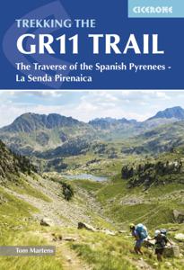
Wandelgids GR 11 Spaanse Pyreneeen - Through the Spanish Pyrenees | Cicerone

Uitstekende wandelgids van dit geweldige gebied. goed beschreven met veel praktische informatie om de route te kunnen lopen, inclusief redelijke kaarten. Beschrijving van de GR 11, het lange afstandswandelpad aan de Spaanse kant van de Pyreneeën. Aanbevolen wandelkaarten Schaal 1:50.000 Wandelkaart Senda Pirenaica GR11 | Editorial Alpina - Set van ...
23,95

Webshops met dit product

Webshop
Bezorging
Prijs

Anderen bekeken ook

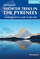
Wandelgids Shorter Treks in the Pyrenees | Cicerone
Uitstekende wandelgids van dit geweldige gebied. Goed beschreven met veel praktische informatie om de route te kunnen lopen, inclusief redelijke kaarten. A guidebook to seven circular treks exploring the Pyrenees of France and Spain. Seven 1 or 2 week routes in dramatic mountain scenery, including the Pic du Midi d'Ossau, Vignemale, Ordesa Canyon, Gavernie, Puigmal and Canigou. Using mostly waymarked mountain paths, with some boulderfield or easy scrambling, the treks are designed with accommodation in mountain refuges or mountain villages at the end of each stage, though there are plenty of options to camp for those who prefer to backpack. Detailed descriptions for each stage of the route are accompanied by sketch maps and elevation profiles, and there are notes on planning, equipment and access. The Pyrenees stretch 400km from Atlantic to Mediterranean, forming a barrier rising to over 3000m between France and Spain. The steep rolling hills of the Basque Country give way to the spe…
23,95
Wandelgids The Pyrenees - Pyreneeen | Cicerone
Uitputtende beschrijving van alle wandel- en klimmogelijkheden in de Pyreneeen. Ongekende diepgang in informatie over wat, waar en hoe de gebieden in elkaar zitten. Geschreven door een van de toonaangevende bergwandelaars op dit moment: Kev Reynolds. Essential guidebook of walks and climbs in the Pyrenees, one of Europe's finest mountain ranges. The guide includes 170 day walks, multi-day walks, climbing routes and mountaineering ascents, and covers all valleys and peaks on both sides of the border with France and Spain, with through routes and peaks to bag.   The guidebook divides the range into 21 sections, including Andorra, the Ordesa National Park, the Carlit Massif, Gavarnie and the Cirque du Lescun to name a few. Each area includes practical information on travel, accommodation and mountain refuges, as well sketch mapping.   Between short, half-hour walks, to 12-day treks and 25 summits, this guidebook will help any walker, climber or trekker experience the best of the Pyre…
24,95
Wandelgids The Westweg | Cicerone
Uitstekende wandelgids van een meerdaagse tocht in het Zwarte Woud in Duitsland. Goede beschrijvingen, veel praktische informatie en redelijke kaarten al zullen deze niet helemaal voldoende zijn. Guidebook to the Westweg (Westway), a 285km walk across Germany's Black Forest from Pforzheim to Basel. This classic route, which includes Feldberg, Black Forest's highest peak, takes 13 to 14 days, each day stage ranging from 15 to 28km. Two variants are described, both well way-marked and suitable for those new to long distance walking. This guidebook is all you need to discover The Westweg, a 285km walk along the length Germany's Black Forest from Pforzheim to Basel. This classic long-distance trail takes around two weeks to walk, in stages of 15-28km. The route is well way-marked and suitable for experienced hikers and those new to long distance walking, though some sections are steep. The Westweg incorporates many of the region's highlights, such the Schwarzwald National Park, the source …
23,95
Wandelgids The Pennine Way | Cicerone
Uitstekende wandelgids van de Pennine Way, waarbij naast alle noodzakelijke informatie ook gebruik gemaakt wordt van de echte topografische kaart. inclusief gidsje met routekaarten van 1:25000  Guidebook to the Pennine Way National Trail with OS map booklet. The 270 mile route from Edale to Kirk Yetholm takes three weeks to walk and is suitable for fit and experienced long distance walkers. The route crosses the Peak District, Yorkshire Dales and North Pennines National Parks. Includes separate OS 1:25,000 map booklet of the route. The Pennine Way is Britain's oldest, toughest long-distance footpath – and arguably its most iconic. Now a National Trail, the 427km (265½ mile) route from Edale in Derbyshire to Kirk Yetholm in the Scottish Borders offers wayfarers the opportunity to immerse themselves in wild beauty of the North. The Pennines boast rolling hills, sweeping moorland and wide glacial valleys, and the Pennine Way has come to embody personal challenge and adventure.    This gui…
23,95
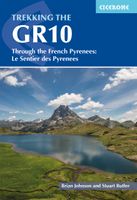
Wandelgids GR10 trail, Pyrenees - Pyreneeen | Cicerone
Engelstalige beschrijving van de mooiste wandeltocht in de Pyreneeen. De gids voldoet aan alle verwachtingen die je kunt hebben. Wel heb je voor de zwaardere gedeelte voor de zekerheid goede kaarten nodig ...... Guidebook to the GR10, a 955km trek across the French Pyrenees from Hendaye on the Atlantic Coast to the Mediterranean coast at Banyuls-sur-Mer. Described in 55-day stages, the route can be completed in its entirety, or in shorter sections using the bus and rail links found throughout the Pyrenees.   Step by step route descriptions are accompanied by 1:100,000 mapping and gradient profiles. Useful practical information is also included such as when to go, getting there and back, camping, accessing fuel and water, plus handy equipment tips and more.   The easiest, oldest and most popular of the three long-distance routes that traverse the mountain range, the GR10 is well waymarked and follows good mountain paths. For many walkers, the highlight of the route is the magnificent wi…
26,50
Wandelgids Trekking in the Apennines - Apennijnen | Cicerone
Uitstekende wandelgids die in etappes de route nauwkeurig beschijft; ook de zijtakken en alternatieve routes koman aan bod. Kaarten zijn schetsmatig en in onze ogen onvoldoende bij slechte weersomstandigheden. Wij raden dan ook om er losse kaarten bij te kopen, voor zover verkrijgbaar! Guidebook to the Grand Apennines Trek, or Grande Escursione Appenninica (GEA). Through Tuscany and Emilia-Romagna and two National Parks, this 400km, 23 day trail explores the mountains, forests and hills of central Italy. Suitable for a range of walkers, it can be split into shorter sections or day walks if needed. This guidebook describes the Grande Escursione Appenninica (GEA), a nearly 400km long, three week trek crossing the Appenines in 23 stages, from Bocca Trabaria to Passo Due Santi on the edge of Liguria. The route dips in and out of Tuscany and Emilia-Romagna, never dropping below 400 metres. Best walked between spring and autumn, it is suitable for any reasonably fit walker. Highlights includ…
22,95
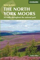
Wandelgids The North York Moors | Cicerone
Uitstekende wandelgids van dit geweldige gebied. Goed beschreven met veel praktische informatie om de routes te kunnen lopen, inclusief redelijke kaarten. Guidebook to 50 walks in the North York Moors National Park. The walks, which range from 4 to 13 miles, are distributed through seven regions within the park, enabling walkers to discover and appreciate the Tabular Hills, Hambleton Hills, Cleveland Hills, Northern Moors, High Moors, Eastern Moors and Cleveland Coast. For those who like a challenge, the course of the classic Lyke Wake Walk, crossing the national park from east to west, is also described.   For each walk (most of which are circular), step-by-step route description is accompanied by extracts of OS mapping. Points of interest are highlighted, and background information provided, detailing the history and industry of the area. The guidebook also includes planning and preparation details such as when to go, where to stay, and how to get around using public transport.   Com…
18,50
Wandelgids Walking in the Yorkshire Dales: South and West | Cicerone
Veelzijdige wandelgids van een deel van de Yorkshire Dales, goede kaarten en beschrijvingen en veel keuze uit een behoorlijk aantal wandelingen. Part of a two-book set, this guidebook describes 44 walks in the southern and western Yorkshire Dales, including the famous 23 mile Three Peaks circuit over Pen-y-Ghent, Whernside and Ingleborough. The other, mostly circular routes of 3½ to 13 miles cover the scenic region between Sedbergh, Kirkby Lonsdale, Settle, Skipton and Grassington. The Yorkshire Dales need little introduction: their picturesque scenery and hundreds of miles of footpaths, tracks and bridleways have been attracting walkers for decades. Part of a two-volume set, this guidebook presents over 40 routes in the south and west of the National Park, with bases including Sedburgh, Malham, Grassington, Skipton, Settle and Kirkby Lonsdale. The walks cover the valleys of Wharfedale, Littondale, Malhamdale, Ribblesdale and Dentdale – each with its own distinctive landscape and chara…
19,95
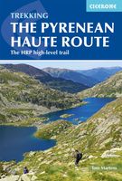
Wandelgids Pyrenean Haute Route - a high level trail, Pyreneeën HRP | Cicerone
Beschrijving van de klassieke HRP, Haute Randonnee Pyreneen. Goede beschrijving van de route met hoogteprofielen en andere praktische informatie. Kaartmateriaal is voor deze zware route onvoldoende aanwezig in de gids.  Aanbevolen wandelkaarten voor de hele of een deel van de route: Wandelkaarten van Rando Editions op Schaal 1:50.000 There are three main trekking routes across the Pyrenees from coast to coast: of these, the Pyrenean Haute Route (or HRP for Haute Route Pyrénéenne) is the most challenging - and arguably, the most spectacular. Unlike the GR10 and GR11, it is not waymarked and borders on mountaineering at times, sticking as closely as possible to the main ridge. It stretches 750km from the Atlantic resort of Hendaye to Banyuls-sur-Mer on the Mediterranean, crossing the French-Spanish border many times on its traverse. The hike calls for experience, navigational competence and self-reliance, but offers rich rewards as you pass through some of the most stunning landscapes th…
24,95
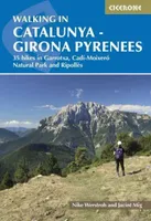
Wandelgids Catalunya - Girona Pyrenees | Cicerone
The delights of Spain's Catalunya - Girona Pyrenees region are revealed in this new walking guide, which covers 35 graded walks of 5 to 19km across Garrotxa, Ripolles and the Cadi-Moixero Natural Park. Walks are included for all abilities, from easy strolls to more demanding walks, and some of the walks are accessible by public transport. The guide provides detailed route descriptions, either 1:25k or 1:50k mapping for each route and a route summary table to help with choosing appropriate walks.   All the walks are illustrated with stunning photos. A list of local campsites and other useful contacts is included at the back, plus notes on refreshment opportunities along the routes. There's also background information on local geology, wildlife and history, and planning details on when to go, where to stay and what to take.   Leave behind Girona's medieval walls, narrow cobbled streets and colourful riverside and you will find a network of trails through the countryside surrounding Giron…
24,95

Klanten-reviews van Wandelgids GR 11 Spaanse Pyreneeen - Through the Spanish Pyrenees | Cicerone

Er zijn nog geen beoordelingen voor dit productBen jij de eerste die een review plaatst?

Meer over Wandelgids GR 11 Spaanse Pyreneeen - Through the Spanish Pyrenees | Cicerone

Productomschrijving

Uitstekende wandelgids van dit geweldige gebied. goed beschreven met veel praktische informatie om de route te kunnen lopen, inclusief redelijke kaarten. Beschrijving van de GR 11, het lange afstandswandelpad aan de Spaanse kant van de Pyreneeën. Aanbevolen wandelkaarten Schaal 1:50.000 Wandelkaart Senda Pirenaica GR11 | Editorial Alpina - Set van 21 kaarten Of Wandelkaarten van Rando Pyreneeën - 10 losse kaarten This comprehensive guidebook to the magnificent GR11 trail, which runs 820km from the Atlantic to the Mediterranean, provides everything trekkers will need to take up the challenge - detailed route description, excellent photographs, lots of background information and unique, custom-produced maps. This glorious traverse of the Pyrenees, on the Spanish side, is a serious challenge - passing over a succession of high alpine passes where boulderfields, scree slopes and occasional snowfields may need to be crossed. It is presented in 47 stages of 8-31km.    It is well waymarked and has regular opportunities to top up on food and drink, described within the routes and in a detailed place-by-place appendix at the back. Also included are bad weather options - although the weather is often good along this route - detours to find accommodation at some points, and advice on where to stay, supplies, language and logistics, as well as a glossary including Aragon, Basque and Catalan words, to help you find your way.   GR-11   The Basque country, Anayet lakes, Ordessa and Monte Perdido National Park, Aiguestortes and Estany de Sant Maurici National Park, the Maladeta range, Andorra, Cap de Creus Natural Park.    
Webshop.nl maakt gebruik van cookies. Ga je verder op onze website, ga dan akkoord met het plaatsen van cookies en de verwerking van deze data door ons en vermelde partners.