webshop.nl
Categorieën
  Sluiten

Stadsplattegrond Vancouver & Greater Vancouver | ITMB

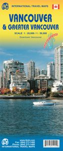
Stadsplattegrond van Vancouver met een extra inzet op kleinere schaal van het centrum. Met register. Waterproof! ITMB first published our own map of Vancouver six editions and twenty years ago. Each time we update, we're surprised at how much change has taken place. This is a double-sided map, with the city on one side and the metropolitan area on ...
13,95

Webshops met dit product

Webshop
Bezorging
Prijs

Anderen bekeken ook

Stadsplattegrond Streetwise London | Michelin
Handige stadsplattegrond van Londen in de vorm van een uitklapkaart, die aan twee zijden bedrukt is. Prettig leesbaar, helder kaartbeeld, met een register en een kleine kaart van het openbaar vervoer. Deze kaart is geplastificeerd. REVISED 2023Streetwise London Map is a laminated city center map of London, England. The accordion-fold pocket size travel map includes a London Underground map with tube lines & stations. Cover includes:Main London City Map 1:20,000London Underground Map - London Tube MapDimensions: 4" x 8.5" folded, 8.5" x unfoldedLondon is one of the most popular, populated and accessible cites on earth.   People love London. And why not? Londoners are charming and helpful, and their city operates on such a high dosage of civility that it could be considered an art form. London is an urban oasis where you can search out cutting edge design, cuisine, fashion, chic neighborhoods, or traditional culture.   When visiting London, be prepared to walk. Whether its basic window s…
9,95
Wegenkaart - landkaart Southern Alberta & Southern British Columbia | ITMB
ITMB, being based in Vancouver, BC, understandably has a local/regional market for our map line. We have a map of Western Canada, as well as an atlas, a very nice map of BC itself, a map of the south half of BC, and a map of part of BC combined with Washington State. What we did not have, until now, was a map covering the most touristically-visited part of all of Canada – namely, the southern halves of both British Columbia and its neighbour, Alberta, with a small amount of Washington State, Idaho, and Montana (to assist those heading north and needing to know about border crossings). Therefore, ITMB is pleased to announce the release of Southern BC and Alberta. Side One covers BC from the US border (with a carry-on to Seattle) north to Prince George and east to the Alberta border, with a carry-on to Calgary. All of Vancouver Island, the Okanagan Valley, and the Rock Mountain National Parks of Banff and Jasper, are included. The map is rich with wilderness campsite (almost 1,000 are sh…
13,95
Wegenkaart - landkaart British Columbia South (Canada) | ITMB
Deze wegenkaart van British Columbia bestrijkt het gebied tussen Vancouver en Calgary, en is de perfecte toeristische kaart voor het verkennen van de regio Rocky Mountain. Alle wegen en spoorlijnen tussen de twee steden worden getoond, evenals campings en parken.   This map covers the area between Vancouver and Calgary, and is the perfect tourist map for exploring the Rocky Mountain region. All roads and rail lines between the two cities are shown, as well as camp grounds, parks. Legend Includes: Points of interests, airports, RV and camping sites, wilderness camps, picnic areas, waterfalls, tourist information, museums, golf courses, gas stations, outdoor activities and other information. Folded paper, road and travel map in color. Scale 1:900,000. Distinguishes roads ranging from divided highways to other roads-4WD/dry weather. Legend includes railways, trails, ferry routes, glaciers, points of interest, international airports, domestic airports, museums, mountain peaks, camping/recr…
13,95
Wegenkaart - landkaart Alaska's Inside Passage | ITMB
Een degelijke kaart met aanduidingen van o.a. nationale parken, vliegveld, benzinepomp, dirt-roads en kleine plattegronden van Anchorage, Seattle, Vancouver en Victoria. Als overzichtskaart goed te gebruiken.    We recently released our USA Pacific Coast Map, covering the segment between San Diego and Vancouver. This map completes the mapping of the Pacific Ocean coastline by mapping the routes followed by cruise ships and Alaska Ferries heading north from Seattle and Vancouver to Alaska. This is a double-sided map, with Vancouver Island and the coastline as far north as Prince Rupert on one side (with inset maps of Seattle, Victoria, and Vancouver)on side 1, and the coastline north to Glacier Bay and an onward inset map to Anchorage (including an inset map of the city) on the second side. As the actual routes followed by the numerous cruise lines vary, we can't show their actual sailing routes, but they generally follow the coastline within viewing distance of either the mainland or c…
13,95
Stadsplattegrond Geneve en Zwitserland | ITMB
This map has been a long time in development preparation. The data for a sophisticated country like Switzerland needs delicate handling to do justice to this lovely country. We did not want to do 'just' another road map, similar to those available from a variety of European publishers. Our version shows the physical reality of this mountainous country to good advantage without obscuring the places of interest to visitors. The road/rail infrastructure within the country is well shown with perhaps more villages being included than would normally be the case. The road network in surrounding countries has been simplified to focus attention on Switzerland itself. Touristic points, such as castles, fortresses, ski areas, and museums have been included, but we removed a lot of data, such as gas stations, schools, post offices, most churches and police stations in an effort to avoiding cluttering the map with an over-load of information. The Geneva side of the map goes from the airport in the …
13,95
Wegenkaart - landkaart 92G Lower Mainland British Columbia - Richmond and New Westminster | ITMB
Goede wegenkaart van British Columbia met topografische uitsnede van Richmond en Westminster. Topographic/Recreation Map 92G&92G2 and G3 - With the 2010 Winter Olympics bearing down on us, this very timely map presents a lovely regional map showing all of the Olympic venues (the Games are being held in Vancouver, Richmond, UBC, Whistler, and the Callaghan Valley – not just in Vancouver). The area of coverage is from Everett (just north of Seattle) in the USA to north of Pemberton, and from Victoria in the west to Chilliwack in the east on the one side, and a detailed 1:50,000 topo map of the Richmond/New Westminster/Surrey/Langley outer urban areas of Metro Vancouver. Both maps are Government of Canada NTS maps, overlaid with touristic and recreational information by ITMB, which holds the copyright on behalf of the Queen (I love being able to say that). The Lower Mainland portion is particularly useful, in that it includes the east coast of Vancouver Island, from Victoria to Nanaimo an…
13,95
Wegenkaart - landkaart - Stadsplattegrond Montreal & Southern Quebec | ITMB
Stadsplattegrond van Montreal met register. Op de achterzijde een kaart van het zuiden van Quebec. 1:12,500/1:850,000 on waterproof paper. In this third, updated, edition of Canada's third largest city, we have added a user-friendly bonus. As is common now to most of our city maps, we have included a regional map of the hinterland of the urban area, so buyers won't have to purchase a second map to explore the environs of the city being presented. In the case of Montreal, being in a huge geographic country, this means Southern Quebec which, because of its size, dictates a map of more than one to a million scale. In the European context this would be the equivalent of Paris and all of France as a 'regional' map of the surrounds of Paris - but that's France and this is Canada.   Montreal (or Mont Royale in its original) was a village called Hochelaga when the early French explorers arrived in the early 1600s. They established a trading fort and, generally speaking, maintained good relatio…
13,95
Wegenkaart - landkaart Bangladesh & India oost | ITMB
Een degelijke kaart met aanduidingen van o.a. nationale parken, vliegveld, benzinepomp, dirt-roads en kleine plattegrond van hoofdstad. Als overzichtskaart goed te gebruiken. I like Bangladesh. Sure, the government is too corrupt and the country gets schmucked every time there's a hurricane, but the people are friendly and hard-working and gradually improving their country. As a travel destination, Bangladesh has to be considered as part of a trip to India for most people, so in addition to updating and modernizing our artwork, we have added a map of the easternmost portion of India, showing access routes and sites of interest in both countries. One of the great treats of Bangladesh is to take a ferry from Dhaka to Khulna, a two-day trip. The map also includes an inset of Dhaka, the capital, although we had to show only a few of the thousands of mosques in the city.    Legend Includes: Roads by classification, Airports, Ferrie routes, Bus stations, Car parks, State boudaries, border cr…
13,95
Wegenkaart - landkaart - Stadsplattegrond Washington D.C. & eastern corridor | ITMB
Stadsplattegrond van Washington D.C., 1:12.500, met een overzichtskaart van het gebied van Boston tot aan Washington DC, 1:1.000.000   This is one of the most-visited cities in the USA and one really NEEDS a map to uncover all the statues, memorials, and buildings of interest. Of course, hotels, shopping areas, transportation hubs, parks, etc are also included. With this edition, we also have added a full-sheet map of the Eastern Corridor of the USA to the reverse side of the map. Starting with Boston in the north, through NYC and Philadelphia to Baltimore and on past DC to Richmond and Raleigh, the Eastern Corridor encompasses one-third of the population of the United States and a dozen States. The map shows road and rail connections, with motorways noted in blue and toll roads in green, and includes major historic and touristic sites within the area of coverage.   Legend Includes: Roads by classification, State Boundaries,State Highways, Main Roads, Secondary and other Roads,Hot spri…
13,95
Reisgids Eyewitness Top 10 Vancouver and Vancouver Island | Dorling Kindersley
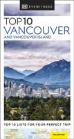
Kleine, rijk geillustreerde reisgids over Vancouver en Vancouver Island. Met alle hoogtepunten, bezienswaardigheden, activiteiten, praktische tips, eet & drink aanrader. Inclusief handige kaartjes. The world's bestselling pocket guidesBeautifully situated between the ocean and picturesque mountains, Vancouver offers the cultural vibrancy of a modern metropolis, as well as the opportunity to enjoy the breathtaking rugged coastline and wilderness of nearby Vancouver Island. Make the most of your trip to this coastal city with DK Eyewitness Top 10. Planning is a breeze with our simple lists of ten, covering the very best that Vancouver and Vancouver Island have to offer and ensuring that you don't miss a thing.   Best of all, the pocket-friendly format is light and easily portable; the perfect companion while out and about. Inside you'll find: -Up-to-date information following the COVID-19 outbreak, insider tips and advice for staying safe-Top 10 lists of Vancouver and Vancouver Island…
13,50

Klanten-reviews van Stadsplattegrond Vancouver & Greater Vancouver | ITMB

Er zijn nog geen beoordelingen voor dit productBen jij de eerste die een review plaatst?

Meer over Stadsplattegrond Vancouver & Greater Vancouver | ITMB

Productomschrijving

Stadsplattegrond van Vancouver met een extra inzet op kleinere schaal van het centrum. Met register. Waterproof! ITMB first published our own map of Vancouver six editions and twenty years ago. Each time we update, we're surprised at how much change has taken place. This is a double-sided map, with the city on one side and the metropolitan area on the other side. Like many North American cities, Vancouver consists of several separate urban areas that have merged together physically but not politically. Greater Vancouver's population is 2,500,000, most of which consists of residential areas. The 'regional' side is where the growth in population is taking place (about 100,000 people move to Vancouver each year) and this is where noticeable developments are taking place - the new South Perimeter Road following the Fraser River eastwards, the new Port Mann toll bridge, the new toll Golden Ears toll bridge across the Fraser. None of this will make sense to non-locals, but since most of our copies sell locally, our press releases have to mention details that may seem irrelevant to people further away. For such people, the latest and greatest map for visitors to Vancouver is now on plastic.   Legend Includes: Roads by classification, Railroads with stations, Skytrain lines, Trains, Buses, Ferries, Ski lift, City border, Hotels, Police stations, Main post offices, Gas stations, Major places of workship, Parks with hiking trails and playgrounds, GVRD and provincial parks, Tourist information centers and points of interest, Marinas, Lighthouses, Hospital and care centers, Universities, Libraries, Community centres, Beaches, Shopping centres and malls, Live theatres, Cinemas, Museums, Galleries, Picnic areas, Golf courses, Sport fields, Stadiums, and much more.
Webshop.nl maakt gebruik van cookies. Ga je verder op onze website, ga dan akkoord met het plaatsen van cookies en de verwerking van deze data door ons en vermelde partners.