webshop.nl
Categorieën
  Sluiten

Stadsplattegrond Geneve en Zwitserland | ITMB

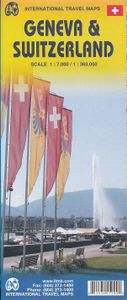
This map has been a long time in development preparation. The data for a sophisticated country like Switzerland needs delicate handling to do justice to this lovely country. We did not want to do 'just' another road map, similar to those available from a variety of European publishers. Our version shows the physical reality of this mountainous coun...
13,95

Webshops met dit product

Webshop
Bezorging
Prijs

Anderen bekeken ook

Fietskaart 01 Cycling guides Cornwall | Goldeneye
Our maps are double-sided, printed on an A2 sheet with a concertina fold. This allows for easy folding and folding, and an ease of access to the mapping. The material is rain and tear-resistant. Our early maps were designed at the scale of 2 miles to 1 inch/1:126,720. The later designs along with digitalisation are 1: 100,000. We were encouraged by the Cycle Touring Club to convert our cartography toward the cycle market (to replace the out-of-print Bartholomew series). As time and the series progressed we have added more data: The National Cycle Network routes, Regional Routes, and Traffic-Free Family Routes, as and when they are developed. These routes are in addition to the Circular Routes Goldeneye Commissioned at the outset of our publishing schedule. We are also adding to new editions; bike shops, cycle hire, and tea rooms, along with the tourist attractions already featured. Our plan is to make available digital versions for cell phones and tablets and to update, on an annual ba…
15,95
Wegenkaart - landkaart Liechtenstein & Oostenrijk West | ITMB
Europe is dotted with mini-states that exist solely for historic reasons but are fiercely independent. Liechtenstein, surrounded by Switzerland on its west and south and Austria on its other borders, is such a state. It is larger and more diverse than many imagine and is quite a popular ski resort region. Side 1 is a detailed map of the principality, framed on the west by the Rhine River and a bit of Switzerland and on the east by Austria. Most development occurs in the Rhine Valley in a north-south direction, dominated by the capital city of Vaduz. There are five access points from Switzerland across the Rhine, one from the south, and two from Austria in the north. The ski haven of Malbun is prominently shown, and the scale of the map is detailed enough to name every major street. This also enabled us the opportunity to include schools, shopping areas, post offices, and churches, as well as a wide range of eating establishments. Walking/hiking trails have also been included. This is t…
14,95
Wegenkaart - landkaart Libya - Tunisia / Libië - Tunesië | ITMB
The recent 'jasmine revolution' brings real-life reality very close to our consciousness. It is fitting that a new map of Tunisia is coming out just at this momentous time of the country's long history, as the country has long been seen as a small but stable fortress in the sea of shifting sand known as North Africa. Having visited the country, the publishers wish its inhabitants well as they undertake the next leg of their political development, and hope that the 'revolution' won't be hijacked by extremist elements. This map benefits from the research the publishers were able to carry out during their recent visit to Tunisia. They were able to confirm a lot of road information, and improve the information on this map. The map also now includes several text blocks called capsule comments, describing in words certain brief facts about points of interest in the country.  The north coast of Africa is also the southern edge of Roman Africa, and the best-preserved ruins are in Libya, which …
13,95
Wegenkaart - landkaart - Stadsplattegrond Poland east - Warsaw, Oost Polen en Warschau | ITMB
ITMB wegenkaarten en wandelkaarten kenmerken zich door het kleurgebruik waarbij zo de nadruk wordt gelegd op de natuurkundige aspecten van het land of de streek. Het soort landschap en de hoogte worden hierdoor zeer duidelijk zichtbaar. Natuurlijk vind je ook de 'gewone' zaken als wegennet, spoorwegen, vliegvelden, ferrys, toeristische bezienswaardigheden en nationale parken er op terug.. Vaak - maar niet op alle kaarten - staat op de achterzijde een stadsplattegrond van hoofdstad of belangrijkste stad in de regio.  Voorzijde: Oost Polen shcaal 1:650.000 Achterzijde: Warschau, schaal 1:9.000 This is, at the same time, our second edition updated map of Warsaw and a brand new title for ITMB, in that we have added a regional map of the eastern half of Poland to the second side of the map. This gives the end user two maps for the price of one by combining the many attractions of the city with its surrounding countryside. Anyone with a small amount of historical knowledge knows that Warsaw …
13,95
Wegenkaart - landkaart West Turkije - Turkey west | ITMB
Turkey is a big country. Most visitors concentrate on Istanbul and the Izmir Coast, which is a shame as there are so many other interesting parts of the country to visit. This map covers the western third of the country as a double-sided map, covering from the Greek/Bulgarian border south to the Mediterranean and east to Eregli and Antalya in the east. Naturally, at a better scale, roads and road conditions can be shown to better advantage, and the ferry routes from Istanbul make more sense. The topography is now showing as contouring more easily, and we have been able to add the next layer of villages. The scale is still not appropriate for showing minor roads and tracks, but we have included as many as we feel we can. The map is printed on durable plastic paper, so will stand up to the rigours of travel quite well. A basin inset map of Istanbul has been included as well.   Legend Includes: Road by classification, Motorways, Multilane Hwy, Main Roads, Rail Ways, Ferry Routes, National…
13,95
Wegenkaart - landkaart - Stadsplattegrond Chicago and the Lake Michigan Region | ITMB
Stadsplattegrond van Chicago (1:12.500) en een overzichtskaart van Lake Michigan (1:100.000) op scheur- en watervast papier. Chicago is the third most populous city in the USA and has historically been a transportation hub. Americans have never developed trans-continental rail lines or highways and now are using O'Hare airport as one of the nation's regional hubs. Historic Route 66 begins its westward trek here and all passengers from eastern cities change trains here. I-90 does pass through Chicago on its westward route, but only because Lake Michigan forces it southward. As a city, Chicago offers fabulous lakeside parks, the 'Golden Mile' of shops, the Loop, the world-class Field Museum, a number of Frank Lloyd Wright designed houses, and the Lincoln Park Zoo. Apart from updating information, this map adds two aspects of value to the previous edition. First, the reverse side now includes a regional map that encompasses Indianapolis, Detroit, Marquette and Sault Ste. Marie at the nort…
13,95
Wegenkaart - landkaart Western Canada | ITMB
Een degelijke kaart met aanduidingen van o.a. nationale parken, vliegveld, benzinepomp, dirt-roads. Als overzichtskaart goed te gebruiken. This is actually our second attempt at mapping the western portion of Canada; the first covered everything from northwestern Ontario to the Pacific Ocean and, while it was an excellent map, the scale that such a huge area covered necessitated severe problems. In this version, all of British Columbia, Alberta, and the Yukon have been mapped from fresh digital data and presented at 1:1.4T scale. This would have been impossible when we prepared the first map. The Northwest Territories portion had to be compressed in two ways; first, the scale is 1:2M; second, only the portion with roads is shown. This is still an extremely large area. One has to consider the actual size of Canada when designing a map. Most countries in Europe would fit into this area, which only covers 20% of Canada. The Fort McMurray forest fire of a year ago covered an area larger th…
13,95
Stadsplattegrond Manila | ITMB
Goede overzichtelijke stadskaart van Manila en directe omgeving. Manila is the capital of the Philippines and a historic city, as well as a major economic and governmental centre. It is also a very big, sprawling city, like many in Asia, and difficult to map. We have prepared a double-sided map of the city, divided north/south, from Quezon City in the north to the new Alaya shopping centre and the world trading centre in the south. The heart of Manila is the area just north of the Pasig River, with its bustling streets and many shops. The hotel region is south of the river, close to the ocean, and we have done our best to show the hotels well, but there are too many to show all of them. This is an excellent map of a major Asian city; one that has never been mapped to this extent for travel previously. Legend Includes: Roads by classification, domestic airports, public transport lines, ferries, prominent buildings, parks, police stations, hospitals, banks, cinemas, hotels, temples, muse…
13,95
Wegenkaart - landkaart Bosnië en Montenegro | ITMB
For some reason, Bosnia Herzegovina has never attracted the attention of firms publishing maps. Understandably, since the breakup of Yugoslavia, the entire region has been somewhat unattractive for visitors. Also, Bosnia by itself is difficult to map, due to its shape. However, we have visited the country several times and find it to be interesting, friendly, and attractive. We were particularly impressed by Montenegro. Since it broke away from Serbia, this country has moved forward quickly. It uses the Euro as a currency, has lovely Mediterranean Sea resorts along its coast, and is a progressive country tying its future to the rest of Europe as a future EU member. The roads in both countries are good, and the damage done by civil in-fighting largely a thing of the past. Both countries are well-worth a visit. The map also includes Kosovo. Ethnically, it is probably more tied to Albania than to Bosnia, but geographically, Bosnia is closer and Kosovo is shown in good detail on this doubl…
13,95
Wegenkaart - landkaart - Stadsplattegrond Toronto & Southern Ontario - Ontario zuid | ITMB
Overzichtskaart van het zuiden van Ontario - schaal 1:600.000 - met op de andere kant een grote plattegrond van Toronto op schaal 1:12.000 Legend Includes: Roads by classification, Accomodations, Museum, Churches, Buildings, Points of tourist, Public Interests, Post Offices, Police Stations, Schools, Live Theatres, Cinemas, Ruins, Bus Terminals, Ferry Terminals, Service Areas, Hospitals, Ports, Mines, RCMP, Major Airports, Secondary Airports, Camp Grounds, National Park and Equivalent Reserves, Ski, Picnic Sites, and much more.   Toronto is the largest city in Canada by far. Touristically, its attraction rests with its central core, from High Park in the west to the Don River in the east, and from the park-like islands in Lake Ontario to Bloor Street in the north. In this area, one finds remnants of the oldest portion of ‘muddy York’, the original fort built to deter American raiders (close to the exhibition grounds), Campbell House (at Queen & University), and the first public school…
13,95

Klanten-reviews van Stadsplattegrond Geneve en Zwitserland | ITMB

Er zijn nog geen beoordelingen voor dit productBen jij de eerste die een review plaatst?

Meer over Stadsplattegrond Geneve en Zwitserland | ITMB

Productomschrijving

This map has been a long time in development preparation. The data for a sophisticated country like Switzerland needs delicate handling to do justice to this lovely country. We did not want to do 'just' another road map, similar to those available from a variety of European publishers. Our version shows the physical reality of this mountainous country to good advantage without obscuring the places of interest to visitors. The road/rail infrastructure within the country is well shown with perhaps more villages being included than would normally be the case. The road network in surrounding countries has been simplified to focus attention on Switzerland itself. Touristic points, such as castles, fortresses, ski areas, and museums have been included, but we removed a lot of data, such as gas stations, schools, post offices, most churches and police stations in an effort to avoiding cluttering the map with an over-load of information. The Geneva side of the map goes from the airport in the north to south of the Old Town and from the Lancy area in the west to the UN complex in the east, showing an improved range of major buildings and businesses as well as hotels, restaurants, pedestrian walkways, churches, tram and train lines and stations, and of course, the famous Jet D'Eaux.   Legend Includes: Road by classification, Motorways,, Main Roads, Rail Ways, Ferry Routes, National parks, Province Border, International Border, Lakes, Hotels, Motels, Viewpoints, Point of Interests and much more...
Webshop.nl maakt gebruik van cookies. Ga je verder op onze website, ga dan akkoord met het plaatsen van cookies en de verwerking van deze data door ons en vermelde partners.