webshop.nl
Categorieën
  Sluiten

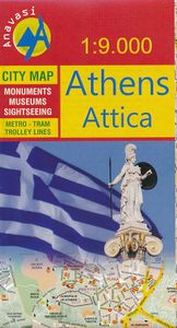
Stadsplattegrond Athene | Anavasi

Handzame kleine plattegrond van Athene, op de achterkant een overizcht van de omgeving van de stad en een korte beschrijving van de belangrijkste bezienswaardigheden. Locations of the city’s 102 important archaeological sites, museums, and other important buildings, plus on the reverse a road map of the environs including the port at Piraeus and th...
5,75

Webshops met dit product

Webshop
Bezorging
Prijs

Anderen bekeken ook

Wegenkaart - landkaart - Stadsplattegrond San Diego - California south | ITMB
Wegenkaart en stadsplattegrond in een kaart: aan de ene zijde San Diego stadsplattegrond en op de andere kant een kaart van het zuiden van Californië. San Diego on a clear, well presented street plan from ITMB, with a transit system diagram, a road map of the city and its environs, and a street plan of central Tijuana, plus on the reverse a road map of the US/Mexico border region extending east beyond El Paso and within USA north to Las Vegas.   On one side is an indexed street plan of San Diego, covering the city’s central districts (as indicated in our coverage image), including the downtown area, the Old Town for which an enlargement is provided, Balboa Park, University Heights, the Mission Bay Park with the SeaWorld, and the city’s international airport. The plan clearly shows the MTS and other public transit stations, highlights main traffic arteries and indicates one way streets. Also marked are recommended cycle routes. Streets are annotated with selected block numbers for easie…
13,95
Stadsplattegrond Firenze - Florence | Borch
Borch Florence is een duidelijke, geplastificeerde plattegrond van het centrum met informatie over openbaar vervoer en bezienswaardigheden. Inclusief straatnamenregister.   Our soft-laminated folded map of Florence shows: Florence Centre 1:7 000, Fiésole 1:12 000, Pisa 1:7 000, Florence & Environs 1:80 000, Florence & Region 1: 450 000 Cathedral of Santa Maria del Fiore 1: 1 900, Italy administrative, Top 24 Sights of Florence and 12 of Pisa. Borch maps are easy to fold, durable and water-repellent with a wipeable surface. Borch Maps show hotels, museums, monuments, markets, top sights and points of interest, useful statistics, conversion charts for temperatures, weights and measurements, climate charts showing temperatures, sunshine hours, precipitation and humidity, overview maps, time zones, and much more...   Florence is famous for its unparalleled art and architecture and is known as the birthplace of the Italian Renaissance. It is the capital city of the region of Tuscany, is sit…
10,25
Stadsplattegrond Bangkok en omgeving | Nelles Verlag
Goede stadskaart van Bangkok en omgeving. Aan beide kanten bedrukt. Met veel toeristische aanduidingen als culturele bezienswaardigheden en aanduidingen van bijvoorbeeld de grotere hotels. Prima leesbare kaart. Bangkok on a double-sided map from Nelles combining an indexed street plan of the city’s central districts at 1:15,000 with a more general plan of the capital with its outer suburbs presented at 1:75,000. Both plans highlight numerous places of interest.   On one side the main, indexed plan covers the city’s inner districts showing public transport routes: metro and skytrain lines with stations, bus routes with line numbers, and express boat service along the river. Public buildings, including selected hotels, are clearly marked and named, and shopping centres or market streets are indicated. The main centre of tourist accommodation, Banglamphoo - Khao San Road area, is also shown in greater detail on a small enlargement.   On the reverse a more general plan at 1:75,000 covers t…
11,95
Fietskaart Cycling guides Dartmoor - South Devon | Goldeneye
Dartmoor. One of England’s greater National Parks; the Forest of Dartmoor covers 365 square miles and contains the highest ground in England south of the Peak District. On its desolate moorland tracks the wanderer can believe they are further from a public road than anywhere in the country, but on the fringes lush valleys lead down on every side to thick woodland, green vegetation and picturesque villages. Dartmoor is well known for its wildlife - attractive herds of ponies, seemingly wild but in fact individually owned, foxes, badgers and otters - also the occasional adder. Fallow, roe and Sitka deer can often be seen, but the red deer of Exmoor have never penetrated the area. Buzzards, kestrels and various Birds of Prey are frequently seen, as well as the wheatear, while crows, ravens and the skylark are fairly commonplace. The Moor abounds in prehistoric remains. There are also many deserted medieval villages with remains of the traditional ‘longhouse’ buildings. For centuries tin m…
12,95
Stadsplattegrond Athene | Borch
Borch Athene is een duidelijke, geplastificeerde plattegrond van het centrum met informatie over openbaar vervoer en bezienswaardigheden. Inclusief straatnamenregister.   Our soft-laminated folded map of Athens shows: Athens 1: 7500, Athens & Region 1:100 000, Attica 1: 750 000, Acropolis 1:2 400, Epidavros 1:7 000, Mycenae 1:3 500, Public Transport Athens, Greece administrative & time zones, Top 30 Sights. Borch Maps are easy to fold, durable and water-repellent with a wipeable surface. Borch Maps show hotels, museums, monuments, markets, public transport, top sights and points of interest, useful statistics, conversion charts for temperatures, weights and measurements, climate charts showing temperatures, sunshine hours and precipitation, overview maps, time zones, and much more...   Named after the Greek goddess Athena, Athens is so much more than just another interesting European capital. In addition to countless epic landmarks, temples, monuments and gardens, this place also happe…
10,25
Stadsplattegrond Boston | Borch
Borch Boston is een duidelijke, geplastificeerde plattegrond van het centrum met informatie over openbaar vervoer en bezienswaardigheden. Inclusief straatnamenregister.   Our soft-laminated folded map of Boston shows: Boston Downtown 1:11 000, Eastern Massachusetts 1:600 000, Boston and Region 1:200 000, Logan International Airport 1:33 000, Public Transport Boston, Top 30 Sights and USA administrative and time zones. Borch maps are easy to fold, durable and water-repellent with a wipeable surface. Borch Maps show hotels, museums, monuments, markets, top sights and points of interest, useful statistics, conversion charts for temperatures, weights and measurements, climate charts showing temperatures, sunshine hours, precipitation and humidity, overview maps, time zones, and much more...   Founded in 1630, Boston is often referred to as the cradle of American democracy, due to major events having taken place here during the American Revolution. Boston is an important port and manufactur…
10,25
Stadsplattegrond Hamburg | Borch
Borch Hamburg is een duidelijke, geplastificeerde plattegrond van het centrum met informatie over openbaar vervoer en bezienswaardigheden. Inclusief straatnamenregister.   Our soft-laminated folded map of Hamburg shows: Hamburg 1:22 000, Hamburg Centre 1:10 500, Blankenese 1:22 000, Hamburg Airport 1:22 000, Hamburg Harbour 1:25 000, Greater Hamburg 1:130 000, public transport, Top 30 sights, Germany administrative & time zone. Borch Maps are easy to fold, durable and water-repellent with a wipeable surface. Borch Maps show hotels, museums, monuments, markets, public transport, top sights and points of interest, useful statistics, conversion charts for temperatures, weights and measurements, climate charts showing temperatures, sunshine hours, precipitation and humidity, overview maps, time zones, and much more...   Located on the southern tip of the Jutland peninsula between continental Europe, Scandinavia, the North and the Baltic Sea, the Hanseatic City of Hamburg is Germany's secon…
10,25
Stadsplattegrond Praag | Freytag & Berndt
Stadsplattegrond van Praag: duidelijk leesbaar, klein register. Stadsplattegrond met register. Helder kaartbeeld waarbij de naamgeving goed leesbaar is weergegeven. Met de toeristische bezienswaardigheden in symbolen weergeven. Veelal ook met een openbaar vervoer of metro kaart als inzet. Large indexed street plan of Prague including its outer suburbs, with a clear enlargement of the central tourist districts of the city, the Old Town and Mala Strana.    The main plan extends west, south and east to show access to the city’s inner districts from the E48/E50/E55 motorway ring and includes the international airport. Tram and bus lines are shown with numbers and stops. Metro stations are marked and suburban railway lines are shown with names of local stations. Map legend includes English.  
13,95
Stadsplattegrond Kopenhagen - Copenhagen | Borch
Borch Kopenhagen is een duidelijke, geplastificeerde plattegrond van het centrum met informatie over openbaar vervoer en bezienswaardigheden. Inclusief straatnamenregister.   Our soft-laminated folded map of Copenhagen shows: Copenhagen 1:11 000, Copenhagen & Region 1:115 000, Kastrup Airport 1: 30 000, Zealand 1:700 000, Public Transport Copenhagen, Denmark administrative and Top 30 sights. Borch Maps are easy to fold, durable and water-repellent with a wipeable surface. Borch Maps show hotels, museums, monuments, markets, public transport, top sights and points of interest, useful statistics, conversion charts for temperatures, weights and measurements, climate charts showing temperatures, sunshine hours and precipitation, overview maps, time zones, and much more...   Copenhagen is the capital city of Denmark, as well as its seat of government and monarchy. This well- organised, tolerant, friendly and welcoming city, with its merchant seafaring history dating back to 1000 AD, is …
10,25
Reisgids Rome en omgeving - Rome and Environs | University of California
Dit is het standaard werk over de kunst en archeoogie van Rome en Lazio, nu beschikbaar in het Engels. This superb guide brings the work of Filippo Coarelli, one of the most widely published and well-known scholars of Roman topography, archeology and art, to a broad English-language audience. Conveniently organized by walking tours and illustrated throughout with clear maps, drawings, and plans, Rome and Environs: An Archaeological Guide covers all of the major, and an unparalleled number of minor, ancient sites in the city, and, unlike most other guides of Rome, includes major and many minor sites within easy reach of the city, such as Ostia Antica, Palestrina, Tivoli, and the many areas of interest along the ancient Roman roads. An essential resource for tourists interested in a deeper understanding of Rome's classical remains, it is also the ideal book for students and scholars approaching the ancient history of one of the world's most fascinating cities. Covers all the major sites …
41,50

Klanten-reviews van Stadsplattegrond Athene | Anavasi

Er zijn nog geen beoordelingen voor dit productBen jij de eerste die een review plaatst?

Meer over Stadsplattegrond Athene | Anavasi

Productomschrijving

Handzame kleine plattegrond van Athene, op de achterkant een overizcht van de omgeving van de stad en een korte beschrijving van de belangrijkste bezienswaardigheden. Locations of the city’s 102 important archaeological sites, museums, and other important buildings, plus on the reverse a road map of the environs including the port at Piraeus and the international airport.   Coverage extends from south of the Acropolis and the Mousson Hill to beyond the central railway station and the National Archaeological Museum, and east well beyond the Lycabettus Hill. 102 locations – archaeological remains, museums, theatres, churches – are highlighted and listed with their addresses and contact details. The plan shows metro stations, and tram routes with line numbers.    On the reverse is a map of the city’s environs showing the road network with the metro and railway lines. Coverage includes the port Piraeus, the city’s international airport and Marathon. English language notes about important places of interest are illustrated with colour photos.
Webshop.nl maakt gebruik van cookies. Ga je verder op onze website, ga dan akkoord met het plaatsen van cookies en de verwerking van deze data door ons en vermelde partners.