webshop.nl
Categorieën
  Sluiten

Wegenkaart - landkaart - Stadsplattegrond San Diego - California south | ITMB

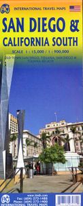
Wegenkaart en stadsplattegrond in een kaart: aan de ene zijde San Diego stadsplattegrond en op de andere kant een kaart van het zuiden van Californië. San Diego on a clear, well presented street plan from ITMB, with a transit system diagram, a road map of the city and its environs, and a street plan of central Tijuana, plus on the reverse a road ma...
13,95

Webshops met dit product

Webshop
Bezorging
Prijs

Anderen bekeken ook

Stadsplattegrond Hanoi & North Vietnam - Noord Vietnam | ITMB
Overzichtelijke stadsplattegrond met register, schaal 1:15700 en een kaart van  Noord Vietnam op schaal 1:920.000. Double-sided map with north Vietnam on one side and a street plan of Hanoi on the reverse. The road map at 1:920,000 shows the area’s road and rail networks and local airports. National parks, nature reserves, beaches and numerous places of interest are highlighted. Provincial boundaries are marked and names of administrative regions prominently shown. Topography is indicated by altitude colouring. Latitude and longitude lines are drawn at 30’ intervals. On the reverse is a street plan of Hanoi at 1:15,700 annotated with numerous places of interest, accommodation, and various facilities. An enlargement shows the Old Town at 1:10,000, and a further inset covers the city’s suburbs area at 1:920,000. Both the road map and the street plan are indexed. All place names are shown in the Roman alphabet but with scrupulous transliteration, since the map was prepared by a company wi…
13,95
Stadsplattegrond München | Freytag & Berndt
Stadsplattegrond met register. Helder kaartbeeld waarbij de naamgeving goed leesbaar is weergegeven. Met de toeristische bezienswaardigheden in symbolen weergeven: monumenten, musea, stadions e.a. Daarnaast handige zaken als postkantoren, parkeergarages en stations. Veelal ook met een openbaar vervoer of metro kaart als inzet   Large street plan of Munich within its administrative boundaries, with an enlargement of the city centre, a plan of its airport, a diagram of the U and S-Bahn networks and a map of the outer suburbs all conveniently placed in a separate booklet.    The main plan covers Munich at 1:22,500, showing the city’s public transport network: tram and bus routes with stops and line numbers, plus U- and S-Bahn stations. Campsites and youth hostels are marked, as well as the usual range of facilities shown on street plans; public buildings, religious establishments, police, etc.   Map legend which includes English is in a separate booklet attached to the map cover. The book…
13,95
Wegenkaart - landkaart San Francisco - Northern California (Californië) | ITMB
San Francisco met schaal 1: 12.500   San Fran is one of my favourite cities; almost as nice as Vancouver. Names such as Chinatown, Nob Hill, the Tenderloin, and Cow Hollow evoke memories of a city that has long moved past its early reputation as a port feeding the goldfields around Sutter's Run, but it is still a clean and sophisticated city to visit. I personally like the old restored trolleys trundling down Market Street, and the restaurants in the Sunset district. This edition adds great value to our map in two ways: first, we have added an extremely detailed and attractive map of all of northern California to the reverse, to help visitors enjoy the Napa Valley, Sacramento, and the Redwood Sequoia trees, and secondly, the map has been printed on plastic paper for durability and attractiveness.   Legend Includes:   Roads by classification, Provincial Boundaries,State Highways, Main Roads, Secondary and other Roads, Capital, Cities, Nature sights, Airports, Point of Interests, Museums…
13,95
Wegenkaart - landkaart - Stadsplattegrond Estonia, Estland en Tallinn | ITMB
Goede wegenkaart van Estland met bezienswaardigheden, kilometers etc. daarop aangegeven. The map displays Estonia on one side and Tallin on the other, each showing a separate index. Road networks distinguish motorways, major and minor roads with intermediate distances on connecting roads. Railways and ferry routes are also shown, while symbols clearly indicate parking and international and domestic airports.   Topography is represented by altitude colouring and graphics locate rivers, lakes, national parks and reserves, Unesco World Heritage sites, scenic spots, hotsprings etc. Symbols mark locations of various places of interest including hotels, campsites, historic ruins, castles, beaches, ports etc. International and administrative boundaries are marked. Latitude and longitude lines are drawn at intervals of 20’.   The street plan of Tallin is a clearly laid out and extends from the Gulf of Tallin to Tallin international airport and the intercity bus station in the south, the Centra…
13,95
Wegenkaart - landkaart Yemen - Jemen | Gizi Map
Yemen, including the Gulf of Aden, at 1:1,250,000 on an excellent and informative map from Gizi Maps, with a street plan of central Sana’a and enlargements of the environs of the capital and Aden, plus the Aden Peninsula.   The map has the publisher’s characteristic bold altitude colouring and plenty of names of various mountain chains, peaks, deserts, etc. Graphics indicate swamps, salt flats, wadis, deserts, lava flows, water wells, oasis, etc, to provide a vivid picture of the country’s topography. Names of the larger towns, provinces and many geographical features are given in both Latin and Arabic alphabets; all other place names are shown only transliterated.   Coverage extends southward to the northern coastline of the Horn of Africa, including the whole of Djibouti and most of Eritrea. Within the Gulf of Aden the Internationally Recommended Transit Corridor (IRTC) is marked, as well as other ferry and shipping routes including those leading to the Socotra Archipelago and in the…
15,95
Stadsplattegrond Praag | Freytag & Berndt
Stadsplattegrond van Praag: duidelijk leesbaar, klein register. Stadsplattegrond met register. Helder kaartbeeld waarbij de naamgeving goed leesbaar is weergegeven. Met de toeristische bezienswaardigheden in symbolen weergeven. Veelal ook met een openbaar vervoer of metro kaart als inzet. Large indexed street plan of Prague including its outer suburbs, with a clear enlargement of the central tourist districts of the city, the Old Town and Mala Strana.    The main plan extends west, south and east to show access to the city’s inner districts from the E48/E50/E55 motorway ring and includes the international airport. Tram and bus lines are shown with numbers and stops. Metro stations are marked and suburban railway lines are shown with names of local stations. Map legend includes English.  
13,95
Stadsplattegrond - Wegenkaart - landkaart Quito & Ecuador Central | ITMB
Een degelijke wegenkaart van Ecuador met aanduidingen van o.a. nationale parken, vliegveld, benzinepomp, dirt-roads en kleine plattegrond van hoofdstad. Als overzichtskaart goed te gebruiken. Finally, ITMB releases its long-awaited re-worked map of the wonderful South America city of Quito. The city is squeezed in between mountain ranges and, the entire city stretches from north (on the right-hand side of the map) to the south. The "bottom" of the map is, actually the eastern portion. A regional inset map clarifies the situation. The street network is clearly shown, along with the rapid line bus way and the city's Metro. The Old Town is perhaps the most interesting portion of the city for visitors and is on the left-hand portion of the map. The newer downtown is centered on La Carolina Park on the right-hand side of the map. This is where most of the shopping malls and hotels are located. The old airport is shown in part on the far right, but the new international airport is located fa…
13,95
Wegenkaart - landkaart 174 California - Californie - Nevada | Michelin
Bijzonder goed leesbare kaart van een deel van de Verenigde Staten - USA, in dit geval het gebied van de staten Californie en Nevada.   Op deze kaart zijn de Nationale Parken goed zichtbaar ingetekend met een heldere achtergrondkleur. Wegnummers, register, afstanden tussen steden en bijvoorbeeld de beroemde groene wegenaanduiding van Michelin ontbreken niet.    Met stadsplattegronden (alleen het centrum)  van Las Vegas, Los Angeles, Phoenix, Salt Lake City, San Diego en San Francisco   Michelin USA California, Nevada Map 174 (scale: 1:1,267,000)—part of Michelin's brand-new US regional map series with bright green covers—zooms in close for comprehensive coverage of California and Nevada, as well as western Utah and Arizona. It contains city maps for easy driving in Las Vegas, Los Angeles, Phoenix, Salt Lake City, San Diego and San Francisco. Michelin star-rated sights and a selection of not-to-be-missed annual events and festivals serve as inspiration for future road trips. Outdoor ent…
9,95
Wegenkaart - landkaart 751 Thailand | Michelin
De Michelin kaart van Thailand is een overzichtelijke landkaart waarop de toeristische sites staan aangeduid. De kaart heeft een plaatsnamenregister en een stadsplattegrond van Bangkok. De plaatsnamen staan op de kaart en in de index in het Nederlands en in het Thais. Thailand at 1:370,000 on an indexed road map from Michelin with street plans of central Bangkok and an enlargement for the capital’s environs. All place names on the map are shown in both Thai and Latin alphabet and the index is in both scripts. Road network emphasizes main routes but also clearly presents local roads, all with road numbers easy to read. Driving distances are shown on primary routes and main connecting roads; steep gradients, viewpoints, toll barriers and border crossings are marked; scenic routes are highlighted. Railway lines are included and domestic airports are marked. Symbols indicate various places of interest.  Topography is shown by relief shading with colouring for forested areas. National parks…
12,95
Wegenkaart - landkaart India: Ladakh - Zanskar | Nelles Verlag
Ladakh and Zanskar at 1:350,000 from Nelles including a street plan of Leh, supplementing the publisher’s coverage of the whole of India on five double-sided maps with their slightly smaller size offering a convenient format for use when travelling.    The map shows the region’s mountainous topography by contours at 200m intervals with very effective relief shading, plus spot heights and mountain passes. In addition to roads and local cart tracks, trekking trails are marked. Symbols indicate various places of interest including campsites, temples, hot springs and waterfalls, etc. Coverage extends from Kulu in the south to the Baltoro Range and the Nubra Valley in the north, with an inset extending the map westwards to include Srinagar, Jammu and Pathankot.    The street plan of Leh shows location of numerous hotels and includes an enlargement for the old town. NEW to Nelles Maps range. 1 : 350,000 scale. Detailed, relief shading clearly shows spot heights and mountain ranges giving a r…
11,95

Klanten-reviews van Wegenkaart - landkaart - Stadsplattegrond San Diego - California south | ITMB

Er zijn nog geen beoordelingen voor dit productBen jij de eerste die een review plaatst?

Meer over Wegenkaart - landkaart - Stadsplattegrond San Diego - California south | ITMB

Productomschrijving

Wegenkaart en stadsplattegrond in een kaart: aan de ene zijde San Diego stadsplattegrond en op de andere kant een kaart van het zuiden van Californië. San Diego on a clear, well presented street plan from ITMB, with a transit system diagram, a road map of the city and its environs, and a street plan of central Tijuana, plus on the reverse a road map of the US/Mexico border region extending east beyond El Paso and within USA north to Las Vegas.   On one side is an indexed street plan of San Diego, covering the city’s central districts (as indicated in our coverage image), including the downtown area, the Old Town for which an enlargement is provided, Balboa Park, University Heights, the Mission Bay Park with the SeaWorld, and the city’s international airport. The plan clearly shows the MTS and other public transit stations, highlights main traffic arteries and indicates one way streets. Also marked are recommended cycle routes. Streets are annotated with selected block numbers for easier identification of addresses. Symbols highlight various places of interest, including numerous hotels. An enlargement presents San Diego’s Old Town in greater detail. Other insets show the town centre of Tijuana, plus a road map of the environs of San Diego and Tijuana, indicating which areas are covered by the street plans.    
Webshop.nl maakt gebruik van cookies. Ga je verder op onze website, ga dan akkoord met het plaatsen van cookies en de verwerking van deze data door ons en vermelde partners.