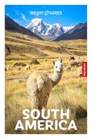
Reisgids South America - Zuid Amerika | Insight Guides

0
Dé gids als het gaat om achtergrondinformatie en prachtige foto’s. Door het formaat en gewicht wellicht niet zo handig in de rugzak, maar wel om thuis voor en na de reis uitgebreid te lezen. Kwalitatief van een hoog niveau! Het hele continent wordt prachtig beschreven. Engelstalig. Insight Guide South America is the most illustrated, full-colour t...

Verkopers met dit product

Verkoper
Bezorging
Prijs
DeZwerver.nl logo
DeZwerver.nl
2,95
26,50

Anderen bekeken ook

Reisgids South America - Zuid Amerika | Insight Guides
Dé gids als het gaat om achtergrondinformatie en prachtige foto’s. Door het formaat en gewicht wellicht niet zo handig in de rugzak, maar wel om thuis voor en na de reis uitgebreid te lezen. Kwalitatief van een hoog niveau! Het hele continent wordt prachtig beschreven. Engelstalig. Insight Guide South America is the most illustrated, full-colour travel guide to the continent on the market, and its lively narrative and stunning images provide both inspiration and information to plan a memorable trip to South America. The Best Of section highlights the unmissable sights and experiences: from Peru's breathtaking citadel of Machu Picchu and the Inca Trail - the number one South American trek on most travellers' wishlists - to vibrant Rio with its famous Carnival and beaches, sophisticated Buenos Aires, and the jungles of the Amazon, home to the greatest biodiversity on the planet. As well as the blockbuster sights, we cover the continent's lesser known but equally fascinating countries su…
26,50
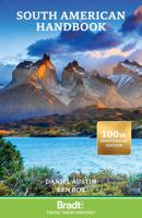
Reisgids South American Handbook - Zuid Amerika | Bradt Travel Guides
De ultieme reisbijbel voor het Zuid-Amerikaanse continent. Alweer de 95 editie vol met praktische informatie, web en emailadressen, maar ook vol met culturele achtergronden van de verschillende landen. De meest complete gids, nog completer dan de Planet! Ideaal voor diegenen die langer op het continent verblijven of voor de reizigers die meerdere landen combineren. Super dikke pil met een stevige harde kaft! South America is a land of superlatives. Home to the world's longest mountain range, tallest waterfall, largest rainforest, driest desert, widest river and highest lake, it astounds with its variety. Now published by Bradt Guides, the award-winning, legendary South America Handbook holds a world record of its own as the longest-running English-language travel guidebook. This brand new, fully updated 95th edition celebrates the centenary of the Handbook, which remains as essential for travellers to South America today as it was in the 1920s.   Embark on extraordinary journeys thr…
39,95
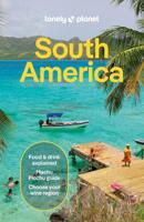
Reisgids South America - Zuid Amerika | Lonely Planet
De bijbel voor Backpackers! Beschrijft alle landen van Zuid Amerika....De perfecte reisgids voor zowel de georganiseerde als de zelfstandige reiziger. Naast een algemene inleiding van het land / streek vol met praktische informatie over hoe je er het beste kunt reizen: slapen, eten, vervoer, excursies ... alles kun je er in vinden. Lonely Planet Lonely Planet’s South America is your passport to the most relevant, up-to-date advice on what to see and skip, and what hidden discoveries await you. Walk Patagonian glaciers, dance the night away in Rio de Janeiro and explore Incan ruins; all with your trusted travel companion. Get to the heart of South America and begin your journey now!   Inside Lonely Planet’s South America Travel Guide:   Up-to-date information - all businesses were rechecked before publication to ensure they are still open after 2020’s COVID-19 outbreak   NEW top experiences feature - a visually inspiring collection of [destination’s] best experiences and where…
24,95
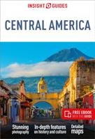
Reisgids Central America | Insight Guides
Een rijk geillustreerde reisgids met diepgaande teksten: één van de beste reisgidsen die er bestaan. Eerste deel bestaat uit een beschrijving van de unieke aspecten van de regio, daarna een deel echte reisgids en als afsluiting een deel met praktische informatie. De uitstekende informatie wordt vergezeld van prachtige foto's en heldere kaarten. Niet alleen om mee te nemen, maar ook om vooraf en zelfs achteraf weer in de stemming te komen. This Central America guidebook is ideal for travellers seeking inspirational guides and planning a more extended trip. It provides interesting facts about Central America's people, history and culture and detailed coverage of the best places to see. This Central America travel book has the style of an illustrated magazine to inspire you and give a taste of Central America. The book is printed on paper from responsible sources, and verified to meet FSC's strict environmental and social standards.   This Central America guidebook covers: Southern Me…
26,50
Wegenkaart - landkaart South America - Zuid Amerika | ITMB
Een degelijke kaart met aanduidingen van o.a. nationale parken, vliegveld, benzinepomp, dirt-roads en kleine plattegrond van hoofdstad. Als overzichtskaart goed te gebruiken. ITMB is very pleased to release a new, digitally-prepared, double-sided map of South America. It covers the entire continent in great detail and has been able to capture the information on the 'old' map, while using the expanded scale of the new map to add and enhance countless details that were crammed on to the earlier editions or for which there was inadequate room to include. This is the most detailed continental map of this part of the world ever published. Legend Includes: Railways, ferry routes, roads by classification, international and domestic airports, rivers, lakes, points of interest, archaeological sites, beaches, lighthouses, mines, glaciers, volcanoes, national parks and other information.  
13,95
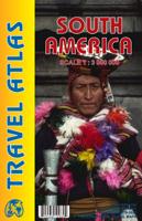
Wegenatlas Travel Atlas South America - Zuid Amerika | ITMB
De eerste gedegen wegenatlas van Zuid Amerika: handig boekje met slappe kaft op A5 formaat. This is unique! ALL of the continent of South America is now available in an easy-to-read, easy-to-use, easy-to-store road atlas at a superb scale. In addition to showing each country systematically, logically, and in great detail, physical features, points of interest, beaches, reefs, parks and reserves, major airports, and roads are shown. The atlas is 5 1/2" wide by 8 1/2" high (15cmx22cm), the same size as our Mexico Road Atlas. This atlas is 112 pages in length, is fully indexed, and has a hard card cover, and a spine. The advantage of this book format is that visitors to more than one country can save money and gain ease of use through a conveniently-sized and attractively presented book format. There is nothing equivalent to this in the world!
16,50
Wandkaart Zuid Amerika - South America political, 100 x 120 cm | Maps International
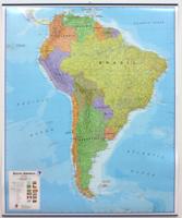
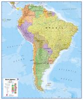
Fraaie politieke kaart van het continent, waarbij vooral de politieke aspecten heel duidelijk te lezen zijn. Alle landen hebben verschillende kleuren, steden en belangrijke verbindingen zijn goed te vinden. Geplastificeerde uitvoering met blauw metalen strips boven en onder de kaart waardoor deze eenvoudig is op te hangen. Maps International's South America political wall map shows all countries in South America from Venezuela and the Grenadine Islands down to Argentina and the most Southerly points of Chile and the Falkland Islands.    This political wall map of South America features countries marked in different colours, with international borders clearly shown. The map's key shows the flags from the countries displayed in this map. This South American political wall map also contains city population detail, capital cities and all the major towns and cities in this continent of South America.    Maps International's North America map is available either plain or laminated. Major mo…
49,95
Wandkaart - Prikbord Zuid Amerika - South America political, 120 x 100 cm | Maps International
Fraaie politieke kaart van het continent, waarbij vooral de politieke aspecten heel duidelijk te lezen zijn. Alle landen hebben verschillende kleuren, steden en belangrijke verbindingen zijn goed te vinden.   Maps International's South America political wall map shows all countries in South America from Venezuela and the Grenadine Islands down to Argentina and the most Southerly points of Chile and the Falkland Islands.    This political wall map of South America features countries marked in different colours, with international borders clearly shown. The map's key shows the flags from the countries displayed in this map. This South American political wall map also contains city population detail, capital cities and all the major towns and cities in this continent of South America.    Maps International's North America map is available either plain or laminated. Major motorways and transport lines are shown making it an ideal map for your planning and logistics needs in this South Ame…
185,-
Wandkaart - Magneetbord Zuid Amerika - South America political, 120 x 100 cm | Maps International
Fraaie politieke kaart van het continent, waarbij vooral de politieke aspecten heel duidelijk te lezen zijn. Alle landen hebben verschillende kleuren, steden en belangrijke verbindingen zijn goed te vinden.   De kaart wordt in deze versie gelijmd op een plaat, voorzien van een mooie aluminium lijst en een ophangsysteem wordt meegeleverd. Daarnaast krijgt u een bakje bijgeleverd dat u er aan kunt bevestigen voor pennen, stiften of magneetjes.   Maps International's South America political wall map shows all countries in South America from Venezuela and the Grenadine Islands down to Argentina and the most Southerly points of Chile and the Falkland Islands.    This political wall map of South America features countries marked in different colours, with international borders clearly shown. The map's key shows the flags from the countries displayed in this map. This South American political wall map also contains city population detail, capital cities and all the major towns and cities in …
269,-
Wegenkaart - landkaart Planning Map South America - Zuid-Amerika | Lonely Planet
Durable and waterproof, with a handy slipcase and an easy-fold format, Lonely Planet's South America Planning Map helps you explore with ease. Get more from your map and your trip with images and information about top attractions, itinerary suggestions and themed lists. With this easy-to-use, full-color map in your back pocket, you can truly get to the heart of South America - so begin your journey now! Easy-fold format Handy slipcase Full color and easy to use Beautiful imagery Tailored itineraries Can't-miss highlights Detailed town index Themed lists Covers: Argentina, Bolivia, Brazil, Chile, Colombia, Ecuador, French Guiana, Guyana, Paraguay, Peru, Suriname, Uruguay, Venezuela  
10,95

Klanten-reviews van Reisgids South America - Zuid Amerika | Insight Guides

Er zijn nog geen beoordelingen voor dit productBen jij de eerste die een review plaatst?

Meer over Reisgids South America - Zuid Amerika | Insight Guides

Productomschrijving

Dé gids als het gaat om achtergrondinformatie en prachtige foto’s. Door het formaat en gewicht wellicht niet zo handig in de rugzak, maar wel om thuis voor en na de reis uitgebreid te lezen. Kwalitatief van een hoog niveau! Het hele continent wordt prachtig beschreven. Engelstalig.

Insight Guide South America is the most illustrated, full-colour travel guide to the continent on the market, and its lively narrative and stunning images provide both inspiration and information to plan a memorable trip to South America. The Best Of section highlights the unmissable sights and experiences: from Peru's breathtaking citadel of Machu Picchu and the Inca Trail - the number one South American trek on most travellers' wishlists - to vibrant Rio with its famous Carnival and beaches, sophisticated Buenos Aires, and the jungles of the Amazon, home to the greatest biodiversity on the planet. As well as the blockbuster sights, we cover the continent's lesser known but equally fascinating countries such as Paraguay, Bolivia and Guyana.    Lively features focus on South America's history and culture, while the Places chapters show you where to go in South America, with beautiful photography, insightful descriptions of all the main attractions, and detailed, full-colour maps for easy orientation. The Travel Tips section provides practical information for planning a trip and getting around once you're there, along with our independent reviews of selected hotels and restaurants in South America.

Productinformatie

    Verken gerelateerde categorieën

    Webshop.nl maakt gebruik van cookies. Ga je verder op onze website, ga dan akkoord met het plaatsen van cookies en de verwerking van deze data door ons en vermelde partners.