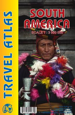

Wegenatlas Travel Atlas South America - Zuid Amerika | ITMB

0
De eerste gedegen wegenatlas van Zuid Amerika: handig boekje met slappe kaft op A5 formaat. This is unique! ALL of the continent of South America is now available in an easy-to-read, easy-to-use, easy-to-store road atlas at a superb scale. In addition to showing each country systematically, logically, and in great detail, physical features, points...

Alle aanbiedingen van dit product

Verkoper
Bezorging
Prijs
DeZwerver.nl logo
DeZwerver.nl
2,95
16,95

Anderen bekeken ook

Wegenatlas Travel Atlas South America - Zuid Amerika | ITMB
De eerste gedegen wegenatlas van Zuid Amerika: handig boekje met slappe kaft op A5 formaat. This is unique! ALL of the continent of South America is now available in an easy-to-read, easy-to-use, easy-to-store road atlas at a superb scale. In addition to showing each country systematically, logically, and in great detail, physical features, points of interest, beaches, reefs, parks and reserves, major airports, and roads are shown. The atlas is 5 1/2" wide by 8 1/2" high (15cmx22cm), the same size as our Mexico Road Atlas. This atlas is 112 pages in length, is fully indexed, and has a hard card cover, and a spine. The advantage of this book format is that visitors to more than one country can save money and gain ease of use through a conveniently-sized and attractively presented book format. There is nothing equivalent to this in the world!
16,95
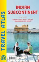
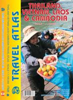
Wegenatlas Travel Atlas Thailand, Vietnam, Laos & Cambodia | ITMB
  Atlas, gebonden, A5 formaat The Indochina Region consists of five countries, including that portion of Burma that sweeps down the western part of the Malay Peninsula. The four other countries form a cohesive entity for travel, especially now that border and visa requirements for travel have been reduced. Thailand itself is definitely the Number One reason for visiting the region. The first portion of the atlas is devoted to Thailand, including detailed page-size maps of Bangkok, Chiang Mai, and Pattaya. Vietnam is the next most-popular destination and is shown in great detail, with inset maps of Hanoi, Hoi An, Hue, Da Nang, Da Lat, Can Tho, and the central Saigon portion of Ho Chi Minh City. Laos and Cambodia are shown with the same degree of attention to detail, including insets of Vientiane, Phnom Penh, and two maps concentrating on Angkor Wat. This is a compact and convenient way for visitors to the region to have everything they need in one format - easy to catty, easy to use Le…
16,95
Wegenkaart - landkaart South America - Zuid Amerika | ITMB
Een degelijke kaart met aanduidingen van o.a. nationale parken, vliegveld, benzinepomp, dirt-roads en kleine plattegrond van hoofdstad. Als overzichtskaart goed te gebruiken. ITMB is very pleased to release a new, digitally-prepared, double-sided map of South America. It covers the entire continent in great detail and has been able to capture the information on the 'old' map, while using the expanded scale of the new map to add and enhance countless details that were crammed on to the earlier editions or for which there was inadequate room to include. This is the most detailed continental map of this part of the world ever published. Legend Includes: Railways, ferry routes, roads by classification, international and domestic airports, rivers, lakes, points of interest, archaeological sites, beaches, lighthouses, mines, glaciers, volcanoes, national parks and other information.  
14,95
Reisgids South America - Zuid Amerika | Lonely Planet
De bijbel voor Backpackers! Beschrijft alle landen van Zuid Amerika....De perfecte reisgids voor zowel de georganiseerde als de zelfstandige reiziger. Naast een algemene inleiding van het land / streek vol met praktische informatie over hoe je er het beste kunt reizen: slapen, eten, vervoer, excursies ... alles kun je er in vinden. Lonely Planet Lonely Planet's local travel experts reveal all you need to know to plan the trip of a lifetime in this latest edition of our guide to South America.   Discover South America's most popular experiences and best kept secrets from admiring one of Argentina's greatest natural wonders, the majestic Glaciar Perito Moreno; to taking in Patagonia's dramatic scenery on a road trip along Chile's Carretera Austral; and marvelling at the striking stone ruins of Ingapirca, Ecuador's most important archaeological site.   Build a trip to remember with Lonely Planet's South America travel guide:   Our classic guidebook format contains the most comp…
27,95
Wegenkaart - landkaart South America Southern - Zuid Amerika, deel Zuid | ITMB
1:2,600,000 scale 6th Edition, double-sided printing. This map shows the southern third of South America in better detail than any other map.gIt starts at northern Chile, southern Paraguay, and central Brasil, and moves south to cover all of Argentina and almost all of Chile. Side 1 is a detailed road map of the region as far south as Buenos Aires. Side 2 covers Patagonia, the coast of Chile, and Tierra del Fuego. Map size: 27"X39"
14,95
Wegenatlas Ireland Comprehensive Road Atlas - Ierland | Collins
Duidelijke en gedetailleerde atlas voor Ierland in A4-formaat met ringband.   Clear, detailed road atlas of Ireland in a handy A4 spiral-bound format. This comprehensive, general purpose road atlas of the whole of Ireland is ideal for both business and pleasure use. The atlas contains a range of mapping scales: • 9 miles to 1 inch route planning map • Main maps at 3.2 miles to 1 inch, which are ideal for navigation. • A wide selection of detailed town centre street plans.   This edition boasts road mapping packed with detail showing colour classified road network, toll roads, land heights, the location of safety cameras, Blue Flag and Green Coast beaches, tourist information centres and a wide range of tourist attractions. There is also comprehensive guide information for visitors to Belfast, Cork, Dublin and Limerick. The locations of Speed Enforcement Zones, which highlight roads that have a high risk of accidents as identified by the Garda and the National Roads Authority, are incl…
14,95
Wegenatlas Navigator Scotland | A4-Formaat | Ringband | Philip's Maps
Duidelijke en gedetailleerde atlas van Schotland met enkele stadsplattegronden en register. Zuid Schotland is van schaal 1:100.000 en het noorden met schaal 1:200.000   Philip's Navigator Scotland is part of the Navigator brand, the UK's best-selling road atlases. The Navigator maps provide highly detailed coverage of the Scotland's road network, including minor country lanes and rural tracks. Most of the Central Lowlands and Scottish Borders are shown at the unique Navigator scale of 1.5 miles to 1 inch, Northern Scotland at 3 miles to 1 inch.   Navigator Scotland offers so much more than road maps: hundreds of individually named farms, houses and hamlets, airports, airfields, stations, ferries, canals, marinas, tourist information centres, and a wide range of places of interest. The atlas has a comprehensive index and includes indexed town plans of major regional centres. The front of the atlas contains a 15-page guide to regional leisure facilities and listings of a wide variety…
15,95
Wegenatlas The Kimberley Atlas & Guide | Hema Maps
A4 formaat, spiraal gebonden, verschillende schalen This guide is jam-packed with information on what to do and see in the Kimberley. Travel writer Denis O'Byrne gives information on the Kimberley's amazing 'must see' landmarks as well as expert favourites that often go unseen. Hema's guide helps you make the most of your visit to the remarkable corner of Australia. With detailed coverage of the Gibb River Road, Broome, Kununurra, Purnululu, (The Bungle Bungles) and many other famous destinations, it ensures you won't miss the 'must-see' attractions, but it also describes some of the lesser known areas favoured by the experts.    Features:   New larger A4 format - easy-to-read Town and locatlities GPS index When to go and how to prepare Handy atlas for navigation, plus detailed maps of the Gibb River Road, Great Northern Highway, Broome and Kununurra regions, and national parks Where to go for the best outdoor experiences Where to stay, from luxurious resorts to the best bush camping …
47,95
Wegenatlas Australia Road & 4WD Touring Atlas A4 | Hema Maps
Uitstekende wegenatlas van heel Australië met goed leesbare kaarten, met stadsplattegronden en afstandstabel. A4-formaat in ringband, Engelstalig. Featuring trusted Hema mapping for all of Australia, the Hema Road & 4WD Touring Atlas is the definitive travel guide for tourers and adventurers. Hema atlases feature more information useful to travellers, including 4WD tracks, campsites, caravan parks, rest areas, 24-hour fuel and points of interest.   This edition contains more mapping than ever before, which is enhanced by a striking new cartographic style that's incredibly easy to read. Included in this is up-to-date mapping for Australia's biggest 4WD destinations: Cape York, Fraser Island, the Top End, the Kimberley, the Pilbara, Central Australia, High Country Victoria and the Flinders Ranges.   A handy distance grid, national park guide, list of accredited information centres and a complete index are also included to assist with trip planning and navigation, making it the perf…
39,95
Wegenatlas Australia Road & 4WD Handy Atlas B5 | Hema Maps
Wegenatlas Australie met toeristische informatie, uitgevoerd in handige spiraalbinding. Geweldige kaarten, goed leesbaar (beetje kleine letters wellicht voor sommigen) met veel toegevoegde waarde als het gaat om details als Nationale Parken, campsites, stranden en afstanden. De schaal varieert per bladzijde Featuring trusted Hema mapping for all of Australia, the Hema Road & 4WD Handy Atlas is the definitive travel guide for tourers and adventurers. Hema atlases feature more information useful to travellers, including 4WD tracks, campsites, caravan parks, rest areas, 24-hour fuel and points of interest.   This edition in a handy size contains more mapping than ever before, which is enhanced by a striking new cartographic style that?s incredibly easy to read. Included in this is up-to-date mapping for Australia's biggest 4WD destinations: Cape York, Fraser Island, the Top End, the Kimberley, the Pilbara, Central Australia, High Country Victoria and the Flinders Ranges.   A handy d…
29,95

Klanten-reviews van Wegenatlas Travel Atlas South America - Zuid Amerika | ITMB

Er zijn nog geen beoordelingen voor dit productBen jij de eerste die een review plaatst?

Meer over Wegenatlas Travel Atlas South America - Zuid Amerika | ITMB

Productomschrijving

De eerste gedegen wegenatlas van Zuid Amerika: handig boekje met slappe kaft op A5 formaat.

This is unique! ALL of the continent of South America is now available in an easy-to-read, easy-to-use, easy-to-store road atlas at a superb scale. In addition to showing each country systematically, logically, and in great detail, physical features, points of interest, beaches, reefs, parks and reserves, major airports, and roads are shown. The atlas is 5 1/2" wide by 8 1/2" high (15cmx22cm), the same size as our Mexico Road Atlas. This atlas is 112 pages in length, is fully indexed, and has a hard card cover, and a spine. The advantage of this book format is that visitors to more than one country can save money and gain ease of use through a conveniently-sized and attractively presented book format. There is nothing equivalent to this in the world!

Productinformatie

    Verken gerelateerde categorieën

    Webshop.nl maakt gebruik van cookies. Ga je verder op onze website, ga dan akkoord met het plaatsen van cookies en de verwerking van deze data door ons en vermelde partners.