webshop.nl
Categorieën
  Sluiten

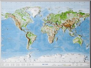
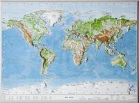
Wereldkaart - Reliëfkaart met voelbaar 3D reliëf 77 x 57 x 1,0 cm | GeoRelief

Prachtige kunststof reliëfkaart met voelbaar reliëf met plaatsnamen, bergnamen en hoogten. Product: a 3D topographical map with colored graphic relief and hill shading and color feature which are derived from high resolution terrain models. Content: World with detailed landscape relief , hydrographic network, city names, mountain names, mountain ra...
77,50

Webshops met dit product

Webshop
Bezorging
Prijs

Anderen bekeken ook

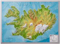
Wandkaart - Reliëfkaart IJsland met voelbaar 3D reliëf 42 x 30 cm | GeoRelief
Prachtig vormgegeven wandkaart van IIsland met reliëf. Uitgevoerd in stevig kunststof is IJsland vanzelfsprekend een land dat zich bij uitstek leent voor een 3D kaart: zo komen de bergmassieven, maar ook de dalen zeer goed tot uiting. De kaart is een mooie herinnering aan een bijzondere trekking of wandeltocht.  Product: a 3D topographical map with colored graphic relief and hill shading and color feature which are derived from high resolution terrain models. Content: Landscape relief, hydrographic network city names, main railway system, motorway network, federal highways, mountain names, elevations, international airports Scale: 1 / 1,4 mio Dikte van de kaart: 14 mm
28,95
Wandkaart - Reliëfkaart Scandinavië met voelbaar 3D reliëf 77 x 55 x 2 cm | GeoRelief
De uitgever van de kaart is de bekende Duitse uitgever GeoRelief GbR. Deze topografische kaart van Scandinavië heeft een hoge kwaliteit met prachtige kleuren  (engelse versie). De kaart bevat de namen van grote steden, spoorwegen, wegennet, de namen van bergketens en internationale luchthavens. Gemaakt van een hoge kwaliteit kunststof. Extreem duurzaam. Met hoogwaardige licht gestructureerde aluminium lijst van 1,5 cm breed. Our relief map of Scandinavia on a scale of 1:2,900,000 and an elevation of the elevations by a factor of 10, presents this yearning destination for nature lovers, anglers, boaters, and outdoor enthusiasts vividly, in detail and a lovingly designed look.
134,95
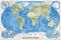
Wereldkaart natuurkundig, oceaanbodem, 116 x 77 cm | National Geographic
Bijzonder fraaie natuurkundige kaart van National Geographic waarbij het accent ligt op de fysische aspecten van de aarde met veel details van de oceanen. Een schoonheid aan de muur!   Our World Physical - Ocean Floor map highlights the Earth's land and undersea forms with exquisite hand-painted relief. Drawn in the Winkel Tripel projection to minimize distortion of the landforms. Two corner inset maps show the Earth's crust and world climatic zones   .Superb representation of the ocean floor makes this physical map of the world one of the most interesting titles in the National Geographic Society’s long list of wall maps. Drawn with great skill to achieve a 3-D effect, ocean floor plains, basins, continental shelves, trenches, ridges and fractures are shown with their names, indicating in many places their depth in metres.   On land masses relief shading shows the mountain chains, whilst the colouring indicates different types of terrain: arid regions, vegetation, tundra, etc. The map…
24,95
Reliëfkaart Duitsland 57 x 77 cm | GeoRelief
De uitgever van de kaart is de bekende Duitse uitgever GeoRelief. Deze topografische kaart van Zwitserland heeft een hoge kwaliteit met prachtige kleuren. De kaart bevat de namen van grote steden, spoorwegen, het wegennet, de namen van bergketens en internationale luchthavens. Gemaakt van een hoge kwaliteit kunststof. Not only those who have ever flown over Germany by plane and enjoyed this indescribable sight will be pleased that thanks to this relief map in scales of 1:1,200,000 or 1:2,400,000 it is now possible to share such unique moments at home or with friends.   Anyone who has ever given away one of our three-dimensional cards will know that this gift will quickly “escalate” into a full-length program item. Suddenly the past holidays are traced with the finger on the map, for example, the train journey with the Harzer Schmalspurbahn on the Brocken in the Harz, the view from the Schauinsland over the foggy sea of the Rhine Graben to the Vosges or the bicycle tour along with the s…
134,95
Reliëfkaart Duitsland 57 x 77 cm | GeoRelief
De uitgever van de kaart is de bekende Duitse uitgever GeoRelief. Deze topografische kaart van Duitsland heeft een hoge kwaliteit met prachtige kleuren. De kaart bevat de namen van grote steden, spoorwegen, het wegennet, de namen van bergketens en internationale luchthavens. Gemaakt van een hoge kwaliteit kunststof.   Not only those who have ever flown over Germany by plane and enjoyed this indescribable sight will be pleased that thanks to this relief map in scales of 1:1,200,000 or 1:2,400,000 it is now possible to share such unique moments at home or with friends.   Anyone who has ever given away one of our three-dimensional cards will know that this gift will quickly “escalate” into a full-length program item. Suddenly the past holidays are traced with the finger on the map, for example, the train journey with the Harzer Schmalspurbahn on the Brocken in the Harz, the view from the Schauinsland over the foggy sea of the Rhine Graben to the Vosges or the bicycle tour along with the s…
77,50
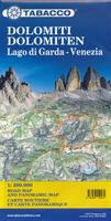
Wegenkaart - landkaart Dolomiti - Dolomieten - Lago di Garda - Venezia | Tabacco Editrice
Dolomites – Lake Garda - Venice region of north-eastern Italy on a road map at 1:200,000 from Tabacco with excellent presentation of the topography derived from the publishers’ highly regarded and popular hiking maps, plus on the reverse a panorama drawing of the mountains. Coverage extends from the Austrian border southwards to the A4 motorway including the whole of Lake Garda, Verona, Padua and Venice, plus east to Lienz/Pordenone.   The map provides a very clear picture of the region’s landscape through graphic relief for its exposed rocky areas, plus relief shading and contours at 100m intervals, and has plenty of names of individual groups, peaks, valleys, etc. Additional colouring indicates woodlands and boundaries of national parks and other protected areas are marked. Minor roads are drawn without generalizing their course, showing the twists and turns across the mountainous terrain. Driving distances are marked on main and many connecting routes. Railway lines are shown with s…
9,95
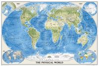
Wereldkaart Natuurkundig, oceaanbodem, 116 x 77 cm | National Geographic
Bijzonder fraaie natuurkundige kaart van National Geographic waarbij het accent ligt op de fysische aspecten van de aarde met veel details van de oceanen. Een schoonheid aan de muur!   Our World Physical - Ocean Floor map highlights the Earth's land and undersea forms with exquisite hand-painted relief. Drawn in the Winkel Tripel projection to minimize distortion of the landforms. Two corner inset maps show the Earth's crust and world climatic zones   .Superb representation of the ocean floor makes this physical map of the world one of the most interesting titles in the National Geographic Society’s long list of wall maps. Drawn with great skill to achieve a 3-D effect, ocean floor plains, basins, continental shelves, trenches, ridges and fractures are shown with their names, indicating in many places their depth in metres.   On land masses relief shading shows the mountain chains, whilst the colouring indicates different types of terrain: arid regions, vegetation, tundra, etc. The map…
36,95
Wereldkaart 09 Natuurkundig - the world physical, 178 x 122 cm | National Geographic
Bijzonder fraaie natuurkundige kaart van National Geographic waarbij het accent ligt op de fysische aspecten van de aarde met veel details van de oceanen. Een schoonheid aan de muur! Deze versie is geplastificeerd.   Our World Physical - Ocean Floor map highlights the Earth's land and undersea forms with exquisite hand-painted relief. Drawn in the Winkel Tripel projection to minimize distortion of the landforms. Two corner inset maps show the Earth's crust and world climatic zones. Scale: 1:24,031,000.  Superb representation of the ocean floor makes this 175.5 x 121.5cm (5ft 9” x 4ft approx.) physical map of the world one of the most interesting titles in the National Geographic Society’s long list of wall maps. Drawn with great skill to achieve a 3-D effect, ocean floor plains, basins, continental shelves, trenches, ridges and fractures are shown with their names, indicating in many places their depth in metres.    On land masses relief shading shows the mountain chains, whilst the co…
74,95

Klanten-reviews van Wereldkaart - Reliëfkaart met voelbaar 3D reliëf 77 x 57 x 1,0 cm | GeoRelief

Er zijn nog geen beoordelingen voor dit productBen jij de eerste die een review plaatst?

Meer over Wereldkaart - Reliëfkaart met voelbaar 3D reliëf 77 x 57 x 1,0 cm | GeoRelief

Productomschrijving

Prachtige kunststof reliëfkaart met voelbaar reliëf met plaatsnamen, bergnamen en hoogten. Product: a 3D topographical map with colored graphic relief and hill shading and color feature which are derived from high resolution terrain models. Content: World with detailed landscape relief , hydrographic network, city names, mountain names, mountain railways, and elevation. Scale: 1 / 53,5 mio
Webshop.nl maakt gebruik van cookies. Ga je verder op onze website, ga dan akkoord met het plaatsen van cookies en de verwerking van deze data door ons en vermelde partners.