webshop.nl
Categorieën
  Sluiten

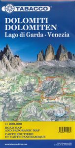
Wegenkaart - landkaart Dolomiti - Dolomieten - Lago di Garda - Venezia | Tabacco Editrice

Dolomites – Lake Garda - Venice region of north-eastern Italy on a road map at 1:200,000 from Tabacco with excellent presentation of the topography derived from the publishers’ highly regarded and popular hiking maps, plus on the reverse a panorama drawing of the mountains. Coverage extends from the Austrian border southwards to the A4 motorway inc...
9,95

Webshops met dit product

Webshop
Bezorging
Prijs

Anderen bekeken ook

Wegenkaart - landkaart Südtirol Alto Adige - Dolomiti - Zuid Tirol - Dolomieten | Tabacco Editrice
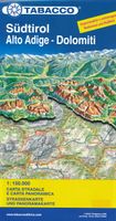
Heel duidelijke wegenkaart van Zuid Tirol. De kaart is goed leesbaar met mooie kleurstellin waardoor goed duidelijk wordt hoe en waar de bergbieden en nationale parken liggen.  The South Tyrol region of north-eastern Italy on a durable, waterproof and tear-resistant road map at 1:150,000 from Tabacco with excellent presentation of the topography derived from the publishers’ highly regarded and popular hiking maps, plus on the reverse a panorama drawing of the mountains. Coverage extends from the Austrian border to just past Trento and Feltre, and west/east from Bormio to well east of Belluno.   The map provides a very clear picture of the region’s landscape through graphic relief for its exposed rocky areas, plus relief shading and contours at 100m intervals, and has plenty of names of individual groups, peaks, valleys, etc. Additional colouring indicates woodlands and boundaries of national parks and other protected areas are marked. Minor roads are drawn without generalizing their co…
12,50
Wandelkaart Banff - Egypt Lake | Gem Trek Maps
Mooie, gedetailleerde kaart uit de serie van Gem Trek Hiking map-guides. Helder kleurgebruik en met de beste / mooiste wandelroutes, hikes en interessante plaatsen erop aangegeven. Gem Trek’s 1:50,000-scale BANFF–EGYPT LAKE MAP covers the most popular hiking trails in the immediate area of the town of Banff in more detail than our Banff & Mount Assiniboine Map.   The Banff–Egypt Lake Map features detailed cartography, accurate hiking trails with distances, and details such as side trips and backcountry campgrounds. For road travellers, it includes viewpoints, picnic areas, and campgrounds.   On the back of the map are trail descriptions of 17 recommended day hikes and four classic multi-day trips, all referenced to the map on the front. Also on the back is a list of trails recommended for early season, birdwatching, wildflowers, waterfalls, expansive views, awe-inspiring scenery, alpine meadows and rainy days. Included are contact numbers for visitor centres and backcountry bookin…
17,95
Wegenkaart - landkaart Cordillera Cantabrica - Asturias y provincias limitrofes | Adrados Ediciones
Gedetailleerde wegenkaart an de Cordillera Cantabrica met hoogtelijnen, hoogte verschillen in kleur en schaduw en UTM coördinaten. Met plaatsnamen index! Cordillera Cantabrica on a detailed road map from the Oviedo based Adrados Ediciones, presenting this mountainous region with contours at 100m intervals, altitude coluring, relief shading and UTM coordinates. Since the publishers specialize in detailed hiking maps, including the best coverage of the Picos de Europa, the map includes an exceptionally large number of names of peaks, passes, etc. Symbols highlight best rock and ice climbing areas, huts and refuges, campsites, mountain rescue posts and information centres. Along the coast numerous beaches are named. Road network includes small country roads and tracks. Local railway lines are shown, although not very easy to see on the base map filled with so much information. The map has a 10km UTM grid. Map legend is in Spanish only. On the reverse is a panorama drawing of the area, loo…
14,95
Wegenkaart - landkaart Icefields Parkway | Gem Trek Maps
Whether you have a day or a week to spend exploring the sights along the spectacular Icefields Parkway highway, Gem Trek's ICEFIELDS PAKRWAY MAP, a combination map and guide, will help you make the most of your time. Like our much-loved hiking maps, our Icefields Parkway map features detailed cartography and is printed on waterproof and tear-resistant paper.   The Icefields Parkway Map shows all viewpoints, picnic areas, trailheads, campgrounds, hostels, lodges and other services along the Icefields Parkway, while the descriptions in the guide point you to the best of these - the best viewpoints of mountains and lakes, the most interesting points of interest and exhibits, and the best bets for spotting wildlife such as moose, bighorn sheep and mountain goats.   Also included are short descriptions of the ten best walks and day hikes along the Icefields Parkway—from the short stroll to Peyto Lake Viewpoint to the rewarding hike through alpine meadows to Helen Lake.   To make it easier t…
13,50
Wandelkaart 04 Lake Louise & Yoho | Gem Trek Maps
Gedetailleerde kaart van dit prachtige gebied; deze kaart is geplastificeerd, scheur- en watervast. Gem Trek’s LAKE LOUISE & YOHO MAP is designed for visitors looking to explore one of North America’s premier day hiking destinations. Whether you are new to hiking or experienced in backcountry travel, you’ll find the waterproof and tear-resistant Lake Louise & Yoho Map to be an invaluable tool.   This map features detailed cartography, accurate hiking trails with distances, and details such as campgrounds, lodges, huts, teahouses, and picnic areas. On the reverse side of  the map are photos and trail descriptions of 11 recommended day hikes covered on the main map, ranging from easy lakeshore walks to more demanding hikes into alpine country. Four overnight or multi-day trips are also featured, along with contact information for two backcountry lodges, Skoki Lodge and Twin Falls Chalet.   Lake Louise & Yoho Map Coverage The Lake Louise & Yoho Map centres on Lake Louise, but also …
17,95
Wegenkaart - landkaart Spitsbergen Svalbard | ITMB
North of Norway exists one of the northernmost communities in the world, an archipelago of islands called Svalbard in Norwegian, and better known as Spitsbergen in English. Until now, it has only been available in map format from the Norwegian Arctic Institute, and then only with difficulty. Side one shows the various islands as an entity. There is only one town of any size in the islands, called Longyearbyen, although there is a more northerly town called Pyramiden and an isolated community on the west coast called Alesund. This is true high Arctic adventure travel; one does not come here unprepared! Most of the islands are uninhabited and largely ice-covered. Edge Island, for example, is a large nature reserve, and Prins Karl Forland is a national park. We have translated land area names into English and placed the Norwegian names in brackets, but have tried leaving the Norwegian names in place wherever possible to assist with local usage. This is one of those ‘off the beaten path’ t…
13,95
Wegenkaart - landkaart Sudan and South Sudan | Gizi Map
Sudan and South Sudan as separate countries on an excellent indexed map at 1:2,500,000 from Gizi Maps with detailed presentation of the topography, administrative divisions, street plans of Khartoum and Juba, etc. Excellent presentation of the terrain in the publisher’s characteristic style provides a vivid picture of the region’s geography: bold altitude colouring with plenty of spot heights and names of peaks, mountain ranges, etc, plus additional graphics for flood plains, swamps, salt flats, deserts, lava fields, wadis and water wells. National parks or other protected areas and interesting natural sites are highlighted. The map indicates the boundary of the disputed Abyei area and shows the internal administrative boundaries and names of the provinces. Within North Sudan names of larger towns and of the provinces are also given in Arabic. Where appropriate, alternative versions of town names are provided (Khartoum/Al Khartum, Omdurman/Umm Durman, etc). The map shows the road ne…
15,95
Wandelkaart 01 Jasper National Park & Maligne Lake | Gem Trek Maps
Scheur- en Watervast papier Gem Trek’s JASPER AND MALIGNE LAKE MAP map is designed for outdoor enthusiasts looking to explore the section of Jasper National Park near the town and out to Maligne Lake. Whether you are touring along the roads or heading into the backcountry, you’ll find the waterproof and tear-resistant Jasper & Maligne Lake Map to be an invaluable tool.   This map features detailed cartography, accurate hiking trails with distances, and details such as campgrounds, equestrian routes, picnic areas, and fire lookouts. On the back of the map are trail descriptions and photos of 18 recommended day hikes, four overnight or multi-day trips, and six classic mountain bike rides. Each of these described trails is referenced and colour-coded to the map on the front. Also on the back is contact information for Jasper National Park, as well for as the three backcountry lodges located in the Tonquin Valley and on the Skyline Trail.   Jasper & Maligne Lake Map Coverage The Jasp…
16,95
Wandelkaart 03 Bow Lake and Saskatchewan Crossing | Gem Trek Maps
This map covers the trails departing from the southern section of the Icefields Parkway from Rampart Creek south to Hector Lake. A 1:100 000-scale inset map on the back of the map increases coverage to the adjoining Mosquito Creek/Fish Lakes area.   The area covered on this map is prime hiking terrain with scenery as superb as the rest of Banff National Park, but with the trails less busy than those in the Banff townsite and Lake Louise areas. Besides spotting marmots in the boulders near Helen Lake, you also have an excellent chance of seeing moose.   On the back of the map are trail descriptions and photos of 16 recommended day hikes, ranging from short and easy to long and strenuous, as well as descriptions of five overnight trips. Classic trails covered include Bow Glacier Falls, Helen Lake, Bow Summit Lookout, Sunset Pass, and Cirque, Chephren and and Glacier Lake trails. All trails are referenced to the front. Contact numbers for parks and info on lodges, campgrounds and hostels …
16,95
Wegenkaart - landkaart Kyrgyzstan - Kirgizië | Gizi Map
Met name door het kleurgebruik een mooie kaart: heel duidelijk wordt het landschap weergegeven. Daarnaast veel topografische details.   Kyrgyzstan at 1:750,000 from Gizi Map with excellent presentation of the country’s mountainous terrain through bold altitude colouring and plenty of names of mountain ranges, etc, road network indicating routes of the old Silk Road, plus a street plan of Bishkek and an administrative map of the country. All place names are in the Latin alphabet.   Topography is vividly shown by bold elevation colouring, with spot heights and graphics for swamps, salt flats and deserts, plus plenty of names of mountain ranges, peaks, valleys, etc. National parks are highlighted. The map shows internal provincial boundaries and also clearly indicates the country’s Uzbek and Tadjik enclaves. Road network includes selected local tracks and highlights routes which used to the part of the old Silk Road. Railway lines are included and local airports are marked. Symbols indica…
15,95

Klanten-reviews van Wegenkaart - landkaart Dolomiti - Dolomieten - Lago di Garda - Venezia | Tabacco Editrice

Er zijn nog geen beoordelingen voor dit productBen jij de eerste die een review plaatst?

Meer over Wegenkaart - landkaart Dolomiti - Dolomieten - Lago di Garda - Venezia | Tabacco Editrice

Productomschrijving

Dolomites – Lake Garda - Venice region of north-eastern Italy on a road map at 1:200,000 from Tabacco with excellent presentation of the topography derived from the publishers’ highly regarded and popular hiking maps, plus on the reverse a panorama drawing of the mountains. Coverage extends from the Austrian border southwards to the A4 motorway including the whole of Lake Garda, Verona, Padua and Venice, plus east to Lienz/Pordenone.   The map provides a very clear picture of the region’s landscape through graphic relief for its exposed rocky areas, plus relief shading and contours at 100m intervals, and has plenty of names of individual groups, peaks, valleys, etc. Additional colouring indicates woodlands and boundaries of national parks and other protected areas are marked. Minor roads are drawn without generalizing their course, showing the twists and turns across the mountainous terrain. Driving distances are marked on main and many connecting routes. Railway lines are shown with stations and mountain transport lines (cable car lines, chair lifts, etc) are included. The map is designed to present the topography of the region rather than its tourist sights, but it does indicate campsites. Latitude and longitude lines are drawn at 10’ and 20’ respectively. Where appropriate, both Italian and German place names are given. Map legend includes English.   On the reverse is a panorama drawing of the Dolomites, looking northwards from the Po plain and the motorway linking Lake Garda and Venice, with the Austrian and German Alps in the background. Annotated with names of mountain ranges, peaks, valleys, etc, the panorama also shows local town and villages and the region’s road network.
Webshop.nl maakt gebruik van cookies. Ga je verder op onze website, ga dan akkoord met het plaatsen van cookies en de verwerking van deze data door ons en vermelde partners.