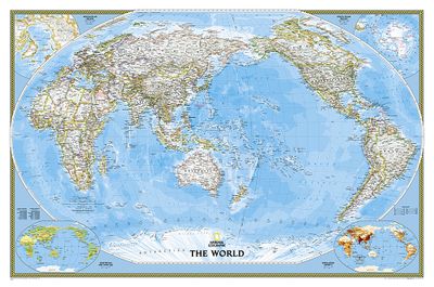
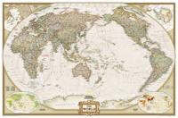
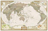
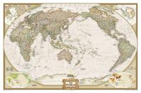
Wereldkaart Politiek, pacific centered, 117 x 78 cm | National Geographic

0
This unique view employs a new map projection to accentuate the Pacific Rim, and shows Oceania and Asia in close proportion to their actual size on the Earth. It brings Oceania and Asia into the center of the picture, while dramatically showing the entire breadth of the Pacific Ocean. The Pacific-centered world map features classic National Geogra...

Verkopers met dit product

Verkoper
Bezorging
Prijs
DeZwerver.nl logo
DeZwerver.nl
5,95
36,95

Anderen bekeken ook

Wereldkaart Politiek, pacific centered, 117 x 78 cm | National Geographic
This unique view employs a new map projection to accentuate the Pacific Rim, and shows Oceania and Asia in close proportion to their actual size on the Earth. It brings Oceania and Asia into the center of the picture, while dramatically showing the entire breadth of the Pacific Ocean. The Pacific-centered world map features classic National Geographic cartography, with political boundaries, thousands of place names, time zones, and special insets showing world vegetation and land use, and population density.     
36,95
Wereldkaart 20324 World Classic, pacific centered, 117 x 78 cm | National Geographic
Bijzondere wereldkaart vanuit een voor ons apart perspectief: de grote oceaan staat centraal. Prachtig beschaafd kleurgebruik en veel topografische aanduidingen maken het een mooie kaart. Volledig up-to-date.   This unique view employs a new map projection to accentuate the Pacific Rim, and shows Oceania and Asia in close proportion to their actual size on the Earth. It brings Oceania and Asia into the center of the picture, while dramatically showing the entire breadth of the Pacific Ocean. The Pacific-centered world map features classic National Geographic cartography, with political boundaries, thousands of place names, time zones, and special insets showing world vegetation and land use, and population density.     
27,95
Wereldkaart Politiek & antiek, pacific centered, 117 x 78 cm | National Geographic
National Geographic's World map is the standard by which all other reference maps are measured. The World map is meticulously researched and adheres to National Geographic's convention of making independent, apolitical decisions based on extensive research using multiple authoritative source.   The Executive style World map uses an antique-style color palette and stunning shaded relief that provide a richness perfect for any decor. The Pacific Centered World map employs a unique view to accentuate the Pacific Rim, and focuses on Oceania and Asia and while showing the entire breadth of the Pacific Ocean. Drawn in a special Winkel Tripel projection, distortions are minimized and unlike many other World maps, Greenland is show the same size as Argentina and not as the size of all of South America.   Thousands of place names are carefully and artistically placed on the map to maintain legibility even in the heavily populated ares of Europe, Asia and the Middle East. Details include clearl…
36,95
Wereldkaart 20327 Politiek & antiek, pacific centered, 117 x 78 cm | National Geographic
National Geographic's World map is the standard by which all other reference maps are measured. The World map is meticulously researched and adheres to National Geographic's convention of making independent, apolitical decisions based on extensive research using multiple authoritative source.   The Executive style World map uses an antique-style color palette and stunning shaded relief that provide a richness perfect for any decor. The Pacific Centered World map employs a unique view to accentuate the Pacific Rim, and focuses on Oceania and Asia and while showing the entire breadth of the Pacific Ocean. Drawn in a special Winkel Tripel projection, distortions are minimized and unlike many other World maps, Greenland is show the same size as Argentina and not as the size of all of South America.   Thousands of place names are carefully and artistically placed on the map to maintain legibility even in the heavily populated ares of Europe, Asia and the Middle East. Details include clearl…
24,95
Wereldkaart Politiek, pacific centered, 185 x 122 cm | National Geographic
This unique view employs a new map projection to accentuate the Pacific Rim, and shows Oceania and Asia in close proportion to their actual size on the Earth. It brings Oceania and Asia into the center of the picture, while dramatically showing the entire breadth of the Pacific Ocean. The Pacific-centered world map features classic National Geographic cartography, with political boundaries, thousands of place names, time zones, and special insets showing world vegetation and land use, and population density. 
68,95
Wereldkaart 20334 Politiek & antiek, pacific centered, 185 x 122 cm | National Geographic
The Pacific-centered map employs a new map projection to accentuate the Pacific Rim, and shows Oceania and Asia in close proportion to their actual size on the Earth. It brings Oceania and Asia into the center of the picture, while dramatically showing the entire breadth of the Pacific Ocean. The Pacific-centered world map features classic National Geographic cartography, with political boundaries, thousands of place names, time zones, and special insets showing world vegetation and land use, and population density.
45,95
Wereldkaart 20331 Politiek, pacific centered, 185 x 122 cm | National Geographic
This unique view employs a new map projection to accentuate the Pacific Rim, and shows Oceania and Asia in close proportion to their actual size on the Earth. It brings Oceania and Asia into the center of the picture, while dramatically showing the entire breadth of the Pacific Ocean. The Pacific-centered world map features classic National Geographic cartography, with political boundaries, thousands of place names, time zones, and special insets showing world vegetation and land use, and population density. 
45,95
Prikbord 26PR Wereldkaart, politiek, 117 x 76 cm | National Geographic
Een prachtige, stijlvol gekleurde kaart - bruin, antieke uitstraling - met een modern kaartbeeld. Alle landen staan er met grenzen en belangrijke steden keurig op, maar de nadruk ligt op de kleurstelling: deze is ‘ouderwets‘ en past goed in een klassiek interieur. Door het kleurgebruik is het reliëf van de bodem van oceanen goed te zien.   Het is de meest verkochte wereldkaart uit ons assortiment!   De wandkaarten op prikbord worden geleverd met een aluminium lijst en een eenvoudig te monteren ophangsysteem. Zij zijn geschikt voor allerhande markeringsystemen als vlaggetjes en prikkers.   Bij dit prikbord wordt gratis een set markeervlaggetjes (20 stuks) bijgeleverd   National Geographic is a renowned authority in cartography. For 120 years the Society's maps have helped spread geographic knowledge around the globe. A vast database allows National Geographic to combine the latest data gained by space-age technology with innovative digital mapping techniques to create state-of-the-art …
200,-
Wegenkaart - landkaart 3118 Pacific Northwest | National Geographic
Mooie kaart van de bekende kaartenmaker National Geographic. Veel details door kleurgebruik. De wegen zijn met kleuren verdeeld in drukke en minder drukke, de wegnummers zijn goed terug te vinden. De kaart onderscheidt zich van andere series door de hoeveelheid topografische details als counties, plaatsnamen en waterwegen en het bevat een register waarin het eenvoudig zoeken is. Daarnaast is de kaart gedrukt op scheur- en watervast papier. The United States Pacific Northwest Adventure Map will guide you through one of the most stunning regions in North America. The states of Washington, Oregon and Idaho contain Olympic, Mt. Rainier, Crater Lake, and North Cascades National Parks, Mt. Saint Helens and Mount Hood volcanoes, Columbia River Gorge, and dozens of magnificent National Monuments, Forests, and Wilderness Areas. The map includes the cities of Seattle, Portland, Boise, Spokane, and Eugene as well as Puget Sound and the spectacular Pacific coastline of Washington and Oregon. It c…
17,50

Klanten-reviews van Wereldkaart Politiek, pacific centered, 117 x 78 cm | National Geographic

Er zijn nog geen beoordelingen voor dit productBen jij de eerste die een review plaatst?

Meer over Wereldkaart Politiek, pacific centered, 117 x 78 cm | National Geographic

Productomschrijving

This unique view employs a new map projection to accentuate the Pacific Rim, and shows Oceania and Asia in close proportion to their actual size on the Earth. It brings Oceania and Asia into the center of the picture, while dramatically showing the entire breadth of the Pacific Ocean. The Pacific-centered world map features classic National Geographic cartography, with political boundaries, thousands of place names, time zones, and special insets showing world vegetation and land use, and population density.     

Productinformatie

    Verken gerelateerde categorieën

    Webshop.nl maakt gebruik van cookies. Ga je verder op onze website, ga dan akkoord met het plaatsen van cookies en de verwerking van deze data door ons en vermelde partners.