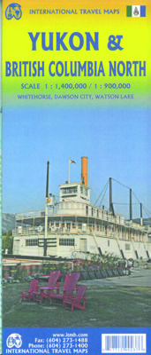
Wegenkaart - landkaart Yukon - British Columbia North | ITMB

0
Overzichtskaart van Yukon, tweezijdig bedrukt. Starting with Yukon (NB: not “the” Yukon, please), this portion of NWT was carved out into its own territory a century ago, as a result of the gold rush to the Klondike. It is the same map we’ve done since 1989, updated whenever necessary and includes inset maps of Whitehorse (the capital), Dawson Cit...

Verkopers met dit product

Verkoper
Bezorging
Prijs
DeZwerver.nl logo
DeZwerver.nl
2,95
14,95

Anderen bekeken ook

Wegenkaart - landkaart South Pacific Cruising & Samoa | ITMB
Een overzichtskaart van de zuidelijke Stille Oceaan met de cruise routes tussen de verschillende eilanden aangegeven. Op de achterzijde een overzichtskaart van Samoa This is a new venture for ITMB. Cruising is a rapidly-growing segment of the travel industry, experiencing double-digit growth rates annually. Obviously, this is a thriving market. In conjunction with several cruise ship lines, we have prepared a map of the South Pacific Ocean, which extends southwards from Hawai'i to the southern tip of New Zealand and eastwards from central Australia/Papua New Guinea to the Pitcairn Islands. Thus, it does not include the popular South East Asia and China coast routes. We think this has to change at a time when 25,000,000 people are travelling by cruise ships. At the same time, we must keep coverage area relevant for those end users of the artwork. Even at 1:12M, most of the area covered is water, with island countries such as Fiji, Tonga, Kiribati, Tahiti, and the Cook Islands being vis…
13,95
Wegenkaart - landkaart British Columbia | ITMB
Wegenkaart van alleen British Columbia. Calgary in het oosten staat er nog net op. Met campsites, register en nationale parken. This is our eight printing of our most popular provincial map for Canada. As with previous versions, we have updated road changes and new bridges. BC is not changing particularly quickly at the moment, due to the economic recession, but tens of thousands of people continue to migrate to the province each year, and its population is expected to double over the next twenty years. Thanks to its enormous size, huge tracts of land have been set aside for wilderness preservation, and yet the province boasts a road and rail network that would be the envy of smaller countries. The scenery tends to be described in superlative terms. Since I live her, I'll avoid the cliches, and content myself by saying that not only is this map superlative, we've reduced the retail price, so it is much more affordable both in America and overseas. Printed on paper, double-sided; inset…
13,95
Wegenkaart - landkaart Western Canada | ITMB
Een degelijke kaart met aanduidingen van o.a. nationale parken, vliegveld, benzinepomp, dirt-roads. Als overzichtskaart goed te gebruiken. This is actually our second attempt at mapping the western portion of Canada; the first covered everything from northwestern Ontario to the Pacific Ocean and, while it was an excellent map, the scale that such a huge area covered necessitated severe problems. In this version, all of British Columbia, Alberta, and the Yukon have been mapped from fresh digital data and presented at 1:1.4T scale. This would have been impossible when we prepared the first map. The Northwest Territories portion had to be compressed in two ways; first, the scale is 1:2M; second, only the portion with roads is shown. This is still an extremely large area. One has to consider the actual size of Canada when designing a map. Most countries in Europe would fit into this area, which only covers 20% of Canada. The Fort McMurray forest fire of a year ago covered an area larger t…
13,95
Wegenkaart - landkaart Nunavut - Northwest Territories | ITMB
The far north of Canada, north of 60 degrees, consists of three territories; the Yukon, the Northwest Territories, and Nunavut. Until now, there has never been a proper map of the territory that was carved off from the NWT a quarter century ago. With only 30,000 people and a scattering of settlements, Nunavut is larger than western Europe in area. This map took us years to prepare, using 1:250,000 government topo maps as a base and tracing thousands of little lakes. The traditional passageway of the fabled Northwest Passage is also shown. The most northerly civilian community in the world is on the map – Grise Bay, as well as Alert, the most remote place on earth. Originally, the NWT covered all of northwestern North America west of the Louisiana Purchase and the Loyalist colonies, and north of the Spanish provinces (essentially north of current day Sactamento). Political changes have reduced its size over the past century and a half to the region of Canada north of the 60th parallel …
13,95
Wegenkaart - landkaart Northern British Columbia | ITMB
British Columbia is big! Gargantuan huge, in fact, although it is lightly populated. ITMB published a map of the more densely populated southern half of the province a number of years ago, and we have been asked to give the same emphasis to the northern half ever since. Here it is! Side 1 is of the western portion, including the Alaskan Panhandle, with the route followed by cruise ships heading north and clearly delineates the border between Canada and the USA that nearly erupted into warfare (54 40 or fight). It also shows the Stewart Highway heading north towards the Yukon, with its branch leading to Hyder, Alaska, the only place in the USA that uses Canadian money and does all its banking in Canada. The second side covers the eastern half of BC’s north, with the Alaska Highway starting in Dawson Creek and extending north to Fort Nelson before veering west into the eastern edge of the Rocky Mountains to the Yukon border. This is true wilderness country. It is virtually unpopulated o…
14,95
Wegenkaart - landkaart Japan North & Hokkaido | ITMB
Een degelijke kaart met aanduidingen van o.a. nationale parken, vliegveld, benzinepomp, dirt-roads en kleine plattegrond van hoofdstad. Als overzichtskaart goed te gebruiken. In one sense, this is a brand new map, in that the artwork is all brand new. In another sense, it is our map of Hokkaid re-worked into a more marketable format. In any case, it is a very much-needed sectional map of that portion of Japan from Tokyo northwards. Hokkaido is actually one of the most interesting parts of Japan to visit. The island was opened to settlement only after the Ameicans forced Japan to allow contacts with foreign countries in 1868, thanks to Admiral Peary and Gunboat Diplomacy. Hokkaido has been relatively untouched by Japan’s rush to economic dominance, so is the country’s skiing capital in winter and the part of Japan most similar to America. An inset map of Sapporo is included. The other side shows the main island of the country from Nagoya and Toyama (which are considerably west of Tokyo…
13,95
Wegenkaart - landkaart Portland & Oregon | ITMB
This is a brand new title from ITMB. Portland is the largest city in the American state of Oregon. It is not the capital; that distinction belongs to Salem, about 50 miles to the south, but Portland is an actual sea-going port, although it is a hundred miles away from the ocean. It is situated on the majestic Columbia River, which at one time formed the border between British-controlled Canada and the emerging United States. That changed after 1842, with the Oregon Treaty, under which both governments agreed to "share" the territory. At that time, the British capital was Astoria, a lovely town at the mouth of the Columbia, but the Governor, realizing that sharing with the Americans meant capitulation to the Americans, moved the capital north to Victoria, on what was then designated a separate colony. Regardless, today both Portland and the State of Oregon present some of the nicest scenery in America. Our portrayal of the city goes from the Northwest Freemont Bridge in the north (the …
13,95
Wegenkaart - landkaart Washington State - British Columbia southwest | ITMB
Een degelijke kaart met aanduidingen van o.a. nationale parken, vliegveld, benzinepomp, dirt-roads en campsites. Als overzichtskaart goed te gebruiken. This map hopes to accomplish two goals; first, it is a detailed road and points of interest map for Washington State and adds to our growing range of State covered in detail, and second, it combines that portion of Canada's BC accessible to Americans heading north. The map has two covers so can be marketed either as a USA map title or a Canadian title. The front side covers all of Washington State, with a bit of Oregon and Idaho, and has a decent-sized inset map of downtown Seattle. The reverse side covers much-larger British Columbia - at least a portion of it, including all of Vancouver Island, all the roads from Vancouver eastwards to the Rockies and north to Kamloops, and hundreds of wilderness campsites in the interior. This side also includes insets of Victoria and downtown Vancouver. This map fills a gap in the travel map market…
13,95
Wegenkaart - landkaart Tahiti - French Polynesia | ITMB
Anyone who has visited Tahiti retains fond memories of a wonderful Polynesian paradise. This map shows the major islands of French Polynesia as a series of large insets on Side 1. An overall inset map showing the many islands is also shown, but for showing detail, one must expand the individual islands. The largest one is the volcanic Tahiti Nui, with the capital city of Pape’ete (or Papeete in English), for which a detailed inset map is included. Most visitors stay in the vicinity of Papeete, along the coast. We show several popular resorts. There is a good circular road around the island’s shoreline, but no roads in the interior. The island is joined to another, called Tahiti Iti, or Little Tahiti, and roads extend partway around this less-developed part of the combined island. Most of the other islands are rarely visited, although they have resorts, beaches, and a lifestyle of their own. Names like Huahine, Riatea, Tahaa, and Maiao may not be as familiar as they should be, but all …
14,95
Wegenkaart - landkaart Botswana - Zimbabwe | ITMB
Een degelijke kaart met aanduidingen van o.a. nationale parken, vliegveld, benzinepomp, dirt-roads en kleine plattegrond van hoofdstad. Als overzichtskaart goed te gebruiken. 7th Edition 1:1,600,000/11:1,000,000 on waterproof stone paper Both Botswana and its neighbour, Zimbabwe, form a common entity and a British heritage in Central Southern Africa, but there the resemblance ends. The Bechuana formed an alliance of sorts with the Pritish to protect them from the Boers in the then-nearby Transvaal. Upon a peaceful transition to independence as Botswana, it has evolved into a democratic and peaceful country. Zimbabwe, formerly Rhodeisa, is a failed state, although potentially, Zimbabwe could dominate tourism if governmental affairs were orderly. This map focuses on Botswana simply because that country is a beacon of orderly pleasantness in the continent; well run, routistacally well developed, with good infrastructure, and close to the game preserves of both South Africa and Zimbabwe. …
13,95

Klanten-reviews van Wegenkaart - landkaart Yukon - British Columbia North | ITMB

Er zijn nog geen beoordelingen voor dit productBen jij de eerste die een review plaatst?

Meer over Wegenkaart - landkaart Yukon - British Columbia North | ITMB

Productomschrijving

Overzichtskaart van Yukon, tweezijdig bedrukt.

Starting with Yukon (NB: not “the” Yukon, please), this portion of NWT was carved out into its own territory a century ago, as a result of the gold rush to the Klondike. It is the same map we’ve done since 1989, updated whenever necessary and includes inset maps of Whitehorse (the capital), Dawson City, and Watson Lake. It is still a territory, not a full province, although essentially self-administering. The NWT side of the sheet shows the brand new all-season gravel road to Tuktoyaktuk on the Arctic Ocean, opening up this part of Canada for land travel for the first time. An inset map of Yellowknife (the capital) is included.


Verken gerelateerde categorieën

Webshop.nl maakt gebruik van cookies. Ga je verder op onze website, ga dan akkoord met het plaatsen van cookies en de verwerking van deze data door ons en vermelde partners.