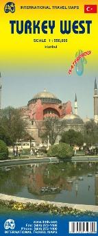
Wegenkaart - landkaart West Turkije - Turkey west | ITMB

0
Turkey is a big country. Most visitors concentrate on Istanbul and the Izmir Coast, which is a shame as there are so many other interesting parts of the country to visit. This map covers the western third of the country as a double-sided map, covering from the Greek/Bulgarian border south to the Mediterranean and east to Eregli and Antalya in the ...

Verkopers met dit product

Verkoper
Bezorging
Prijs
DeZwerver.nl logo
DeZwerver.nl
2,95
13,95

Anderen bekeken ook

Wegenkaart - landkaart West Turkije - Turkey west | ITMB
Turkey is a big country. Most visitors concentrate on Istanbul and the Izmir Coast, which is a shame as there are so many other interesting parts of the country to visit. This map covers the western third of the country as a double-sided map, covering from the Greek/Bulgarian border south to the Mediterranean and east to Eregli and Antalya in the east. Naturally, at a better scale, roads and road conditions can be shown to better advantage, and the ferry routes from Istanbul make more sense. The topography is now showing as contouring more easily, and we have been able to add the next layer of villages. The scale is still not appropriate for showing minor roads and tracks, but we have included as many as we feel we can. The map is printed on durable plastic paper, so will stand up to the rigours of travel quite well. A basin inset map of Istanbul has been included as well.   Legend Includes: Road by classification, Motorways, Multilane Hwy, Main Roads, Rail Ways, Ferry Routes, Nationa…
13,95
Wegenkaart - landkaart Turkije - Turkey | ITMB
Turkey is a fascinating country; so much potential, and seemingly unable to focus on progress as opposed to ideology. Touristically, the country is quite safe, but internal politics are as divided here as in Egypt (and seemingly every Muslim country) between secularists (if it is proper to call them that) who want a 'normal' country with a division between secular and religious affairs and those wanting a more traditional religious society where religious values shape the society. Our first edition sold out in a little more than a year, which is pretty amazing in itself, and we have made major improvements to this edition to maintain its popularity. The biggest change is that we have more strongly emphasized the major road network, as most visitors stay on the well-travelled routes around the country, rather than taking back roads to small villages. The second change has been to increase the font size for major urban areas, to make them easier to read. Turkey is a very large country g…
13,95
Wegenkaart - landkaart Turkije - Turkey Central including Cappadocia | ITMB
Covering the central portions of Turkey and especially the popular Cappadocia region. Turkey itself is a fascinating country. This map covers the portion from the Mediterranean coast all the way to Syria and north to the Black Sea port of Samsun. This part of Turkey is somewat less sophisticated than the western coastal cities and Istanbul, but it evokes memories of the many e,pires that have traversed the region. Cappadochia was created centuries ago by local people fearing the hordes of invaders that periodically appeared on the horizon and secreted themselves in soft stone caves carved in an inhospitable part of the country. Today, this is one of Turkey's touristic attractions, but the map is much more than that, this is detailed road map to explore an exciting part of the world.
13,95
Wegenkaart - landkaart - Stadsplattegrond Istanbul & Northwest Turkey | ITMB
Dubbelzijdige kaart van ITMB met aan een kant een wegenkaart  1:550.000 met aanduidingen van o.a. nationale parken, vliegveld, benzinepomp, dirt-roads. Als overzichtskaart goed te gebruiken. Aan de andere kant een overzichtelijke stadsplattegrond 1: 11.000 met stratenindex en aanduiding van toeristische informatie en culturele instellingen zoals musea, monumenten, schouwburgen en sportaccomodaties. Daarnaast bevaten de meeste kaarten een heldere aanduiding van het openbaarvervoer (opstappunten van metro), parkeergelegenheden, postkantoren en andere praktische informatie. Istanbul is one of the most interesting cities in Europe. It is loaded with interesting places to see and places to go. The map shows all major touristic sites (my favourite is Constantine s Column), the ferry routes that criss cross the Bosphorus, and the transit lines that move everyone around the city. We have made a significant change to the regional map on the second side of the sheet; in this edition, we provide…
13,95
Wegenkaart - landkaart 3018 Adventure Map Turkey Turkije | National Geographic
Wegenkaart van Turkije met vermelding van veel bezienswaardigheden, nationale parken en attrakties. Watervast en scheurvast. National Geographic's Turkey Adventure Map is designed to meet the unique needs of adventure travelers with its durability and accurate information. This folded map provides global travelers with the perfect combination of detail and perspective, highlighting hundreds of points of interest and the diverse and unique destinations within the country.   The front side of the Turkey map details the eastern region of the country, from its borders with Syria and Iraq to the south, and with Iran and Armenia to the East, extending to the Black Sea and Georgia to the north. The regions featured on this side are Southeast Anatolia and East Anatolia. The reverse side of the map details Turkey’s western portion of the country, from its border with Greece to the west, to the Mediterranean Sea to the south, extending to the Black Sea to the north. This side covers the Black S…
17,50
Wegenkaart - landkaart Turkey - Turkije | Marco Polo
Duidelijke wegenkaart van Marco Polo: alle wegen, zowel de verharde als belangrijke onverharde wegen zijn weergegeven.  Mooie toeristisch interessante wegen die de moeite waard zijn, zijn groen gearceerd. Veel toeristische informatie is toegevoegd zoals de nationale parken, campings, kastelen en vliegvelden. Afstanden tussen belangrijke steden en benzinestations staan ook op de kaart. Een plaatsnamenregister ontbreekt niet.   Let the Marco Polo Türkiye / Turkey Road Map guide you around this stunning country.   From the Turquoise Riviera to the Fairy Chimneys of Cappadocia this highly durable, detailed touring map of Turkey will ensure you don’t miss a thing. It folds away easily and is always on standby to help when you're stuck.   Perfect touring map - the scale is 1 : 800 000 ideal to help you tour the country by car or campervan Easy to use - the superbly clear mapping in strong colours and easy to read text will help you navigate the country like a local Durable, tear-resi…
14,95
Wegenkaart - landkaart 3019 Adventure Map Turkey Mediterranean Coast Turkije | National Geographic
Wegenkaart van de zuidelijke kust van Turkije met vermelding van veel bezienswaardigheden, nationale parken en attrakties. Watervast en scheurvast.   National Geographic's Turkey, Mediterranean Coast Adventure Map is designed to meet the unique needs of adventure travelers with its durability and accurate information. This folded map provides global travelers with the perfect combination of detail and perspective, highlighting hundreds of points of interest and the diverse and unique destinations within the country.   The front side of the Turkey Mediterranean Coast map details the southern coastal region of the country. This side shows the Mediterranean Sea to the south and Syria to the east. The coastline extends from Kas to Iskenderum. The reverse side of the map details Turkey’s western coastal region of the country and its border with Greece and Bulgaria. This side shows the western coast from the Sea of Marmara down to the Mediterranean Sea. The map includes the locations of cit…
17,50
Wegenkaart - landkaart Cuba West | ITMB
Een degelijke wegenkaart met aanduidingen van o.a. nationale parken, vliegveld. Als overzichtskaart goed te gebruiken. his is a brand new title for ITMB and reflects the growing interest in travel to Cuba resulting from improved relations with the USA. Licenses to fly into the country from a dozen cities have already been approved; 60 more are awaiting approval. All are for flights into Havana and Varadero airports – in other words, the western half of the country. ITMB already has an exceptionally good map of the entire country. We also have a separate map of Havana. This map expands the scale and opens the information for the western half of the island nation as a double-sided map, with the portion west of Havana (La Habana) to Pinar del Rio province in the far west and south to the Isla de la Juventud (better known, but mis-named, as the Bay of Pigs Invasion Site). This side also has an excellent map of the Varadero beach resort area as an inset, and a map of greater Havana. The ot…
13,95
Reisgids Turkey essential - Turkije | Fodor's Travel
Whether you want to visit the Grand Bazaar in Istanbul, cruise along the Turquoise Coast, or go hot-air ballooning in Cappadocia, the local Fodor's travel experts in Turkey are here to help! Fodor's Essential Turkey guidebook is packed with maps, carefully curated recommendations, and everything else you need to simplify your trip-planning process and make the most of your time. This new edition has been fully-redesigned with an easy-to-read layout, fresh information, and beautiful color photos. Fodor's Essential Turkey travel guide includes: AN ILLUSTRATED ULTIMATE EXPERIENCES GUIDE to the top things to see and do MULTIPLE ITINERARIES to effectively organize your days and maximize your time MORE THAN 36 DETAILED MAPS and a FREE PULL-OUT MAP to help you navigate confidently COLOR PHOTOS throughout to spark your wanderlust! HONEST RECOMMENDATIONS on the best sights, restaurants, hotels, nightlife, shopping, performing arts, activities, and more PHOTO-FILLED "BEST OF" FEATU…
23,50
Wegenkaart - landkaart - Stadsplattegrond Kyoto & Japan West | ITMB
Dubbelzijdige kaart met aan de ene kant een plattegrond, 1 op 12.500, van Kyoto. Aan de andere kant een degelijke kaart met aanduidingen van o.a. nationale parken, vliegveld, benzinepomp en bezienswaardigheden van West Japan. Als overzichtskaart goed te gebruiken.   We are very pleased to see another updated edition of this very popular part of Japan coming out. Kyoto itself is rich in cultural heritage and has an excellent transit system for getting around. Regardless, one really needs a good map to find the temples and shrines. The map also includes an excellent inset map of Nara, a smaller city with an even greater concentration of temples and historic buildings. It is, however, the other side of the map, covering the western part of Japan that is the real value of this map. Stretching from Nagoya in the east past Kyoto and Osaka to Hiroshima and on to Fukuoka, this regional map is at an excellent scale to enable travellers to find their way around easily. All rail lines are includ…
13,95

Klanten-reviews van Wegenkaart - landkaart West Turkije - Turkey west | ITMB

Er zijn nog geen beoordelingen voor dit productBen jij de eerste die een review plaatst?

Meer over Wegenkaart - landkaart West Turkije - Turkey west | ITMB

Productomschrijving

Turkey is a big country. Most visitors concentrate on Istanbul and the Izmir Coast, which is a shame as there are so many other interesting parts of the country to visit. This map covers the western third of the country as a double-sided map, covering from the Greek/Bulgarian border south to the Mediterranean and east to Eregli and Antalya in the east. Naturally, at a better scale, roads and road conditions can be shown to better advantage, and the ferry routes from Istanbul make more sense. The topography is now showing as contouring more easily, and we have been able to add the next layer of villages. The scale is still not appropriate for showing minor roads and tracks, but we have included as many as we feel we can. The map is printed on durable plastic paper, so will stand up to the rigours of travel quite well. A basin inset map of Istanbul has been included as well.   Legend Includes: Road by classification, Motorways, Multilane Hwy, Main Roads, Rail Ways, Ferry Routes, National parks, Province Border, International Border, Lakes, Monuments, Caves, Ruins, Campsites, Hotels, Motels, Viewpoints, Point of Interests and much more...

Productinformatie

    Verken gerelateerde categorieën

    Webshop.nl maakt gebruik van cookies. Ga je verder op onze website, ga dan akkoord met het plaatsen van cookies en de verwerking van deze data door ons en vermelde partners.