webshop.nl
Categorieën
  Sluiten

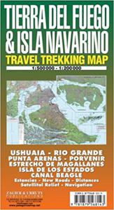
Wegenkaart - landkaart - Wandelkaart trekkingmap Tierra del Fuego & Isla Navarino | Zagier & Urruty

Kaart gebaseerd op satellietfoto's met ingetekende hoogtelijnen, campsites, routes en hutten. Bedenk dat het allemaal wel heel globaal is, het is niet de meest ideale schaal om op te lopen. The Argentine and Chilean sectors of Tierra del Fuego. Satellital relief, winter resorts, secondary roads, tracks, distances. Special maps of Staten Land, Navar...
17,95

Webshops met dit product

Webshop
Bezorging
Prijs

Anderen bekeken ook

Wegenkaart - landkaart Argentina South & Tierra Del Fuego | ITMB
  Een degelijke kaart met aanduidingen van o.a. nationale parken, vliegveld, benzinepomp, dirt-roads etc. Als overzichtskaart goed te gebruiken.   Op één kant van de kaart staat het zuiden van Argentinië (schaal 1:2.200.00) en op de andere kant staat Tierra del Fuego (schaal 1:750.000).   We have switched focus from Northern Argentina and Buenos Aires to Southern Argentina and Tierra del Fuego. This long stretch of South America's second largest country lies beside Chile and is home to many whales and sea lions watching sites. Throughout this long strip of a combination of mountains, seas, and forests, tourists will find this land to be unique and natural. On the other side of this map and at the very end of the two countries sits the famous Land of Fire island, Tierra del Fuego. This triangle shaped island is both part of Chile and Argentina and has been a desirable tourist destination. We have also included an inset map of Ushuaia, "the southernmost city in the world" that is closest…
13,95
Wegenkaart - landkaart Antarctica & Tierra del Fuego | ITMB
Goede overzichtskaart van Antarctica, schaal 1:7.000.000 met toeristische informatie en informatie over het klimaat en de natuur. Aan de andere zijde een kaart van Tierra del Fuego, schaal 1:750.000, de Falklandeilanden, schaal 1:1.100.000 en een plattegrond van Ushaia, schaal 1:10.00 This is actually brand new artwork, replacing the partly-digital version with new digitized line work. It looks similar to our earlier editions; its real value will be in tracking changes to the continent as the ice cover gradually melts.  Folded color map of Antarctica. Scale: 1:7,000,000. Map of the continent shows glaciers, islands, mountains, ice rises, other natural features and stations/settlements. Information about climate and natural features, flora and fauna of the land and surrounding seas and history. I
14,50
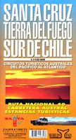
Wegenkaart - landkaart Santa Cruz - Tierra del Fuego - Sur de Chile (Zuid Chili - Vuurland) | Zagier & Urruty
Mooie overzichtskaart / wegenkaart voor het zuiden van Chili en Vuurland. Inclusief een overzicht van de voor fietsers aantrekkelijke Carretera Austral, de eindeloze weg die Vuurland met het echte Chili verbindt. The southern tip of America from Coihaique and Copahue to Cape Horn. Estancias, National Road 40 and Carretera Austral. Patagonian Channels. National Parks and inns. Service charts and distances.
17,95
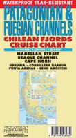
Wegenkaart - landkaart Patagonian & Fuegian Channels - Chilean Fjords Cruise Chart Beagle Channel - Patagonië | Zagier & Urruty
Intricate representation of Chilean fjords along the western and far southern edge of southern South America. This clear and uncluttered map shows details of the coastline with minimal topographical information. Historical notes and elevations of coastline illustrated from different bearings. Scale 1:1,400,000 Historical and hydrographical chart. Cruise log for the intrincate coast of the south of South America. Insets of Beagle Channel "Glaciers Avenue", Agostini Fjord, Wulaia Inlet and Romanche Bay   Kaap Hoorn, Straat Magellaan, Punta Arenas, Ushuaia, Cordillera Darwin, Seno Agostini Uitgevouwen 70 x 100 cm
22,95
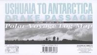
Wegenkaart - landkaart Ushuaia to Antarctica - Drake Passage | Zagier & Urruty
Deze kaart is geschikt voor bootreizen van Ushuaia naar Antarctica. De kaart bevat behalve dieptemeters en stromingen ook de plaatsen van scheepswrakken en andere interessante plekken. The ship voyage from South America to the Antarctic Peninsula is a travel of a lifetime. After two days navigating on a sea of miles deep with the strongest and wildest currents and winds, the traveler arrives to a paradise for people looking for nature, history and adventure. This map is based in the Argentine Hydrographic Survey and the Ushuaia Maritime Museum charts and includes historic sites in the area as well as place for stamps and signatures from the ship and stations crew. A certificate for having crossed the Drake Passage is printed, too. afmeting 65 x 95 cm
17,95
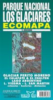
Wegenkaart - landkaart Parque Nacional los Glaciares | Zagier & Urruty
LOS GLACIARES NATIONAL PARK ECOMAP The most incredible Park of Patagonia, including Perito Moreno Glacier and Mount Fitz Roy. Satellite relief, roads, navigation, camping, inns and estancias, etc. El Parque mas espectacular de la Patagonia, donde sobresalen el Glaciar Perito Moreno y el Monte Fitz Roy. Rutas, navegaciones, estancias turisticas, paradores, camping, etc. Spanish / English edition. Southern Patagonia’s main National Park, Los Glaciares, with the world's only advancing glacier. The map uses satellite imagery, enhanced with colours and hill-shading to give a vivid representation of the relief. Many local peaks, glaciers and other geographical features are marked and named. Road network includes unpaved roads and dirt tracks, with locations of petrol stations and intermediate driving distances. Ferry connections on the region’s numerous lakes are also indicated. Symbols highlight accommodation and restaurant facilites. Latitude and longitude lines are drawn at 15' intervals.…
17,95
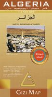
Wegenkaart - landkaart Algeria - Algerije | Gizi Map
Mooie, duidelijke kaart van Algerije met plaatsnaamaanduiding in het Engels en het Arabisch. A detailed general map with relief depicted by vivid elevation tinting. The map is indexed and selected location names are written in Arabic as well as standard roman text. Coverage includes neighbouring Tunisia and most of Morocco. Terrain features such as sand deserts, stone deserts, salt flats, water holes and swamps are distinguished, and selected peak heights are indicated. Bathymetric tinting is also applied. Several categories of roads are distinguished, including selected tracks, with intermediate driving distances marked on many routes. Railways, oil and gas piplines, and administrative boundaries are drawn and symbols denote oil and gas production sites, airports, ports, places of worship, campsites, hostels, beach resorts, oases, lighthouses, forts, museums, UNESCO sites and other antiquities and sites of interest. Lines of latitude and longitude are drawn at 1° intervals. The multil…
15,95
Wegenkaart - landkaart Argentinië - Argentina | Borch
Mooie, geplastificeerde kaart van het Argentinië. Deze kaart biedt een goed overzicht van het land met detailkaarten.   Our soft-laminated folded map of Argentina shows: Argentina 1:3 800 000, Isla Grande de Tierra del Fuego 1:1 900 000, Los Glaciares National Park 1:750 000, Mount Fitz Roy 1: 250 000, Greater Buenos Aires 1:650 000, Buenos Aires 1:18 000, Cordoba 1:14 000, Salta 1:16 000, Argentina administrative and time zones. Borch Maps are easy to fold, durable and water-repellent with a wipeable surface. Borch Maps show hotels, museums, monuments, markets, public transport, top sights and points of interest, useful statistics, conversion charts for temperatures, weights and measurements, climate charts showing temperatures, sunshine hours, precipitation and humidity, overview maps, time zones, and much more...   Enchanted by the sophisticated European flair of Buenos Aires, watching the world go by from a sidewalk café whilst taking a break from the buzzing nightlife, one could a…
11,50

Klanten-reviews van Wegenkaart - landkaart - Wandelkaart trekkingmap Tierra del Fuego & Isla Navarino | Zagier & Urruty

Er zijn nog geen beoordelingen voor dit productBen jij de eerste die een review plaatst?

Meer over Wegenkaart - landkaart - Wandelkaart trekkingmap Tierra del Fuego & Isla Navarino | Zagier & Urruty

Productomschrijving

Kaart gebaseerd op satellietfoto's met ingetekende hoogtelijnen, campsites, routes en hutten. Bedenk dat het allemaal wel heel globaal is, het is niet de meest ideale schaal om op te lopen. The Argentine and Chilean sectors of Tierra del Fuego. Satellital relief, winter resorts, secondary roads, tracks, distances. Special maps of Staten Land, Navarino Island and beagle Channel. The most updated available. Isla Navarino 1:200.000 rest 1:500.000
Webshop.nl maakt gebruik van cookies. Ga je verder op onze website, ga dan akkoord met het plaatsen van cookies en de verwerking van deze data door ons en vermelde partners.