webshop.nl
Categorieën
  Sluiten

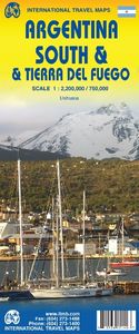
Wegenkaart - landkaart Argentina South & Tierra Del Fuego | ITMB

  Een degelijke kaart met aanduidingen van o.a. nationale parken, vliegveld, benzinepomp, dirt-roads etc. Als overzichtskaart goed te gebruiken.   Op één kant van de kaart staat het zuiden van Argentinië (schaal 1:2.200.00) en op de andere kant staat Tierra del Fuego (schaal 1:750.000).   We have switched focus from Northern Argentina and Buenos Ai...
13,95

Webshops met dit product

Webshop
Bezorging
Prijs

Anderen bekeken ook

Wegenkaart - landkaart Patagonië en Zuid Chili - Patagonia - Chile south | ITMB
Een degelijke wegenkaart met aanduidingen van o.a. nationale parken, vliegveld, benzinepomp, dirt-roads. Als overzichtskaart goed te gebruiken.   Zuid Chili schaal 1:1.770.000 Patagonië schaal 1:2.200.000   This is a brand new map for ITMB and concentrates on the fast-changing southern portion of Chile (known as the Austral) and Patagonia, which technically only exists in southern Argentina, but in reality can't be shown easily on a map without including the same area in Chile. Thus, one side concentrates on Chile south of Los Angeles (yes, there's one there too!) in two long strip maps that go all the way to Cape Horn (or Hoorn, in Dutch) south of Tierra del Fuego. Although it has nothing to do with this part of Chile, we have also included the main portion of touristic Easter Island, an inset of what is popularly referred to as Robinson Crusoe Island (Alexander Selkirk was marooned here for a number of years, and is the real-life model of the fictional Crusoe) and an inset map of Ush…
13,95
Wegenkaart - landkaart 3400 Adventure Map Argentina - Argentinië | National Geographic
Wegenkaart van Argentinië met vermelding van veel bezienswaardigheden, nationale parken en attrakties. Watervast en scheurvast. Juist door deze vermeldingen onderscheidt de kaart zich van andere wegenkaarten. National Geographic's Argentina Adventure Map is designed to meet the unique needs of adventure travelers—detailed, durable, and accurate. Argentina includes the locations of thousands of major cities and towns with an index for easily locating them, plus a clearly marked road network complete with distances and designations for major highways, limited access highways, minor roads, and more.   What sets National Geographic Adventure Maps apart from traditional road maps are the hundreds of points-of-interest that highlight the diverse, unique, and exotic destinations within Argentina including national parks and preserves, World Heritage sites, archeological sites, churches of interest, scenic viewpoints, natural points of interest, and important travel aids like airports, airstri…
17,50
Wegenkaart - landkaart The Andes | ITMB
Een degelijke wegenkaart van de hele Andes met aanduidingen van o.a. nationale parken, vliegveld, Als overzichtskaart goed te gebruiken. We are pleased to be able to re-introduce this important title into our publishing range after a lapse caused by Covid. The Andes mountain chain is the southern extension of the Sierra Nevada chain through Mexico and Central America, which is, in turn the southern extension of the Rocky Mountain chain from Alaska to the Mexican border. The Andes is a magnificent series of high mountains that enters Colombia and spreads southwards through Ecuador and Peru all the way to southern Patagonia. The map is double-sided, with the Northern Andes on one side and the other side divided into two side-by-side maps portraying the Central Andes and the Southern Andes. Thus, the map coverage focuses on the Andes themselves, rather than on all of South America. All of Colombia and Peru are shown, most of Bolivia, all of Chile, and the Patagonian portion of Argentina e…
13,95
Wegenkaart - landkaart Antarctica & Tierra del Fuego | ITMB
Goede overzichtskaart van Antarctica, schaal 1:7.000.000 met toeristische informatie en informatie over het klimaat en de natuur. Aan de andere zijde een kaart van Tierra del Fuego, schaal 1:750.000, de Falklandeilanden, schaal 1:1.100.000 en een plattegrond van Ushaia, schaal 1:10.00 This is actually brand new artwork, replacing the partly-digital version with new digitized line work. It looks similar to our earlier editions; its real value will be in tracking changes to the continent as the ice cover gradually melts.  Folded color map of Antarctica. Scale: 1:7,000,000. Map of the continent shows glaciers, islands, mountains, ice rises, other natural features and stations/settlements. Information about climate and natural features, flora and fauna of the land and surrounding seas and history. I
14,50
Wegenkaart - landkaart Argentinië - Argentina | Borch
Mooie, geplastificeerde kaart van het Argentinië. Deze kaart biedt een goed overzicht van het land met detailkaarten.   Our soft-laminated folded map of Argentina shows: Argentina 1:3 800 000, Isla Grande de Tierra del Fuego 1:1 900 000, Los Glaciares National Park 1:750 000, Mount Fitz Roy 1: 250 000, Greater Buenos Aires 1:650 000, Buenos Aires 1:18 000, Cordoba 1:14 000, Salta 1:16 000, Argentina administrative and time zones. Borch Maps are easy to fold, durable and water-repellent with a wipeable surface. Borch Maps show hotels, museums, monuments, markets, public transport, top sights and points of interest, useful statistics, conversion charts for temperatures, weights and measurements, climate charts showing temperatures, sunshine hours, precipitation and humidity, overview maps, time zones, and much more...   Enchanted by the sophisticated European flair of Buenos Aires, watching the world go by from a sidewalk café whilst taking a break from the buzzing nightlife, one could a…
11,50
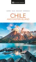
Reisgids Eyewitness Travel Chile & Easter Island - Chili en Paaseiland | Dorling Kindersley
Prachtig geillustreerde reisgids met o.a. 3D tekeningen, fraaie kaarten en geweldige foto’s. Daarnaast uitgebreide achtergrondbeschrijvingen. Echt om in de stemming te komen! Groot formaat gids. Engelstalig The ideal travel companion, full of insider advice on what to see and do, plus detailed itineraries and comprehensive maps for exploring this breathtakingly beautiful country.Tour picturesque Chilean vineyards, stargaze in the Atacama Desert, explore the glaciers of the Torres del Paine National Park in Patagonia or admire Rapa Nui's moai statues: everything you need to know is clearly laid out within colour-coded chapters. Discover the best of Chile and Easter Island with this indispensable travel guide.Inside DK Eyewitness Travel Guide Chile and Easter Island:- Over 35 colour maps help you navigate with ease- Simple layout makes it easy to find the information you need- Comprehensive tours and itineraries of Chile and Easter Island, designed for every interest and budget- Illustra…
22,50
Wegenkaart - landkaart South America Southern - Zuid Amerika, deel Zuid | ITMB
1:2,600,000 scale 6th Edition, double-sided printing. This map shows the southern third of South America in better detail than any other map.gIt starts at northern Chile, southern Paraguay, and central Brasil, and moves south to cover all of Argentina and almost all of Chile. Side 1 is a detailed road map of the region as far south as Buenos Aires. Side 2 covers Patagonia, the coast of Chile, and Tierra del Fuego. Map size: 27"X39"
13,95
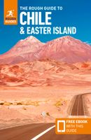
Reisgids Chile - Chili | Rough Guides
Zeer goede reisgids voor zowel de georganiseerde maar vooral voor de zelfstandige reiziger. Boordevol informatie over reizen, slapen, eten, maar ook musea en cultuur. Voor Europese landen en vooral steden meestal completer en beter dan de Lonely Planet ! This practical travel guide to Chile & Easter Island features detailed factual travel tips and points-of-interest structured lists of all iconic must-see sights as well as some off-the-beaten-track treasures. Our itinerary suggestions and expert author picks of things to see and do will make it a perfect companion both, ahead of your trip and on the ground. This Chile & Easter Island guide book is packed full of details on how to get there and around, pre-departure information and top time-saving tips, including a visual list of things not to miss. Our colour-coded maps make Chile & Easter Island easier to navigate while you're there. This guide book to Chile & Easter Island has been fully updated post-COVID-19 and it comes with a fr…
24,95
Wegenkaart - landkaart 3402 Adventure Map Chile - Chili | National Geographic
Wegenkaart van Chili met vermelding van veel bezienswaardigheden, nationale parken en attrakties. Watervast en scheurvast. Juist door deze vermeldingen onderscheidt de kaart zich van andere wegenkaarten.   National Geographic's Chile Adventure Map is designed to meet the unique needs of adventure travelers—detailed, durable, and accurate. Chile includes the locations of thousands of major cities and towns with an index for easily locating them, plus a clearly marked road network complete with distances and designations for major highways, toll roads, limited access highways and more.   What sets National Geographic Adventure Maps apart from traditional road maps are the hundreds of points-of-interest that highlight the diverse, unique, and exotic destinations within Chile including National Parks and Preserves, World Heritage Sites, Archeological sites, ski areas, beaches, waterfalls, natural points of interest and important travel aids like airports, airstrips, rail lines, lighthouses…
17,50
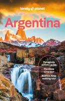
Reisgids Argentina and Uruguay - Argentinië | Lonely Planet
De perfecte reisgids voor zowel de georganiseerde als de zelfstandige reiziger. Naast een algemene inleiding van het land / streek vol met praktische informatie over hoe je er het beste kunt reizen: slapen, eten, vervoer, excursies ... alles kun je er in vinden. LET OP: Met 50 pagina's over Uruguay!! Lonely Planet's local travel experts reveal all you need to know to plan the trip of a lifetime to Argentina.   Discover popular and off the beaten track experiences from marvelling at Iguazú Falls jaw-dropping waterfalls with rainbows, to watching whales leap out of the water on Playa Las Canteras, and dancing the tango at a traditional Buenos Aires milonga.   Build a trip to remember with Lonely Planet's Argentina travel guide:   Our classic guidebook format provides you with the most comprehensive level of information for planning multi-week trips Updated with an all new structure and design so you can navigate Argentina and connect experiences together with ease Create your pe…
27,50

Klanten-reviews van Wegenkaart - landkaart Argentina South & Tierra Del Fuego | ITMB

Er zijn nog geen beoordelingen voor dit productBen jij de eerste die een review plaatst?

Meer over Wegenkaart - landkaart Argentina South & Tierra Del Fuego | ITMB

Productomschrijving

  Een degelijke kaart met aanduidingen van o.a. nationale parken, vliegveld, benzinepomp, dirt-roads etc. Als overzichtskaart goed te gebruiken.   Op één kant van de kaart staat het zuiden van Argentinië (schaal 1:2.200.00) en op de andere kant staat Tierra del Fuego (schaal 1:750.000).   We have switched focus from Northern Argentina and Buenos Aires to Southern Argentina and Tierra del Fuego. This long stretch of South America's second largest country lies beside Chile and is home to many whales and sea lions watching sites. Throughout this long strip of a combination of mountains, seas, and forests, tourists will find this land to be unique and natural. On the other side of this map and at the very end of the two countries sits the famous Land of Fire island, Tierra del Fuego. This triangle shaped island is both part of Chile and Argentina and has been a desirable tourist destination. We have also included an inset map of Ushuaia, "the southernmost city in the world" that is closest to the South Pole.   Legend Includes: Roads by classification, Airports, Ferries, Lighthouses, Hot Springs, View Points, Beaches, Ruins, Historical Sites, World Heritage Sites, Border Crossings, Points of Interest, Gas Stations, Museums, Churches, Post Offices, Shopping Centres, Monuments, Volcanoes, Camping Grounds, Oil Fields, Restaurants and more.
Webshop.nl maakt gebruik van cookies. Ga je verder op onze website, ga dan akkoord met het plaatsen van cookies en de verwerking van deze data door ons en vermelde partners.