webshop.nl
Categorieën
  Sluiten

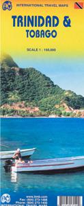
Wegenkaart - landkaart Trinidad & Tobago | ITMB

This is our newest map for the Caribbean region and essentially replaces the now-defunct Rough Guide map for this country. Trinidad has a chequered history. First ‘discovered’ by Columbus, and named Holy Trinity, its inhabitants were fairly quickly deported as slaves to work in Spanish colonies elsewhere. Sir Walter Raleigh, who was little more tha...
13,95

Webshops met dit product

Webshop
Bezorging
Prijs

Anderen bekeken ook

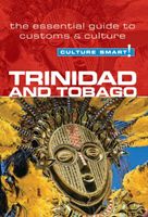
Reisgids Culture Smart! Trinidad and Tobago | Kuperard
De Cultuur Bewust!-gids geeft toeristen en zakenlieden belangrijke informatie met betrekking tot de cultuur van alledag in het land van bestemming. Anders dan in de gebruikelijke reisgidsen wordt de lezer in deze reeks bijgespijkerd op het gebied van omgangsvormen, normen en waarden, hoe zich te gedragen en wat verwacht mag worden op zakelijk en sociaal gebied. Het zijn beknopte zakformaatgidsen met interessante wetenswaardigheden over het dagelijks leven. Een must voor iedereen die naar het buitenland gaat voor vakantie, studie of werk. The twin Caribbean islands of Trinidad and Tobago could hardly be more different. Trinidad is vibrant, cosmopolitan, culturally diverse, and multiethnic, with a population descended from East Indian, African, Spanish, French, Dutch, American, Chinese, Syrian, and English forebears. This potent mix finds full expression in unbridled revelry each February with the celebration of Carnival—a dazzling, open-to-all-comers, mass participation street extravaga…
14,95
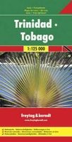
Wegenkaart - landkaart Trinidad & Tobago | Freytag & Berndt
Goede gedetailleerde wegenkaart van Trinidad & Tobago. Met natuurparken, Bezienswaardigheden. De afstand worden aangegeven in kilometers. Very clear map of the two islands with road information and place names easy to read. The map has the same geographic content as that published by Rough Guides, but with different colouring and the presentation of the topography - here with vivid relief shading rather than with contours and altitude tinting, and without the bathymetric tinting over the surrounding sea. Altitudes for a few peaks are marked, and swamps and reefs are also shown.   The clear road detail includes minor roads and tracks, with intermediate driving distances marked on main routes and selected petrol stations. Internal administrative boundaries and names are clearly marked, and reserves and protected areas are shown. Symbols show airports, harbours and many other tourism features and landmarks e.g. golf courses, zoos, botanical gardens, waterfalls, beaches and watersport site…
14,95
Wegenkaart - landkaart Great Britain - Engeland - Schotland | ITMB
  Een degelijke kaart met aanduidingen van o.a. nationale parken, vliegveld, benzinepomp, dirt-roads en kleine plattegrond van hoofdstad. Als overzichtskaart goed te gebruiken.   This is the third set of artwork for Great Britain that we have published and the first that is completely our own artwork (the previous versions were joint ventures). In mapping, as in life, one has to differentiate between the political entity known as the United Kingdom and the geo-political reality of Greater Britain, which includes the Channel Islands, the Isle of Man, and various assorted entities that are loosely attached to the UK by history. We have tried, in this edition, to combine a detailed road map with a touristic sites map. Given that Britain is both densely covered by thousands of narrow laneway passing themselves off as sub-B level roads and by having the greatest treasure trove in the world of castles, manor houses, gardens, museums, and interesting places worth visiting, and the task of por…
13,95
Wegenkaart - landkaart Jersey - Guernsey - Sark - Alderney (Kanaaleilanden) | ITMB
Goede detailkaart van alle kanaaleilanden. Het is zo gedetailleerd dat zelfs straatnamen er op staan. De kaart is ook nog eens geplastificeerd en daarmee scheur- en watervast.  ITMB is pleased to re-introduce the Channel Islands map area after a lengthy hiatus of preparing new artwork. The first version of this part of Europe was licensed artwork by a local firm in Jersey, and upon running out of copies of the printed map, we opted to prepare fresh artwork of our own to continue this interesting corner of the continent to continue to be available. The islands, collectively known in English as the Channel Islands, are one of those anomalies that make Europe so attractive. They are part of Great Britain, but not part of the UK; hence, they are not part of the EU. They are self-governing entities ‘owned’ by the Queen in her role of being Duchess of Normandy. This is, of course, merely a hereditary situation, but the islands were the personal possessions of William the Conqueror in 1066, a…
13,95
Wegenkaart - landkaart Cuba | Borch
Mooie geplasticieerde kaart van Cuba. Deze kaart biedt een goed overzicht van het land met detailkaarten. Our soft-laminated map of Cuba includes: Cuba West 1:1 000 000, Cuba East 1:1000 000, La Habana 1:16 000, Varadero 1:25 000, Playas del Este 1:22 000, Santiago de Cuba 1:16 000, Cuba administrative & time zones. Borch Maps are easy to fold, durable and water-repellent with a wipeable surface. Borch Maps show hotels, museums, monuments, markets, public transport, top sights and points of interest, useful statistics, conversion charts for temperatures, weights and measurements, climate charts showing temperatures, sunshine hours, precipitation and humidity, overview maps, time zones, and much more...   The largest island in the Caribbean evokes images of blue, crystal-clear waters lapping against immaculate white beaches or revealing the colourful underwater life of the stunning reefs, cool courtyards enclosed by colonial buildings, stylish barmen mixing exotic, potent cocktails, and…
11,50
Waterkaart Caribbean Cruising | ITMB
The Caribbean Sea is one of the most popular cruising destinations in the world. This colourful double-sided map starts just north of Orlando/Tampa in order to show the northernmost Bahamian islands and south as far as the Panama Canal at Colon and the coast of Venezuela. The map shows good detail for each island and the legal boundaries of each island nation. Side 1 concentrates on the western Caribbean, essentially the Bahamas, Cuba, Jamaica, and the Cayman Islands. Here’s a fun fact most of you won’t know: tiny Navassa Island between Haiti and Jamaica is claimed by both the USA and Haiti! Side 2 concentrates on the eastern islands of the Caribbean, such as Hispaniola (Haiti and the Dominican Republic), Puerto Rico and the US and British Virgin Islands, Turks & Caicos, and the Lesser Antilles chain of island countries, such as Antigua, Guadeloupe, Barbados, and Trinidad/Tobago, among others. Coverage then extends westward along the Venezuelan coastline to include the Dutch possession…
14,95
Wegenkaart - landkaart Oklahoma & Texas | ITMB
Een degelijke wegenkaart met aanduidingen van o.a. nationale parken, vliegveld, benzinepomp, dirt-roads. Als overzichtskaart goed te gebruiken. ITMB is pleased to announce the newest addition to our range of titles on the USA. Increasingly, we are developing our artwork to cover the larger states attractively and comprehensively, but also, we hope sensibly. Texas and Oklahoma share a common heritage of having been formed out of land taken from others through the long-held policy of Manifest Destiny. Today, Texas is the second largest State in the union (after Alaska), and is the only State to have previously been an independent country. It also includes the oldest urban area in the USA, Presidio, founded by the Spaniards to guard the ford over the Rio Grande. Because of its shape, and the natural proximity of the State of Oklahoma along its northern edge, combining the two States just made sense. The map is presented double-sided (top half/bottom half) on waterproof paper that is durab…
13,95
Wegenkaart - landkaart Cuba West | ITMB
Een degelijke wegenkaart met aanduidingen van o.a. nationale parken, vliegveld. Als overzichtskaart goed te gebruiken. his is a brand new title for ITMB and reflects the growing interest in travel to Cuba resulting from improved relations with the USA. Licenses to fly into the country from a dozen cities have already been approved; 60 more are awaiting approval. All are for flights into Havana and Varadero airports – in other words, the western half of the country. ITMB already has an exceptionally good map of the entire country. We also have a separate map of Havana. This map expands the scale and opens the information for the western half of the island nation as a double-sided map, with the portion west of Havana (La Habana) to Pinar del Rio province in the far west and south to the Isla de la Juventud (better known, but mis-named, as the Bay of Pigs Invasion Site). This side also has an excellent map of the Varadero beach resort area as an inset, and a map of greater Havana. The oth…
13,95
Wegenkaart - landkaart - Stadsplattegrond Montreal & Southern Quebec | ITMB
Stadsplattegrond van Montreal met register. Op de achterzijde een kaart van het zuiden van Quebec. 1:12,500/1:850,000 on waterproof paper. In this third, updated, edition of Canada's third largest city, we have added a user-friendly bonus. As is common now to most of our city maps, we have included a regional map of the hinterland of the urban area, so buyers won't have to purchase a second map to explore the environs of the city being presented. In the case of Montreal, being in a huge geographic country, this means Southern Quebec which, because of its size, dictates a map of more than one to a million scale. In the European context this would be the equivalent of Paris and all of France as a 'regional' map of the surrounds of Paris - but that's France and this is Canada.   Montreal (or Mont Royale in its original) was a village called Hochelaga when the early French explorers arrived in the early 1600s. They established a trading fort and, generally speaking, maintained good relatio…
13,95
Wegenkaart - landkaart Lesser Antilles - Caraibisch gebied - Antillen | Nelles Verlag
Goede wegenkaart van van een groot aantal eilanden. Aan beide kanten bedrukt. Met veel toeristische aanduidingen als nationale parken en culturele bezienswaardigheden. Prima leesbare kaart en zeker als overzichtskaart goed te gebruiken. Folded road and tourist map of the Lesser Antilles Caribbean island chain at 1:2 500 000 scale. Places of interest, national parks, and beaches are all highlighted and shaded-relief colouring clearly depicts the topography.   The map includes insets showing Trinidad and Tobago at 1:500 000, the Virgin Islands at 1:250 000, Anegada at 1:250 000, St. Croix at 1:300 000, Anguilla and St. Martin at 1:300 000, St. Kitts and Nevis at 1:300 000, St. Barts at 1:300 000, Saba at 1:300 000, St. Eustatius at 1:300 000, Montserrat at 1:300 000, Aruba at 1:150 000, Curacao at 1:300 000, Bonaire at 1:300 000, Barbados at 1:300 000, The Grenadines at 1:300 000, Grenada at 1:300 000, St. Vincent and The Grenadines at 1:300 000, Canouan at 1:300 000, Barbuda at 1:300…
11,95

Klanten-reviews van Wegenkaart - landkaart Trinidad & Tobago | ITMB

Er zijn nog geen beoordelingen voor dit productBen jij de eerste die een review plaatst?

Meer over Wegenkaart - landkaart Trinidad & Tobago | ITMB

Productomschrijving

This is our newest map for the Caribbean region and essentially replaces the now-defunct Rough Guide map for this country. Trinidad has a chequered history. First ‘discovered’ by Columbus, and named Holy Trinity, its inhabitants were fairly quickly deported as slaves to work in Spanish colonies elsewhere. Sir Walter Raleigh, who was little more than a pirate in spite of later saving England from the Spanish Armada, sacked the only Spanish settlement in 1595. Britain captured the island in 1797, adding Tobago to its administration in 1889. The country’s two claims to fame are the largest Carnival street festival in the world, and having the world’s largest lake of boiling asphalt. Tobago has an amazing history, having changed colonial masters 30 times in a century, as Britain, France, and Spain competed for dominance in the Caribbean. Nowadays, both islands are tourist havens, with delightful caves to explore on Trinidad and scuba diving on Tobago. This is a very detailed map, printed on paper, single-sided.
Webshop.nl maakt gebruik van cookies. Ga je verder op onze website, ga dan akkoord met het plaatsen van cookies en de verwerking van deze data door ons en vermelde partners.