webshop.nl
Categorieën
  Sluiten

Wegenkaart - landkaart Tel Aviv - Jaffa en Centraal Israel | ITMB

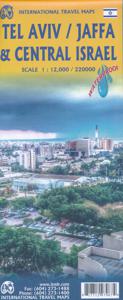
Een kaart die naast het wegennet en plaatsen ook de nadruk legt op de natuurkundige aspecten van het land of gebied. Met kleur worden de verschillende hoogtelagen weergegeven, waardoor je een mooi beeld krijgt van het land. Met symbolen worden bijvoorbeeld benzinepompen aangeduid maar ook stranden. Grote plattegrond Tel Aviv op schaal 1:12.000 Op a...
13,95

Webshops met dit product

Webshop
Bezorging
Prijs

Anderen bekeken ook

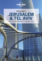
Reisgids Pocket Jerusalem and Tel Aviv | Lonely Planet
Pocket reisgidsen van Lonely Planet zijn een kleinere versie dan de 'echte' Planets. Vaak echter van bijzondere bestemmingen binnen een bepaald land waardoor er meer aandacht is en uitgebreidere tips zijn voor die bepaalde streek i.v.m. de grote Planets. Handzaam formaat, makkelijk in de binnenzak! Toch ook deze vol met praktische informatie. Lonely Planet's Pocket Jerusalem & Tel Aviv is your passport to the most relevant, up-to-date advice on what to see and skip, and what hidden discoveries await you. Gaze at the architectural magnificence of the Temple Mount / Al Haram Ash Sharif, feel the spiritual power of the Western Wall and weave between mounds of fresh produce and cafes at Mahane Yehuda Market - all with your trusted travel companion. Get to the heart of Jerusalem & Tel Aviv and begin your journey now! Inside Lonely Planet's Pocket Jerusalem & Tel Aviv: Full-colour maps and images throughout Highlights and itineraries help you tailor your trip to your personal needs and in…
12,95
Reisgids Eyewitness Top 10 Israel and the Palestinian Territories | Dorling Kindersley
Kleine, rijk geillustreerde reisgids over Israel. Met alle hoogtepunten, bezienswaardigheden, activiteiten, praktische tips, eet & drink aanrader. Inclusief handige kaartjes.Engelstalig! An unbeatable, pocket-sized guide to Israel and Petra, packed with insider tips and ideas, colour maps, top 10 lists, and a laminated pull-out map - all designed to help you see the very best of Israel and Petra.   Visit the Western Wall, explore Temple Mount, spend some time in Bethlehem or experience the famous waters of the Dead Sea. From Top 10 beaches to the Top 10 museums - discover the best of Israel and Petra with this easy-to-use travel guide.   Inside Top 10 Israel and Petra: - Eight easy-to-follow itineraries, perfect for a day trip, a weekend or a week - Top 10 lists showcase Israel and Petra's best attractions, covering Tel Aviv-Jaffa, Hairfa, Petra, the Western Wall, Bethlehem and more. - Free laminated pull-out map of Israel and Petra, plus five colour neighbourhood maps - In-de…
13,50
Reisgids Eyewitness Travel Jerusalem, Israel and the Palestinian Territories | Dorling Kindersley
Prachtig geillustreerde reisgids met o.a. 3D tekeningen, fraaie kaarten en geweldige foto’s. Daarnaast uitgebreide achtergrondbeschrijvingen. Echt om in de stemming te komen! De engelstalige versie van de Capitool Reisgids. Infused with a fascinating mix of cultural influences, sacred sites and ancient ruins, you'll be itching to book a trip to Jerusalem! This updated travel guide brings Jerusalem, Israel and the Palestinian territories to life, transporting you to a landscape of dramatic desert outcrops and Mediterranean beaches that have enchanted visitors since the dawn of civilization. Discover serene sacred sights and bustling Bauhaus boulevards. This updated eyewitness travel guide includes: - Our pick of Jerusalem, Israel and the Palestinian Territories' must-sees, top experiences, and hidden gems - The best spots to eat, drink, shop and stay - Detailed maps and walks make navigating the region easy - Easy-to-follow itineraries - Expert advice: get ready, get around and stay s…
22,50
Stadsplattegrond Jerusalem - Jeruzalem | Borch
Borch Jerusalem is een duidelijke, geplastificeerde plattegrond van het centrum met informatie over openbaar vervoer en bezienswaardigheden. Inclusief straatnamenregister.   Jerusalem 1:8 000, Bethlehem 1:11 000, Greater Jerusalem 1:30 000, Central Israel 1:400 000, Dome of the Rock, Holy Sepulchre, The Middle East administrative & Time Zones   Our soft-laminated folded map of Jerusalem shows: Jerusalem 1:8 000, Bethlehem 1:11 000, Greater Jerusalem 1:30 000, Central Israel 1:400 000, Dome of the Rock, Holy Sepulchre, The Middle East administrative & time zones and Top 30 Sights. Borch maps are easy to fold, durable and water-repellent with a wipeable surface. Borch Maps show hotels, museums, monuments, markets, public transport, top sights and points of interest, useful statistics, conversion charts for temperatures, weights and measurements, climate charts showing temperatures, sunshine hours, precipitation and humidity, overview maps, time zones, and much more...   One of the most f…
10,25
Reisgids Israel | Bradt Travel Guides
Voor vele landen net zo goed, zo niet beter dan de Planet. Beduidend soberder uitgevoerd, maar ook met veel informatie voor backpackers en met veel kaartmateriaal. Een aanrader! This new third edition of Bradt's Israel has been fully updated to reflect all the most recent changes and includes a comprehensive and detailed history section, plus improved maps and structural revisions to aid navigation. Israel is a land where three world religions - Judaism, Christianity and Islam - meet in stunning landscapes, where ancient architecture stands next to modern, where the fertile north spills into the arid southern desert and where the secular live alongside the devout. From its ancient history and the sacred Jewish, Christian and Muslim sites of Jerusalem, to modern Tel Aviv with its trendy districts, countless museums and bustling markets, Israel has a lot more to offer than meets the eye. In Bradt's Israel you'll find tips on the top hotels and restaurants, details of local wines, fascina…
22,50
Wegenkaart - landkaart Palestine & Jerusalem - Palestina | ITMB
This is a new title for ITMB and the first time a separate map for that portion of the area known as Palestine and controlled by Palestinians has been published. This is essentially an attempt to show a political reality that exists, in that no one denies that both the West Bank and the Gaza Strip exist, albeit as a tightly-controlled entity that is not a country in the traditional sense of the word but is, nonetheless the homeland of millions of people and a self-governing entity. Jerusalem has been shown as an entity, without a border, in order to emphasize its importance as a unifying point of three great religions. Barricades do exist within the city, but these exist mostly to prevent clashes and reduce frictions, and we prefer to concentrate our hopes for Jerusalem as a future symbol of unity. Geographically, to fit both the southerly Gaza Strip area and the northerly West Bank portion together, it has been necessary to include large portions of Israel proper. The border has been …
13,95
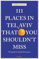
Reisgids 111 places in Tel Aviv That You Shouldn't Miss | Emons
Tel Aviv is known for two things above all: its Bauhaus architecture and its nightlife. Both are wonderful, but represent only a small part of this many-faceted city. Often called the Big Orange, for many people this white city on the sea is a synonym for innovation and diversity, but in many ways it is astonishingly provincial, orderly and family-friendly. Tel Aviv has classic sights to see. If you want to get to know the city really well, you simply have to walk its streets. 111 Places in Tel Aviv That You Shouldn't Miss shows you the way. The ultimate insider's guide to Tel Aviv Features interesting and unusual places not found in traditional travel guides Part of the international 111 Places/111 Shops series with over 250 titles and 1.5 million copies in print worldwide Appeals to both the local market (almost 433,000 people call Tel Aviv home) and the tourist market (2.3 million people visit Tel Aviv every year!) Fully illustrated with 111 full-page colour photographs
18,50
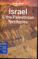
Reisgids Israël & the Palestinean Territories - Palestina | Lonely Planet
De perfecte reisgids voor zowel de georganiseerde als de zelfstandige reiziger. Naast een algemene inleiding van het land / streek vol met praktische informatie over hoe je er het beste kunt reizen: slapen, eten, vervoer, excursies ... alles kun je er in vinden. Engelstalig. Lonely Planet At the intersection of Asia, Europe and Africa – both geographically and culturally – Israel and the Palestinian Territories have been a meeting place of cultures, empires and religions since history began. Lonely Planet will get you to the heart of Israel & the Palestinian Territories, with amazing travel experiences and the best planning advice.   Lonely Planet’s Israel & the Palestinian Territories is your passport to the most relevant, up-to-date advice on what to see and skip, and what hidden discoveries await you. Walk amongst the ruins of ancient Jericho; take an early morning walk up to the Temple Mount for a breathtaking view of the Dome of the Rock; float in the briny waters of the Dead S…
23,95
Stadsplattegrond Jerusalem & Holy Land - Jeruzalem en Noord Israël | ITMB
Een goede kaart van Jeruzalem en op de andere zijde noord- Israel met een schaal van 1:225.000, gedrukt op scheur- en watervast papier. Let op: de index van de kaart bevat plaatsnamen van geheel Israël en bevat zodoende plaatsnamen die niet op deze kaart staan. Jerusalem is an ancient city and also a religious centre, revered by Christians and Muslims alike. Lan and I visited the city in January and updated minor changes to the old walled city. We also wanted to change the regional map, but not its coverage or content, so we changed its name to Holy Land, on the assumption that the market for this map rests with pilgrims and those following well-known Biblical place names: the Sea of Galilee, Bethlehem, Nazareth etc. On our trip, we also discovered Agamemnon, which I'd believed to be mythological, and the crusader fortress of Acre, on the coast. Israel/Palestine offers so much more than 'just' Jerusalem that a map of this nature is essential for anyone visiting this part of the world. …
13,95
Wegenkaart - landkaart 3208 Adventure Map Israel | National Geographic
Wegenkaart van Isreal met vermelding van veel bezienswaardigheden, nationale parken en attrakties. Watervast en scheurvast. Juist door deze vermeldingen onderscheidt de kaart zich van andere wegenkaarten. National Geographic's Israel Adventure Map is designed to meet the unique needs of adventure travelers with its durability and accurate information. This folded map provides global travelers with the perfect combination of detail and perspective, highlighting hundreds of points of interest and the diverse and unique destinations within the country.   The map includes the locations of cities and towns with a user-friendly index, plus a clearly marked road network complete with distances and designations for major highways, main roads, and tracks and trails for those seeking to explore more remote regions. The front side of the Israel map details the northern region of the country, from its border with Lebanon to the north, to Syria and Jordan to the east and the Mediterranean Sea to th…
17,50

Klanten-reviews van Wegenkaart - landkaart Tel Aviv - Jaffa en Centraal Israel | ITMB

Er zijn nog geen beoordelingen voor dit productBen jij de eerste die een review plaatst?

Meer over Wegenkaart - landkaart Tel Aviv - Jaffa en Centraal Israel | ITMB

Productomschrijving

Een kaart die naast het wegennet en plaatsen ook de nadruk legt op de natuurkundige aspecten van het land of gebied. Met kleur worden de verschillende hoogtelagen weergegeven, waardoor je een mooi beeld krijgt van het land. Met symbolen worden bijvoorbeeld benzinepompen aangeduid maar ook stranden. Grote plattegrond Tel Aviv op schaal 1:12.000 Op andere zijde kaart van Centraal Israel op schaal 1:220.000 This map resulted from our visit to Israel a couple of years ago. We got lost in Tel Aviv and wasted a lot of time trying to find our way to where we were staying. Although quite good maps of Tel Aviv exist, most are in Hebrew and are very "Israeli". We decided to do a map that combined the newish city of Tel Aviv with its older and more exotic neighbour, Jaffa, which is currently dominated by those of a non-Jewish orientation. Jaffa is the ancient port used by Phoenicians, Greeks, Romans, and traders plying the Silk Road to China. Its old town is quite compact and a treat to explore. Tel Aviv is the practical capital of Israel, despite Trump's attempt to inflame passions by saying he will move the US embassy to Jerusalem. Israel is always a high-explosives-on-a-short-fuse kind of country; lovely to visit, but stressful. Tel Aviv is a cultured and sensible Mediterranean city with gorgeous beaches, modern buildings, and a feeling of prosperity. We found it to be a 'normal' city in comparison to other parts of the country that we visited. The other side of the sheet forms a detailed map of the central portion of Israel, from Haifa to Beersheba to the Dead Sea, so includes the West Bank and the Gaza Strip as well as Jerusalem, Bethlehem, Nazareth, the Sea of Galilee, and most sites of a religious nature, so satisfies pilgrims as well as the explorer. My favourite site was Acre, now called Akko, which is still a walled city.   
Webshop.nl maakt gebruik van cookies. Ga je verder op onze website, ga dan akkoord met het plaatsen van cookies en de verwerking van deze data door ons en vermelde partners.