webshop.nl
Categorieën
  Sluiten

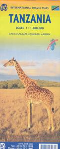
Wegenkaart - landkaart Tanzania | ITMB

Uitstekende wegenkaart van Tanzania met zowel de toeristische informatie als Nationale Parken en bezienswaardigheden, maar ook de topografische details als plaatsen en wegen, spoorlijnen en rivieren, hoogten, lengte- en breedtegraden. An easy-to-use road and geographical map of Tanzania to plan your trip, to prepare your itinerary, and to travel in...
14,95

Webshops met dit product

Webshop
Bezorging
Prijs

Anderen bekeken ook

Wandelkaart Kilimanjaro en wegenkaart Noord Tanzania | ITMB
Wandelkaart van het National Park Kilimajaro met wandelroutes .ITMB has been publishing a map of Mount Kilimanjaro for fifteen years! This 4th edition includes an exceptional value-added map of Northern Tanzania and Southern Kenya that should prove to be very useful to end users, who can now use one map from landing in Nairobi or Dar to reach the mountain park, travel the Serengeti all the way to Lake Victoria, and loop back to Dar es Salaam via the new highway through Dodomo. Inset maps of Arusha, Dar, and Stone City in Zanzibar are included. This new map is issued without increasing the price! Legend Includes: Roads by classification, Airports, Points of Interest, Ports, Borders crossings, Hospitals/Medical Facilities, Viewpoints/Forts, Mines, Ruins/Archaelogical Sites, Information Centres, Museums, Campsites/Huts, Hotels/Motels, World Heritage Sites, Lodges, Missions, Ferries, Elevation Spots, Beaches/Dinving spots, Shipwrecks/Ligthouses, National Parks, Wetland/Swamp, Coral Reef, M…
13,95
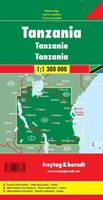
Wegenkaart - landkaart Tanzania | Freytag & Berndt
Prima wegenkaart - landkaart van Tanzania, nu met een nieuwe schaal van 1:1.300.000. Met uitgebreide legenda zodat campings, tankstations, bezienswaardigheden en dergelijke staan aangegeven. Explore Tanzania with this Freytag & Berndt road map. The best way to plan your trip, prepare your itinerary, and to travel independently in this country.   This map includes an index on the back, and touristic information on this map includes accommdation, international airports, museums, places of particular interest, antique sites and river/canal systems.
14,95
Reisgids Handbook Kilimanjaro & Northern Tanzania | Footprint
Kleine versie van de grotere Handbooks serie van Footprint, daardoor een stuk handzamer voor wie zich beperkt to dit bepaalde gebied. Nog altijd vol met goede tips, veel praktische informatie en handige kaartjes. From the snow-capped beauty of Mount Kilimanjaro, Africa's highest mountain, to the vast plains of the Serengeti, the north of Tanzania offers enormous diversity. Whether you're spotting the Big Five on safari, trekking spectacular peaks or exploring the incredible Ngorongoro Crater, Footprint's Kilimanjaro & Northern Tanzania Handbook covers all the top attractions in this fascinating region, plus tips for escaping the crowds and getting off the beaten track. Practicalities section with essential advice on getting there and around. Highlights map & inspirational color section, so you know what not to miss. Comprehensive listings including where to eat, sleep and relax - whatever your budget. Detailed street maps for Dar es Salaam, Arusha and other key locations & national par…
15,50
Wegenkaart - landkaart Ierland | ITMB
As technology improves, we are able to produce more detailed maps than was previously possible. Such is the case with Ireland, a part of the world consisting of two countries divided by religion and history. Preparing a map of Ireland as a double-sided map means cutting the island into two geographic portions. Side 1 covers the northern half. This includes the portion known as Northern Ireland, or Ulster, and a fair portion of the Republic of Ireland, or Eire; essentially everything north of Dublin and west to Counties Mayo and Galway. Side 2 covers the southern half of the island from just north of Dublin to the outer tips of County Kerry. It also includes a nice inset map of central Dublin. Naturally, all motorways and roads are included, as are touristic attractions, camping/caravan sites, ferry terminals, and Top Attractions. This is a very detailed travel map of the island, printed on waterproof paper for durability. We had great fun driving around Ireland researching this map. It…
14,95
Wegenkaart - landkaart Great Britain - Engeland - Schotland | ITMB
  Een degelijke kaart met aanduidingen van o.a. nationale parken, vliegveld, benzinepomp, dirt-roads en kleine plattegrond van hoofdstad. Als overzichtskaart goed te gebruiken.   This is the third set of artwork for Great Britain that we have published and the first that is completely our own artwork (the previous versions were joint ventures). In mapping, as in life, one has to differentiate between the political entity known as the United Kingdom and the geo-political reality of Greater Britain, which includes the Channel Islands, the Isle of Man, and various assorted entities that are loosely attached to the UK by history. We have tried, in this edition, to combine a detailed road map with a touristic sites map. Given that Britain is both densely covered by thousands of narrow laneway passing themselves off as sub-B level roads and by having the greatest treasure trove in the world of castles, manor houses, gardens, museums, and interesting places worth visiting, and the task of por…
13,95
Wegenkaart - landkaart Jersey - Guernsey - Sark - Alderney (Kanaaleilanden) | ITMB
Goede detailkaart van alle kanaaleilanden. Het is zo gedetailleerd dat zelfs straatnamen er op staan. De kaart is ook nog eens geplastificeerd en daarmee scheur- en watervast.  ITMB is pleased to re-introduce the Channel Islands map area after a lengthy hiatus of preparing new artwork. The first version of this part of Europe was licensed artwork by a local firm in Jersey, and upon running out of copies of the printed map, we opted to prepare fresh artwork of our own to continue this interesting corner of the continent to continue to be available. The islands, collectively known in English as the Channel Islands, are one of those anomalies that make Europe so attractive. They are part of Great Britain, but not part of the UK; hence, they are not part of the EU. They are self-governing entities ‘owned’ by the Queen in her role of being Duchess of Normandy. This is, of course, merely a hereditary situation, but the islands were the personal possessions of William the Conqueror in 1066, a…
13,95
Wegenkaart - landkaart Africa north east - noord oost Afrika | ITMB
This is the third ITMB title on Africa to be released using our digital data base material. As with Africa as a continental map and Africa North West, this map covers a large area and tries to do so fairly and in detail. The essential areas of coverage are Libya and Egypt in the north, with Sudan/South Sudan, Ethiopia/Eritrea in the middle, and Kenya/Uganda in the south, with a fair portion of Tanzania and Congo thrown in simply because it fits. Being a regional map, it is useful for the 'big' picture. It is quite detailed, showing roads, towns, and major touristic sites. It is more detailed and at a better scale than the Michelin map of the same name   Legend Includes: Road by classification, Main Road, National Park, Lake, Capital, International Airport, Oasis, Ruins, Hotels and much more...
13,95
Wegenkaart - landkaart Seychellen & Indische Oceaan | ITMB
Aan de ene kant een degelijke kaart van de Seychellen, schaal 1:45.000, met aanduidingen van o.a. nationale parken, vliegveld, benzinepomp, dirt-roads. As overzichtskaart goed te gebruiken. Aan de andere kant een overzicht van de Indische oceaan, schaal 1:10.000.000   This is actually two brand new maps in one.  This is a brilliant new map of the Seychelles archipelago and a first-ever map of the entire Indian Ocean. The islands of the Seychelles are too widely-spaced to portray except by as a series of ten insets. The main island is Mahe, which also houses the capital of Victoria (inset provided) and numerous resorts. Many of the islands have French names, reflecting the colonial to-and-fro that typified relations between Britain and France. Praslin, Curiuse, Falicite, La Digue, and Desroches are not names that bring immediate recognition, but they are the names of islands belonging to the Seychelles. The map shows dozens of resorts, as well as restaurants, touristic sites, historic s…
13,95
Wegenkaart - landkaart England & Wales - Engeland | ITMB
Een degelijke kaart met aanduidingen van o.a. nationale parken, vliegveld, benzinepompen. ITMB publishes a map of Great Britain, but each portion of GB needs its own map to show roads and attractions in more detail. This is a brilliant map of both England and Wales, showing the entire 'country' in a double-sided format. The place names index is formidable, but England in particular is a series of little villages, so it has been very difficult to decide what to include and what to leave out. This map is showing motorways, divided carriageways, all A & B highways, railway lines, airports, historic sites and touristic attractions, parks and gardens, and just about everything that we could fit on to the page to provide users with a detailed, usable map. We have been able to fit all of southern England/Wales as far north as Chester/Lincoln on side A and with a little overlap, from those cities north to the well over the Scottish border, up to Perth/Dundee filling side B. The Isle of Man and…
13,95
Wegenkaart - landkaart Litouwen & Letland | ITMB
ITMB is very pleased to release its first-ever map of the Baltic country of Lithuania, which occupies Side 1 of this double-sided map. It is bordered by Latvia on its north, the Russian enclave of Kalingrad on its southeast, and Poland and Belarus on its south and east. It is now on the front lines of tension between Russia and its neighbours, as are all the Baltic states. It is also a valued member of both NATO and the EU, and as such is easy to access from either Poland or Latvia. Lithuania fronts on to the Baltic Sea with a major port at Klaipeda (formerly Memel), with its capital being Vilnius. Historically, the country has suffered German and Russian invasions during the 20th century, the last of which resulted in the country losing its independence completely by being absorbed into the Russian Empire in the latter stages of WW2. It regained its independence in 1991, with the collapse of the USSR and shortly thereafter applied to join both the European Union and NATO. Touristicall…
14,95

Klanten-reviews van Wegenkaart - landkaart Tanzania | ITMB

Er zijn nog geen beoordelingen voor dit productBen jij de eerste die een review plaatst?

Meer over Wegenkaart - landkaart Tanzania | ITMB

Productomschrijving

Uitstekende wegenkaart van Tanzania met zowel de toeristische informatie als Nationale Parken en bezienswaardigheden, maar ook de topografische details als plaatsen en wegen, spoorlijnen en rivieren, hoogten, lengte- en breedtegraden. An easy-to-use road and geographical map of Tanzania to plan your trip, to prepare your itinerary, and to travel independently in this African country. This double-sided map contains a place name index, inset maps of Dar es Salaam, Arusha and Stone Town. The legend is in English. Touristic information: places of interest, vistas, ruins and archaeological sites, museums, Unesco World Heritage sites, hotel/motel, campsites, ferry lines, ports, airports, national parks, petrol stations, hospitals and médical facilities, border crossing.
Webshop.nl maakt gebruik van cookies. Ga je verder op onze website, ga dan akkoord met het plaatsen van cookies en de verwerking van deze data door ons en vermelde partners.