webshop.nl
Categorieën
  Sluiten

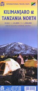
Wandelkaart Kilimanjaro en wegenkaart Noord Tanzania | ITMB

Wandelkaart van het National Park Kilimajaro met wandelroutes .ITMB has been publishing a map of Mount Kilimanjaro for fifteen years! This 4th edition includes an exceptional value-added map of Northern Tanzania and Southern Kenya that should prove to be very useful to end users, who can now use one map from landing in Nairobi or Dar to reach the m...
13,95

Webshops met dit product

Webshop
Bezorging
Prijs

Anderen bekeken ook

Wegenkaart - landkaart Tanzania | ITMB
Uitstekende wegenkaart van Tanzania met zowel de toeristische informatie als Nationale Parken en bezienswaardigheden, maar ook de topografische details als plaatsen en wegen, spoorlijnen en rivieren, hoogten, lengte- en breedtegraden. An easy-to-use road and geographical map of Tanzania to plan your trip, to prepare your itinerary, and to travel independently in this African country. This double-sided map contains a place name index, inset maps of Dar es Salaam, Arusha and Stone Town. The legend is in English. Touristic information: places of interest, vistas, ruins and archaeological sites, museums, Unesco World Heritage sites, hotel/motel, campsites, ferry lines, ports, airports, national parks, petrol stations, hospitals and médical facilities, border crossing.
13,95
Wegenkaart - landkaart Banff - Jasper national parks | ITMB
Gedetailleerde wegenkaart van deze 2 bekende nationale parken in Canada. Naast toerischtische informatie zjn de belangrijkste wandelpaden schetsmatig ingetekend en worden de campings weergegeven, hogtelijnen geven een goed beeld van de hoogteverschillen en bergern in het gebied.. Jasper staat op de ene kant en Banff op de andere zijde.  Banff is the first national park declared anywhere in the world, done at a time when the idea of reserving huge tracts of land for the enjoyment of future generations was an admirable, though unheard of, concept. The park in the Rocky Mountains of western Alberta remains as lovely and as enjoyable as it must have seemed to the early CPR railway surveyors searching for a route through the mountains to join the then-colony of British Columbia to Canada. Nowadays, the park is laced with roads and hiking trails, and the town of Banff within the park is severely pressed to maintain a balance between serving the needs of the millions of visitors each year and…
13,95
Wegenkaart - landkaart 3203 Adventure Map Morocco - Marokko | National Geographic
Wegenkaart van Marokko met vermelding van veel bezienswaardigheden, nationale parken en attrakties. Watervast en scheurvast. Juist door deze vermeldingen onderscheidt de kaart zich van andere wegenkaarten. National Geographic's Morocco Adventure Map is designed to meet the unique needs of adventure travelers—detailed, durable, and accurate. Morocco includes the locations of thousands of cities and towns with an index for easily locating them, plus a clearly marked road network complete with distances and designations for motorways, dual carriageways, major roadways, and more. Transportation within and beyond the country is made easier with the location of airports, airfields, railroads, ferry routes, river crossings, lighthouses, harbors, border crossings, and petrol stations. What sets National Geographic Adventure Maps apart from traditional road maps are the hundreds of points of interest that highlight the diverse, unique, and exotic destinations within Morocco. In addition to typi…
17,50
Wegenkaart - landkaart Jasper National Park & Northern Alberta | ITMB
  Jasper National Park kaart, zeer gedetailleerd (schaal 1:250.000) plus op de anderekant van de kaart staat Noord Alberta, schaal 1:1.000.000. Natuurkundige overzichtskaart met veel plaatsen en wegen, spoorlijnen en rivieren, hoogten, lengte- en breedtegraden.   Two words immediately come to my mind if I were to describe Northern Alberta: Oil and Cold. Oil sands could be found relatively easily within the Northern Alberta region. This pushes the Canadian economy forward as gasoline and other petroleum products are becoming higher in demand. Northern Alberta is also about the subzero temperature. The region of Northern Alberta mostly contains very cold, long winters and warm, short summers. Fort McMurray, for example, one of the famous urban communities located in the Wood buffalo municipality, has only a yearly mean temperature of 0.7 degrees Celsius. Nonetheless, Northern Alberta is also a land of recreation activities and wild adventures. On the other side of the Northern Alberta m…
13,95
Wegenkaart - landkaart Sierra Nevada | National Geographic
&; Waterproof &; Tear-Resistant &; Travel Map   National Geographic's Sierra Nevada Destination Map strikes the perfect balance between map and guidebook and is an ideal resource for touring the rugged landscape of this culturally and geographically unique region of California and Nevada.   The front side of the print map reveals a detailed map of the region stretching from the Oregon border to California's Eldorado National Forest, bordered by the Sacramento Valley to the west and Nevada's Great Basin to the east. Modoc, Shasta-Trinity, Lassen, Plumas, and Humbolt-Toiyabe National Forests are also included on the map. The map features a comprehensive road network including scenic byways as well as areas of interest such as Indian Reservations, National Parks and Monuments, and Recreation Areas. Trails, historic sites, museums, cultural centers, scenic areas, state parks and other points of interest are also included. In addition, the map features beautiful photographs and informat…
17,50
Wegenkaart - landkaart Montana & Idaho | ITMB
Een degelijke kaart met aanduidingen van o.a. nationale parken, vliegveld, benzinepompen. ITMB is pleased to release two more state maps, this time of Montana on one side, and adjacent Idaho on the other side. Montana prides itself on being the ‘blue sky’ state. Due to its high elevation, the sky does appear to be a darker shade of blue than is common in areas closer to the ocean. The state is lightly populated, so much of its attractiveness rests with natural features, such as Glacier National Park on the Canadian border, and Yellowstone National Park on the Wyoming border. The state is also perfect camping country, and our map includes dozens of authorized campsites. It also includes the national heritage site of Little Big Horn, where Lt. Colonel Custer and the US 7th Cavalry were massacred after foolishly attacking a vastly larger encampment of Sioux and Cheyenne first nations people under the leadership of Sitting Bull. The second side of the map portrays the State of Idaho, an eq…
13,95
Wegenkaart - landkaart 8 Table Mountain and Cape Peninsula - Kaapstad | MapStudio
Wegenkaart van een deel van Zuid Afrika met inzetten van de meest belangrijke gebieden. Het overzicht is soms misschien een beetje onduidelijk. maar de details in de inzetten en delen van de kaart zijn prima en voldoen goed voor het rondrijden met een eigen auto. Table Mountain Road Map and Cape Peninsula includes an illustrated terrain map of Table Mountain at a scale of 1:50 000. Detailed street map of the city centre including access points to trails, hikes and routes, major and minor roads of the entire Cape Peninsula. Also includes detailed activities map of Cape Town & the Peninsula.   This Table Mountain Road Map and Cape Peninsula also include full-colour photographs of activities and areas of interest, national parks and reserves, protected areas and marine reserves, lighthouse and shipwreck positions, mountain biking access areas.   Also found in this Table Mountain Road Map and Cape Peninsula is entrance gates and good swimming beaches, visitor centres, best viewpoints and h…
16,95
Wegenkaart - landkaart 3300 Adventure Map Finland & Northern Scandinavia - Finland en noord Scandinavië | National Geographic
Wegenkaart van Finland en noord Scandinavië met vermelding van veel bezienswaardigheden, nationale parken en attrakties. Watervast en scheurvast. Juist door deze vermeldingen onderscheidt de kaart zich van andere wegenkaarten. National Geographic's Finland and Northern Scandinavia Adventure Map is designed to meet the unique needs of adventure travelers with its detail, durability, and accuracy. Scandinavia North includes the locations of thousands of cities and towns with an index for easily locating them, plus a clearly marked road network complete with distances and designations for expressways, motorways, and more. What sets National Geographic Adventure Maps apart from traditional road maps are the hundreds of points of interest that highlight the diverse and unique destinations within northern Scandinavia. World Heritage sites, museums, amusement parks, zoos, castles, archeological sites, churches, and more are included, making it invaluable to travelers hoping to experience all …
17,50
Wegenkaart - landkaart 3309 Sardinia - Sardinië | National Geographic
Wegenkaart van Sardinië, Italië met vermelding van veel bezienswaardigheden, nationale parken en attrakties. Watervast en scheurvast. Juist door deze vermeldingen onderscheidt de kaart zich van andere wegenkaarten.   Sardinia Adventure Map is designed to meet the unique needs of adventure travelers—detailed, durable, and accurate. Sicily includes the locations of thousands of cities and towns with an index for easily locating them, plus a clearly marked road network complete with distances and designations for highways, major roadways, and more. What sets National Geographic Adventure Maps apart from traditional road maps are the hundreds of points of interest that highlight the diverse and unique destinations within Sardinia. World Heritage sites, museums, monuments, archeological sites, fortresses, churches, castles and more are included, making it invaluable to travelers hoping to experience all the history, art, and culture the region has to offer. Beaches, harbors, and popular sur…
17,50
Wegenkaart - landkaart Benelux - Nederland, België en Luxemburg | ITMB
Een degelijke wegenkaart met aanduidingen van o.a. nationale parken, vliegveld, benzinepomp, dirt-roads. Als overzichtskaart goed te gebruiken.   This is a double sided map with Netherlands & Belgium on 1 side. The Belgium portion occupies other shared with Luxembourg. The map has two covers, one side saying Belgium and Luxembourg, with a cover picture of a town square, and the other side says Netherlands and Belgium, with a cover picture of a windmill. The map's artwork is completely new and different from the previous edition, and much more in keeping with ITMB's style for Europe. Motorways are in blue, main roads in green, and other roads in red casing. Road distances between points are noted, as well as motorway rest areas, and touristic sites such as windmills, noteworthy churches, and camping areas. Height elevations are minimal, but park areas have been shown. The border portion of France is also included, as well as appropriate border portions of Germany. The 'Low Countries' ar…
13,95

Klanten-reviews van Wandelkaart Kilimanjaro en wegenkaart Noord Tanzania | ITMB

Er zijn nog geen beoordelingen voor dit productBen jij de eerste die een review plaatst?

Meer over Wandelkaart Kilimanjaro en wegenkaart Noord Tanzania | ITMB

Productomschrijving

Wandelkaart van het National Park Kilimajaro met wandelroutes .ITMB has been publishing a map of Mount Kilimanjaro for fifteen years! This 4th edition includes an exceptional value-added map of Northern Tanzania and Southern Kenya that should prove to be very useful to end users, who can now use one map from landing in Nairobi or Dar to reach the mountain park, travel the Serengeti all the way to Lake Victoria, and loop back to Dar es Salaam via the new highway through Dodomo. Inset maps of Arusha, Dar, and Stone City in Zanzibar are included. This new map is issued without increasing the price! Legend Includes: Roads by classification, Airports, Points of Interest, Ports, Borders crossings, Hospitals/Medical Facilities, Viewpoints/Forts, Mines, Ruins/Archaelogical Sites, Information Centres, Museums, Campsites/Huts, Hotels/Motels, World Heritage Sites, Lodges, Missions, Ferries, Elevation Spots, Beaches/Dinving spots, Shipwrecks/Ligthouses, National Parks, Wetland/Swamp, Coral Reef, Marine Reserves, Game Reserve Areas, Conservation Areas, and more.
Webshop.nl maakt gebruik van cookies. Ga je verder op onze website, ga dan akkoord met het plaatsen van cookies en de verwerking van deze data door ons en vermelde partners.