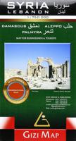
Wegenkaart - landkaart Syria and Libanon - Syrië | Gizi Map

0
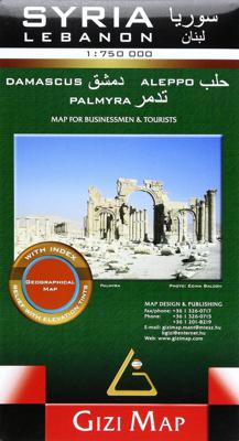
Geographical map of Syria and Lebanon edited by Gizi Map. This detailed map presents topography, country road infrastructure and oil / gas pipelines. It includes inserts in the area of Damascus and Aleppo, as well as the streets of the streets of these two cities. This map also covers Lebanon and the border areas of neighboring countries (to the s...

Verkopers met dit product

Verkoper
Bezorging
Prijs
DeZwerver.nl logo
DeZwerver.nl
2,95
15,95

Anderen bekeken ook

Wegenkaart - landkaart Syria and Libanon - Syrië | Gizi Map
Geographical map of Syria and Lebanon edited by Gizi Map. This detailed map presents topography, country road infrastructure and oil / gas pipelines. It includes inserts in the area of Damascus and Aleppo, as well as the streets of the streets of these two cities. This map also covers Lebanon and the border areas of neighboring countries (to the south of Jerusalem and Amman). The road network includes local slopes and desert roads. Railways and local airports are marked. Indication of points of interest, interesting natural sites, etc. The names of the provinces of Syria and large cities are also presented in the Arabic alphabet. Index of cities on the back. Multilingual legend including English and Arabic.
15,95
Wegenkaart - landkaart Syrien - Libanon | Reise Know-How Verlag
Tweetalige kaart van Syrië en Libanon, inclusief plattegronden van Aleppo, Damascus en Palmyra (Engels en Duits). Door ingetekende lengte- en breedtegraden is het gebruik van GPS mogelijk. Met hoogtelijnen en uitgebreid wegennetwerk: daarnaast worden ook de afstanden tussen belangrijke plaatsen duidelijk leesbaar weergegeven. Het kleurgebruik is zodanig dat je een goede indruk krijgt van hoogteverschillen en soorten landschap. Natuurlijk staan de toeristische bezienswaardigheden duidelijk vermeld.   Gedrukt op water- en scheurvast papier! Polyart is een synthetisch product vrij van giftige stoffen dus duurzaam. Het papier gaat echt lang mee.   Topography is indicated by altitude colouring with numerous spot heights and names of mountain ranges and passes. Salt lakes, swamps, seasonal rivers and glacier are also shown. Detailed presentation of the road network includes minor roads and tracks and railways are also shown.   Internal administrative units are presented with their boundarie…
11,50
Wegenkaart - landkaart Lybië - Libya | Gizi Map
Libya at 1:1,750,000 on an indexed road map from Gizi Map with exceptionally fine and detailed presentation of its physical geography, oil and gas wells and pipelines, water aqueducts, ancients sites and other places of interest, etc. Names of larger towns and selected smaller locations, as well as of many topographic features are also shown in Arabic.   The map provides a very fine presentation of the country’s geography through relief shading and graphics for sandy or stone deserts, swamps, salt flats, oasis, and water wells, plus numerous spot heights and plenty of names of mountain ranges, wadis, etc. Road network shows desert tracks and gives distances on main routes. Railway lines are included and domestic airports/aerodromes are marked. The map also shows oil or gas wells and pipelines, water aqueducts and boundaries of administrative provinces. Symbols indicate locations with campsites or youth hostels, various places of interest including archaeological sites and natural curi…
15,95
Wegenkaart - landkaart Ukraine - Moldova | Gizi Map
Kaart van Oekraïne met Moldavië, met een uitbreiding met de Krim in meer detail, plus plattegronden van het centrum van Kiev en Lviv. Wegennet is ingedeeld in zes typen, rij-afstanden aangegeven op hoofd-en secundaire routes, en verder worden grensovergangen weergegeven. Ukraine with Moldova on an indexed road map at 1:1,100,000 from Gizi Map, with an enlargement showing southern Crimea in greater detail, plus street plans of central Kiev and Lviv. All place names are shown transliterated into Latin alphabet, with those of major cities also given in their Cyrillic versions. Altitude colouring with relief shading indicates the mountainous regions, with the marshlands of northern Ukraine also marked. National parks and other protected areas are highlighted. Road network is graded into six types, driving distances are marked on main and secondary routes, and border crossings are shown. Railway lines, ferry routes on the Black Sea and Azov Sea, and local airports are included. Symbols hig…
15,95
Wegenkaart - landkaart Algeria - Algerije | Gizi Map
Mooie, duidelijke kaart van Algerije met plaatsnaamaanduiding in het Engels en het Arabisch. A detailed general map with relief depicted by vivid elevation tinting. The map is indexed and selected location names are written in Arabic as well as standard roman text. Coverage includes neighbouring Tunisia and most of Morocco. Terrain features such as sand deserts, stone deserts, salt flats, water holes and swamps are distinguished, and selected peak heights are indicated. Bathymetric tinting is also applied. Several categories of roads are distinguished, including selected tracks, with intermediate driving distances marked on many routes. Railways, oil and gas piplines, and administrative boundaries are drawn and symbols denote oil and gas production sites, airports, ports, places of worship, campsites, hostels, beach resorts, oases, lighthouses, forts, museums, UNESCO sites and other antiquities and sites of interest. Lines of latitude and longitude are drawn at 1° intervals. The multi…
15,95
Reisgids Libanon - Lebanon | Bradt Travel Guides
Vergelijkbare gids met de Lonely Planet, wat soberder uitgevoerd, maar veelal meer informatie. This new, thoroughly updated third edition of Bradt’s Lebanon remains the only English-language guide dedicated to the smallest country on the Asian continent. Comprehensively updated throughout to reflect recent economic, political and social changes, it includes revised and new listings for hotels, restaurants, and what to see and do, catering for all types of travellers and budgets. Although only half the size of Wales, Lebanon offers extraordinary diversity. Some of the world’s oldest human settlements, including the Phoenician ports of Tyre and Byblos – two of Lebanon’s five World Heritage sites – sit alongside modern Beirut. The absorbing capital is popular for its world-renowned cuisine, eclectic nightlife, mosaic of peoples and kaleidoscope of religions. In Lebanon’s second city, Tripoli, busy medieval souks are watched over by a vast Crusader castle. Nearby, snow-capped mountains …
26,50
Wegenkaart - landkaart Algeria - Algerije | Gizi Map
A detailed general map with relief depicted by vivid elevation tinting. The map is indexed and selected location names are written in Arabic as well as standard roman text. Coverage includes neighbouring Tunisia and most of Morocco. Terrain features such as sand deserts, stone deserts, salt flats, water holes and swamps are distinguished, and selected peak heights are indicated. Bathymetric tinting is also applied.   Several categories of roads are distinguished, including selected tracks, with intermediate driving distances marked on many routes. Railways, oil and gas piplines, and administrative boundaries are drawn and symbols denote oil and gas production sites, airports, ports, places of worship, campsites, hostels, beach resorts, oases, lighthouses, forts, museums, UNESCO sites and other antiquities and sites of interest. Lines of latitude and longitude are drawn at 1° intervals. The multilingual legend includes English and Arabic. A wallmap version of this map is also available…
15,95
Wegenkaart - landkaart Kaukasus - Caucasus | Gizi Map
  The Caucasus at 1:1,000,000 from Gizi Map, presenting the region in a road edition with relief shading to show its topography and make the road network stand out better against the background. Coverage includes the southern republics of Russia. International boundaries are clearly marked.    Within Georgia the map indicates the boundaries of South Ossetia, Abkhazia and Adjara; in Azerbaijan the border of Nagorno Karabach and the ceasefire line are marked. Coverage within Russia extends north of Krasnodar and Stavropol, with boundaries of individual republics including Chechnya, North Ossetia and Dagestan. Place names are shown in Latin alphabet, but within Georgia, Armenia and Russia larger towns are also named in local script.   Relief shading with plenty of names of geographical features such as individual mountain ranges, peaks, swamps, salt flats, etc, presents the topography. Road network is graded in six types, with driving distances on main and selected connecting routes. Rai…
15,95
Wegenkaart - landkaart Yemen - Jemen | Gizi Map
Yemen, including the Gulf of Aden, at 1:1,250,000 on an excellent and informative map from Gizi Maps, with a street plan of central Sana’a and enlargements of the environs of the capital and Aden, plus the Aden Peninsula.   The map has the publisher’s characteristic bold altitude colouring and plenty of names of various mountain chains, peaks, deserts, etc. Graphics indicate swamps, salt flats, wadis, deserts, lava flows, water wells, oasis, etc, to provide a vivid picture of the country’s topography. Names of the larger towns, provinces and many geographical features are given in both Latin and Arabic alphabets; all other place names are shown only transliterated.   Coverage extends southward to the northern coastline of the Horn of Africa, including the whole of Djibouti and most of Eritrea. Within the Gulf of Aden the Internationally Recommended Transit Corridor (IRTC) is marked, as well as other ferry and shipping routes including those leading to the Socotra Archipelago and in th…
15,95
Wegenkaart - landkaart Sudan and South Sudan | Gizi Map
Sudan and South Sudan as separate countries on an excellent indexed map at 1:2,500,000 from Gizi Maps with detailed presentation of the topography, administrative divisions, street plans of Khartoum and Juba, etc. Excellent presentation of the terrain in the publisher’s characteristic style provides a vivid picture of the region’s geography: bold altitude colouring with plenty of spot heights and names of peaks, mountain ranges, etc, plus additional graphics for flood plains, swamps, salt flats, deserts, lava fields, wadis and water wells. National parks or other protected areas and interesting natural sites are highlighted. The map indicates the boundary of the disputed Abyei area and shows the internal administrative boundaries and names of the provinces. Within North Sudan names of larger towns and of the provinces are also given in Arabic. Where appropriate, alternative versions of town names are provided (Khartoum/Al Khartum, Omdurman/Umm Durman, etc). The map shows the road n…
15,95

Klanten-reviews van Wegenkaart - landkaart Syria and Libanon - Syrië | Gizi Map

Er zijn nog geen beoordelingen voor dit productBen jij de eerste die een review plaatst?

Meer over Wegenkaart - landkaart Syria and Libanon - Syrië | Gizi Map

Productomschrijving

Geographical map of Syria and Lebanon edited by Gizi Map. This detailed map presents topography, country road infrastructure and oil / gas pipelines. It includes inserts in the area of Damascus and Aleppo, as well as the streets of the streets of these two cities. This map also covers Lebanon and the border areas of neighboring countries (to the south of Jerusalem and Amman). The road network includes local slopes and desert roads. Railways and local airports are marked. Indication of points of interest, interesting natural sites, etc. The names of the provinces of Syria and large cities are also presented in the Arabic alphabet. Index of cities on the back. Multilingual legend including English and Arabic.

Productinformatie

    Verken gerelateerde categorieën

    Webshop.nl maakt gebruik van cookies. Ga je verder op onze website, ga dan akkoord met het plaatsen van cookies en de verwerking van deze data door ons en vermelde partners.