
Wegenkaart - landkaart Sudan and South Sudan | Gizi Map

0
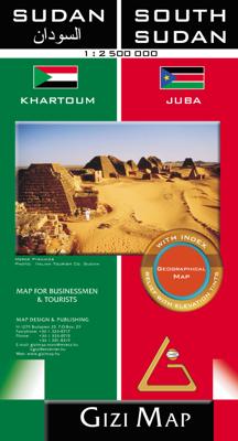
Sudan and South Sudan as separate countries on an excellent indexed map at 1:2,500,000 from Gizi Maps with detailed presentation of the topography, administrative divisions, street plans of Khartoum and Juba, etc. Excellent presentation of the terrain in the publisher’s characteristic style provides a vivid picture of the region’s geography: bold...

Alle aanbiedingen van dit product

Verkoper
Bezorging
Prijs
DeZwerver.nl logo
DeZwerver.nl
2,95
17,95

Anderen bekeken ook

Wegenkaart - landkaart Sudan and South Sudan | Gizi Map
Sudan and South Sudan as separate countries on an excellent indexed map at 1:2,500,000 from Gizi Maps with detailed presentation of the topography, administrative divisions, street plans of Khartoum and Juba, etc. Excellent presentation of the terrain in the publisher’s characteristic style provides a vivid picture of the region’s geography: bold altitude colouring with plenty of spot heights and names of peaks, mountain ranges, etc, plus additional graphics for flood plains, swamps, salt flats, deserts, lava fields, wadis and water wells. National parks or other protected areas and interesting natural sites are highlighted. The map indicates the boundary of the disputed Abyei area and shows the internal administrative boundaries and names of the provinces. Within North Sudan names of larger towns and of the provinces are also given in Arabic. Where appropriate, alternative versions of town names are provided (Khartoum/Al Khartum, Omdurman/Umm Durman, etc). The map shows the road n…
17,95
Wegenkaart - landkaart Sudan - south Sudan, Soedan | ITMB
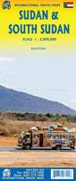
Een degelijke kaart met aanduidingen van o.a. nationale parken, vliegveld, benzinepomp, dirt-roads en kleine plattegrond van hoofdstad. Als overzichtskaart goed te gebruiken. This latest edition comes out at a time when a good map of the largest country in Africa needs a good map the most. Sudan is not a country with an improving infrastructure, nor is it one of the safest countries for travellers. However, its position in Africa makes it pivotal to the politics and ethnicity of much of northeastern Africa, and its importance can be gauged by the fact that this ITMB title is already into its third edition. It is one of the most difficult countries in the world to map, simply because so much of it is difficult to enter. We wish to dedicate this map to those brave souls who continue to provide food and medical support for all the peoples of Sudan – the humanitarians, whose contributions have made this map possible. Legend Includes: Roads by classification, international and national air…
14,95
Wegenkaart - landkaart 1 China South - China Zuid | Gizi Map
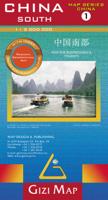
Mooie overzichtskaart van alleen Zuid China met fraai kleurgebruik voor hoogte en reliëf. De kaart is tweetalig en heeft een groot aantal plaatsen, topografisch zonder meer goed. Het gebied betreft zuid-oosten van China en Taiwan, van Nanjing en Shanghai in het noorden tot Hainan Island en het noorden van Vietnam en Laos. Bold altitude colouring, with spot heights and names of mountain ranges and other geographical features, provides an excellent picture of the terrain. The maps show various categories of roads including selected tracks, with intermediate driving distances marked on many routes. Railways, shipping and ferry lines, and local airports are also shown. Province boundaries are indicated and national parks are highlighted. Symbols marks landmarks and features such as tombs, monasteries, churches, temples, ruins, UNESCO sites including the Great Wall, and other places of interest.  
17,95
Wegenkaart - landkaart Noorwegen - Norwegen | Kümmerly & Frey
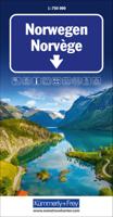
For everyone who travels around Europe frequently and needs or wants to plan his/her route in advance we recommend the Kummerly and Frey 1:750 000 road map series. These maps provide a quick overview of the travel route, indicate distances and offer information on road classes as well as being reliable travelling companions. Large, indexed map of Norway, presenting the whole country in two panels side by side.  Clear, well-presented cartography has fine relief shading and spot heights to indicate the topography, with national parks prominently marked. Detailed presentation of the road network includes scenic routes, roads closed to traffic, seasonal closures of mountain passes, etc. Towns and places of particular interest are highlighted.
15,95
Wegenkaart - landkaart St Lucia | Gizi Map
Lovely indexed road map of St. Lucia, with street plans of central Castries and the holiday complex at Anse Chastanet. Bright altitude colouring and vivid relief shading provide an excellent picture of the islands topography. Mangroves and coral reefs are marked. Road network includes minor local roads and tracks. The map also shows the country’s administrative divisions. Protected nature areas and animal watching locations are marked and the map highlights hotels and tourist accommodation, waymarked hiking trails, sites for scuba diving, watersports and deep see fishing, golf courses, various places of interest and natural curiosities, etc. The map has a 2’ latitude/longitude grid and is indexed. Also included are street plans of central Castries and the holiday complex at Anse Chastenet, plus an overview map of the southern Caribbean.  
17,95
Wegenkaart - landkaart China Administrative Map | Gizi Map
This folded, political map of China shows provinces in different colors. Map features province boundaries, major cities, airports, waterways, ports and the Great Wall. Inset of Pearl River Delta. Legend in 5 languages: English, German, French, Italian, and Chinese. Scale is 1:6.5 million. A basic political map of the country, with colours clearly distinguishing the provinces. Major towns and rivers are identified and the great wall is marked. Symbols depict airports and ports. Manes are written in Roman and Chinese script. An inset shows Hong Kong and the Pearl River Delta region at 1:1,000,000
17,95
Wegenkaart - landkaart Algeria - Algerije | Gizi Map
Mooie, duidelijke kaart van Algerije met plaatsnaamaanduiding in het Engels en het Arabisch. A detailed general map with relief depicted by vivid elevation tinting. The map is indexed and selected location names are written in Arabic as well as standard roman text. Coverage includes neighbouring Tunisia and most of Morocco. Terrain features such as sand deserts, stone deserts, salt flats, water holes and swamps are distinguished, and selected peak heights are indicated. Bathymetric tinting is also applied. Several categories of roads are distinguished, including selected tracks, with intermediate driving distances marked on many routes. Railways, oil and gas piplines, and administrative boundaries are drawn and symbols denote oil and gas production sites, airports, ports, places of worship, campsites, hostels, beach resorts, oases, lighthouses, forts, museums, UNESCO sites and other antiquities and sites of interest. Lines of latitude and longitude are drawn at 1° intervals. The multi…
17,95
Wegenkaart - landkaart Mongolia - Mongolië | Gizi Map
Tweetalige kaart A folded road map covering covering all of Mongolia, as well as parts of the surrounding countries. Subtle relief shading and spot heights show the topography. Road detail is good including many minor tracks, intermediate road distances are also shown in kilometres on the bigger roads.   Various places of interest are marked out including airports, monuments, ruins, administrative boundaries and national parks All place names are written in roman script, with bigger towns also in cyrillic. The extensive index included on the back of the map gives all place names in roman and cyrillic script.    An inset showing a street map of the capital, Ulaan Baatar, at 1:30 000 is also included.   The legend is in 7 languages including English.
17,95
Wegenkaart - landkaart 2 Centraal China | Gizi Map
Mooie overzichtskaart van alleen Centraal China met fraai kleurgebruik voor hoogte en reliëf. De kaart is tweetalig en heeft een groot aantal plaatsen, topografisch zonder meer goed. Gebied: centraal en oost China, van Shenyang in het noordoosten tot Chongqing in het zuiden en Yiayuguan in het westen, inclusief de Chinese Muur. Bold altitude colouring, with spot heights and names of mountain ranges and other geographical features, provides an excellent picture of the terrain. The maps show various categories of roads including selected tracks, with intermediate driving distances marked on many routes. Railways, shipping and ferry lines, and local airports are also shown. Province boundaries are indicated and national parks are highlighted. Symbols marks landmarks and features such as tombs, monasteries, churches, temples, ruins, UNESCO sites including the Great Wall, and other places of interest.  
17,95
Wegenkaart - landkaart 05 (Roadmap versie) Tibet - Bhutan - Nepal | Gizi Map
Wegenkaart van Tibet, Bhutan, Nepal met veel plaatsen en wegen, spoorlijnen en rivieren, hoogten, lengte- en breedtegraden - zeer gedetailleerd schaal. Deze kaart is meer gericht op toeristische details, meer op het wegennetwerk, en minder op natuurkunsige aspecten, daar is van dezelfde uitgever de Natuurkunsige versie meer geschikt.   Tibet in a series of indexed regional maps of China from Gizi Map, in a road edition with relief shading which makes all the place names stand out better against a lighter background. The map provides an alternative to the altitude colouring used in the geographical edition of this title which follows the presentation used for other regions of China. Most place names are also shown in local versions, with the Tibetan language included in the multilingual legend. The maps extend south to include the whole of Nepal and Bhutan.   In the remaining part of this series, including the geographical edition of Tibet, bold altitude colouring with spot heights plu…
17,95

Klanten-reviews van Wegenkaart - landkaart Sudan and South Sudan | Gizi Map

Er zijn nog geen beoordelingen voor dit productBen jij de eerste die een review plaatst?

Meer over Wegenkaart - landkaart Sudan and South Sudan | Gizi Map

Productomschrijving

Sudan and South Sudan as separate countries on an excellent indexed map at 1:2,500,000 from Gizi Maps with detailed presentation of the topography, administrative divisions, street plans of Khartoum and Juba, etc.

Excellent presentation of the terrain in the publisher’s characteristic style provides a vivid picture of the region’s geography: bold altitude colouring with plenty of spot heights and names of peaks, mountain ranges, etc, plus additional graphics for flood plains, swamps, salt flats, deserts, lava fields, wadis and water wells. National parks or other protected areas and interesting natural sites are highlighted.

The map indicates the boundary of the disputed Abyei area and shows the internal administrative boundaries and names of the provinces. Within North Sudan names of larger towns and of the provinces are also given in Arabic. Where appropriate, alternative versions of town names are provided (Khartoum/Al Khartum, Omdurman/Umm Durman, etc).

The map shows the road network with desert tracks, indicating distances on main routes and locations of border crossings. Railway lines are included, local airports are marked, and also shown is the ferry connection on the Nile between Aswan and Wadi Halfa . Various places of interest are highlighted, including UNESCO World Heritage sites, pyramids, archaeological remains, etc. Also shown are areas of oil extraction and oil pipelines. The map has latitude and longitude lines at intervals of 1°. The index is on the reverse. Multilingual map legend includes English.

Also provided are large, clear street plans of Khartoum and Juba, annotated with places of interest and various facilities.

Productinformatie

    Verken gerelateerde categorieën

    Webshop.nl maakt gebruik van cookies. Ga je verder op onze website, ga dan akkoord met het plaatsen van cookies en de verwerking van deze data door ons en vermelde partners.