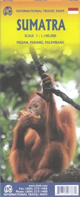
Wegenkaart - landkaart Sumatra | ITMB

0

Verkopers met dit product

Verkoper
Bezorging
Prijs
DeZwerver.nl logo
DeZwerver.nl
2,95
13,95

Anderen bekeken ook

Wegenkaart - landkaart 1 Sumatra | Reise Know-How Verlag
Tweetalige kaart (Engels en Duits). Door ingetekende lengte- en breedtegraden is het gebruik van GPS mogelijk. Met hoogtelijnen en uitgebreid wegennetwerk: daarnaast worden ook de afstanden tussen belangrijke plaatsen duidelijk leesbaar weergegeven. Het kleurgebruik is zodanig dat je een goede indruk krijgt van hoogteverschillen en soorten landschap. Natuurlijk staan de toeristische bezienswaardigheden duidelijk vermeld. Gedrukt op water- en scheurvast papier! Polyart is een synthetisch product vrij van giftige stoffen dus duurzaam. Het papier gaat echt lang mee. Topography is indicated by altitude colouring with numerous spot heights and names of mountain ranges and passes. Salt lakes, swamps, seasonal rivers and glacier are also shown. Detailed presentation of the road network includes minor roads and tracks and railways are also shown.   Internal administrative units are presented with their boundaries and names. National parks and other protected areas are highlighted. A wide rang…
17,95
Wegenkaart - landkaart Bermuda | ITMB
Een degelijke kaart met aanduidingen van o.a. nationale parken, vliegveld, benzinepomp, dirt-roads. Als overzichtskaart goed te gebruiken. Bermuda is a lovely mid-Atlantic island far off the coast of South Carolina. It is full of colonial architecture and an ‘island’ way of life. Tourism is a key ingredient of the colony’s lifeblood and the island is very popular with cruise ships. There is ample accommodation for longer-term visitors, good roads, and much history. The airport was built by the US Navy during WW2 and is still a US Naval Air Station, but shares the runway with civil aviation. The map includes an excellent inset of St. George’s, which still has its stocks close to the town hall, and another of Hamilton, the capital. This is where most cruise ships dock. For those with the time, the map shows the Railway Trail along the former route of the island’s now-defunct rail line. Lots to see; lots to do!   Map size: 27*39"   Legend Includes: Roads by classification, Rivers and Lak…
13,95
Wegenkaart - landkaart Ierland | ITMB
As technology improves, we are able to produce more detailed maps than was previously possible. Such is the case with Ireland, a part of the world consisting of two countries divided by religion and history. Preparing a map of Ireland as a double-sided map means cutting the island into two geographic portions. Side 1 covers the northern half. This includes the portion known as Northern Ireland, or Ulster, and a fair portion of the Republic of Ireland, or Eire; essentially everything north of Dublin and west to Counties Mayo and Galway. Side 2 covers the southern half of the island from just north of Dublin to the outer tips of County Kerry. It also includes a nice inset map of central Dublin. Naturally, all motorways and roads are included, as are touristic attractions, camping/caravan sites, ferry terminals, and Top Attractions. This is a very detailed travel map of the island, printed on waterproof paper for durability. We had great fun driving around Ireland researching this map. I…
14,95
Wegenkaart - landkaart Queensland | ITMB
Een degelijke wegenkaart van Queensland met aanduidingen van o.a. nationale parken, vliegveld, benzinepomp, dirt-roads en kleine plattegrond van hoofdstad. Als overzichtskaart goed te gebruiken. We complete our series of regional maps covering Australia with this map of Queensland, which nicely fills a double-sided sheet with only small portions of adjoining states showing. The map also includes a large inset map of central Brisbane. At this scale, the road/rail network of this part of Australia becomes very clear. The first side concentrates on the northern portion of the state, and the other side, the more densely-developed southern half. The map includes a listing of the state’s top attractions, and notes al major touristic attractions. Although gas/petrol stations are commonly found, we have included some gas symbols in remoter parts of Queensland to encourage drivers to venture into roads less travelled. All states and territories of Australia are now available from ITMB as separ…
13,95
Wegenkaart - landkaart Peru | ITMB
Een degelijke kaart met aanduidingen van o.a. nationale parken, vliegveld, dirt-roads en kleine plattegrond van hoofdstad. Als overzichtskaart goed te gebruiken. Peru at 1:1,500,000 on a double-sided, waterproof and tear-resistant, indexed map from ITMB, with large, clear street plans of central Lima and Cusco, highlighting accommodation, places of interest and various facilities. The map divides the country north/south, approximately along the line between the Cordillera Blanca and Cordillera Huyahuash, with very little overlap between the two sides. Topography is very effectively presented by altitude colouring, with spot heights and additional graphics for swamps and marshland, glaciers and volcanos. The map shows the country’s road network distinguishing between all-weather and seasonable roads and indicates driving distances on main routes. Railway lines, including the popular routes linking Cusco with Puno and Arequipa, are very clearly shown. The map also shows local airports a…
13,95
Wegenkaart - landkaart Alberta | ITMB
Een degelijke wegenkaart voor Alberta met aanduidingen van o.a. nationale parken, vliegveld, benzinepomp, dirt-roads. Als overzichtskaart goed te gebruiken. Wegenkaart Alberta   Alberta is many different things - a dynamic powerhouse of the Canadian economy, the source of oil in vast quantities, cow country, the Calgary Stampede, the Rockies. Alberta is a real gem in the crown of Canada, and is one of the most popular touristic destinations in North America. This double-sided map shows everything from Head-Smashed-In Buffalo Jump to the dinosaur pits of the badlands around Drumheller, to the foothills resorts close to the national parks of Banff and Jasper, and the gigantic parks themselves. The Province of Alberta is huge in area and exuberant as only a confident entity can be. This is Canada in its glory! A great place to visit, and a great map to explore it with. Printed on paper.   Legend Includes: Roads by classification, Airports, Points of Interest, Information Centres, Museums…
14,50
Wegenkaart - landkaart Tanzania | ITMB
Uitstekende wegenkaart van Tanzania met zowel de toeristische informatie als Nationale Parken en bezienswaardigheden, maar ook de topografische details als plaatsen en wegen, spoorlijnen en rivieren, hoogten, lengte- en breedtegraden. An easy-to-use road and geographical map of Tanzania to plan your trip, to prepare your itinerary, and to travel independently in this African country. This double-sided map contains a place name index, inset maps of Dar es Salaam, Arusha and Stone Town. The legend is in English. Touristic information: places of interest, vistas, ruins and archaeological sites, museums, Unesco World Heritage sites, hotel/motel, campsites, ferry lines, ports, airports, national parks, petrol stations, hospitals and médical facilities, border crossing.
14,95
Wegenkaart - landkaart Canada | ITMB
Een degelijke kaart met aanduidingen van o.a. nationale parken, vliegveld, benzinepomp, dirt-roads en kleine plattegrond van hoofdstad. Well, it’s about time, eh?!? ITMB, after only thirty years on the go, finally gets around to publishing a map of Canada. When we first started mapping, there was a pressing need for good maps of Central and South America, then of Africa, then etc etc and we never found time to concentrate on our own country until fairly recently. This map was prepared by Natural Resources Canada and is, as a result, as accurate a map as one could hope to have. We are very proud of it, and very pleased to be able to use such top-rate cartography. The map covers all of the land mass of Canada, from its southernmost point to the top of Ellesmere Island and from the Atlantic coast to the Pacific. It’s an excellent map, but I’m going to give one proviso. Canada is the second-largest country on the face of the planet and there is no way that a single-sided sheet can portray…
13,95

Klanten-reviews van Wegenkaart - landkaart Sumatra | ITMB

Er zijn nog geen beoordelingen voor dit productBen jij de eerste die een review plaatst?

Meer over Wegenkaart - landkaart Sumatra | ITMB

Productinformatie

    Verken gerelateerde categorieën

    Webshop.nl maakt gebruik van cookies. Ga je verder op onze website, ga dan akkoord met het plaatsen van cookies en de verwerking van deze data door ons en vermelde partners.