webshop.nl
Categorieën
  Sluiten

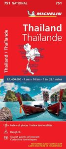
Wegenkaart - landkaart 751 Thailand | Michelin

De Michelin kaart van Thailand is een overzichtelijke landkaart waarop de toeristische sites staan aangeduid. De kaart heeft een plaatsnamenregister en een stadsplattegrond van Bangkok. De plaatsnamen staan op de kaart en in de index in het Nederlands en in het Thais. Thailand at 1:370,000 on an indexed road map from Michelin with street plans of c...
12,95

Webshops met dit product

Webshop
Bezorging
Prijs

Anderen bekeken ook

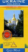
Wegenkaart - landkaart Ukraine - Moldova | Gizi Map
Kaart van Oekraïne met Moldavië, met een uitbreiding met de Krim in meer detail, plus plattegronden van het centrum van Kiev en Lviv. Wegennet is ingedeeld in zes typen, rij-afstanden aangegeven op hoofd-en secundaire routes, en verder worden grensovergangen weergegeven. Ukraine with Moldova on an indexed road map at 1:1,100,000 from Gizi Map, with an enlargement showing southern Crimea in greater detail, plus street plans of central Kiev and Lviv. All place names are shown transliterated into Latin alphabet, with those of major cities also given in their Cyrillic versions. Altitude colouring with relief shading indicates the mountainous regions, with the marshlands of northern Ukraine also marked. National parks and other protected areas are highlighted. Road network is graded into six types, driving distances are marked on main and secondary routes, and border crossings are shown. Railway lines, ferry routes on the Black Sea and Azov Sea, and local airports are included. Symbols high…
15,95
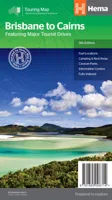
Wegenkaart - landkaart Brisbane to Cairns | Hema Maps
Detailkaart van een deel van Australië. Zeer goed leesbaar, met naast de topografische details veel symbolen waarmee allerhande toeristische zaken worden aangeduid als campsites, nationale parken, attracties, wandelmogelijkheden etc. An easy-to-follow map that shows both the coastal and inland routes from Brisbane to Cairns. Roadside rest areas, intermediate distances, and a quick-find distance chart are also shown. The map shows all the popular tourist destinations along the Queensland coast. Routes between Brisbane with Cairns in a series of touring maps connecting Australia’s main centres of population along some of the most spectacular routes such as the Great Ocean Road or the Savannah Way. The maps highlight 24-hour fuel supplies, roadside rest areas, camping facilities, places of interest, etc., and include distance charts and, in some titles, city maps. Road network indicates unsurfaced roads and tracks. The maps also show railway lines. There is no topographical information be…
13,95
Wegenkaart - landkaart - Stadsplattegrond San Diego - California south | ITMB
Wegenkaart en stadsplattegrond in een kaart: aan de ene zijde San Diego stadsplattegrond en op de andere kant een kaart van het zuiden van Californië. San Diego on a clear, well presented street plan from ITMB, with a transit system diagram, a road map of the city and its environs, and a street plan of central Tijuana, plus on the reverse a road map of the US/Mexico border region extending east beyond El Paso and within USA north to Las Vegas.   On one side is an indexed street plan of San Diego, covering the city’s central districts (as indicated in our coverage image), including the downtown area, the Old Town for which an enlargement is provided, Balboa Park, University Heights, the Mission Bay Park with the SeaWorld, and the city’s international airport. The plan clearly shows the MTS and other public transit stations, highlights main traffic arteries and indicates one way streets. Also marked are recommended cycle routes. Streets are annotated with selected block numbers for easie…
13,95
Wegenkaart - landkaart 738 Roemenië - Roemenie | Michelin
Zoals je van Michelin mag verwachten is deze kaart zeer overzichtelijk en heeft een duidelijk helder kaartbeeld. De kaart geeft uitgebreid toeristische informatie weer. Met register, afstanden en reistijden. Wegen worden naar verschillende klasse ingedeeld en - mooi van Michelin - de interessante mooie routes worden gemarkeerd met een groene streep.    Hindernissen voor automobilisten met caravans zijn gemarkeerd: steile hellingen, bergpassen of een anderzins moeilijke route. Bezienswaardigheden als een kasteel, religieus gebouw, ruine of grot is door een symbool goed te vinden.   The Michelin national road map of Romania at 1:750,000 scale is best suited to trip & route planning. The map gives comprehensive coverage of national road networks showing major motorways, dual carriageways, national & regional main roads and some smaller local roads. Unsurfaced roads and tracks and some major footpaths are also shown. The map shows useful motoring information for motorways and major roads -…
11,95
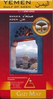
Wegenkaart - landkaart Yemen - Jemen | Gizi Map
Yemen, including the Gulf of Aden, at 1:1,250,000 on an excellent and informative map from Gizi Maps, with a street plan of central Sana’a and enlargements of the environs of the capital and Aden, plus the Aden Peninsula.   The map has the publisher’s characteristic bold altitude colouring and plenty of names of various mountain chains, peaks, deserts, etc. Graphics indicate swamps, salt flats, wadis, deserts, lava flows, water wells, oasis, etc, to provide a vivid picture of the country’s topography. Names of the larger towns, provinces and many geographical features are given in both Latin and Arabic alphabets; all other place names are shown only transliterated.   Coverage extends southward to the northern coastline of the Horn of Africa, including the whole of Djibouti and most of Eritrea. Within the Gulf of Aden the Internationally Recommended Transit Corridor (IRTC) is marked, as well as other ferry and shipping routes including those leading to the Socotra Archipelago and in the…
15,95
Wegenkaart - landkaart 01 Kaapstad - Cape Town and Surrounding Attractions | MapStudio
Het overzicht is soms misschien een beetje onduidelijk. maar de details in de inzetten en delen van de kaart zijn prima en voldoen goed voor het rondrijden met een eigen auto. Double-sided map, with a general road map on one side, plus numerous street plans and descriptions of four special routes on the reverse. The main map covers an area within reach as day trips from Cape Town, extending east to Swellendam and north to Langebaan. Road classification includes unsurfaced roads, intermediate driving distances on main and secondary roads, toll routes with gates, and mountain passes. Railways are shown with local stations. An impression of relief is provided by elevation tinting (perhaps somewhat confusing for regular map users - the higher the altitude, the greener the colour!), spot heights for main peaks, and names of mountain ranges. Nature and forest reserves, plus salt pans and marshes are indicated. Symbols mark local airfields, historical sites, caravan parks, many wine estates, …
16,95
Stadsplattegrond Bangkok en omgeving | Nelles Verlag
Goede stadskaart van Bangkok en omgeving. Aan beide kanten bedrukt. Met veel toeristische aanduidingen als culturele bezienswaardigheden en aanduidingen van bijvoorbeeld de grotere hotels. Prima leesbare kaart. Bangkok on a double-sided map from Nelles combining an indexed street plan of the city’s central districts at 1:15,000 with a more general plan of the capital with its outer suburbs presented at 1:75,000. Both plans highlight numerous places of interest.   On one side the main, indexed plan covers the city’s inner districts showing public transport routes: metro and skytrain lines with stations, bus routes with line numbers, and express boat service along the river. Public buildings, including selected hotels, are clearly marked and named, and shopping centres or market streets are indicated. The main centre of tourist accommodation, Banglamphoo - Khao San Road area, is also shown in greater detail on a small enlargement.   On the reverse a more general plan at 1:75,000 covers t…
11,95
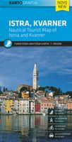
Wegenkaart - landkaart - Fietskaart Istrië - Kvarner | Kartografija
Goede kaart van Istrië en het noordelijk deel van de Kroatische kust. Op een behoorlijke schaal, geschikt voor aurto en fietsers is het gebied met helder leesbare kleuren mooi op kaart gezet. Met symbolen worden de toeristische zaken als bezienswaardigheden weergegeven, maar ook campings en havens.   Istria and Kvarner, the northern part of Croatia’s Adriatic coast, at 1:100,000 on a detailed, GPS compatible double-sided road map from Kartografija in Ljubljana highlighting picturesque locations. On one side is Istria with coverage extending north to Trieste - on the reverse the map shows the northern part of the Adriatic coast and its islands, extending south to cover all but the southernmost tip of Lošinj and approximately half of Pag.    Topography is shown by relief shading with contours at 40m intervals. Road network includes small local roads and selected cart tracks. Driving distances are shown on main and most secondary routes, and locations of border crossings and petrol statio…
12,95
Wegenkaart - landkaart 754 Finland | Michelin
Zoals je van Michelin mag verwachten is deze kaart zeer overzichtelijk en heeft een duidelijk helder kaartbeeld. De kaart geeft uitgebreid toeristische informatie weer. Met register, afstanden en reistijden.   Wegen worden naar verschillende klasse ingedeeld en - mooi van Michelin - de interessante mooie routes worden gemarkeerd met een groene streep. Hindernissen voor automobilsiten met caravans zijn gemarkeerd: steile hellingen, bergpassen of een anderzins moeilijke route. Bezienswaardigheden als een kasteel, religieus gebouw, ruine of grot is door een symbool goed te vinden.   The Michelin National road map of Finland at 1:1,250,000 scale is ideal for route planning. The map gives comprehensive coverage of national road networks showing all major motorways, dual carriageways, national & regional main roads and some single-lane roads. Also shows unsurfaced roads. The map is divided by grid showing latitude and longitude.   Distances between major locations are marked along roads, wit…
11,95
Wegenkaart - landkaart 743 Algerije - Tunesië | Michelin
Kaart van beroemde kaartenmakers en voor Algerije en Tunesie weer een hele goede. Uitermate goed leesbaar, prettig kleurgebruik. Zoals je van Michelin mag verwachten is deze kaart zeer overzichtelijk en heeft een duidelijk helder kaartbeeld. De kaart geeft uitgebreid toeristische informatie weer. Met register, afstanden en reistijden. Wegen worden naar verschillende klasse ingedeeld en - mooi van Michelin - de interessante mooie routes worden gemarkeerd met een groene streep.    Hindernissen voor automobilisten met caravans zijn gemarkeerd: steile hellingen, bergpassen of een anderzins moeilijke route. Bezienswaardigheden als een kasteel, religieus gebouw, ruine of grot is door een symbool goed te vinden. The Michelin National road map of Algeria & Tunisia at 1:1,000,000 scale is ideal for trip & route planning. The map gives comprehensive coverage of national road networks showing all major motorways, dual carriageways, national & regional main roads and some local roads. Also shows u…
12,95

Klanten-reviews van Wegenkaart - landkaart 751 Thailand | Michelin

Er zijn nog geen beoordelingen voor dit productBen jij de eerste die een review plaatst?

Meer over Wegenkaart - landkaart 751 Thailand | Michelin

Productomschrijving

De Michelin kaart van Thailand is een overzichtelijke landkaart waarop de toeristische sites staan aangeduid. De kaart heeft een plaatsnamenregister en een stadsplattegrond van Bangkok. De plaatsnamen staan op de kaart en in de index in het Nederlands en in het Thais. Thailand at 1:370,000 on an indexed road map from Michelin with street plans of central Bangkok and an enlargement for the capital’s environs. All place names on the map are shown in both Thai and Latin alphabet and the index is in both scripts. Road network emphasizes main routes but also clearly presents local roads, all with road numbers easy to read. Driving distances are shown on primary routes and main connecting roads; steep gradients, viewpoints, toll barriers and border crossings are marked; scenic routes are highlighted. Railway lines are included and domestic airports are marked. Symbols indicate various places of interest.  Topography is shown by relief shading with colouring for forested areas. National parks are prominently highlighted. Latitude and longitude lines are drawn at 1° intervals. The index is next to the map. Map legend includes English.   An inset presents the environs of Bangkok in greater clarity. Two street plans show Bangkok, highlighting its main sights: the city’s central districts, plus an enlargement for its centre.   Bangkok, Chanthaburi, Chiang Mai, Khong Chiam, Phuket-ville, Thaïlande
Webshop.nl maakt gebruik van cookies. Ga je verder op onze website, ga dan akkoord met het plaatsen van cookies en de verwerking van deze data door ons en vermelde partners.