webshop.nl
Categorieën
  Sluiten

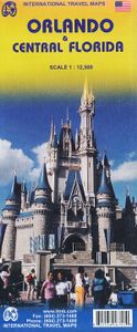
Wegenkaart - landkaart - Stadsplattegrond Orlando en Central Florida | ITMB

The title of most popular vacation spot on earth is claimed by two cities – Orlando and Las Vegas – both in the States. Sorry London and Paris, but apparently you’re down the list a ways. We don’t want to play favourites, so we’re publishing both cities, with Orlando coming out first. When one thinks of Central Florida, most people probably think o...
13,95

Webshops met dit product

Webshop
Bezorging
Prijs

Anderen bekeken ook

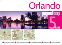
Stadsplattegrond Popout Map Orlando | Compass Maps
Handig ( borstzak- ) formaat stadsplattegrond met voldoende detail, zodat je ook de kleinere straatjes erop aantreft. Van veel wereldsteden inmidddels leverbaar en dat is mooi, want juist in dit soort steden wil je je handen liever vrij houden en niet teveel hoeven stoeien met het uitvouwen van een grote plattegrond, en/of teveel als "toerist" opvallen. Door het unieke vouwsysteem blijft alles zeer compact en biedt het kaartje een razendvlugge manier van orientatie. Wel is dit product alleen geschikt voor het ( grote ) centrum van de stad.Verder geven de kaartjes uit deze reeks ook de meeste highlights van de stad aan en ( indien van toepassing ) een overzichtskaartje van de metro. Explore Florida's playground, Walt Disney World and Orlando, with the help of this genuinely pocket-sized, pop-up, map. Small in size yet big on detail, this compact, dependable, Walt Disney World and Orlando pop-up map will ensure you don't miss a thing. * Includes 2 PopOut maps - a detailed pop-up street …
7,95
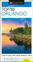
Reisgids Eyewitness Top 10 Orlando | Dorling Kindersley
Een compacte reisgids met veel illustraties, veel aandacht voor cultuur en bevolking en hier en daar praktische informatie. Kleine versie, handig in de binnenzak. Engelstalig Reveal a new thrilling side of Orlando and explore hidden gems! There is loads more to Orlando than just rollercoaster rides and theme parks. It offers beautiful nature reserves, shopping malls, lavish spas and vibrant nightlife! This Top 10 Orlando travel book will help make your trip an exciting and memorable one. With a new lightweight format, this Orlando travel guide is perfect for your pocket or bag when you're on the move. Here's what you'll find inside: - Up-to-date information following the COVID-19 outbreak, insider tips and advice for staying safe - Top 10 lists of Orlando's must-sees, including Disney's Hollywood Studios(R), Universal Studios Florida(TM), Merritt Island and LEGOLAND(R) - Orlando's most interesting areas, with the best places for sightseeing, food and drink, and shopping - Themed lists…
13,50
Wegenkaart - landkaart 3126 Southeast United States | National Geographic
Mooie kaart van de bekende kaartenmaker National Geographic. Veel details door kleurgebruik. De wegen zijn met kleuren verdeeld in drukke en minder drukke, de wegnummers zijn goed terug te vinden. De kaart onderscheidt zich van andere series door de hoeveelheid topografische details als counties, plaatsnamen en waterwegen en het bevat een register waarin het eenvoudig zoeken is. Daarnaast is de kaart gedrukt op scheur- en watervast papier. The United States Southeast Adventure Map will guide you through the diverse landscapes of this remarkable region, from the white sand beaches of Florida, to the barrier islands of North Carolina, through the coastal plains and rolling piedmont regions, and into the stunning Blue Ridge Mountains of Virginia, West Virginia, North Carolina, Tennessee and Georgia. Great Smoky Mountains and Shenandoah National Parks straddle the ridge of the Appalachian Mountains and stand in dramatic contrast to the sawgrass marshlands of Everglades National Park and th…
17,50
Stadsplattegrond Orlando | Borch
Borch Orlando is een duidelijke, geplastificeerde plattegrond van het centrum met informatie over openbaar vervoer en bezienswaardigheden. Inclusief straatnamenregister.   Our soft-laminated folded map of Orlando shows: Orlando Downtown 1:11 000, Central Florida 1:1 200 000, Orlando and Region 1:200 000, Walt Disney World 1:25 000, International Drive Area 1:25 000, Top 30 Sights, USA administrative and time zones. Borch Maps are easy to fold, durable and water-repellent with a wipeable surface. Borch Maps show hotels, museums, monuments, markets, public transport, top sights and points of interest, useful statistics, conversion charts for temperatures, weights and measurements, climate charts showing temperatures, sunshine hours, precipitation and humidity, overview maps, time zones, and much more...   Orlando, America’s fantasy capital, has the second largest number of hotel rooms in the country and is home to the Walt Disney World Resort (including the Magic Kingdom, Epcot, Disney's…
10,25
Wegenkaart - landkaart USA Florida & Deep South | ITMB
Florida has been unavailable for far too long! We wanted to improve the area of coverage while converting the artwork to a GIS-based digital data base, so the area of coverage now includes Georgia, Alabama, part of Mississippi, and most of the Carolinas. This would be an excellent map to use on the way south (or north) along I-95 or I-85 through Atlanta or Augusta and south to the Gulf Coast. The Panhandle of Florida is on the same side of the sheet, with the second side being devoted to Florida south to the Keys. There isn't enough space to show many insets; just the Orlando area and a Florida map showing population by counties. Another innovation we have introduced is to print the map on waterproof paper, for durability as well as for use as an umbrella during sudden downpours! Legend Includes: Road by classification, motorway, two land road, railway with station, waterway and much more...   Deep South, schaal 1: 1000000 Florida schaal 1: 720000
13,95
Wegenkaart - landkaart USA: east half | ITMB
Goede overzichtskaart van het oosten de USA. Deze uitgever heeft ook het westen van de USA op kaart uitgebracht. Beide kaarten geven zodoende een compleet beeld van de Verenigde Staten. The United States of America is a humongous travel attraction. Whether one is thinking of NYC or Disneyland, Hollywood or longhorn cattle, America is a fascinating place. ITMB specializes in mapping exotic travel destinations and in making even well-known places exotic. This is the first of a series of maps that we hope to publish on the USA in the years to come. We decided to start with two maps, East Half and West Half, because the size of the country and its complexity mitigated against doing one map for the entire half-continent. Even at the scale chosen, it was extremely difficult to portray all the parks, national monuments, battlefields, and touristic attractions that this fascinating country offers. One side covers the Atlantic seaboard from Maine to Florida, with insets of Washington, the Flori…
13,95
Stadsplattegrond - Wegenkaart - landkaart Quito & Ecuador Central | ITMB
Een degelijke wegenkaart van Ecuador met aanduidingen van o.a. nationale parken, vliegveld, benzinepomp, dirt-roads en kleine plattegrond van hoofdstad. Als overzichtskaart goed te gebruiken. Finally, ITMB releases its long-awaited re-worked map of the wonderful South America city of Quito. The city is squeezed in between mountain ranges and, the entire city stretches from north (on the right-hand side of the map) to the south. The "bottom" of the map is, actually the eastern portion. A regional inset map clarifies the situation. The street network is clearly shown, along with the rapid line bus way and the city's Metro. The Old Town is perhaps the most interesting portion of the city for visitors and is on the left-hand portion of the map. The newer downtown is centered on La Carolina Park on the right-hand side of the map. This is where most of the shopping malls and hotels are located. The old airport is shown in part on the far right, but the new international airport is located fa…
13,95
Wegenkaart - landkaart - Stadsplattegrond Poland east - Warsaw, Oost Polen en Warschau | ITMB
ITMB wegenkaarten en wandelkaarten kenmerken zich door het kleurgebruik waarbij zo de nadruk wordt gelegd op de natuurkundige aspecten van het land of de streek. Het soort landschap en de hoogte worden hierdoor zeer duidelijk zichtbaar. Natuurlijk vind je ook de 'gewone' zaken als wegennet, spoorwegen, vliegvelden, ferrys, toeristische bezienswaardigheden en nationale parken er op terug.. Vaak - maar niet op alle kaarten - staat op de achterzijde een stadsplattegrond van hoofdstad of belangrijkste stad in de regio.  Voorzijde: Oost Polen shcaal 1:650.000 Achterzijde: Warschau, schaal 1:9.000 This is, at the same time, our second edition updated map of Warsaw and a brand new title for ITMB, in that we have added a regional map of the eastern half of Poland to the second side of the map. This gives the end user two maps for the price of one by combining the many attractions of the city with its surrounding countryside. Anyone with a small amount of historical knowledge knows that Warsaw …
13,95
Wegenkaart - landkaart - Stadsplattegrond Istanbul & Northwest Turkey | ITMB
Dubbelzijdige kaart van ITMB met aan een kant een wegenkaart  1:550.000 met aanduidingen van o.a. nationale parken, vliegveld, benzinepomp, dirt-roads. Als overzichtskaart goed te gebruiken. Aan de andere kant een overzichtelijke stadsplattegrond 1: 11.000 met stratenindex en aanduiding van toeristische informatie en culturele instellingen zoals musea, monumenten, schouwburgen en sportaccomodaties. Daarnaast bevaten de meeste kaarten een heldere aanduiding van het openbaarvervoer (opstappunten van metro), parkeergelegenheden, postkantoren en andere praktische informatie. Istanbul is one of the most interesting cities in Europe. It is loaded with interesting places to see and places to go. The map shows all major touristic sites (my favourite is Constantine s Column), the ferry routes that criss cross the Bosphorus, and the transit lines that move everyone around the city. We have made a significant change to the regional map on the second side of the sheet; in this edition, we provide …
13,95
Stadsplattegrond Miami | Borch
Borch Miami is een duidelijke, geplastificeerde plattegrond van het centrum met informatie over openbaar vervoer en bezienswaardigheden. Inclusief straatnamenregister.   Miami Downtown 1:15 000, Miami Beach 1:15 000, Coconut Grove 1:15 000, Greater Miami 1:350 000, Southern Florida 1:500 000, Public Transportation   Our soft-laminated folded map of Miami shows: Miami Downtown 1:15 000, Miami Beach 1:15 000, Coconut Grove 1:15 000, Greater Miami 1:350 000, Southern Florida 1:500 000, Coral Gables 1:30 000, Public Transportation Miami, Top 30 Sights, USA administrative & time zones. Borch Maps are easy to fold, durable and water-repellent with a wipeable surface. Borch Maps show hotels, museums, monuments, markets, public transport, top sights and points of interest, useful statistics, conversion charts for temperatures, weights and measurements, climate charts showing temperatures, sunshine hours, precipitation and humidity, overview maps, time zones, and much more...   Exotic Miami is …
10,25

Klanten-reviews van Wegenkaart - landkaart - Stadsplattegrond Orlando en Central Florida | ITMB

Er zijn nog geen beoordelingen voor dit productBen jij de eerste die een review plaatst?

Meer over Wegenkaart - landkaart - Stadsplattegrond Orlando en Central Florida | ITMB

Productomschrijving

The title of most popular vacation spot on earth is claimed by two cities – Orlando and Las Vegas – both in the States. Sorry London and Paris, but apparently you’re down the list a ways. We don’t want to play favourites, so we’re publishing both cities, with Orlando coming out first. When one thinks of Central Florida, most people probably think of Disneyworld or other theme parks, and orange groves. There are a LOT of things to see and do in this part of Florida, which is why it is so popular with visitors. Surprisingly, good maps of the region are few, as we discovered during the IMTa map conference there a couple of years ago. Frustrated by inaccurate freebie maps and discouraged by the simplistic maps available from commercial firms, we’ve tried to create a ‘break-through’ map, combining the various attractions immediately surrounding Orlando itself, such as a detailed map of the Disneyland complex, the Universal Studios’ amazing theme area, and the hotel strip along Interstate 4, and including a detailed map of Orlando itself. The reverse side contains an updated edition of our Central Florida map, covering all the attractions between saint Petersburg and the Suncoast to Cape Canaveral and the Space Coast, and from Lake Okeechobee in the south to Tavares in the north.
Webshop.nl maakt gebruik van cookies. Ga je verder op onze website, ga dan akkoord met het plaatsen van cookies en de verwerking van deze data door ons en vermelde partners.