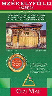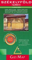
Wegenkaart - landkaart South-Eastern Transylvania - Zuidoost Transsylvanie | Gizi Map

0
Natuurkundige wegenkaart met veel aandacht voor hoogte door een uitbundig kleurgebruik. Discover the Hungarian Transylvania (Székelyföld) with this colourful road and geographical map, The best way to prepare your trip, to plan your itinerary, and to travel independently in the centre of Romania. The legend is in 5 languages (English, Romanian, an...

Verkopers met dit product

Verkoper
Bezorging
Prijs
DeZwerver.nl logo
DeZwerver.nl
2,95
15,95

Anderen bekeken ook

Wegenkaart - landkaart South-Eastern Transylvania - Zuidoost Transsylvanie | Gizi Map
Natuurkundige wegenkaart met veel aandacht voor hoogte door een uitbundig kleurgebruik. Discover the Hungarian Transylvania (Székelyföld) with this colourful road and geographical map, The best way to prepare your trip, to plan your itinerary, and to travel independently in the centre of Romania. The legend is in 5 languages (English, Romanian, and Hungarian included). Localities names are written in Hungarian and Romanian. Symbols for several touristic information: camping sites, castles, palaces, particular Székely gates, parts of World Heritage, spas, national parks,
15,95
Reisgids Transylvania - Transsylvanië | Bradt Travel Guides
De enige reisgids over Transsylvanië! Een goede, vooral praktische reisgids met veel info over overnachten, eetgelegenheden, vervoer, maar ook wandelingen. Daarnaast nog aandacht voor achtergronden als geschiedenis, cultuur en landschap. Sober uitgevoerd, maar complete reisgids. This new, fourth edition of Bradt's Romania: Transylvania remains the only standalone, full-length, English-language travel guidebook to Transylvania – the legendary, enchanting and increasingly popular region of Romania. Co-authored by former British Ambassador to Romania Paul Brummell, Romania: Transylvania has been thoroughly updated by prolific travel writer Tim Burford, who wrote his first Romania guide in 1991.   Transylvania (the ‘land beyond the forest') is a wild, wooded, intensely romantic region, filled with mountains and gorges, myths and legends, dragons, bears, wolves – and vampires. Bram Stoker called it ‘one of the wildest and least-known parts of Europe', a description that remains true today.…
26,50
Wegenkaart - landkaart Adventure map Transylvania - Transsylvanië | TerraQuest
De kracht zit hem in het feit dat deze kaart in delen is geplastificeerd en daardoor ook - ondanks de plastic laag - makkelijk in delen is te vouwen.    Terraquest say 'TerraQuest maps are designed and developed primarily for tourists preparing for treks to remote corners of the world. Our proven map laminating technology allows you to freely use the maps even in harsh conditions, while appreciating the clear and easy-to-read information compiled by our team of qualified cartographers. The distinctive feature of terraQuest laminated maps is the manufacturing method. Due to a special lamination process and patented map joining techniques, the maps easily adjust to your choice of format , even for one-hand use only. They are exceptionally durable and may be folded repeatedly. You can also add and erase your own notes directly onto the map with an erasable pen without damage to the map'
12,95
Wegenkaart - landkaart Transsylvanië, Siebenbuergen Transylvania | Freytag & Berndt
Gedetailleerde, tweezijdige landkaart met toeristische informatie, index en afstanden in kilometers.. Kaart van een bijzonder gebied in Roemenië, het land van Dracula! De berijdbare wegen zijn goed weergeven, zowel de hoofdwegen als provinciale en lokale wegen; wegnummers worden vermeld. Afstanden tussen plaatsen zijn in kilometers op de kaart ingetekend, daarnaast worden ook op belangrijke plekken benzinepompen gemarkeerd. In het kaartbeeld wordt door middel van schaduw het reliëf weergegeven en soms enkele punten in het landschap met de daadwerkelijke hoogte. Provinciegrenzen zijn goed terug te vinden, nationale parken en reservaten ook. Met allerhande symbolen worden toeristische bezienswaardigheden weergegeven als monumenten, historisch belangrijke plekken en uitzichtpunten. In bepaalde plaatsen zijn hotels en campings te vinden, luchthavens, treinverbindingen en havens vindt u er ook op!
14,95
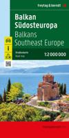
Wegenkaart - landkaart Balkan - Zuidoost Europa | Freytag & Berndt
A nicely detailed travelers map of Southeast Europe from Prague east to Odessa and south to Italy, Greece and western Turkey, including the Danube, Romania, Bulgaria and the Black Sea from Odessa to Istanbul. At a scale of 1:2,000,000.  Explore the Balkans and South-East Europe with this Freytag & Berndt road map - the best way to prepare your trip, to plan your itinerary, and to travel independently.    This map covers the following countries: Greece, Albania, FYROM, Bulgaria, Kosovo, Serbia, Montenegro, Bosnia Herzegocina, Croatia, Slovenia, Hungary, Romania, Moldova, the Czech & Slovak Republics, Western Turkey, Western Ukraine, Austria, and Southern Italy.   The map includes a localities index and more detailed city maps of Athens, Belgrade, Bratislava, Bucarest, Budapest, Chisinau, Istanbul, Kiev, Ljubljana, Podgorica, Prague, Pristina, Sarajevo, Skopje, Sofija, Tirana, Vienna, and Zagreb.
14,95
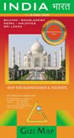
Wegenkaart - landkaart India | Gizi Map
Natuurkundige wegenkaart van India met ook veel aandacht voor het wegennet en plaatsen, achterop de kaart staat een uitgebreid register. A detailed and attractive general map showing relief through altitude tinting, with an inset administrative map also included. Coverage extends beyond India to include the whole of Nepal, Bangladesh and large sections of Myanmar, Pakistan and Afghanistan. The Maldives, Andaman & Nicobar Islands and Eastern India (Assam & surroundings) are shown in insets. Selected peak heights are indicated and some terrain features such as salt flats, glaciers & swamps are distinguished. Several categories of roads are distinguished, including selected minor roads and tracks, with intermediate driving distances marked on many routes. Railways, shipping routes, airports and ports are marked and administrative region boundaries (and disputed frontiers) are shown. Symbols denote major places of worship, palaces, temples, beach resorts, antiquities, archeological sites,…
15,95
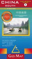
Wegenkaart - landkaart 1 China South - China Zuid | Gizi Map
Mooie overzichtskaart van alleen Zuid China met fraai kleurgebruik voor hoogte en reliëf. De kaart is tweetalig en heeft een groot aantal plaatsen, topografisch zonder meer goed. Het gebied betreft zuid-oosten van China en Taiwan, van Nanjing en Shanghai in het noorden tot Hainan Island en het noorden van Vietnam en Laos. Bold altitude colouring, with spot heights and names of mountain ranges and other geographical features, provides an excellent picture of the terrain. The maps show various categories of roads including selected tracks, with intermediate driving distances marked on many routes. Railways, shipping and ferry lines, and local airports are also shown. Province boundaries are indicated and national parks are highlighted. Symbols marks landmarks and features such as tombs, monasteries, churches, temples, ruins, UNESCO sites including the Great Wall, and other places of interest.  
15,95
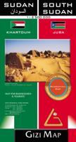
Wegenkaart - landkaart Sudan and South Sudan | Gizi Map
Sudan and South Sudan as separate countries on an excellent indexed map at 1:2,500,000 from Gizi Maps with detailed presentation of the topography, administrative divisions, street plans of Khartoum and Juba, etc. Excellent presentation of the terrain in the publisher’s characteristic style provides a vivid picture of the region’s geography: bold altitude colouring with plenty of spot heights and names of peaks, mountain ranges, etc, plus additional graphics for flood plains, swamps, salt flats, deserts, lava fields, wadis and water wells. National parks or other protected areas and interesting natural sites are highlighted. The map indicates the boundary of the disputed Abyei area and shows the internal administrative boundaries and names of the provinces. Within North Sudan names of larger towns and of the provinces are also given in Arabic. Where appropriate, alternative versions of town names are provided (Khartoum/Al Khartum, Omdurman/Umm Durman, etc). The map shows the road n…
15,95
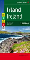
Wegenkaart - landkaart Ierland | Freytag & Berndt
Goede tweezijdige wegenkaart van het hele land. Met register en enkele stadsplattegronden.   De berijdbare wegen zijn goed weergeven, zowel de hoofdwegen als provinciale en lokale wegen; wegnummers worden vermeld. Afstanden tussen plaatsen zijn in kilometers op de kaart ingetekend, daarnaast worden ook op belangrijke plekken benzinepompen gemarkeerd.   In het kaartbeeld wordt door middel van schaduw het reliëf weergegeven en soms enkele punten in het landschap met de daadwerkelijke hoogte. Provinciegrenzen zijn goed terug te vinden, nationale parken en reservaten ook. Met allerhande symbolen worden toeristische bezienswaardigheden weergegeven als monumenten, historisch belangrijke plekken en uitzichtpunten. In bepaalde plaatsen zijn hotels en campings te vinden, luchthavens, treinverbindingen en havens vindt u er ook op!Explore Ireland with this Freytag & Berndt double-sided road map. The best way to plan your trip, prepare your itinerary, and to travel independently in this country. …
14,95
Wegenkaart - landkaart Kaukasus - Caucasus | Gizi Map
  The Caucasus at 1:1,000,000 from Gizi Map, presenting the region in a road edition with relief shading to show its topography and make the road network stand out better against the background. Coverage includes the southern republics of Russia. International boundaries are clearly marked.    Within Georgia the map indicates the boundaries of South Ossetia, Abkhazia and Adjara; in Azerbaijan the border of Nagorno Karabach and the ceasefire line are marked. Coverage within Russia extends north of Krasnodar and Stavropol, with boundaries of individual republics including Chechnya, North Ossetia and Dagestan. Place names are shown in Latin alphabet, but within Georgia, Armenia and Russia larger towns are also named in local script.   Relief shading with plenty of names of geographical features such as individual mountain ranges, peaks, swamps, salt flats, etc, presents the topography. Road network is graded in six types, with driving distances on main and selected connecting routes. Rai…
15,95

Klanten-reviews van Wegenkaart - landkaart South-Eastern Transylvania - Zuidoost Transsylvanie | Gizi Map

Er zijn nog geen beoordelingen voor dit productBen jij de eerste die een review plaatst?

Meer over Wegenkaart - landkaart South-Eastern Transylvania - Zuidoost Transsylvanie | Gizi Map

Productomschrijving

Natuurkundige wegenkaart met veel aandacht voor hoogte door een uitbundig kleurgebruik.

Discover the Hungarian Transylvania (Székelyföld) with this colourful road and geographical map, The best way to prepare your trip, to plan your itinerary, and to travel independently in the centre of Romania. The legend is in 5 languages (English, Romanian, and Hungarian included). Localities names are written in Hungarian and Romanian. Symbols for several touristic information: camping sites, castles, palaces, particular Székely gates, parts of World Heritage, spas, national parks,

Productinformatie

    Verken gerelateerde categorieën

    Webshop.nl maakt gebruik van cookies. Ga je verder op onze website, ga dan akkoord met het plaatsen van cookies en de verwerking van deze data door ons en vermelde partners.