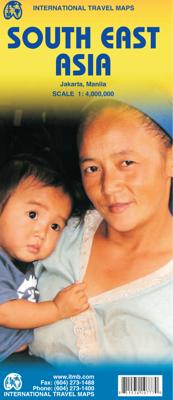
Wegenkaart - landkaart South East Asia - Zuid Oost Azië | ITMB

0
  Een degelijke kaart met aanduidingen van o.a. nationale parken, vliegveld, benzinepomp en dirt-roads. Als overzichtskaart goed te gebruiken. Met Laos, Cambodja, Vietnam, Thailand, Maleisië, Filipijnen en Indonesië.   The part of the world from southern China, through the Indo-Chinese peninsula, and sweeping through the Indonesian archipelago to ...

Verkopers met dit product

Verkoper
Bezorging
Prijs
DeZwerver.nl logo
DeZwerver.nl
2,95
13,95

Anderen bekeken ook

Wegenkaart - landkaart Tahiti - French Polynesia | ITMB
Anyone who has visited Tahiti retains fond memories of a wonderful Polynesian paradise. This map shows the major islands of French Polynesia as a series of large insets on Side 1. An overall inset map showing the many islands is also shown, but for showing detail, one must expand the individual islands. The largest one is the volcanic Tahiti Nui, with the capital city of Pape’ete (or Papeete in English), for which a detailed inset map is included. Most visitors stay in the vicinity of Papeete, along the coast. We show several popular resorts. There is a good circular road around the island’s shoreline, but no roads in the interior. The island is joined to another, called Tahiti Iti, or Little Tahiti, and roads extend partway around this less-developed part of the combined island. Most of the other islands are rarely visited, although they have resorts, beaches, and a lifestyle of their own. Names like Huahine, Riatea, Tahaa, and Maiao may not be as familiar as they should be, but all …
14,95
Wegenkaart - landkaart South Pacific Cruising & Samoa | ITMB
Een overzichtskaart van de zuidelijke Stille Oceaan met de cruise routes tussen de verschillende eilanden aangegeven. Op de achterzijde een overzichtskaart van Samoa This is a new venture for ITMB. Cruising is a rapidly-growing segment of the travel industry, experiencing double-digit growth rates annually. Obviously, this is a thriving market. In conjunction with several cruise ship lines, we have prepared a map of the South Pacific Ocean, which extends southwards from Hawai'i to the southern tip of New Zealand and eastwards from central Australia/Papua New Guinea to the Pitcairn Islands. Thus, it does not include the popular South East Asia and China coast routes. We think this has to change at a time when 25,000,000 people are travelling by cruise ships. At the same time, we must keep coverage area relevant for those end users of the artwork. Even at 1:12M, most of the area covered is water, with island countries such as Fiji, Tonga, Kiribati, Tahiti, and the Cook Islands being vis…
13,95
Wegenkaart - landkaart Bhutan & Northeast India | ITMB
Een degelijke kaart met aanduidingen van o.a. nationale parken, vliegveld, benzinepomp, dirt-roads en kleine plattegronden van Thimphu, Paro en Calcutta. Als overzichtskaart goed te gebruiken.   De ene kant van de kaart heeft Bhutan erop staan, met een schaal van 1:35.000. De andere kant van de kaart omvat noordoost India. Schaal 1:1.300.000    Bhutan is a beautiful mountainous country, squeezed between India and China. It is not a part of the world experiencing significant change, and this version is pretty much the same as our previous one, although updated with minor changes. Printed double-sided, with Northeast India on the other side.   Legend Includes: Roads by classification, Express Way, National Highway, Major Highway, Secondary Road, Other road/track, Railway, Ferry Route , State Boundary, Undefined Boundary, River and Lake, Glacier, Desert/ swamp, Mountain peak, Pass, Historical Site, Monument, Bhuddist Monument, Radio Tower, Post Office, Police Station, Hospital, Library, …
13,95
Wegenkaart - landkaart - Fietskaart Vanouver Island south - Victoria | ITMB
ITMB wegenkaarten en wandelkaarten kenmerken zich door het kleurgebruik waarbij zo de nadruk wordt gelegd op de natuurkundige aspecten van het land of de streek. Het soort landschap en de hoogte worden hierdoor zeer duidelijk zichtbaar. Natuurlijk vind je ook de 'gewone' zaken als wegennet, spoorwegen, vliegvelden, ferrys, toeristische bezienswaardigheden en nationale parken er op terug.. Vaak - maar niet op alle kaarten - staat op de achterzijde een stadsplattegrond van hoofdstad of belangrijkste stad in de regio.  Voorzijde: Vancouver Island zuidelijk gedeelte met schaal 1:270.000 Achterzijde: stadsplattegrond Victoria met schaal 1:10.000 Victoria is a brand new title for ITMB. The city is the capital of British Columbia (each of Canada’s provinces and territories has its own capital, in addition to Ottawa for the entire country). Located at the southern tip of Vancouver Island, Victoria was established as the colonial capital after the Oregon Treaty of 1846 forced the British to ab…
13,95
Wegenkaart - landkaart Paraguay & Bolivia South | ITMB
Een degelijke kaart met aanduidingen van o.a. nationale parken, vliegveld, benzinepomp, dirt-roads en kleine plattegrond van hoofdstad. Als overzichtskaart goed te gebruiken. Technically, this is a new title for ITMB, in that it is not merely an updating of a previous edition, but it is still a map of Paraguay, basically, so we count it as an updated edition with part of Bolivia included. Expanding the area of coverage benefits visitors combining Paraguay and Bolivia into one trip. The first side covers Bolivia from La Paz south to the Paraguayan border, with inset maps of Potosi and Santa Cruz. The second side concentrates on Paraguay itself, with inset maps of Asuncion, the Asuncion region, and northern Paraguay. Small bits of bordering countries also are included. Road connections within Paraguay have been shown to good advantage. Both countries, being land-locked, are somewhat isolated, making travel to them something more adventuresome than visits to neighbouring countries. Howev…
13,95
Wegenkaart - landkaart - Stadsplattegrond Poland east - Warsaw, Oost Polen en Warschau | ITMB
ITMB wegenkaarten en wandelkaarten kenmerken zich door het kleurgebruik waarbij zo de nadruk wordt gelegd op de natuurkundige aspecten van het land of de streek. Het soort landschap en de hoogte worden hierdoor zeer duidelijk zichtbaar. Natuurlijk vind je ook de 'gewone' zaken als wegennet, spoorwegen, vliegvelden, ferrys, toeristische bezienswaardigheden en nationale parken er op terug.. Vaak - maar niet op alle kaarten - staat op de achterzijde een stadsplattegrond van hoofdstad of belangrijkste stad in de regio.  Voorzijde: Oost Polen shcaal 1:650.000 Achterzijde: Warschau, schaal 1:9.000 This is, at the same time, our second edition updated map of Warsaw and a brand new title for ITMB, in that we have added a regional map of the eastern half of Poland to the second side of the map. This gives the end user two maps for the price of one by combining the many attractions of the city with its surrounding countryside. Anyone with a small amount of historical knowledge knows that Warsaw…
13,95
Wegenkaart - landkaart - Wegenatlas Pan-Americana North | ITMB
Wegenatlas - A5 formaat - verschillende schalen - voor de het Noord-Amerikaanse gedeelte van de Pan-Americana ( Pan-American Highway ) van Alaska langs the Pacific kust van British Colombia in Canada, de staten Washington, Oregon en Californie, Mexico, Guatemala tot Panama.   The Pan-American Highway was created by the USA to improve road communications within the Western Hemisphere post-WW2. The highway started at the Mexican border and eventually reached somewhere south of Santiago in Chile. It was a vote-buying gimmick by the Americans to fund allies, but it also created an essential 'spine' road through Central America to the Darien Gap and along the west coast of South America to the then-limits of Chile. Driving the Pan-Am has become a travel experience. More recently, the improvement in more northerly highways, such as the Dalton Highway from Fairbanks to Prudhoe Bay in Alaska, the paving of most of the Stewart Highway through British Columbia, and the tremendous improvement in…
16,50
Wegenkaart - landkaart 3014 Adventure Map India South - Zuid | National Geographic
Wegenkaart van Zuid India met vermelding van veel bezienswaardigheden, nationale parken en attrakties. Watervast en scheurvast. National Geographic's India South Adventure Map is designed to meet the unique needs of adventure travelers with its durability and detailed, accurate information. The map includes the locations of thousands of cities and towns with a user-friendly index, as well as a clearly marked road network complete with distances and designations for highways, major routes and secondary roads.   The India South Adventure Map differs from a traditional road map for it includes hundreds of points of interest that highlight the diverse and unique destinations found in this region. The map features UNESCO World Heritage sites, archaeological sites, wildlife sanctuaries, Hindu and Buddhist temples, sacred sites, forts, palaces, ruins, waterfalls, caves and other points of interest, making it an invaluable resource to travelers hoping to experience all the history and culture…
17,50
Wegenkaart - landkaart Jersey - Guernsey - Sark - Alderney (Kanaaleilanden) | ITMB
Goede detailkaart van alle kanaaleilanden. Het is zo gedetailleerd dat zelfs straatnamen er op staan. De kaart is ook nog eens geplastificeerd en daarmee scheur- en watervast.  ITMB is pleased to re-introduce the Channel Islands map area after a lengthy hiatus of preparing new artwork. The first version of this part of Europe was licensed artwork by a local firm in Jersey, and upon running out of copies of the printed map, we opted to prepare fresh artwork of our own to continue this interesting corner of the continent to continue to be available. The islands, collectively known in English as the Channel Islands, are one of those anomalies that make Europe so attractive. They are part of Great Britain, but not part of the UK; hence, they are not part of the EU. They are self-governing entities ‘owned’ by the Queen in her role of being Duchess of Normandy. This is, of course, merely a hereditary situation, but the islands were the personal possessions of William the Conqueror in 1066, …
14,50
Wegenkaart - landkaart Uzbekistan, Kyrgyzstan, Tajikistan | ITMB
Een degelijke kaart met aanduidingen van o.a. nationale parken, vliegveld, benzinepomp, dirt-roads en kleine plattegrond van hoofdstad. Als overzichtskaart goed te gebruiken.   Finally, our ITMB map of Uzbekistan is back in print! Tourism to the ‘Stans’ is increasing as these former parts of the Soviet Empire find their way in a changing world. This time, we have combined the country with the two other Stans on one side, which makes sense given their shape; then, on the reverse side, we have expanded the artwork to show Kyrgyzstan and Tajikistan to good advantage. The map also includes excellent inset maps of Samarkand, Tashkent, Dushanbe, and Bishkek, which I’m sure all are familiar names. Needless to say, all three countries count as ‘adventure’ travel. Facilities are good in major cities, but roads are of an uncertain quality, and accommodations sparse. Still, this is an exceptionally interesting part of the world. The traditional Great Silk Road passed through this region, and to …
13,95

Klanten-reviews van Wegenkaart - landkaart South East Asia - Zuid Oost Azië | ITMB

Er zijn nog geen beoordelingen voor dit productBen jij de eerste die een review plaatst?

Meer over Wegenkaart - landkaart South East Asia - Zuid Oost Azië | ITMB

Productomschrijving


Een degelijke kaart met aanduidingen van o.a. nationale parken, vliegveld, benzinepomp en dirt-roads. Als overzichtskaart goed te gebruiken. Met Laos, Cambodja, Vietnam, Thailand, Maleisië, Filipijnen en Indonesië.   The part of the world from southern China, through the Indo-Chinese peninsula, and sweeping through the Indonesian archipelago to the hundreds of islands comprising the Philippines, is a fascinating part of the world to map. Countless cultures interact in this vast region - the mountain people along the Vietnamese/Laotian border, the fisherman of coastal regions and islands, the lovely and gentle Balinese, and the business-like Javanese. This is an extremely important part of the world - touristically attractive, economically thriving, and scenically unbeatable. This latest edition will be useful for anyone visiting the region. It is detailed, printed double-sided. This map has proven to be a better seller than expected, necessitating a review. We keep the same cover, same ISBN, same price..   Legend Includes: Roads by classification,International boundary, Motorway, Divided Highway, Major Highway, Highway, Main Road, Railway Tunnel, Ferry Route, River, National Park, Sandy Desert, Coral reef, Marsh, International Port, International Airport, Landing Ground, Active Volcano, Piece of Interest, Lighthouse/Hot Spring, Beach resort, Historic Vestige, Chinese Temple, Church/Mosquee,Sailinf/Canoeing, Market, Cave, Tomb and much more

Productinformatie

    Verken gerelateerde categorieën

    Webshop.nl maakt gebruik van cookies. Ga je verder op onze website, ga dan akkoord met het plaatsen van cookies en de verwerking van deze data door ons en vermelde partners.