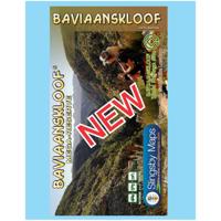
Wegenkaart - landkaart South Africa: Baviaanskloof | Slingsby Maps

0
Whether you’re a hiker, mountain biker or 4×4 enthusiast this is the map you need for your visit to the spec- tacular Baviaanskloof. This is the most comprehensive, fully researched and detailed map of the Baviaansk- loof ever published. The map is fully GPS-compatible and will enable you to explore this fabulous, rugged wilderness, its geological...

Verkopers met dit product

Verkoper
Bezorging
Prijs
DeZwerver.nl logo
DeZwerver.nl
2,95
29,95

Anderen bekeken ook

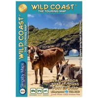
Wegenkaart - landkaart South Africa: Wild Coast | Slingsby Maps
Wild Coast   Brand new 6th Edition of this great map : for 15 years the best and only detailed touring map of the Wild Coast!   The Wild Coast is a wilderness paradise, strewn with natural wonders. Over one hundred lagoons thread this romantic coast, pristine beaches await fishermen, surfers and holiday makers; mighty waterfalls plunge directly into the sea, rivers gouge deep secret valleys into this heartland of South Africa’s history. Birthplace and resting place of Nelson Rolihlahla Mandela, this extraordinary landscape is where visions were dreamed, battles fought, ships came to dramatic ends.   The sixth edition of our Wild Coast map is bigger and better than ever. The fully-revised map now includes larger insets of some important areas, as well as distance charts for coastal hikers, with the estuary-to-estuary distances down the length of the coast, from Port Edward to East London, amongst many other updates.
29,95
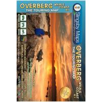
Wegenkaart - landkaart South Africa: Overberg Whale Coast | Slingsby Maps
The Overberg is one of the premier tourist regions of South Africa. Here the Cape Fold Mountains march eastward from Sir Lowry’s Pass, a rugged backdrop to this old Cape landscape of farmsteads, gravel passes and unspoiled views. Delightful towns await you – historic Swellendam, McGregor and the wine farms of the Bonnievale valley, Hermanus and the fishing villages beyond. Missions, beaches littered with shipwreck sites, whales trolling the surf — all kinds of wonders await you!   This double sided, full-relief map covers the whole of the official Overberg Tourism Region.   Side one extends from Somerset West along the coast to Cape Hangklip, Hermanus thence to Cape Agulhas and on eastwards to Port Beaufort/Witsand and the Breede River, then north to Heidelberg, Barrydale and Montagu. From Robertson the map extends west to Villiersdorp and back to Stellenbosch.   Side two includes enlarged inset maps of 24 of the larger towns in the region, at the greatly-enlarged scale of 1:25 000, o…
29,95
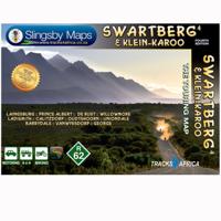
Wegenkaart - landkaart South Africa: Swartberg & Klein-Karoo | Slingsby Maps
All roads from National Highways to minor gravel roads are shown; the many classifications that indi- cate the quality of each road help you plan your route No less than 28 mountain passes are shown — all are public roads! Distances are clearly shown; comprehensive 4 x 4 information GPS coordinates in DD MM SS format are provided for every road-junction All tourism facilities and accommodation establishments are shown in the out-of-town areas; there are insets of the major towns The map links to our maps of the Baviaanskloof, the Garden Route, Overberg and the Tankwa-Karoo Additional info:   Swartberg and Klein-Karoo region on a contoured and GPS compatible, double-sided, waterproof and   tear-resistant map at 1:160,000 from Slingsby Maps, with excellent topographic detail and plenty of tourist information, including street plans of ten main towns.   The map provides a very detailed picture of this mountainous terrain, with altitude colouring, shading, con- tours at 20m intervals and …
29,95
Wegenkaart - landkaart Garden Route | Zuid Afrika | Slingsby Maps
Brand new 11th edition of the FIRST and still the BEST Garden Route map … Now thoroughly updated. From Witsand and Heidelberg in the west, this ALL-NEW map has been extended eastwards through Mossel Bay, George, Knysna and Plett to include JEFFERYS BAY and the GAMTOOS RIVER MOUTH – with fully updated Tourism info AND a greatly improved scale!   The Garden Route is so much more than a scenic national road. Explore the intriguing winding side roads and you’ll discover places with names like Whiskey Creek, De Vlugt, Phantom Pass and Noetzie. In these lit- tle known by ways, you can find old goldmines, traces of elephants, magical forest walks, castles on beaches and old passes.   Water and tear resistant in plastic sleeve.   Features:   This is a relief-shaded double-sided map covering the whole of the Western Cape’s official Garden Route Tourism Region, from Heidelberg in the west to Jeffery’s Bay in the east It includes the Tsitsikamma and Outeniqua Mountains and the Langkloof to …
29,50
Wegenkaart - landkaart - Fietskaart Clare (Ierland) | Xploreit Maps
Mooie geplastificeerde en scheurvaste kaart van de County Clare met index. This Xploreit map is an essential companion for your next trip to County Clare. Whatever your location in the county, a quick scan of the map will reveal all the local attractions including the best drives, cycle routes and walks in the area.  It is fully revised and now includes the Clare section of the long-distance Euro Velo Atlantic Cycle Route. From Loop Head, with its famous lighthouse, you can follow West Clare’s wild and rugged coast as it rises to the spectacular Cliffs of Moher and meets The Burren, the unique limestone pavement of the northern uplands. East Clare has numerous walking and sightseeing opportunities also, with Lough Derg and Slieve Bernagh as highlights. Convenient and informative, this touring map will help you discover ancient megalithic tombs, imposing castles, sparkling lakes, golden beaches and the many charming towns and villages dotted around ‘The Banner County’. Topography is sh…
23,50
Wandelkaart - Wegenkaart - landkaart 308 Tinos | Terrain maps
Gedetailleerde wegenkaart en wandelkaart met alle kleine wegen, wandelpaden, hoogtelijnen en toeristische informatie aangegeven. Alle tekst is tweetalig in Engels en Grieks en de waterproof kaart is geschikt voor gebruik met GPS. This is a great map of Tinos because:   •    It is waterproof and rip-proof. You can fold and unfold it a thousand times, fold it in irregular ways, dunk it in the sea or leave it out in the rain. This map is indestructible!    •    It is the first time the island’s entire coastline is mapped. Cartography was done with TERRAIN’s specially equipped and staffed cartographic vessel. This means that you can locate all beaches of the island, down to the tiniest cove! In fact, the special features of every single beach are recorded: whether it is sandy or pebbled, whether it features natural tree shade, water, a beach bar or organized water sports, whether the seabed in front of the beach is sandy or rocky (so that you will know where to anchor).    •    It feature…
12,50
Wandelkaart - Wegenkaart - landkaart St. Eustatius | Kasprowski Maps
Bijzonder gedetailleerde kaart (1:10.000 !) van alleen het eiland St. Eustatius. Zowel de wegen als ook de wandelpaden staan er op vermeld. Stranden, interessante plekken en bovendien de meeste duikplakken staan met diepte helder weergegeven op de kaart. This first and only complete road and street map with a street index of the Dutch Caribbean island of Saint Eustatius (Statia), ( Scale 1 : 10 000 ) renders roads and streets with their names and locates hiking trails and diving sites.    The map is sold folded, measuring 4 7/8" x 8 7/8" ( 12.5 cm x 22.5 cm ), and is designed for easy opening and refolding. Its full unfolded format is 26 3/8" x 35"  ( 67 cm x 89 cm ).   Designed for travelers, this excellent map has unsurpassed coverage of the island, and its extensive information and depth of detail fit a broad range of interests. The map has hill shading, three levels of roads (footpaths, secondary roads, and main roads) and symbols representing a large number of physical features. …
18,50
Wegenkaart - landkaart South Africa: Day Drives from Cape Town | Slingsby Maps
Our Day Drives from Cape Town map is the most comprehensive map available of the heartland of the Western Cape. The map shows all the roads, towns and relief of the area from Cape Town north to Citrus- dal, north-east to Laingsburg and east to Stilbaai / Albertinia: all destinations within easy motoring reach of Cape Town.   The most important tourist features are included, with ‘smiling faces’ indicating the most scenic routes. This is a popular general guide.   Waterproof and tear resistant in plastic sleeve.
29,95
Wandelkaart South Africa: Table Mountain | Slingsby Maps
This highly detailed map shows all approved paths on the mountain and includes full GPS information. The map shows the Hoerikwaggo and the Peoples Trail, and covers the area from Signal Hill to Devils Peak and Llandudno to Constantia Nek and the Vlakkenberg Plateau. This is the only map of the mountain endorsed by the Table Mountain National Park, and approved by the Mountain Club of South Africa.   Distances and estimated times shown for all paths above the Contour Path or Pipe Track Long/Lat grid at 10" intervals as well as the 200 metre square UTM grid; Completely revised vegetation distribution Some vanished paths removed; some new ones added Three Firs, Oudekraal Ravine and Constantia Corner routes upgraded; Clearer depiction of many features, including dangerous routes All approved paths, with DD MM SS GPS coordinates for major junctions 10 metre contours & delicate colour height shading bring the topography to life Forty quality photos of the most prominent mountain flow…
29,95

Klanten-reviews van Wegenkaart - landkaart South Africa: Baviaanskloof | Slingsby Maps

Er zijn nog geen beoordelingen voor dit productBen jij de eerste die een review plaatst?

Meer over Wegenkaart - landkaart South Africa: Baviaanskloof | Slingsby Maps

Productomschrijving

Whether you’re a hiker, mountain biker or 4×4 enthusiast this is the map you need for your visit to the spec- tacular Baviaanskloof. This is the most comprehensive, fully researched and detailed map of the Baviaansk- loof ever published. The map is fully GPS-compatible and will enable you to explore this fabulous, rugged wilderness, its geological marvels, extraordinary flora and fauna, and the poignant reminders of its Khoisan past…   Includes the new Leopard Trail and several interactive features.

Verken gerelateerde categorieën

Webshop.nl maakt gebruik van cookies. Ga je verder op onze website, ga dan akkoord met het plaatsen van cookies en de verwerking van deze data door ons en vermelde partners.