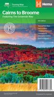
Wegenkaart - landkaart Savannah Way - Cairns to Broome | Hema Maps

0
Detailkaart van een deel van Australië. Zeer goed leesbaar, met naast de topografische details veel symbolen waarmee allerhande toeristische zaken worden aangeduid als campsites, nationale parken, attracties, wandelmogelijkheden etc. Find out all you need to know about travelling the Savannah Way between Cairns and Broome. As well as providing a d...

Verkopers met dit product

Verkoper
Bezorging
Prijs
DeZwerver.nl logo
DeZwerver.nl
2,95
17,50

Anderen bekeken ook

Nieuw
Wegenkaart - landkaart Brisbane to Cairns | Hema Maps
Detailkaart van een deel van Australië. Zeer goed leesbaar, met naast de topografische details veel symbolen waarmee allerhande toeristische zaken worden aangeduid als campsites, nationale parken, attracties, wandelmogelijkheden etc. An easy-to-follow map that shows both the coastal and inland routes from Brisbane to Cairns. Roadside rest areas, intermediate distances, and a quick-find distance chart are also shown. The map shows all the popular tourist destinations along the Queensland coast. Routes between Brisbane with Cairns in a series of touring maps connecting Australia’s main centres of population along some of the most spectacular routes such as the Great Ocean Road or the Savannah Way. The maps highlight 24-hour fuel supplies, roadside rest areas, camping facilities, places of interest, etc., and include distance charts and, in some titles, city maps. Road network indicates unsurfaced roads and tracks. The maps also show railway lines. There is no topographical information b…
17,50
Wegenkaart - landkaart South Africa: Swartberg & Klein-Karoo | Slingsby Maps
All roads from National Highways to minor gravel roads are shown; the many classifications that indi- cate the quality of each road help you plan your route No less than 28 mountain passes are shown — all are public roads! Distances are clearly shown; comprehensive 4 x 4 information GPS coordinates in DD MM SS format are provided for every road-junction All tourism facilities and accommodation establishments are shown in the out-of-town areas; there are insets of the major towns The map links to our maps of the Baviaanskloof, the Garden Route, Overberg and the Tankwa-Karoo Additional info:   Swartberg and Klein-Karoo region on a contoured and GPS compatible, double-sided, waterproof and   tear-resistant map at 1:160,000 from Slingsby Maps, with excellent topographic detail and plenty of tourist information, including street plans of ten main towns.   The map provides a very detailed picture of this mountainous terrain, with altitude colouring, shading, con- tours at 20m intervals and …
29,95
Nieuw
Wegenkaart - landkaart SC3-SC4 Swellendam to Mossel Bay | Tracks4Africa
The Cape to Addo map series covers the southern parts of the Western Cape of South Africa in a series of eight highly detailed maps, printed on four sheets of A1 durable paper.   We start in Cape Town in the west and move along the southern coast through the Overberg, Winelands, Garden Route, Klein Karoo R62, Baviaanskloof to eventually arrive in the Addo National Park up to Gqeberha (Port Elizabeth) in the east.   The maps are highly detailed and well researched. Our map scale is 1:200 000 which allows us to show a lot of detail including minor gravel roads, hiking trails, farm boundaries and points of interest which are relevant to self-drive tourists.   The size of the paper is kept small enough to allow this to be the perfect road tripping map. We use Duraflex paper and print two maps per sheet of A1 paper, making this a four-sheet series. Each map sheet is individually packed in a plastic protective sleeve.   The maps are perfect for day drives, overlanding or just doing road tri…
29,95
Nieuw
Wegenkaart - landkaart SC5-SC6 George to Kareedouw | Tracks4Africa
The Cape to Addo map series covers the southern parts of the Western Cape of South Africa in a series of eight highly detailed maps, printed on four sheets of A1 durable paper.   We start in Cape Town in the west and move along the southern coast through the Overberg, Winelands, Garden Route, Klein Karoo R62, Baviaanskloof to eventually arrive in the Addo National Park up to Gqeberha (Port Elizabeth) in the east.   The maps are highly detailed and well researched. Our map scale is 1:200 000 which allows us to show a lot of detail including minor gravel roads, hiking trails, farm boundaries and points of interest which are relevant to self-drive tourists.   The size of the paper is kept small enough to allow this to be the perfect road tripping map. We use Duraflex paper and print two maps per sheet of A1 paper, making this a four-sheet series. Each map sheet is individually packed in a plastic protective sleeve.   The maps are perfect for day drives, overlanding or just doing road tri…
29,95
Nieuw
Wegenkaart - landkaart SC1-SC2 Cape Town to Montagu | Tracks4Africa
We start in Cape Town in the west and move along the southern coast through the Overberg, Winelands, Garden Route, Klein Karoo R62, Baviaanskloof to eventually arrive in the Addo National Park up to Gqeberha (Port Elizabeth) in the east.   The maps are highly detailed and well researched. Our map scale is 1:200 000 which allows us to show a lot of detail including minor gravel roads, hiking trails, farm boundaries and points of interest which are relevant to self-drive tourists.   The size of the paper is kept small enough to allow this to be the perfect road tripping map. We use Duraflex paper and print two maps per sheet of A1 paper, making this a four-sheet series. Each map sheet is individually packed in a plastic protective sleeve.   The maps are perfect for day drives, overlanding or just doing road trips in your sedan, 4WD or motorbike along our beautiful southern coast, Klein Karoo and parts of the proper Karoo. Mountain passes form a prominent feature in this area, and these …
29,95
Wegenkaart - landkaart Explorer Map North Queensland | Hema Maps
Detailkaart van een deel van Australië. Zeer goed leesbaar, met naast de topografische details veel symbolen waarmee allerhande toeristische zaken worden aangeduid als campsites, nationale parken, attracties, wandelmogelijkheden etc. Covering Australia's beautiful North Queensland. There is alot of town map insets, tourist information, and photographs on the reverse side Touring map of the northern half of Queensland, with enlargements of popular areas, street plans, lists of facilities, etc. The main map extends south to well beyond the Flinders Highway between Townsville and Mount Isa, including Mackay on the coast. The map shows the road network, including minor roads and unsurfaced tracks, plus railways and local airfields/aerodromes. Designated Tourist Routes are highlighted and symbols mark places of interest (many annotated with brief description), historical sites, tourist resorts, youth hostels, etc. Topography is indicated by names of mountain ranges and peaks, as well as by…
17,50
Nieuw
Wegenkaart - landkaart Explorer Map Nullarbor Plain - Western Map | Hema Maps
This map is part of Hema's new Nullarbor Plain Map Series and covers the area from Kalgoorlie to Border Village and its surrounds.   Truly one of the worlds great adventure drives, Australia's semi-arid Nullarbor Plain stretches some 1,256 kilometres (781 miles) via the Eyre Highway and links the cities of Adelaide and Perth (or vice versa depending on your direction). The length of this journey is so large we needed to stretch it over two maps; East from Port Pirie to Border Village in South Australia and the Western sheet from Border Village to Kalgoorlie.    While all the key sites and facilities along the Eyre Highway are listed this map allows you to broaden your horizon and consider some of the other attractions off the Highway, including; the various Nullarbor caves, iconic beaches across the Great Australian Bight and thousands of kilometres of 4WD tracks (including Old Coach Road (by permit)), all field-checked by the Hema Map Patrol for superior accuracy.   This map combines…
17,50
Nieuw
Wegenkaart - landkaart Melbourne and Region Map | Hema Maps
Handige kaart van zowel de stad Melbourne als het omliggende gebied. Description Melbourne & Region The Melbourne and Region map features a primary map of Greater Melbourne (1:115,000) that includes highways, major roads and local streets, as well as 24-hour fuel, parks and caravan parks. On the reverse is a Melbourne CBD map with accommodation, shopping and other places of interest pinpointed, along with train and tram network maps and a Melbourne Region map. Key Features Highways, major roads and local streets Points of interest Accommodation Travel Information Parks Caravan Parks 24 Hour Fuel Tram lines Railway stations Suburbs Suburbs Index Shopping centres Theatres/Cinemas Sporting venues Tram and Train network maps The cosmopolitan capital of Victoria, Melbourne is a city of distinct districts: each with its own particular appeal. For a different view of the city head to the observation deck at the Eureka Skydeck for 360° views. A cruise along the Yarra River provides yet anothe…
14,50
Nieuw
Wegenkaart - landkaart SC7-SC8 Baviaanskloof to Addo | Tracks4Africa
The Cape to Addo map series covers the southern parts of the Western Cape of South Africa in a series of eight highly detailed maps, printed on four sheets of A1 durable paper.   We start in Cape Town in the west and move along the southern coast through the Overberg, Winelands, Garden Route, Klein Karoo R62, Baviaanskloof to eventually arrive in the Addo National Park up to Gqeberha (Port Elizabeth) in the east.   The maps are highly detailed and well researched. Our map scale is 1:200 000 which allows us to show a lot of detail including minor gravel roads, hiking trails, farm boundaries and points of interest which are relevant to self-drive tourists.   The size of the paper is kept small enough to allow this to be the perfect road tripping map. We use Duraflex paper and print two maps per sheet of A1 paper, making this a four-sheet series. Each map sheet is individually packed in a plastic protective sleeve.   The maps are perfect for day drives, overlanding or just doing road tri…
29,95
Nieuw
Wegenkaart - landkaart Pilbara and the Coral Coast | Hema Maps
Detailkaart van een deel van Australië. Zeer goed leesbaar, met naast de topografische details veel symbolen waarmee allerhande toeristische zaken worden aangeduid als campsites, nationale parken, attracties, wandelmogelijkheden etc. One of the last great frontiers in Australia, the Pilbara is real 4WD country. This map has been field-checked using Hema's GPS mapping system and includes tracks and roads that have never before appeared on maps. The information side of the map presents all the points of interest, the history, and all the important information a person needs to know in order to safely traverse this remote countryside. Detailed, indexed road map with cartography similar to Hema’s excellent coverage of Australia’s interior in the “Great Desert Tracks” series: road information distinguishes between tracks plotted by the publishers themselves with GPS and those complied from the country’s topographic survey data. Topography is shown by relief shading, with colours and graphi…
17,50

Klanten-reviews van Wegenkaart - landkaart Savannah Way - Cairns to Broome | Hema Maps

Er zijn nog geen beoordelingen voor dit productBen jij de eerste die een review plaatst?

Meer over Wegenkaart - landkaart Savannah Way - Cairns to Broome | Hema Maps

Productomschrijving

Detailkaart van een deel van Australië. Zeer goed leesbaar, met naast de topografische details veel symbolen waarmee allerhande toeristische zaken worden aangeduid als campsites, nationale parken, attracties, wandelmogelijkheden etc.

Find out all you need to know about travelling the Savannah Way between Cairns and Broome. As well as providing a detailed road map for the entire length of the Savannah Way, this map includes handy advice on road conditions, average rainfall and safe driving tips. The useful information also highlights the features you pass in Queensland, Northern Territory and Western Australia.

Routes between Cairns and Broome in Hema’s range of very popular touring maps showing roads connecting Australia’s main centres of population along some of the most spectacular routes such as the Great Ocean Road or the Savannah Way. The maps highlight 24-hour fuel supplies, roadside rest areas, camping facilities, places of interest, etc., and include distance charts and, in some titles, city maps. Road network indicates unsurfaced roads and tracks. The maps also show railway lines. There is no topographical information beyond names of mountain ranges and selected peaks, plus rivers and lakes, but national and state parks, conservation areas and reserves, and aboriginal lands are all highlighted. The maps have a grid showing latitude and longitude at intervals of 1º or 2º.

In this title: double-sided map showing the road network along Australia’s northern coastline and highlighting the facilities along the Savannah Way, its variants, and other main roads and tracks such as the Explorer Highway, the Matilda Highway, etc. Fuel symbols indicate the type of fuel available at stations. Both local railway lines and the Australasia Railway from Darwin towards the centre and Adelaide are also shown. Tables provide list of facilities within the national parks in all three states covered by the map, distances and rainfall along the Savannah Way, plus notes on driving conditions, places of interest, etc. Latitude/longitude grid is at 1º intervals.


Verken gerelateerde categorieën

Webshop.nl maakt gebruik van cookies. Ga je verder op onze website, ga dan akkoord met het plaatsen van cookies en de verwerking van deze data door ons en vermelde partners.