webshop.nl
Categorieën
  Sluiten

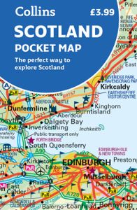
Wegenkaart - landkaart Pocket Map Scotland | Collins

Handy little full colour map of Scotland. Excellent value and very detailed for its size. Double-sided folded map with the Central Belt, southern Scotland and northern England on one side and northern Scotland including Orkney and Shetland on the reverse.   This map features:* Clear mapping at a scale of 8.7 miles to 1 inch* National Tourist Routes...
7,95

Webshops met dit product

Webshop
Bezorging
Prijs

Anderen bekeken ook

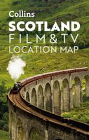
Wegenkaart - landkaart Pocket Map Scotland Film and TV Location Map | Collins
Full-colour, handy guide to more than 60 of the most popular film and TV locations in Scotland. Striking images and detailed descriptions allow for a comprehensive guide to Scotland's most recognisable filming sites in a convenient, travel-sized guide. Follow the journeys your favourite characters undertook from Hogwarts to Gotham City, Skyfall to Lallybroch, as this guide covers the best Scotland has to offer Hollywood and Bollywood.   This map features: Full coverage of the road, stations, and streets of ScotlandScenic images and detailed descriptions of famous filming locationsLocations include: Harry Potter, James Bond, The Da Vinci Code, Still Game, Outlander, Good Omens, and The CrownIdeal companion to a sat-nav - it enables route planning and route sense-checking  
7,95
Wegenkaart - landkaart Pocket Map Wales | Collins
Kleine handzame kaart van Wales Handy little full colour map of Wales. Excellent value and very detailed for its size.   Key features of this map include: • Clear mapping at a scale of 3.95 miles to 1 inch • National Tourist Routes showing best routes through the most scenic areas • Top 100 places of interest • Park and Ride locations • Ideal companion to a sat-nav – it enables route planning and route sense-checking   Essential for those planning a trip or who want an inexpensive and easy-to-use back up for a sat-nav..
7,95
Wegenkaart - landkaart Scotland - Schotland road map 2025 | Collins
Explore Scotland with easy-to-read mapping from Collins. Full-color map of Scotland at 8.7 miles to 1 inch (1:550.000), with clear road network and administrative areas shown in color. The map covers the whole of Scotland and part of Northern England conveniently on one side, and is ideal for reference or route planning.   The map shows the road network in detail for easy route planning and has easily identifiable local council areas and boundaries.   The main features of this road map are:   Fully updated Administrative areas shown in color Clear, detailed road network and road distances Town and city names, rivers, railway lines and canals are clearly shown 7 city/town center street plans showing places of interest Index to place names Mileage chart Car ferry routes Key in English, French and German
11,50
Wegenkaart - landkaart Pocket Map Wild Atlantic Way | Collins
Handy full-colour map of Ireland’s Wild Atlantic Way with a high level of detail. Clear mapping of the full 2500 km (over 1500 miles) route, showing the road network and places of interest.   Clear, detailed Collins road mapping is presented in a handy format ideal for the pocket or handbag. It is excellent value and very detailed for its size, covering the whole of the Wild Atlantic Way.   Ideal for tourists, locals, hikers and adventurers. Places of interest marked, including famous film locations.   This map includes: • Clear mapping at a scale of 8.7 miles to 1 inch • National Tourist Routes showing best routes through the most scenic areas • Places of interest include film locations such as Star Wars • Tourist and signature locations clearly marked • Suggested itineraries • Detailed place names index • Ideal companion to a sat-nav – it enables route planning and route sense-checking
7,95
Wegenkaart - landkaart Pocket Map Cornwall | Collins
Handzame wegenkaart voor Cornwall This handy little full color map of Cornwall is an excellent value and very detailed for its size. Key features include clear mapping at a scale of 8.7 miles to 1 inch; National Tourist Routes showing the best routes through the most scenic areas; Top 100 places of interest; and Park and Ride locations. An ideal companion to a sat nav, it enables route planning and route sense-checking. Essential for those planning a trip.
7,95
Wegenkaart - landkaart Pocket Map NC500 | Collins
Handy little full colour map of the popular North Coast 500 route. A perfect guide for travelling around Northern Scotland. Detailed mapping and tourist information ideal for any road trip.   Main features of this map include: • Clear mapping • Tourist attractions located and described • Ideal for touring with castles, museums, gardens, monuments, mountains, golf courses, walks and camping/caravan sites all on the map • Photographs of the main attractions along the route • Index to places of interest and place names   Essential for those planning a trip on the North Coast 500.
7,95
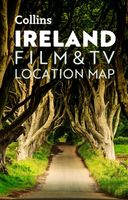
Wegenkaart - landkaart Pocket Map Ireland Film and TV Location Map | Collins
Full-colour, handy guide to more than 50 of the most popular film and TV locations in Ireland. Striking images and detailed descriptions allow for a comprehensive guide to Ireland's most recognisable filming sites in a convenient, travel-sized guide. Follow the journeys your favourite characters undertook in world-famous productions such as Game of Thrones and Star Wars as this guide covers the best Ireland has to offer Hollywood and Bollywood.   This map features: Clear mapping at a scale of 8.7 miles to 1 inch. Scenic images and detailed descriptions of famous filming locations. More than 50 Film and Television locations, including: Game of Thrones, Harry Potter, Star Wars, Derry Girls, Vikings, and P.S.   I Love You. Ideal companion to a sat-nav - it enables route planning and route sense-checking.
7,95
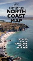
Wegenkaart - landkaart North Coast Road Trip Map | Destination Earth
This North Coast road trip map is the essential tool that will guide you through the breathtaking landscapes, stunning coastal views, and enchanting villages of the North Coast 500 in Scotland. Designed by travel enthusiasts, for travel enthusiasts, our map is more than just a navigation tool. It's a gateway to adventure, a treasure trove of hidden gems, and a companion that will make your journey even more extraordinary. Featuring a detailed and easy-to-read layout, this Destination NC500 Map will assist you in planning and navigating your way along the 500-mile route. With precise mile markers, highlighted attractions, and recommended stopping points, this map will ensure you don't miss a single sight along the way.   NC500 A1 Map Features:     Exact Locations: All of the exact locations of over 110+ Sights and Attractions, as well as Accommodation, Restaurants, Campervan Water and Waste Facilities, Electric Vehicle Charging Points, Train Stations, Airports, and much more! Must-know …
13,-
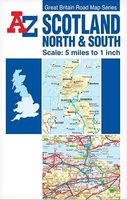
Wegenkaart - landkaart Scotland North & South | A-Z Map Company
The Great Britain Road Map series comprises of five fold-out sheet maps which together cover the whole of Great Britain. Shown at a scale of 5 miles to 1 inch, a continuous grid referencing system permits several or all of the sheets to be mounted together whilst retaining index compatibility.   This A-Z map of Scotland North and South is a full colour, double-sided, fold-out road map.   The Northern Scotland map covers the mainland of northern Scotland from Oban and Perth in the south to Cape Wrath and John o' Groats in the north, including the Isle of Skye, the Inner Hebrides and the Western Isles. The Orkney and Shetland Islands are featured in an inset map at a scale of approximately 12.5 inches to 1 mile. The Southern Scotland map covers the remainder of Scotland southwards and a large section of Northern England to include Berwick-upon-Tweed, Newcastle-upon-Tyne, Middlesbrough, York, Skipton, Fleetwood, Whitehaven and Carlisle. The Isle of Man and part of Northern Ireland are als…
10,95
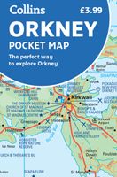
Wegenkaart - landkaart Pocket Map Orkney | Collins
Handy little full colour map of the Orkney Islands in Scotland. Detailed mapping and tourist information for Orkney mainland, Westray, Sanday, Stronsay, Shapinsay, Hoy, South Ronaldsay and the other islands. Excellent value and very detailed for its size. Main features of this map:   • Clear mapping at a scale of 2.7 miles to 1 inch • Tourist attractions located and described • Ideal for touring with sights, places to stay, cafe/restaurant, things to do all on the map • Transport links map showing how to get to and depart the islands • Index to places of interest and place names   Essential for those planning a trip around the Orkney Isles.
7,95

Klanten-reviews van Wegenkaart - landkaart Pocket Map Scotland | Collins

Er zijn nog geen beoordelingen voor dit productBen jij de eerste die een review plaatst?

Meer over Wegenkaart - landkaart Pocket Map Scotland | Collins

Productomschrijving

Handy little full colour map of Scotland. Excellent value and very detailed for its size. Double-sided folded map with the Central Belt, southern Scotland and northern England on one side and northern Scotland including Orkney and Shetland on the reverse.   This map features:* Clear mapping at a scale of 8.7 miles to 1 inch* National Tourist Routes showing best routes through the most scenic areas* Top 100 places of interest* Park and Ride locations* Ideal companion to a sat-nav - it enables route planning and route sense-checking Essential for those planning a trip or who want an inexpensive and easy-to-use back up for a sat-nav.

Verken gerelateerde categorieën

Webshop.nl maakt gebruik van cookies. Ga je verder op onze website, ga dan akkoord met het plaatsen van cookies en de verwerking van deze data door ons en vermelde partners.