webshop.nl
Categorieën
  Sluiten

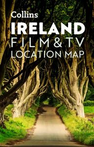
Wegenkaart - landkaart Pocket Map Ireland Film and TV Location Map | Collins

Full-colour, handy guide to more than 50 of the most popular film and TV locations in Ireland. Striking images and detailed descriptions allow for a comprehensive guide to Ireland's most recognisable filming sites in a convenient, travel-sized guide. Follow the journeys your favourite characters undertook in world-famous productions such as Game of...
7,95

Webshops met dit product

Webshop
Bezorging
Prijs

Anderen bekeken ook

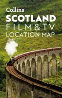
Wegenkaart - landkaart Pocket Map Scotland Film and TV Location Map | Collins
Full-colour, handy guide to more than 60 of the most popular film and TV locations in Scotland. Striking images and detailed descriptions allow for a comprehensive guide to Scotland's most recognisable filming sites in a convenient, travel-sized guide. Follow the journeys your favourite characters undertook from Hogwarts to Gotham City, Skyfall to Lallybroch, as this guide covers the best Scotland has to offer Hollywood and Bollywood.   This map features: Full coverage of the road, stations, and streets of ScotlandScenic images and detailed descriptions of famous filming locationsLocations include: Harry Potter, James Bond, The Da Vinci Code, Still Game, Outlander, Good Omens, and The CrownIdeal companion to a sat-nav - it enables route planning and route sense-checking  
7,95
Fotoboek Ireland | Amber Books
Become a visual explorer through more than 200 stunning images that celebrate the beautiful country, culture, and history of Ireland. Ireland holds a special place in people's hearts--even for many who haven't been there. To some the appeal is its natural beauty, to others it's the history; to some it's the country's strong folk tradition, to others it feels like a mystical place. This beautiful guide celebrates the island's most evocative and beautiful places, whether in nature or man-made, from the miles of near-empty beaches to the Mourne Mountains in County Down, from the pretty fishing towns of County Cork to Dublin's elegant Georgian streets. Featuring images from both the Republic of Ireland and Northern Ireland, Ireland ranges widely across landscapes and history, from rugged cliffs and rolling hills to mysterious stone circles, magnificent cathedrals and ruined abbeys; and from medieval forts and castles to grand Victorian follies and villages abandoned during the Potato Fami…
13,95
Wegenkaart - landkaart Pocket Map Wild Atlantic Way | Collins
Handy full-colour map of Ireland’s Wild Atlantic Way with a high level of detail. Clear mapping of the full 2500 km (over 1500 miles) route, showing the road network and places of interest.   Clear, detailed Collins road mapping is presented in a handy format ideal for the pocket or handbag. It is excellent value and very detailed for its size, covering the whole of the Wild Atlantic Way.   Ideal for tourists, locals, hikers and adventurers. Places of interest marked, including famous film locations.   This map includes: • Clear mapping at a scale of 8.7 miles to 1 inch • National Tourist Routes showing best routes through the most scenic areas • Places of interest include film locations such as Star Wars • Tourist and signature locations clearly marked • Suggested itineraries • Detailed place names index • Ideal companion to a sat-nav – it enables route planning and route sense-checking
7,95
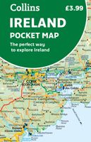
Wegenkaart - landkaart Pocket Map Ireland pocket map - Ierland | Collins
Kleine handzame kaart van Ierland.    Explore Ireland with this handy, full colour map. Handy little full colour map of Ireland at an excellent price. It is double-sided, with the south of Ireland up to and including Dublin on one side, and from Dublin northwards on the other.   Ideal for the pocket, bag or glovebox of the car. This map includes:* All the latest road changes* Places of interest* Ferry routes* Speed enforcement zones and safety camera locations Scale:1:470,0007.5 miles to 1 inch    
7,95
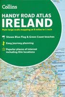
Wegenatlas Handy Road Atlas Ireland - Ierland | Collins
Handzame wegenatlas op A5 formaat van Ierland. Vrij grove schaal maar heel handig door formaat en goed kaartbeeld.  Met enkele stadsplattegronden en een paar pagina's met hoogtepunten van het land.  Explore Ireland with this handy format route-planning atlas in full colour, complete with information on places of tourist interest. There are also fully indexed town centre plans of Belfast, Cork, Dublin, Galway, Limerick and Londonderry. Now with places of interest marked including famous film locations. This atlas, at A5 size, contains mapping of the whole of Ireland at 9 miles to 1 inch (1:570,240). The mapping is beautifully designed with colour classified roads and subtle layered height tinting. The atlas is ideal for residents, visitors and tourists alike. Key features of the atlas include:* All Ireland route planning maps* Town centre plans* Places of interest including TV and film locations such as Game of Thrones, Star Wars and Harry Potter* Blue Flag and Green Coast beaches map* …
8,95
Wegenkaart - landkaart Planning Map Ireland | Lonely Planet
Durable and waterproof, with a handy slipcase and an easy-fold format, Lonely Planet's Ireland Planning Map is your essential navigation tool. This full-colour map features accompanying images   and information about top attractions, itinerary suggestions, a transport guide, themed lists and practical travel tips.         Durable and waterproof   Easy-fold format and convenient size   Handy slipcase   Full colour and easy to use   Before-you-go info   Beautiful imagery   Tailored itineraries   Can't-miss regional highlights   Detailed town index   Transport planner   Themed lists   Covers Dublin, County Wicklow, Enniskerry, Wicklow Mountains, Glendalough, County Meath, Brú na Bóinne, Cork, Ring of Kerry, Dingle, Cliffs of Moher, The Burren, Adare, Kilkenny, Rock of Cashel, Waterford City, Connemara, Galway City, Ennis, Killarney, Aran Islands, Donegal, Belfast, Causeway Coast, Derry City   Looking for more extensive coverage? Check out Lonely Planet's Ireland, our most comprehensive gu…
10,95
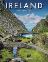
Fotoboek Ireland | Ierland | Amber Books
Ireland holds a special place in people’s hearts – even for many who haven’t been there. To some the appeal is its natural beauty, to others it’s the history; to some it’s Ireland’s lasting folk tradition, to others it even seems to be a mystical place. Ireland: The Emerald Isle presents 150 outstanding photographs celebrating the island’s most evocative and beautiful places, whether in nature or man-made, from the miles of near empty beaches to the Mourne Mountains in County Down, from the pretty fishing towns of County Cork to Dublin’s elegant Georgian streets. Featuring images from both the Republic of Ireland and Northern Ireland, the book ranges widely across landscapes and history, from rugged cliffs and rolling hills to mysterious stone circles, magnificent cathedrals and ruined abbeys; and from medieval forts and castles to grand Victorian follies and villages abandoned during the Potato Famine. While some images such as the striking basalt columns of the Giant’s Causeway may b…
27,95
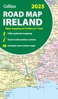
Wegenkaart - landkaart Ireland - Ierland road map 2025 | Collins
Explore Ireland with easy-to-read mapping from Collins. Full-color map of Ireland at 9 miles to 1 inch (1:570,240), with clear, detailed road network and counties and new administrative areas shown in color. This double-sided map covers the whole of Ireland, and is ideal for reference or route planning.   This map of Ireland shows the road network in detail. It is ideal for business users, with coloring of local council areas, but it is also perfect for tourists as a route planning map.   Main features include:   Fully updated New administrative areas shown in color Clear, detailed road network Town and city names, rivers, lakes, spot heights, railway lines and canals are clearly shown City/town centre street plans of Belfast, Cork, Dublin, Dún Laoghaire, Galway, Limerick, Londonderry/Derry and Waterford showing places of interest Full index to place names Mileage chart Car ferry routes Key in English, French and German Area of coverage Covers the whole of the Republic of Ireland and N…
11,50
Reisgids Ireland - Ierland | Insight Guides
Goede reisgids voor Ierland. Dé gids als het gaat om achtergrondinformatie en prachtige foto’s. Kwalitatief van een hoog niveau! Engelstalig. This Insight Guide is a lavishly illustrated inspirational travel guide to Ireland and a beautiful souvenir of your trip. Perfect for travellers looking for a deeper dive into the destination's history and culture, it's ideal to inspire and help you plan your travels. With its great selection of places to see and colourful magazine-style layout, this Ireland guidebook is just the tool you need to accompany you before or during your trip.   Whether it's deciding when to go, choosing what to see or creating a travel plan to cover key places like Dublin and Connemara, it will answer all the questions you might have along the way. It will also help guide you when you'll be exploring the Aran Islands or discovering the Glens of Antrim on the ground. Our Ireland travel guide was fully-updated post-COVID-19.   The Insight Guide Ireland covers: Dub…
23,95

Klanten-reviews van Wegenkaart - landkaart Pocket Map Ireland Film and TV Location Map | Collins

Er zijn nog geen beoordelingen voor dit productBen jij de eerste die een review plaatst?

Meer over Wegenkaart - landkaart Pocket Map Ireland Film and TV Location Map | Collins

Productomschrijving

Full-colour, handy guide to more than 50 of the most popular film and TV locations in Ireland. Striking images and detailed descriptions allow for a comprehensive guide to Ireland's most recognisable filming sites in a convenient, travel-sized guide. Follow the journeys your favourite characters undertook in world-famous productions such as Game of Thrones and Star Wars as this guide covers the best Ireland has to offer Hollywood and Bollywood.   This map features: Clear mapping at a scale of 8.7 miles to 1 inch. Scenic images and detailed descriptions of famous filming locations. More than 50 Film and Television locations, including: Game of Thrones, Harry Potter, Star Wars, Derry Girls, Vikings, and P.S.   I Love You. Ideal companion to a sat-nav - it enables route planning and route sense-checking.
Webshop.nl maakt gebruik van cookies. Ga je verder op onze website, ga dan akkoord met het plaatsen van cookies en de verwerking van deze data door ons en vermelde partners.