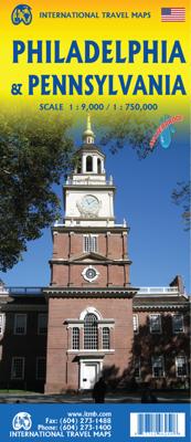
Wegenkaart - landkaart Philadelphia & Pennsylvania | ITMB

0
This map began as a result of a map conference held in Philadelphia a few years ago. Maps of the city at that time tended to concentrate on the entire spread-out urban area, resulting in the historic core, which was of interest mostly to visitors, crowded into a small portion of the map. Our map covers from the zoo and art gallery in the north to ...

Verkopers met dit product

Verkoper
Bezorging
Prijs
DeZwerver.nl logo
DeZwerver.nl
2,95
13,95

Anderen bekeken ook

Wegenkaart - landkaart Bangladesh & India oost | ITMB
Een degelijke kaart met aanduidingen van o.a. nationale parken, vliegveld, benzinepomp, dirt-roads en kleine plattegrond van hoofdstad. Als overzichtskaart goed te gebruiken. I like Bangladesh. Sure, the government is too corrupt and the country gets schmucked every time there's a hurricane, but the people are friendly and hard-working and gradually improving their country. As a travel destination, Bangladesh has to be considered as part of a trip to India for most people, so in addition to updating and modernizing our artwork, we have added a map of the easternmost portion of India, showing access routes and sites of interest in both countries. One of the great treats of Bangladesh is to take a ferry from Dhaka to Khulna, a two-day trip. The map also includes an inset of Dhaka, the capital, although we had to show only a few of the thousands of mosques in the city.    Legend Includes: Roads by classification, Airports, Ferrie routes, Bus stations, Car parks, State boudaries, border c…
13,95
Wegenkaart - landkaart Bahrain & Qatar | ITMB
Een degelijke kaart met aanduidingen van o.a. nationale parken, vliegveld, benzinepomp, dirt-roads en kleine plattegrond van hoofdstad. Als overzichtskaart goed te gebruiken.  Schaal: - Bahrein 1:115.000 - Qatar 1:300.000 The northern portion of the United Arab Emirates consists of a small peninsula (Qatar) and an island (Bahrain). Although these countries are not geographically significant in relation to their neighbours, they are enormously wealthy, thanks to oil, and have aspirations of grandeur. Qatar hosted the FIFA World Cup of soccer in November 2022. This is significant. Qatar, as a destination country, is now 'on the map'. Its capital, Doha, is quite well developed, with three Metro subway lines, motorways, and a sophisticated city centre dominated by superb high-rise architecture. Just to the west, the island of Bahrain is just as wealthy, and just as likely to have ornate architecture, luxurious shopping arcades, and an extravagant lifestyle. Its capital, Manama, is growing…
13,95
Wegenkaart - landkaart India North & West | ITMB
Een degelijke kaart met aanduidingen van o.a. nationale parken, vliegveld, benzinepomp, dirt-roads en kleine plattegrond van hoofdstad. Als overzichtskaart goed te gebruiken. Northern and western India on a double-sided, indexed map from ITMB, providing on each side useful coverage of some of the country’s most visited areas. Each side of the map has a separate index of localities. The northern side is centred on Delhi and extends north to the Line of Control dividing Jammu and Kashmir. Coverage east along the Ganges extends beyond Varanasi; west to Jodhour, the outskirts of Ahmadabad and to Vadodara (Baroda); and south to Nagpur, the geographical centre of India. The western side of the map extends from Delhi to Bangalore and Mysore, and inland beyond Hyderabad, so includes Mumbai and Goa. The map has altitude colouring (in feet) and shows the country’s road and rail networks and local airports. Symbols highlight various places of interest including historic or scenic sites, hill sta…
13,95
Wegenkaart - landkaart Scotland - Schotland | ITMB
Anyone who has been in this business for a few years remembers Ordnance Survey and their brilliantly detailed artwork. They should also remember that OS guarded this artwork religiously. That all changed when the then head of government in the UK, one soon-forgotten Gordon Brown, decreed that commercial OS artwork had to be discontinued and artwork had to be made more freely available to users. I expected an outpouring of new artwork by private UK firms. It did not happen; in fact, the range of travel maps decreased dramatically. However, OS artwork is still an excellent source of mapping artwork. This is a wonderful double-sided, detailed map of Scotland. It is both extremely detailed and accurate. We have added symbols for parks, historic sites, battlefields, country hotels, and anything else that we think would interest visitors. In order to portray Scotland to best scale advantage, the only inset included with this map are those of outlying islands, such as the Shetlands. ITMB als…
13,95
Wegenkaart - landkaart Mexico Central & Mexico City | ITMB
Goede wegenkaart met duidelijk kleurgebruik. Het betreft een deel van Mexico met op de achterkant een stadsplattegrond van het centrale deel van Mexico City. MC is the largest city in the Western Hemisphere, with a population of 28,000,000 (or twice as big as New York City!). It would be impractical to portray the entire urban area on one map and have it make sense, so we show the portion of greatest interest to visitors, from the Chapultepec Zoological Park in the west to the incredibly busy Tapo Bus Terminal in the east, and from the railway station in the north to the southern east-west motorway just south of the main hospital complex. Much of MC’s touristic interest is concentrated in the Zona Rosa, Reforma, and Zocalo segments of the city centre, and these are shown in detail, noting hotels, major restaurants, shopping areas, and points of interest.   The map also includes inset maps of the San Angel area just north of the university, an inset map of the greater Mexico City Feder…
13,95
Wegenkaart - landkaart - Stadsplattegrond Poland east - Warsaw, Oost Polen en Warschau | ITMB
ITMB wegenkaarten en wandelkaarten kenmerken zich door het kleurgebruik waarbij zo de nadruk wordt gelegd op de natuurkundige aspecten van het land of de streek. Het soort landschap en de hoogte worden hierdoor zeer duidelijk zichtbaar. Natuurlijk vind je ook de 'gewone' zaken als wegennet, spoorwegen, vliegvelden, ferrys, toeristische bezienswaardigheden en nationale parken er op terug.. Vaak - maar niet op alle kaarten - staat op de achterzijde een stadsplattegrond van hoofdstad of belangrijkste stad in de regio.  Voorzijde: Oost Polen shcaal 1:650.000 Achterzijde: Warschau, schaal 1:9.000 This is, at the same time, our second edition updated map of Warsaw and a brand new title for ITMB, in that we have added a regional map of the eastern half of Poland to the second side of the map. This gives the end user two maps for the price of one by combining the many attractions of the city with its surrounding countryside. Anyone with a small amount of historical knowledge knows that Warsaw…
13,95
Wegenkaart - landkaart - Wegenatlas Pan-Americana North | ITMB
Wegenatlas - A5 formaat - verschillende schalen - voor de het Noord-Amerikaanse gedeelte van de Pan-Americana ( Pan-American Highway ) van Alaska langs the Pacific kust van British Colombia in Canada, de staten Washington, Oregon en Californie, Mexico, Guatemala tot Panama.   The Pan-American Highway was created by the USA to improve road communications within the Western Hemisphere post-WW2. The highway started at the Mexican border and eventually reached somewhere south of Santiago in Chile. It was a vote-buying gimmick by the Americans to fund allies, but it also created an essential 'spine' road through Central America to the Darien Gap and along the west coast of South America to the then-limits of Chile. Driving the Pan-Am has become a travel experience. More recently, the improvement in more northerly highways, such as the Dalton Highway from Fairbanks to Prudhoe Bay in Alaska, the paving of most of the Stewart Highway through British Columbia, and the tremendous improvement in…
16,50
Wegenkaart - landkaart - Stadsplattegrond Montreal & Southern Quebec | ITMB
Stadsplattegrond van Montreal met register. Op de achterzijde een kaart van het zuiden van Quebec. 1:12,500/1:850,000 on waterproof paper. In this third, updated, edition of Canada's third largest city, we have added a user-friendly bonus. As is common now to most of our city maps, we have included a regional map of the hinterland of the urban area, so buyers won't have to purchase a second map to explore the environs of the city being presented. In the case of Montreal, being in a huge geographic country, this means Southern Quebec which, because of its size, dictates a map of more than one to a million scale. In the European context this would be the equivalent of Paris and all of France as a 'regional' map of the surrounds of Paris - but that's France and this is Canada.   Montreal (or Mont Royale in its original) was a village called Hochelaga when the early French explorers arrived in the early 1600s. They established a trading fort and, generally speaking, maintained good relati…
13,95
Wegenkaart - landkaart Sahara | ITMB
Een degelijke overzichtskaart met aanduidingen van o.a. nationale parken, vliegveld, benzinepomp, dirt-roads.Waterproof. Double-sided, waterproof and tear-resistant map, extending east to just beyond 25°(the border of Libya and Egypt) , and roughly to 15° degrees (Bamako and Niamey) on its western half, and slightly further south on the other side (beyond Kano and Ndjamena). Elevation colouring indicates the topography, with landscape feature such as calderas, scarps and cliffs, lava fields, dunes, serir, marches, seasonal rivers, and salt pans. Oases and numerous wells/waterholes are also marked, most of them with names. International boundaries are shown with, where appropriate, border crossings. Road network includes rough tracks, and indicates location of petrol stations. Railways within the coastal areas of the covered countries are marked, and the map also shows small local airfields. A range of symbols indicate selected accommodation including rest houses and campsites, hospita…
13,95
Wegenkaart - landkaart Togo en Benin | ITMB
Een degelijke kaart met aanduidingen van o.a. nationale parken, vliegveld, benzinepomp, dirt-roads en kleine plattegrond van hoofdstad. Als overzichtskaart goed te gebruiken. Togo and Benin. These two countries have developed an incredible tourism industry and are very popular with visitors. They are larger than one expects; small in comparison to neighbouring Nigeria, but large as countries go. This map is brand new artwork at a much more attractive scale than the previous version; printed double-sided with much more information than was available to us when the original map was being developed. We’ve also added a few capsule comments about interesting facts related to the two countries, and large inset maps of Lome and Porto Novo. The map is divided into a north half and south half, as most attractions are in the south. As with all ITM maps, this one shows physical features, road conditions, and petrol stations in more isolated parts of both countries. Legend Includes: Roads by clas…
13,95

Klanten-reviews van Wegenkaart - landkaart Philadelphia & Pennsylvania | ITMB

Er zijn nog geen beoordelingen voor dit productBen jij de eerste die een review plaatst?

Meer over Wegenkaart - landkaart Philadelphia & Pennsylvania | ITMB

Productomschrijving

This map began as a result of a map conference held in Philadelphia a few years ago. Maps of the city at that time tended to concentrate on the entire spread-out urban area, resulting in the historic core, which was of interest mostly to visitors, crowded into a small portion of the map. Our map covers from the zoo and art gallery in the north to West Oregon St in South Phillie, so takes on much more than the historic area and the downtown, but does so at an excellent scale, so everything from the Liberty Bell to the University of Pennsylvania campus shows up clearly and easy to read. The other side of the map is also a brand new map for ITMB.     Legend Includes: Roads by classification, Airports, Aerodromes and small aircrafts, Ferrie routes, Bus terminals, Metro Stations, Railway stations, Gas stations, Car Parks, Border crossing, State parks with or without campsites, Hospitals, Shopping centres, Postoffices, Police stations, FireStations, Museums, Tourist information centers, Points of interest, , Churches, Mosques, Synagogues, Chinese Temples, Points of Interest, Waterfalls, World heritage sites, Lighthouses, Hot springs, Mines and quarries, Native American reserves, Restaurants, Theatres, Banks, Caves, Embassies, Libraries, Shools, Universities, Banks, Cinemas Hotels, Notable buildings, Zoo, swimming pools, Beaches, Skiing, Tennis courts, Ball fields, Golf courses, Stadiums and much more.

Productinformatie

    Verken gerelateerde categorieën

    Webshop.nl maakt gebruik van cookies. Ga je verder op onze website, ga dan akkoord met het plaatsen van cookies en de verwerking van deze data door ons en vermelde partners.