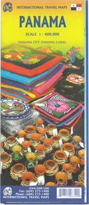
Wegenkaart - landkaart Panama | ITMB

0

Verkopers met dit product

Verkoper
Bezorging
Prijs
DeZwerver.nl logo
DeZwerver.nl
niet bekend
2,95
14,95

Anderen bekeken ook

Wegenkaart - landkaart Panama Canal - Central Panama | ITMB
Een degelijke kaart met aanduidingen van o.a. nationale parken, vliegveld, benzinepomp, dirt-roads en kleine plattegrond van hoofdstad. Als overzichtskaart goed te gebruiken. Met name de natuurkundige apecten van het land of streek worden heel duidelijk weergegeven.  One of the world’s great travel adventures is sailing through the Panama Canal, which we did last year (see cover photo). Panama itself is a large enough country that the canal, which is visited annually by millions of passengers, cannot be shown in meaningful detail. So, whether one is on board one of the many cruise ships squeezing into the Miraflores Locks or are a visitor ashore watching, the canal is a great attraction. The map is double-sided, with central Panama (the part most visited) filling side one. Side two is divided in half along the central fold. A very detailed map of Panama City fills the left side, and the first-ever map of the canal itself fills the other. This is a marvelously portrayed rendition of th…
13,95
Wegenkaart - landkaart Venezuela | ITMB
Wegenkaart met tevens aanduidingen van Nationale Parken en reservaten. Stadsplattegrond van Caracas 1:25.000 en kaart 1:500.000 van omgeving Caracas. This is another one of our brand new maps. The artwork has been digitally-prepared, and this time printed double-sided to achieve a MUCH better scale. We have included a regional inset map of the Caracas area, and insets of the Roraima Mountains region, but the size of Venezuela is such that the rest of the paper consists solely of the country itself. The southern portion remains relatively unexplored and undeveloped, with few roads and only the occasional settlement, and the northern coastal region shows the road network very well. This is the first new map of Venezuela in many years. Legend Includes: Roads by classification, Railways, Rivers, Rapids, Lakes, Swamps, Points of Interest, Airports, Harbours, Archaeological Sites, Museums, Churches, Car Ferries, Oilfields, Heights in meters, Beaches, Hospitals, Hotels, Universities, Gas Sta…
13,95
Wegenkaart - landkaart Colombia | ITMB
Goede wegenkaart waarbij naast de gebruikelijke zaken als wegen en plaatsen ook veel aandacht is voor de natuurkundige aspecten van het land. Door het kleurgebruik wordt goed duidelijk waar bos, oerwoud, rivieren, meren liggen. Hoogtes zijn zichtbaar door gebruik van verschillende kleuren. Vaak is op de kaart nog een kleine plattegrond van het centrum van de belangrijkste stad te vinden. Colombia is growing in popularity as a travel destination. It is also changing quickly as peace and stability return to a lovely country. We have updated the map to the best of our ability and now have detailed inset maps of Bogota, Medellin, and Cartagena. The border to Ecuador is now an improved crossing. We have printed this updated edition on plastic paper, another improvement, in line with our policy of converting most hot, humid, country maps to plastic.  Legend Includes: Roads by classification, Rivers and Lakes, National Park, Airports, Points of Interests, Mining, Archaeological sites, Beach …
13,95
Wegenkaart - landkaart Laos | ITMB
Een degelijke kaart van Laos met aanduidingen van o.a. nationale parken, vliegveld, benzinepomp, dirt-roads en kleine plattegronden van Vientiane, Luang Prabang we're very pleased to introduce you to this new, double-sided, map at a great scale, with fantastic detail. To me, the north side is the most interesting, covering the portion of Laos from Vientiane, the capital, to the Chinese border. Detailed inset maps of Vientiane and Louang Prabang, the temple city, are included on this side, as are bits of both Thailand and Vietnam. The south portion fills the other side of the sheet, including a goodly portion of Vietnam, showing all border crossings. Much of Thailand has had to be obscured, unfortunately, to make room for the place names index, but the immediate border areas are shown, including the rail line south from Vientiane. In an interesting departure from previous ITMB maps, the back cover consists of a detailed inset map of Vientiane at 1:16,000 scale, making it easy to use in…
13,95
Wegenkaart - landkaart Cuba | ITMB
Een degelijke wegenkaart van Cuba met aanduidingen van o.a. nationale parken, vliegveld, benzinepomp, dirt-roads en kleine plattegrond van hoofdstad. Als overzichtskaart goed te gebruiken. Cuba is the hidden agenda in this year's US election. Thus far, no candidate is making extreme statements about it. This is good, because with the withdrawal of Fidel from active politics, the government is starting to open its doors and effect some real changes. As a tourist destination, Cuba is without doubt the Number One attraction in the Caribbean. With easy access from Toronto, Mexico City, and the Bahamas, Cuba is within reach by everyone - even American running-dog imperialist war-mongers are welcomed. Hey, it's Cuba, man; everyone parties! Printed on ITM plastic paper, double-sided. Legend Includes: Roads by classification, international and domestic airports, mines, rivers, parks, points of interests, beaches, viewpoints, caves, dams, ports, hotels, gas stations, lighthouses, and other inf…
13,95
Wegenkaart - landkaart Sahara | ITMB
Een degelijke overzichtskaart met aanduidingen van o.a. nationale parken, vliegveld, benzinepomp, dirt-roads.Waterproof. Double-sided, waterproof and tear-resistant map, extending east to just beyond 25°(the border of Libya and Egypt) , and roughly to 15° degrees (Bamako and Niamey) on its western half, and slightly further south on the other side (beyond Kano and Ndjamena). Elevation colouring indicates the topography, with landscape feature such as calderas, scarps and cliffs, lava fields, dunes, serir, marches, seasonal rivers, and salt pans. Oases and numerous wells/waterholes are also marked, most of them with names. International boundaries are shown with, where appropriate, border crossings. Road network includes rough tracks, and indicates location of petrol stations. Railways within the coastal areas of the covered countries are marked, and the map also shows small local airfields. A range of symbols indicate selected accommodation including rest houses and campsites, hospita…
13,95
Wegenkaart - landkaart Mali | ITMB
Een degelijke kaart met aanduidingen van o.a. nationale parken, vliegveld, benzinepomp, dirt-roads en kleine plattegrond van hoofdstad. Als overzichtskaart goed te gebruiken.   Folded road and travel map in color. Scale 1:2,400,000. Distinguishes roads ranging from primary paved roads to other roads or tracks. Legend includes international airport/national airports, air fields, gasoline/petrol stations, post office, hospital/medical facilities, hotels, motels/lodging, resthouse or hostel, campsites or huts, museums, border crossings, no border crossings, points of interest, crafts/pottery, archaelogical sites, historic ruins or sites, mines, bus station, forts, mosques, churches/missions, oasis, caves, fishing ports, beaches, hiking/trekking. Includes inset map of Bamako and Timbuktu, road distance chart and extensive index.
13,95
Wegenkaart - landkaart Ghana | ITMB
Een degelijke kaart met aanduidingen van o.a. nationale parken, vliegveld, benzinepomp, dirt-roads en kleine plattegrond van hoofdstad. Als overzichtskaart goed te gebruiken. Folded road and travel map in color. Scale 1:500,000. Distinguishes roads ranging from motorways to other roads. Legend includes tracks, railroads, ferry routes, international airports, national airports, aerodromes/small aircrafts, gasoline/petrol stations, bus stations, hospitals/medical facilities, castles/forts, points of interest, ruins or archaeological sites, campsites and huts, museums, lodges, churches, mosques. Includes inset map of Cape Coast, Accra and Kumasi. Extensive index.
13,95

Klanten-reviews van Wegenkaart - landkaart Panama | ITMB

Er zijn nog geen beoordelingen voor dit productBen jij de eerste die een review plaatst?

Meer over Wegenkaart - landkaart Panama | ITMB

Productinformatie

    Verken gerelateerde categorieën

    Webshop.nl maakt gebruik van cookies. Ga je verder op onze website, ga dan akkoord met het plaatsen van cookies en de verwerking van deze data door ons en vermelde partners.