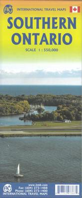
Wegenkaart - landkaart Ontario Zuid | ITMB

0

Verkopers met dit product

Verkoper
Bezorging
Prijs
DeZwerver.nl logo
DeZwerver.nl
2,95
12,95

Anderen bekeken ook

Wegenkaart - landkaart - Stadsplattegrond Toronto & Southern Ontario - Ontario zuid | ITMB
Overzichtskaart van het zuiden van Ontario - schaal 1:600.000 - met op de andere kant een grote plattegrond van Toronto op schaal 1:12.000 Legend Includes: Roads by classification, Accomodations, Museum, Churches, Buildings, Points of tourist, Public Interests, Post Offices, Police Stations, Schools, Live Theatres, Cinemas, Ruins, Bus Terminals, Ferry Terminals, Service Areas, Hospitals, Ports, Mines, RCMP, Major Airports, Secondary Airports, Camp Grounds, National Park and Equivalent Reserves, Ski, Picnic Sites, and much more.   Toronto is the largest city in Canada by far. Touristically, its attraction rests with its central core, from High Park in the west to the Don River in the east, and from the park-like islands in Lake Ontario to Bloor Street in the north. In this area, one finds remnants of the oldest portion of ‘muddy York’, the original fort built to deter American raiders (close to the exhibition grounds), Campbell House (at Queen & University), and the first public schoo…
13,95
Wegenkaart - landkaart Ontario | ITMB
Een degelijke kaart voor Ontario met aanduidingen van o.a. nationale parken, vliegveld, benzinepomp, dirt-roads en kleine plattegrond van Toronto, Sault Ste. Marie. Als overzichtskaart goed te gebruiken. Ontario and Quebec form the portion of Canada known as Central Canada. Ontario is the industrial heartland of the country, and the southern portion is the most densely-populated and urbanized part of Canada. Toronto is a city of 2.8M people and the heartland of an economic region serving 100,000,000 people in two countries. Southern Ontario is also home for six million residents, some of the most historic sites in the country, and major recreational land masses (Algonquin Park, Bruce Trail, Muskoka/Haliburton). Northern Ontario, on the other side of the map, occupies the bulk of the land area of the province, and is dominated by the Canadian Shield (a pre-Cambrian rock formation that is the oldest land on earth, rich in mineral wealth). The North is dominated by recreational activitie…
13,95
Wegenkaart - landkaart Accra & Ghana zuid | ITMB
Ghana was the first African colony to become an independent nation, in 1957. It may not be the largest, most populous, or richest country on the continent, but it is one of the best-managed and prosperous democracies. One seldom hears about Ghana on the news as a result, because there is seldom bad news to report! Accra is one of the oldest cities in sub-Saharan Africa, and the coast of Ghana is littered by historical remnants of trading forts built by the Portuguese, the Dutch, and the British during the age of expansion. Accra itself is an interesting city and our motivation in publishing a map of it is simply the reality that no map existed prior to this effort. The regional map shows Ghana's coastline to advantage and the interior of the country as far north as Kumasi.   Legend Includes: Roads by classification, Airports, Aerodromes and small aircrafts, Ferries, Bus terminals, Railway stations, Gas stations, Border crossing and custom posts, Hospitals, Museums, Tourist information…
13,95
Wegenkaart - landkaart - Stadsplattegrond China South - Zuid | ITMB
Een degelijke wegenkaart met aanduidingen van o.a. nationale parken, vliegveld, benzinepomp, dirt-roads. Als overzichtskaart goed te gebruiken.   China is a very large country. While our map of the entire country is fine for general travel and sells well, China is too large to show areas in detail. This map concentrates on the part of China from Shanghai south and all the way west to Lhasa and includes Taiwan and Hainan Island. We are not trying to make any sort of political comment here, but geographically, both Tibet and Taiwan fall within the area of coverage and are both included for this reason alone. The map also includes insets of Hong Kong, Guangzhou and Shanghai   Legend Includes: Roads by classification, Points of Interest, National Parks, Airports, Golf Courses, Beaches, Campsites, Waterfalls, Viewpoints, Churches, Surfing/Scuba Diving Spots, Fishing Spots, Hospitals, harbours/Ports, Lighthouses, Museums, Monuments, Caves, Mosques, Mountain Peaks, Botanic Gardens, Wildlife …
13,95

Klanten-reviews van Wegenkaart - landkaart Ontario Zuid | ITMB

Er zijn nog geen beoordelingen voor dit productBen jij de eerste die een review plaatst?

Meer over Wegenkaart - landkaart Ontario Zuid | ITMB

Productinformatie

    Verken gerelateerde categorieën

    Webshop.nl maakt gebruik van cookies. Ga je verder op onze website, ga dan akkoord met het plaatsen van cookies en de verwerking van deze data door ons en vermelde partners.