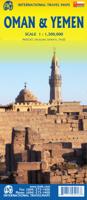
Wegenkaart - landkaart Oman & Yemen - Jemen | ITMB

0
Een degelijke kaart met aanduidingen van o.a. nationale parken, vliegveld, benzinepomp, dirt-roads en kleine plattegrond van hoofdstad. Als overzichtskaart goed te gebruiken.    We were in Oman a couple of weeks before year end and can certify that it is a safe and attractive country to visit; completely different from its neighbours. The main ci...

Alle aanbiedingen van dit product

Verkoper
Bezorging
Prijs
DeZwerver.nl logo
DeZwerver.nl
2,95
14,95

Anderen bekeken ook

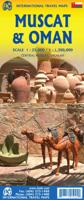
Wegenkaart - landkaart Oman & Yemen - Jemen | ITMB
Een degelijke kaart met aanduidingen van o.a. nationale parken, vliegveld, benzinepomp, dirt-roads en kleine plattegrond van hoofdstad. Als overzichtskaart goed te gebruiken.    We were in Oman a couple of weeks before year end and can certify that it is a safe and attractive country to visit; completely different from its neighbours. The main city is Muscat, which has an inset map on the country side of the sheet, as well as a map of Salalah, in the far west of the country. The road network of the country is well developed, with several crossings to the UAE. Unfortunately, none are available to Saudi Arabia, and the crossing to Yemen, while open, is not advised, due to on-going fighting. Oman also has two enclaves surrounded by UAE; a small one north of Fujairah, and another at the northern tip of the peninsula, separating the Gulf of Oman from the Persian (or Arabic) Gulf. Oman has a long history and an interesting culture, and is well worth a visit. The other side of the sheet con…
14,95
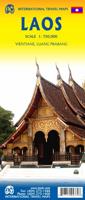
Wegenkaart - landkaart Laos | ITMB
Een degelijke kaart van Laos met aanduidingen van o.a. nationale parken, vliegveld, benzinepomp, dirt-roads en kleine plattegronden van Vientiane, Luang Prabang we're very pleased to introduce you to this new, double-sided, map at a great scale, with fantastic detail. To me, the north side is the most interesting, covering the portion of Laos from Vientiane, the capital, to the Chinese border. Detailed inset maps of Vientiane and Louang Prabang, the temple city, are included on this side, as are bits of both Thailand and Vietnam. The south portion fills the other side of the sheet, including a goodly portion of Vietnam, showing all border crossings. Much of Thailand has had to be obscured, unfortunately, to make room for the place names index, but the immediate border areas are shown, including the rail line south from Vientiane. In an interesting departure from previous ITMB maps, the back cover consists of a detailed inset map of Vientiane at 1:16,000 scale, making it easy to use in…
14,95
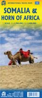
Wegenkaart - landkaart Somalië & Hoorn van Afrika | ITMB
Een degelijke kaart met aanduidingen van o.a. nationale parken, vliegveld, benzinepomp, dirt-roads en kleine plattegrond van hoofdstad. Als overzichtskaart goed te gebruiken. Met aan de ene zijde een kaart van Somalië, schaal 1:1.700.000, en op de andere zijde een overzichtskaart van de Hoorn van Afrika, schaal 1:3.400.000 Somalia is one of the more interesting off-the-beaten-path countries. The area around Mogadishu prefers to call itself Somalia, but controls only a portion of the overall country area. Then there is Jubaland, on the Kenyan border, aligned very closely to the former Italian colony boundaries of the same name. Truly, an amazing juxtaposition of countries within countries! The reverse side of the sheet presents a very interesting regional perspective of the area between the northern border of Ethiopia, a small portion of Sudan and a reasonable portion of South Sudan, all of Uganda, most of Kenya, all of Djibouti, and a fair portion of Eritrea, as well as the former Ade…
14,95
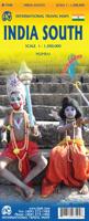
Wegenkaart - landkaart India South | ITMB
Een degelijke kaart met aanduidingen van o.a. nationale parken, vliegveld, benzinepomp, dirt-roads en kleine plattegrond van Mumbai. Als overzichtskaart goed te gebruiken. Gedrukt op watervast papier wat de levensduur van deze kaart ten goede komt! India is a very large country! It also has an unusual diamond shaped physical appearance that makes it hard to map. The north is also very different from the south, so we decided to expand our data base for India and publish a map covering India from Hyderabad and Mumbai south to the southern tip of the country. As the country economically modernizes, it becomes better known. As a country, India is fascinating and a great travel experience. I well remember visiting the temple city of Tiruchirappalli many years ago and travelling by local trains (an experience that tends to sear itself on to ones memory cells!) Interesting-sounding names fill the map: Madurai, Kochi, Bangalore, Nagpur, and Pune; the map reeks of adventure and exoticism!  
14,95
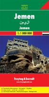
Wegenkaart - landkaart Yemen - Jemen | Freytag & Berndt
Uitstekende kaart van Jemen. Met index, Nationale parken en afstanden in kilometers. Goed kaartbeeld, register. Wel een vrij grote lap van een kaart, maar prima in detail en geen probleem in de auto / camper. De berijdbare wegen zijn goed weergeven, zowel de hoofdwegen als provinciale en lokale wegen; wegnummers worden vermeld. Afstanden tussen plaatsen zijn in kilometers op de kaart ingetekend, daarnaast worden ook op belangrijke plekken benzinepompen gemarkeerd. In het kaartbeeld wordt door middel van schaduw het reliëf weergegeven en soms enkele punten in het landschap met de daadwerkelijke hoogte. Provinciegrenzen zijn goed terug te vinden, nationale parken en reservaten ook. Met allerhande symbolen worden toeristische bezienswaardigheden weergegeven als monumenten, historisch belangrijke plekken en uitzichtpunten. In bepaalde plaatsen zijn hotels en campings te vinden, luchthavens, treinverbindingen en havens vindt u er ook op!
14,95
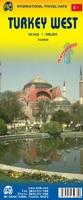
Wegenkaart - landkaart West Turkije - Turkey west | ITMB
Turkey is a big country. Most visitors concentrate on Istanbul and the Izmir Coast, which is a shame as there are so many other interesting parts of the country to visit. This map covers the western third of the country as a double-sided map, covering from the Greek/Bulgarian border south to the Mediterranean and east to Eregli and Antalya in the east. Naturally, at a better scale, roads and road conditions can be shown to better advantage, and the ferry routes from Istanbul make more sense. The topography is now showing as contouring more easily, and we have been able to add the next layer of villages. The scale is still not appropriate for showing minor roads and tracks, but we have included as many as we feel we can. The map is printed on durable plastic paper, so will stand up to the rigours of travel quite well. A basin inset map of Istanbul has been included as well.   Legend Includes: Road by classification, Motorways, Multilane Hwy, Main Roads, Rail Ways, Ferry Routes, Nationa…
14,95
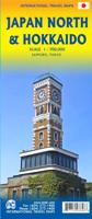
Wegenkaart - landkaart Japan North & Hokkaido | ITMB
Een degelijke kaart met aanduidingen van o.a. nationale parken, vliegveld, benzinepomp, dirt-roads en kleine plattegrond van hoofdstad. Als overzichtskaart goed te gebruiken. In one sense, this is a brand new map, in that the artwork is all brand new. In another sense, it is our map of Hokkaid re-worked into a more marketable format. In any case, it is a very much-needed sectional map of that portion of Japan from Tokyo northwards. Hokkaido is actually one of the most interesting parts of Japan to visit. The island was opened to settlement only after the Ameicans forced Japan to allow contacts with foreign countries in 1868, thanks to Admiral Peary and Gunboat Diplomacy. Hokkaido has been relatively untouched by Japan’s rush to economic dominance, so is the country’s skiing capital in winter and the part of Japan most similar to America. An inset map of Sapporo is included. The other side shows the main island of the country from Nagoya and Toyama (which are considerably west of Tokyo…
14,95
Wegenkaart - landkaart Utah & Colorado | ITMB
Een degelijke wegenkaart met aanduidingen van o.a. nationale parken, vliegveld, benzinepomp, dirt-roads. Als overzichtskaart goed te gebruiken. ITMB is gradually mapping the entire USA in appropriate scales. Most States fit fairly well into the 1:500 to 1:750T scale, and Utah is perfect for mapping. It is also a perfectly nice place to visit, so we are pleased to add it to our program. This map shares a sheet with Colorado, so please note that the ordering information is the same. Utah is Mormon country and the temple in Salt Lake City is a sight to see. The Great Salt Lake to its west is interesting to view, but more popular is the Bonneville Salt Flats at its western edge, where so many speed records have been won. Utah also has two of Americas most scenic national parks: Zion in the southwest and Canyonlands in the southeast. Combined with Colorado to its east and to Idaho in the north (ITMBs Pacific Northwest regional map) and ITMBs companion maps of Arizona and New Mexico, this m…
14,95
Wegenkaart - landkaart Canada | ITMB
Een degelijke kaart met aanduidingen van o.a. nationale parken, vliegveld, benzinepomp, dirt-roads en kleine plattegrond van hoofdstad. Well, it’s about time, eh?!? ITMB, after only thirty years on the go, finally gets around to publishing a map of Canada. When we first started mapping, there was a pressing need for good maps of Central and South America, then of Africa, then etc etc and we never found time to concentrate on our own country until fairly recently. This map was prepared by Natural Resources Canada and is, as a result, as accurate a map as one could hope to have. We are very proud of it, and very pleased to be able to use such top-rate cartography. The map covers all of the land mass of Canada, from its southernmost point to the top of Ellesmere Island and from the Atlantic coast to the Pacific. It’s an excellent map, but I’m going to give one proviso. Canada is the second-largest country on the face of the planet and there is no way that a single-sided sheet can portray…
14,95
Wegenkaart - landkaart Indonesië - Indonesia | ITMB
Een degelijke landkaart van Indonesië met aanduidingen van o.a. nationale parken, vliegvelden en grote wegen. Als overzichtskaart goed te gebruiken. De nadruk ligt echter vooral op de natuurkundige aspecten. Scheur- en watervast! Met een kleine kaart van Jakarta. The hundreds of islands making up the island nation of Indonesia make a double-sided map inevitable in order to show any significant amount of detail. Side 1 shows the western half, starting with Sumatra in the upper left and including Java and most of the island of Borneo (Kalimantan Province to the Indonesians). This side also includes a large inset map of central Jakarta (for better detail see our separate map of the city); ditto for Sumatra, Java, and Borneo. Bali, Lombok, and Sumbawa islands are in the lower right portion of the map, and most of Malaysia and all of Singapore are included, simply because they are there. The infamous volcanic island of Krakatoa is located just to the west of Java. The other side of the map…
14,95

Klanten-reviews van Wegenkaart - landkaart Oman & Yemen - Jemen | ITMB

Er zijn nog geen beoordelingen voor dit productBen jij de eerste die een review plaatst?

Meer over Wegenkaart - landkaart Oman & Yemen - Jemen | ITMB

Productomschrijving

Een degelijke kaart met aanduidingen van o.a. nationale parken, vliegveld, benzinepomp, dirt-roads en kleine plattegrond van hoofdstad. Als overzichtskaart goed te gebruiken.    We were in Oman a couple of weeks before year end and can certify that it is a safe and attractive country to visit; completely different from its neighbours. The main city is Muscat, which has an inset map on the country side of the sheet, as well as a map of Salalah, in the far west of the country. The road network of the country is well developed, with several crossings to the UAE. Unfortunately, none are available to Saudi Arabia, and the crossing to Yemen, while open, is not advised, due to on-going fighting. Oman also has two enclaves surrounded by UAE; a small one north of Fujairah, and another at the northern tip of the peninsula, separating the Gulf of Oman from the Persian (or Arabic) Gulf. Oman has a long history and an interesting culture, and is well worth a visit. The other side of the sheet consists of a detailed map of Yemen which, although it is an interesting part of the world. Inset maps of Sana’a and Taizz are included, as well as of the strategically-located island of Socotra ((Suqutra), guarding the entrance to the Red Sea. Altogether, this is a map of a very interesting part of the world.   Legend Includes: Roads by classification, Rivers and Lakes, National Park, Airports, Points of Interests, Mining, Highways, Main Roads, Zoos, Fishing, , and much more...


Productinformatie

    Verken gerelateerde categorieën

    Webshop.nl maakt gebruik van cookies. Ga je verder op onze website, ga dan akkoord met het plaatsen van cookies en de verwerking van deze data door ons en vermelde partners.